Whympney Wood

Wood, Forest in Staffordshire Staffordshire Moorlands

England

Whympney Wood

Car or Boat, Caverswall Quarry
Car or Boat, Caverswall Quarry Credit: Brian Deegan

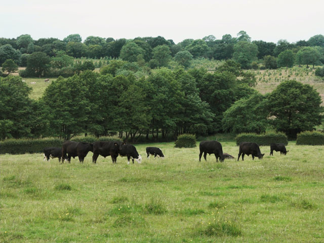
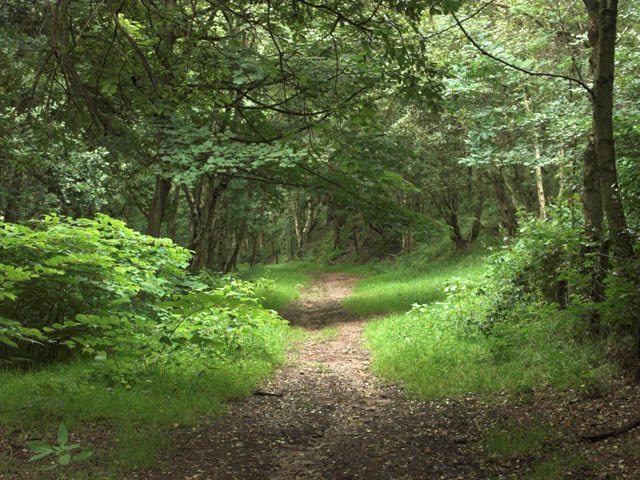
Whympney Wood is a picturesque forest located in Staffordshire, England. Covering an area of approximately 100 acres, it is a popular destination for nature lovers and outdoor enthusiasts. The wood is characterized by its diverse range of trees, including oak, birch, and beech, which create a stunning canopy during the summer months.

The wood is home to a wide variety of wildlife, making it an ideal spot for birdwatching and animal spotting. Visitors may be lucky enough to catch a glimpse of deer, foxes, squirrels, and a variety of bird species. The tranquil atmosphere and peaceful surroundings provide a perfect escape from the hustle and bustle of everyday life.

Numerous walking trails crisscross the wood, allowing visitors to explore its beauty at their own pace. The paths are well-maintained and easy to navigate, making it suitable for people of all ages and abilities. Along the way, there are benches and picnic areas where visitors can take a break and enjoy the serenity of the forest.

Whympney Wood is also a popular spot for educational visits and school trips. The woodland offers a unique opportunity for children to learn about the natural environment and the importance of conservation. Educational programs and guided tours are available to enhance the learning experience.

Overall, Whympney Wood in Staffordshire is a hidden gem for nature enthusiasts, offering a peaceful retreat amidst beautiful surroundings. Whether it's a leisurely stroll or an educational adventure, this forest provides an escape into nature's embrace.

If you have any feedback on the listing, please let us know in the comments section below.

Whympney Wood Images

Images are sourced within 2km of 52.994266/-2.0404527 or Grid Reference SJ9744. Thanks to Geograph Open Source API. All images are credited.

Car or Boat, Caverswall Quarry
The Red Lion At Boundary
Dilhorne trig
Dilhorne trig
Dilhorne Colliery This small colliery was an outlier to the main North Staffordshire coalfield around the Potteries and was always situated in a rural setting. Despite closure in the 60s, many of the original colliery buildings have survived, partly due to having been occupied by a chemical firm that operated the site until very recently. The colliery was also used as the base for the Foxfield Light Railway <a href="https://www.geograph.org.uk/photo/427914">SJ9744 : Foxfield Light Railway at Dilhorne Colliery, 1970</a> until it developed its current headquarters at Caverswall. The line was the rail link from the colliery to the main British Rail network.
Since the move to Caverswall, the Foxfield Railway has not operated passenger services to the colliery site, terminating short at Dilhorne Park. In recent years work has been proceeding to bring the rest of line up to standard again, and passenger services are due to recommence to Dilhorne Colliery in 2007. As part of the regeneration of the site, Heritage Lottery funding has been made avaialble for refurbishment of parts of the colliery site, including the main headgear. This is particularly interesting in being of reinforced concrete construction which was always a rarity.
Dilhorne Colliery
This small colliery was an outlier to the main North Staffordshire coalfield around the Potteries and was always situated in a rural setting. Despite closure in the 60s, many of the original colliery buildings have survived, partly due to having been occupied by a chemical firm that operated the site until very recently. The colliery was also used as the base for the Foxfield Light Railway SJ9744 : Foxfield Light Railway at Dilhorne Colliery, 1970 until it developed its current headquarters at Caverswall. The line was the rail link from the colliery to the main British Rail network. Since the move to Caverswall, the Foxfield Railway has not operated passenger services to the colliery site, terminating short at Dilhorne Park. In recent years work has been proceeding to bring the rest of line up to standard again, and passenger services are due to recommence to Dilhorne Colliery in 2007. As part of the regeneration of the site, Heritage Lottery funding has been made avaialble for refurbishment of parts of the colliery site, including the main headgear. This is particularly interesting in being of reinforced concrete construction which was always a rarity.
Dilhorne Colliery Station Work in progress (June 2006) on the new terminus of the Foxfield Light Railway. This was the original terminus and headquarters of the railway before its move to Caverswall, after which the service to the colliery site was discontinued. heritage lottery grants have bee obtained for redevelopment of the colliery site, including refurbishment of some of the colliery buildings and structures. The main headgear structure on the right has already benefited from this.
Dilhorne Colliery Station
Work in progress (June 2006) on the new terminus of the Foxfield Light Railway. This was the original terminus and headquarters of the railway before its move to Caverswall, after which the service to the colliery site was discontinued. heritage lottery grants have bee obtained for redevelopment of the colliery site, including refurbishment of some of the colliery buildings and structures. The main headgear structure on the right has already benefited from this.
Foxfield Light Railway at Dilhorne Colliery, 1970 A shot taken during the early days of the Foxfield Light Railway, for comparison with those of the present day <a href="https://www.geograph.org.uk/photo/427619">SJ9744 : Dilhorne Colliery</a>. This was at the time the railway's operating centre, using many of the sidings in the former colliery area. These have since been removed, basically leaving only the main line. Several of the colliery buildings visible in this picture no longer exist, and the spoil heap has been landscaped.
Foxfield Light Railway at Dilhorne Colliery, 1970
A shot taken during the early days of the Foxfield Light Railway, for comparison with those of the present day SJ9744 : Dilhorne Colliery. This was at the time the railway's operating centre, using many of the sidings in the former colliery area. These have since been removed, basically leaving only the main line. Several of the colliery buildings visible in this picture no longer exist, and the spoil heap has been landscaped.
Dilhorne Methodist Church Dilhorne Methodist Church in Godleybrook was built in 1816. It is part of the Cheadle Methodist Circuit.
Dilhorne Methodist Church
Dilhorne Methodist Church in Godleybrook was built in 1816. It is part of the Cheadle Methodist Circuit.
Old Engine Farm The area around this farm was extensively mined for coal. In the 1770s, two Newcomen-type steam engines, known as "fire engines", were built to pump water from a nearby mine.
Old Engine Farm
The area around this farm was extensively mined for coal. In the 1770s, two Newcomen-type steam engines, known as "fire engines", were built to pump water from a nearby mine.
Little Bank Top Farm
Summerhill House
Summerhill House
Farm Crossing on the Foxfield Steam Railway The Foxfield Railway was built in 1892-1893 to provide a link to the national railway network for the Foxfield Colliery. It is now a preserved steam railway run by the Foxfield Light Railway Society.
Farm Crossing on the Foxfield Steam Railway
The Foxfield Railway was built in 1892-1893 to provide a link to the national railway network for the Foxfield Colliery. It is now a preserved steam railway run by the Foxfield Light Railway Society.
Crossing Gate on the Foxfield Steam Railway The Foxfield Railway was built in 1892-1893 to provide a link to the national railway network for the Foxfield Colliery. It is now a preserved steam railway run by the Foxfield Light Railway Society.
Crossing Gate on the Foxfield Steam Railway
The Foxfield Railway was built in 1892-1893 to provide a link to the national railway network for the Foxfield Colliery. It is now a preserved steam railway run by the Foxfield Light Railway Society.
Houses at Boundary from Commonside
Fishing lakes In the background are the massed products of the nearby JCB factory.
Fishing lakes
In the background are the massed products of the nearby JCB factory.
Callow Hill Farm
Callow Hill Farm
Farmland near Field House
Foxfield Railway south of Caverswall Road crossing The railway was built in 1892-3 to connect Foxfield colliery to the outside world. The colliery closed in 1965. The railway is now operated by enthusiasts most weekends May to October.
Foxfield Railway south of Caverswall Road crossing
The railway was built in 1892-3 to connect Foxfield colliery to the outside world. The colliery closed in 1965. The railway is now operated by enthusiasts most weekends May to October.
Woodland track
Woodland track
Show me another place!

Whympney Wood is located at Grid Ref: SJ9744 (Lat: 52.994266, Lng: -2.0404527)

Administrative County: Staffordshire

District: Staffordshire Moorlands

Police Authority: Staffordshire

What 3 Words

///memory.podcast.streak. Near Cheadle, Staffordshire

Related Wikis

Dilhorne

Dilhorne is an ancient parish and village in Staffordshire, three miles from Cheadle and six miles from Stoke-on-Trent. The village is within the Staffordshire...

Dilhorne Hall

Dilhorne Hall located in Dilhorne, Staffordshire, England, was the ancestral home of the Buller family. == History == The Hall occupied an area of approximately...

Dilhorne Park railway station

Dilhorne Park railway station is a heritage railway station in Staffordshire on the Foxfield Railway. The station is a halt set in woodland, and at 760...

Caverswall

Caverswall is a village and parish in Staffordshire, to the south west of Staffordshire Moorlands. In the middle of the 19th century there were about 1500...

Forsbrook Pendant

The Forsbrook Pendant is a piece of Anglo Saxon jewellery found in Forsbrook, Staffordshire, England and sold to the British Museum in 1879. It is a 7th...
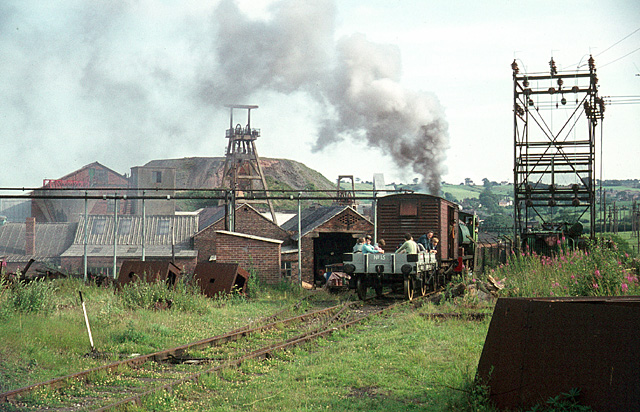
Foxfield Railway

The Foxfield Railway is a preserved standard gauge line located south east of Stoke-on-Trent. The line was built in 1893 to serve the colliery at Dilhorne...

Caverswall Road railway station

Caverswall Road railway station is a heritage railway station on the Foxfield Railway in Staffordshire. It serves as the centre of the railway's operations...

Caverswall Castle

Caverswall Castle is a privately owned early-17th-century English mansion built in a castellar style upon the foundations and within the walls of a 13th...

Nearby Amenities

Located within 500m of 52.994266,-2.0404527
Dilhorne
Place: village
Wikidata: Q2096305
Lat/Long: 52.9904082/-2.0396825
Bus Stop
Royal Oak PH
Bus: yes
Naptan AtcoCode: 3800C806200
Naptan Bearing: NE
Naptan BusStopType: CUS
Naptan CommonName: Royal Oak PH
Naptan Indicator: Adj
Naptan Landmark: Royal Oak PH
Naptan PlusbusZoneRef: STOKEOT
Naptan Street: High Street
Naptan Verified: no
Public Transport: platform
Source: naptan_import
Lat/Long: 52.9900037/-2.0406996
Bus Stop
Royal Oak PH
Bus: yes
Naptan AtcoCode: 3800C806201
Naptan Bearing: SW
Naptan BusStopType: CUS
Naptan CommonName: Royal Oak PH
Naptan Indicator: Opp
Naptan Landmark: Royal Oak PH
Naptan PlusbusZoneRef: STOKEOT
Naptan Street: High Street
Naptan Verified: no
Public Transport: platform
Source: naptan_import
Lat/Long: 52.9899048/-2.0406995
Bus Stop
Sarver Lane
Bus: yes
Naptan AtcoCode: 3800C836901
Naptan Bearing: NE
Naptan CommonName: Sarver Lane
Naptan Indicator: Opp
Naptan Landmark: Sarver Ln
Naptan PlusbusZoneRef: STOKEOT
Naptan Street: High Street
Naptan Verified: no
Public Transport: platform
Source: naptan_import
Lat/Long: 52.9903545/-2.0399551
Booth: K6
Removed Amenity: telephone
Lat/Long: 52.9901904/-2.0401989
Pub
The Royal Oak
Addr Postcode: ST10 2PE
Addr Street: High Street
Fhrs Id: 1259719
Source Addr: FHRS Open Data
Lat/Long: 52.9900925/-2.0407028
Barrier: stile
Foot: yes
Lat/Long: 52.9931456/-2.0467016
Power: pole
Lat/Long: 52.9934907/-2.0345577
Power: pole
Lat/Long: 52.994143/-2.0342332
Power: pole
Lat/Long: 52.9981067/-2.0374486
Power: pole
Lat/Long: 52.9969188/-2.0376865
Power: pole
Lat/Long: 52.9961471/-2.0378636
Power: pole
Lat/Long: 52.9941848/-2.0355922
Power: pole
Lat/Long: 52.9928418/-2.034879
Power: pole
Lat/Long: 52.9922715/-2.0390871
Power: pole
Lat/Long: 52.9934714/-2.0396571
Power: pole
Lat/Long: 52.9941687/-2.038665
Power: pole
Lat/Long: 52.994152/-2.0373494
Power: pole
Lat/Long: 52.9941613/-2.0374018
Power: pole
Lat/Long: 52.9941273/-2.0455192
Power: pole
Lat/Long: 52.9941434/-2.0408969
Power: pole
Lat/Long: 52.9941534/-2.040009
Post Box
Post Box Type: wall
Royal Cypher: GR
Royal Cypher Wikidata: Q33102273
Lat/Long: 52.9902321/-2.0401332
The data included in this document is from www.openstreetmap.org. The data is made available under ODbL.

Have you been to Whympney Wood?

Leave your review of Whympney Wood below (or comments, questions and feedback).