Godalming

Settlement in Surrey Waverley

England

Godalming

Old Milestone, was on the A3100 (was A3), Ockford Road The milestone was located on the narrow strip of tarmac between road and stone wall, on the East side of the road, opposite no. 108. Parish of Godalming (Waverley district). Carved stone post, Guildford facets design, erected by the Kingston & Sheetbridge, 1st District trust in the 18th century. 

Inscription was unreadable.

The milestone was destroyed by a lorry sometime before 2005. The image was taken before 2001.

Milestone Society National ID: SY_LP32
Old Milestone, was on the A3100 (was A3), Ockford Road Credit: Lionel Joseph

Godalming is a historic town located in the county of Surrey, England. Situated just 30 miles southwest of London, it is part of the larger borough of Waverley. With a population of around 22,000 residents, Godalming is a bustling town known for its rich history and picturesque surroundings.

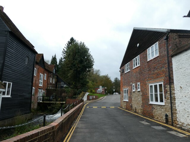
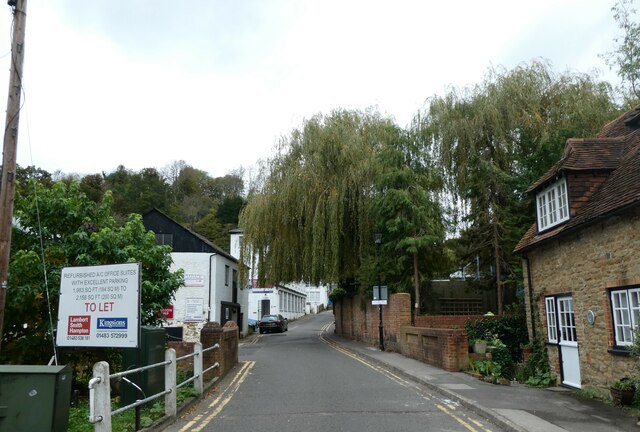
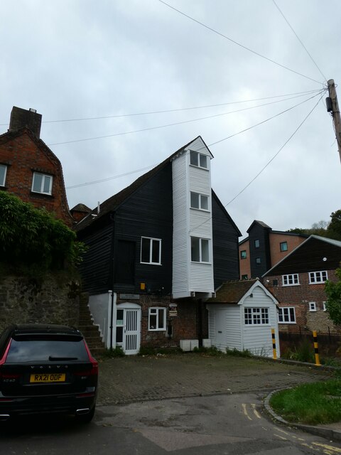
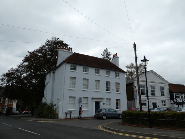
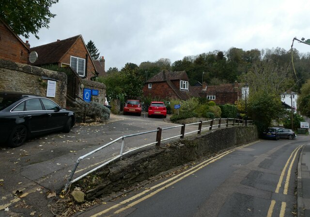
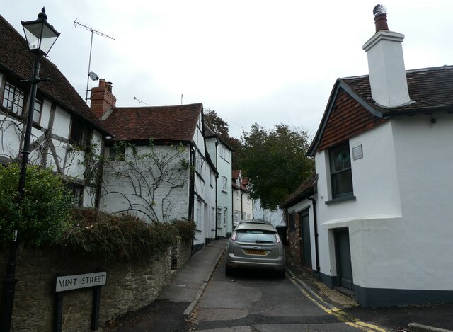
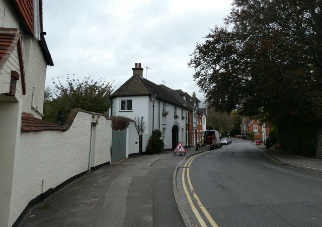
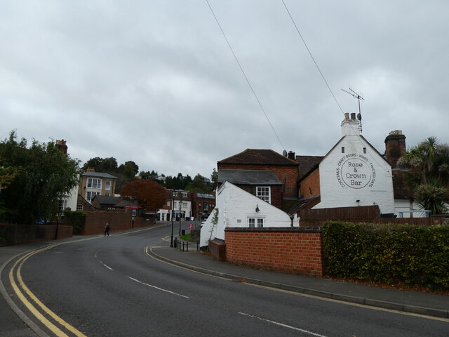
The town traces its roots back to Saxon times and boasts several well-preserved medieval buildings. The centerpiece of Godalming is its charming High Street, lined with timber-framed buildings that date back to the 16th and 17th centuries. This area exudes a traditional English feel and is home to a variety of independent shops, cafes, and restaurants.

Godalming is also famous for being the first town in the world to have a public electricity supply, thanks to its pioneering resident, Sir William Prescott. The Electric Theatre, which opened in 1913, is a testament to this achievement and remains a popular cultural hub in the town.

Nature enthusiasts will appreciate Godalming's proximity to the Surrey Hills Area of Outstanding Natural Beauty. The town is surrounded by rolling hills, woodlands, and the tranquil River Wey, offering numerous opportunities for outdoor activities such as hiking, cycling, and boating.

Transportation options in Godalming are excellent, with regular train services connecting the town to London Waterloo, Guildford, and other nearby towns. The town's excellent schools, including Charterhouse School, contribute to its reputation as an attractive place for families.

Overall, Godalming seamlessly blends its historical charm with modern amenities, making it an appealing destination for both residents and visitors alike.

If you have any feedback on the listing, please let us know in the comments section below.

Godalming Images

Images are sourced within 2km of 51.185427/-0.614151 or Grid Reference SU9643. Thanks to Geograph Open Source API. All images are credited.

Old Milestone, was on the A3100 (was A3), Ockford Road The milestone was located on the narrow strip of tarmac between road and stone wall, on the East side of the road, opposite no. 108. Parish of Godalming (Waverley district). Carved stone post, Guildford facets design, erected by the Kingston & Sheetbridge, 1st District trust in the 18th century. 

Inscription was unreadable.

The milestone was destroyed by a lorry sometime before 2005. The image was taken before 2001.

Milestone Society National ID: SY_LP32
Old Milestone, was on the A3100 (was A3), Ockford Road
The milestone was located on the narrow strip of tarmac between road and stone wall, on the East side of the road, opposite no. 108. Parish of Godalming (Waverley district). Carved stone post, Guildford facets design, erected by the Kingston & Sheetbridge, 1st District trust in the 18th century. Inscription was unreadable. The milestone was destroyed by a lorry sometime before 2005. The image was taken before 2001. Milestone Society National ID: SY_LP32
Looking from Mill Lane towards Mill Pool House Godalming  is a historic market town, civil parish and administrative centre, 4 miles  SSW of Guildford. It is located on the banks of the River Wey in a hilly, heavily wooded part of the London commuter belt and Green Belt.
Godalming is regarded as an expensive residential town, partly due to its visual appeal and good transport links. In recent years it has been ranked the UK's third most desirable property hotspot, voted the fourth best area of the UK in which to live and judged in 2013 to have the highest quality of life in Great Britain.
Wikipedia: <span class="nowrap"><a title="http://en.wikipedia.org/wiki/Godalming" rel="nofollow ugc noopener" href="http://en.wikipedia.org/wiki/Godalming">Link</a><img style="margin-left:2px;" alt="External link" title="External link - shift click to open in new window" src="https://s1.geograph.org.uk/img/external.png" width="10" height="10"/></span>
Looking from Mill Lane towards Mill Pool House
Godalming is a historic market town, civil parish and administrative centre, 4 miles SSW of Guildford. It is located on the banks of the River Wey in a hilly, heavily wooded part of the London commuter belt and Green Belt. Godalming is regarded as an expensive residential town, partly due to its visual appeal and good transport links. In recent years it has been ranked the UK's third most desirable property hotspot, voted the fourth best area of the UK in which to live and judged in 2013 to have the highest quality of life in Great Britain. Wikipedia: LinkExternal link
Houses in Mill Lane Godalming  is a historic market town, civil parish and administrative centre, 4 miles  SSW of Guildford. It is located on the banks of the River Wey in a hilly, heavily wooded part of the London commuter belt and Green Belt.
Godalming is regarded as an expensive residential town, partly due to its visual appeal and good transport links. In recent years it has been ranked the UK's third most desirable property hotspot, voted the fourth best area of the UK in which to live and judged in 2013 to have the highest quality of life in Great Britain.
Wikipedia: <span class="nowrap"><a title="http://en.wikipedia.org/wiki/Godalming" rel="nofollow ugc noopener" href="http://en.wikipedia.org/wiki/Godalming">Link</a><img style="margin-left:2px;" alt="External link" title="External link - shift click to open in new window" src="https://s1.geograph.org.uk/img/external.png" width="10" height="10"/></span>
Houses in Mill Lane
Godalming is a historic market town, civil parish and administrative centre, 4 miles SSW of Guildford. It is located on the banks of the River Wey in a hilly, heavily wooded part of the London commuter belt and Green Belt. Godalming is regarded as an expensive residential town, partly due to its visual appeal and good transport links. In recent years it has been ranked the UK's third most desirable property hotspot, voted the fourth best area of the UK in which to live and judged in 2013 to have the highest quality of life in Great Britain. Wikipedia: LinkExternal link
Looking north-west along Mill Lane Godalming  is a historic market town, civil parish and administrative centre, 4 miles  SSW of Guildford. It is located on the banks of the River Wey in a hilly, heavily wooded part of the London commuter belt and Green Belt.
Godalming is regarded as an expensive residential town, partly due to its visual appeal and good transport links. In recent years it has been ranked the UK's third most desirable property hotspot, voted the fourth best area of the UK in which to live and judged in 2013 to have the highest quality of life in Great Britain.
Wikipedia: <span class="nowrap"><a title="http://en.wikipedia.org/wiki/Godalming" rel="nofollow ugc noopener" href="http://en.wikipedia.org/wiki/Godalming">Link</a><img style="margin-left:2px;" alt="External link" title="External link - shift click to open in new window" src="https://s1.geograph.org.uk/img/external.png" width="10" height="10"/></span>
Looking north-west along Mill Lane
Godalming is a historic market town, civil parish and administrative centre, 4 miles SSW of Guildford. It is located on the banks of the River Wey in a hilly, heavily wooded part of the London commuter belt and Green Belt. Godalming is regarded as an expensive residential town, partly due to its visual appeal and good transport links. In recent years it has been ranked the UK's third most desirable property hotspot, voted the fourth best area of the UK in which to live and judged in 2013 to have the highest quality of life in Great Britain. Wikipedia: LinkExternal link
The Old Mill, Mill Lane Godalming  is a historic market town, civil parish and administrative centre, 4 miles  SSW of Guildford. It is located on the banks of the River Wey in a hilly, heavily wooded part of the London commuter belt and Green Belt.
Godalming is regarded as an expensive residential town, partly due to its visual appeal and good transport links. In recent years it has been ranked the UK's third most desirable property hotspot, voted the fourth best area of the UK in which to live and judged in 2013 to have the highest quality of life in Great Britain.
Wikipedia: <span class="nowrap"><a title="http://en.wikipedia.org/wiki/Godalming" rel="nofollow ugc noopener" href="http://en.wikipedia.org/wiki/Godalming">Link</a><img style="margin-left:2px;" alt="External link" title="External link - shift click to open in new window" src="https://s1.geograph.org.uk/img/external.png" width="10" height="10"/></span>
The Old Mill, Mill Lane
Godalming is a historic market town, civil parish and administrative centre, 4 miles SSW of Guildford. It is located on the banks of the River Wey in a hilly, heavily wooded part of the London commuter belt and Green Belt. Godalming is regarded as an expensive residential town, partly due to its visual appeal and good transport links. In recent years it has been ranked the UK's third most desirable property hotspot, voted the fourth best area of the UK in which to live and judged in 2013 to have the highest quality of life in Great Britain. Wikipedia: LinkExternal link
Junction of Mill Lane and Mint Street Godalming  is a historic market town, civil parish and administrative centre, 4 miles  SSW of Guildford. It is located on the banks of the River Wey in a hilly, heavily wooded part of the London commuter belt and Green Belt.
Godalming is regarded as an expensive residential town, partly due to its visual appeal and good transport links. In recent years it has been ranked the UK's third most desirable property hotspot, voted the fourth best area of the UK in which to live and judged in 2013 to have the highest quality of life in Great Britain.
Wikipedia: <span class="nowrap"><a title="http://en.wikipedia.org/wiki/Godalming" rel="nofollow ugc noopener" href="http://en.wikipedia.org/wiki/Godalming">Link</a><img style="margin-left:2px;" alt="External link" title="External link - shift click to open in new window" src="https://s1.geograph.org.uk/img/external.png" width="10" height="10"/></span>
Junction of Mill Lane and Mint Street
Godalming is a historic market town, civil parish and administrative centre, 4 miles SSW of Guildford. It is located on the banks of the River Wey in a hilly, heavily wooded part of the London commuter belt and Green Belt. Godalming is regarded as an expensive residential town, partly due to its visual appeal and good transport links. In recent years it has been ranked the UK's third most desirable property hotspot, voted the fourth best area of the UK in which to live and judged in 2013 to have the highest quality of life in Great Britain. Wikipedia: LinkExternal link
Society of Friends Meeting House, Mill Lane A Friends meeting house is a meeting house of the Religious Society of Friends (Quakers), where meeting for worship is usually held.
Wikipedia: <span class="nowrap"><a title="https://en.wikipedia.org/wiki/Friends_meeting_house" rel="nofollow ugc noopener" href="https://en.wikipedia.org/wiki/Friends_meeting_house">Link</a><img style="margin-left:2px;" alt="External link" title="External link - shift click to open in new window" src="https://s1.geograph.org.uk/img/external.png" width="10" height="10"/></span>
Society of Friends Meeting House, Mill Lane
A Friends meeting house is a meeting house of the Religious Society of Friends (Quakers), where meeting for worship is usually held. Wikipedia: LinkExternal link
Looking from Mill Lane into Mint Street Godalming  is a historic market town, civil parish and administrative centre, 4 miles  SSW of Guildford. It is located on the banks of the River Wey in a hilly, heavily wooded part of the London commuter belt and Green Belt.
Godalming is regarded as an expensive residential town, partly due to its visual appeal and good transport links. In recent years it has been ranked the UK's third most desirable property hotspot, voted the fourth best area of the UK in which to live and judged in 2013 to have the highest quality of life in Great Britain.
Wikipedia: <span class="nowrap"><a title="http://en.wikipedia.org/wiki/Godalming" rel="nofollow ugc noopener" href="http://en.wikipedia.org/wiki/Godalming">Link</a><img style="margin-left:2px;" alt="External link" title="External link - shift click to open in new window" src="https://s1.geograph.org.uk/img/external.png" width="10" height="10"/></span>
Looking from Mill Lane into Mint Street
Godalming is a historic market town, civil parish and administrative centre, 4 miles SSW of Guildford. It is located on the banks of the River Wey in a hilly, heavily wooded part of the London commuter belt and Green Belt. Godalming is regarded as an expensive residential town, partly due to its visual appeal and good transport links. In recent years it has been ranked the UK's third most desirable property hotspot, voted the fourth best area of the UK in which to live and judged in 2013 to have the highest quality of life in Great Britain. Wikipedia: LinkExternal link
Looking north-northwest along Station Road Godalming  is a historic market town, civil parish and administrative centre, 4 miles  SSW of Guildford. It is located on the banks of the River Wey in a hilly, heavily wooded part of the London commuter belt and Green Belt.
Godalming is regarded as an expensive residential town, partly due to its visual appeal and good transport links. In recent years it has been ranked the UK's third most desirable property hotspot, voted the fourth best area of the UK in which to live and judged in 2013 to have the highest quality of life in Great Britain.
Wikipedia: <span class="nowrap"><a title="http://en.wikipedia.org/wiki/Godalming" rel="nofollow ugc noopener" href="http://en.wikipedia.org/wiki/Godalming">Link</a><img style="margin-left:2px;" alt="External link" title="External link - shift click to open in new window" src="https://s1.geograph.org.uk/img/external.png" width="10" height="10"/></span>
Looking north-northwest along Station Road
Godalming is a historic market town, civil parish and administrative centre, 4 miles SSW of Guildford. It is located on the banks of the River Wey in a hilly, heavily wooded part of the London commuter belt and Green Belt. Godalming is regarded as an expensive residential town, partly due to its visual appeal and good transport links. In recent years it has been ranked the UK's third most desirable property hotspot, voted the fourth best area of the UK in which to live and judged in 2013 to have the highest quality of life in Great Britain. Wikipedia: LinkExternal link
Looking south-southeast along Station Road Godalming  is a historic market town, civil parish and administrative centre, 4 miles  SSW of Guildford. It is located on the banks of the River Wey in a hilly, heavily wooded part of the London commuter belt and Green Belt.
Godalming is regarded as an expensive residential town, partly due to its visual appeal and good transport links. In recent years it has been ranked the UK's third most desirable property hotspot, voted the fourth best area of the UK in which to live and judged in 2013 to have the highest quality of life in Great Britain.
Wikipedia: <span class="nowrap"><a title="http://en.wikipedia.org/wiki/Godalming" rel="nofollow ugc noopener" href="http://en.wikipedia.org/wiki/Godalming">Link</a><img style="margin-left:2px;" alt="External link" title="External link - shift click to open in new window" src="https://s1.geograph.org.uk/img/external.png" width="10" height="10"/></span>
Looking south-southeast along Station Road
Godalming is a historic market town, civil parish and administrative centre, 4 miles SSW of Guildford. It is located on the banks of the River Wey in a hilly, heavily wooded part of the London commuter belt and Green Belt. Godalming is regarded as an expensive residential town, partly due to its visual appeal and good transport links. In recent years it has been ranked the UK's third most desirable property hotspot, voted the fourth best area of the UK in which to live and judged in 2013 to have the highest quality of life in Great Britain. Wikipedia: LinkExternal link
Looking towards the Rose and Crown Godalming  is a historic market town, civil parish and administrative centre, 4 miles  SSW of Guildford. It is located on the banks of the River Wey in a hilly, heavily wooded part of the London commuter belt and Green Belt.
Godalming is regarded as an expensive residential town, partly due to its visual appeal and good transport links. In recent years it has been ranked the UK's third most desirable property hotspot, voted the fourth best area of the UK in which to live and judged in 2013 to have the highest quality of life in Great Britain.
Wikipedia: <span class="nowrap"><a title="http://en.wikipedia.org/wiki/Godalming" rel="nofollow ugc noopener" href="http://en.wikipedia.org/wiki/Godalming">Link</a><img style="margin-left:2px;" alt="External link" title="External link - shift click to open in new window" src="https://s1.geograph.org.uk/img/external.png" width="10" height="10"/></span>
Looking towards the Rose and Crown
Godalming is a historic market town, civil parish and administrative centre, 4 miles SSW of Guildford. It is located on the banks of the River Wey in a hilly, heavily wooded part of the London commuter belt and Green Belt. Godalming is regarded as an expensive residential town, partly due to its visual appeal and good transport links. In recent years it has been ranked the UK's third most desirable property hotspot, voted the fourth best area of the UK in which to live and judged in 2013 to have the highest quality of life in Great Britain. Wikipedia: LinkExternal link
Mint Street Car Park: late October 2021 Car parks are one of the most prosaic yet necessary features of modern life. Unbelievably, The City & Suburban Electric Carriage Company at 6 Denman Street, London, opened the first multi-storey car park in the in May 1901.  The first park and ride scheme operated from the 1960s in Oxford and the city also  introduced the first fully automatic pay on foot system in 1974. Ranging in size from a few spaces to the utterly enormous, they are still evolving. Cars, despite the widespread alarm about global warming, are getting bigger. Most of us deplore their necessity, but still hope for a space when we get to one!
Mint Street Car Park: late October 2021
Car parks are one of the most prosaic yet necessary features of modern life. Unbelievably, The City & Suburban Electric Carriage Company at 6 Denman Street, London, opened the first multi-storey car park in the in May 1901. The first park and ride scheme operated from the 1960s in Oxford and the city also introduced the first fully automatic pay on foot system in 1974. Ranging in size from a few spaces to the utterly enormous, they are still evolving. Cars, despite the widespread alarm about global warming, are getting bigger. Most of us deplore their necessity, but still hope for a space when we get to one!
Blue plaque in Mint Street For more about Woods see <span class="nowrap"><a title="http://www.godalmingmuseum.org.uk/index.php?page=percy-woods" rel="nofollow ugc noopener" href="http://www.godalmingmuseum.org.uk/index.php?page=percy-woods">Link</a><img style="margin-left:2px;" alt="External link" title="External link - shift click to open in new window" src="https://s1.geograph.org.uk/img/external.png" width="10" height="10"/></span>
Blue plaque in Mint Street
For more about Woods see LinkExternal link
Scaffolding on a house in Mint Street Godalming  is a historic market town, civil parish and administrative centre, 4 miles  SSW of Guildford. It is located on the banks of the River Wey in a hilly, heavily wooded part of the London commuter belt and Green Belt.
Godalming is regarded as an expensive residential town, partly due to its visual appeal and good transport links. In recent years it has been ranked the UK's third most desirable property hotspot, voted the fourth best area of the UK in which to live and judged in 2013 to have the highest quality of life in Great Britain.
Wikipedia: <span class="nowrap"><a title="http://en.wikipedia.org/wiki/Godalming" rel="nofollow ugc noopener" href="http://en.wikipedia.org/wiki/Godalming">Link</a><img style="margin-left:2px;" alt="External link" title="External link - shift click to open in new window" src="https://s1.geograph.org.uk/img/external.png" width="10" height="10"/></span>
Scaffolding on a house in Mint Street
Godalming is a historic market town, civil parish and administrative centre, 4 miles SSW of Guildford. It is located on the banks of the River Wey in a hilly, heavily wooded part of the London commuter belt and Green Belt. Godalming is regarded as an expensive residential town, partly due to its visual appeal and good transport links. In recent years it has been ranked the UK's third most desirable property hotspot, voted the fourth best area of the UK in which to live and judged in 2013 to have the highest quality of life in Great Britain. Wikipedia: LinkExternal link
Looking north-west along Cow Lane Godalming  is a historic market town, civil parish and administrative centre, 4 miles  SSW of Guildford. It is located on the banks of the River Wey in a hilly, heavily wooded part of the London commuter belt and Green Belt.
Godalming is regarded as an expensive residential town, partly due to its visual appeal and good transport links. In recent years it has been ranked the UK's third most desirable property hotspot, voted the fourth best area of the UK in which to live and judged in 2013 to have the highest quality of life in Great Britain.
Wikipedia: <span class="nowrap"><a title="http://en.wikipedia.org/wiki/Godalming" rel="nofollow ugc noopener" href="http://en.wikipedia.org/wiki/Godalming">Link</a><img style="margin-left:2px;" alt="External link" title="External link - shift click to open in new window" src="https://s1.geograph.org.uk/img/external.png" width="10" height="10"/></span>
Looking north-west along Cow Lane
Godalming is a historic market town, civil parish and administrative centre, 4 miles SSW of Guildford. It is located on the banks of the River Wey in a hilly, heavily wooded part of the London commuter belt and Green Belt. Godalming is regarded as an expensive residential town, partly due to its visual appeal and good transport links. In recent years it has been ranked the UK's third most desirable property hotspot, voted the fourth best area of the UK in which to live and judged in 2013 to have the highest quality of life in Great Britain. Wikipedia: LinkExternal link
Looking southwards in Church Street Godalming  is a historic market town, civil parish and administrative centre, 4 miles  SSW of Guildford. It is located on the banks of the River Wey in a hilly, heavily wooded part of the London commuter belt and Green Belt.
Godalming is regarded as an expensive residential town, partly due to its visual appeal and good transport links. In recent years it has been ranked the UK's third most desirable property hotspot, voted the fourth best area of the UK in which to live and judged in 2013 to have the highest quality of life in Great Britain.
Wikipedia: <span class="nowrap"><a title="http://en.wikipedia.org/wiki/Godalming" rel="nofollow ugc noopener" href="http://en.wikipedia.org/wiki/Godalming">Link</a><img style="margin-left:2px;" alt="External link" title="External link - shift click to open in new window" src="https://s1.geograph.org.uk/img/external.png" width="10" height="10"/></span>
Looking southwards in Church Street
Godalming is a historic market town, civil parish and administrative centre, 4 miles SSW of Guildford. It is located on the banks of the River Wey in a hilly, heavily wooded part of the London commuter belt and Green Belt. Godalming is regarded as an expensive residential town, partly due to its visual appeal and good transport links. In recent years it has been ranked the UK's third most desirable property hotspot, voted the fourth best area of the UK in which to live and judged in 2013 to have the highest quality of life in Great Britain. Wikipedia: LinkExternal link
Empty seats by The Pepperpot Godalming  is a historic market town, civil parish and administrative centre, 4 miles  SSW of Guildford. It is located on the banks of the River Wey in a hilly, heavily wooded part of the London commuter belt and Green Belt.
Godalming is regarded as an expensive residential town, partly due to its visual appeal and good transport links. In recent years it has been ranked the UK's third most desirable property hotspot, voted the fourth best area of the UK in which to live and judged in 2013 to have the highest quality of life in Great Britain.
Wikipedia: <span class="nowrap"><a title="http://en.wikipedia.org/wiki/Godalming" rel="nofollow ugc noopener" href="http://en.wikipedia.org/wiki/Godalming">Link</a><img style="margin-left:2px;" alt="External link" title="External link - shift click to open in new window" src="https://s1.geograph.org.uk/img/external.png" width="10" height="10"/></span>
Empty seats by The Pepperpot
Godalming is a historic market town, civil parish and administrative centre, 4 miles SSW of Guildford. It is located on the banks of the River Wey in a hilly, heavily wooded part of the London commuter belt and Green Belt. Godalming is regarded as an expensive residential town, partly due to its visual appeal and good transport links. In recent years it has been ranked the UK's third most desirable property hotspot, voted the fourth best area of the UK in which to live and judged in 2013 to have the highest quality of life in Great Britain. Wikipedia: LinkExternal link
Godalming High Street: late October 2021 Godalming  is a historic market town, civil parish and administrative centre, 4 miles  SSW of Guildford. It is located on the banks of the River Wey in a hilly, heavily wooded part of the London commuter belt and Green Belt.
Godalming is regarded as an expensive residential town, partly due to its visual appeal and good transport links. In recent years it has been ranked the UK's third most desirable property hotspot, voted the fourth best area of the UK in which to live and judged in 2013 to have the highest quality of life in Great Britain.
Wikipedia: <span class="nowrap"><a title="http://en.wikipedia.org/wiki/Godalming" rel="nofollow ugc noopener" href="http://en.wikipedia.org/wiki/Godalming">Link</a><img style="margin-left:2px;" alt="External link" title="External link - shift click to open in new window" src="https://s1.geograph.org.uk/img/external.png" width="10" height="10"/></span>
Godalming High Street: late October 2021
Godalming is a historic market town, civil parish and administrative centre, 4 miles SSW of Guildford. It is located on the banks of the River Wey in a hilly, heavily wooded part of the London commuter belt and Green Belt. Godalming is regarded as an expensive residential town, partly due to its visual appeal and good transport links. In recent years it has been ranked the UK's third most desirable property hotspot, voted the fourth best area of the UK in which to live and judged in 2013 to have the highest quality of life in Great Britain. Wikipedia: LinkExternal link
Show me another place!

Godalming is located at Grid Ref: SU9643 (Lat: 51.185427, Lng: -0.614151)

Administrative County: Surrey

District: Waverley

Police Authority: Surrey

What 3 Words

///peanut.snake.itself. Near Godalming, Surrey

Related Wikis

Godalming

Godalming is a market town and civil parish in southwest Surrey, England, around 30 miles (49 km) southwest of central London. It is in the Borough of...
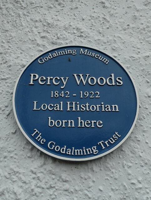
Godalming Museum

Godalming Museum is a local museum in the town of Godalming, Surrey, England.The museum covers the local history of the town and the surrounding area....

St Edmund Church, Godalming

St Edmund's Church (in full, The Church of St Edmund King and Martyr) is the Roman Catholic parish church of Godalming, a town in the English county of...

Church of St Peter & St Paul, Godalming

The Church of St. Peter and St. Paul is a parish church of the Church of England in Godalming, Surrey. The parish is mostly urban and excludes rural outskirts...

The Burys

The Burys at Godalming, Surrey was used as the venue for nine first-class cricket matches between 1821 and 1830. It was used by the Godalming Cricket Club...

Borough of Waverley

The Borough of Waverley is a local government district with borough status in Surrey, England. The council is based in the town of Godalming. The borough...

Godalming Borough Hall

Godalming Borough Hall is a municipal building in Bridge Street in Godalming, England. The building is the meeting place of Godalming Town Council. �...

Godalming railway station

Godalming railway station is a stop on the Portsmouth Direct Line, 34 miles 37 chains (55.5 km) down the line from London Waterloo. The station, opened...

Nearby Amenities

Located within 500m of 51.185427,-0.614151
Traffic Signals
Lat/Long: 51.1854142/-0.6096685
Source: NPE tracing
Lat/Long: 51.1886036/-0.6170903
Godalming
Public Transport: stop_position
Railway: stop
Source: NPE tracing
Train: yes
Lat/Long: 51.1874098/-0.6183591
Source: NPE tracing
Lat/Long: 51.1843457/-0.620683
Godalming
Place: town
Wikidata: Q909146
Wikipedia: en:Godalming
Lat/Long: 51.1857892/-0.6149074
Crossing: informal
Lat/Long: 51.1875872/-0.6164791
Townhall
Godalming Borough Hall
Addr City: Godalming
Addr Housename: Godalming Borough Hall
Addr Postcode: GU7 1HR
Addr Street: Bridge Street
Check Date: 2022-09-01
Fhrs Id: 1053945
Source: Local Knowledge
Wheelchair: yes
Lat/Long: 51.1867971/-0.6092902
Crossing
Button Operated: yes
Crossing: traffic_signals
Crossing Island: no
Surface Colour: rainbow
Tactile Paving: yes
Traffic Signals Sound: yes
Traffic Signals Vibration: yes
Lat/Long: 51.184611/-0.6111708
Post Box
Lat/Long: 51.183433/-0.6116343
Access: yes
Leisure: playground
Note: relative locations of these sport areas unknown
Lat/Long: 51.1817126/-0.6114571
Post Box
Collection Plate: CP7D
Collection Times: Mo-Fr 09:00; Sa 07:00
Last Checked: 2020-09-26
Operator: Royal Mail
Post Box Type: lamp
Ref: GU7 8D
Royal Cypher: EIIR
Royal Cypher Wikidata: Q33102113
Source: survey
Lat/Long: 51.1812151/-0.6163865
Bicycle Parking
Capacity: 4
Lat/Long: 51.1859927/-0.6103719
Crossing
Crossing: unmarked
Kerb: lowered
Tactile Paving: no
Lat/Long: 51.1870028/-0.6134092
Waste Basket
Lat/Long: 51.1872013/-0.6148296
Building: yes
Created By: Potlatch 0.10f
Man Made: watermill
Lat/Long: 51.1892337/-0.6173425
Bus Stop
Borough Hall
Bench: yes
Bin: yes
Bus: yes
Public Transport: platform
Shelter: yes
Tactile Paving: no
Wheelchair: yes
Lat/Long: 51.1870521/-0.6090018
Springwood House
Building: yes
Lat/Long: 51.1845653/-0.6089633
Power: substation
Lat/Long: 51.1857684/-0.6090811
Bus Stop
High Street
Bus: yes
Local Ref: D
Naptan AtcoCode: 40004411009A
Naptan Bearing: NE
Naptan CommonName: High Street
Naptan Indicator: Stop D
Naptan Landmark: Bridge Street
Naptan NaptanCode: surdtdwg
Naptan Street: Bridge Street
Naptan Verified: no
Public Transport: platform
Source: naptan_import
Wheelchair: yes
Lat/Long: 51.1859558/-0.6104495
Bus Stop
The Square
Bench: yes
Bus: yes
Local Ref: A
Naptan AtcoCode: 40004411244A
Naptan Bearing: W
Naptan CommonName: The Square
Naptan Indicator: Stop A
Naptan Landmark: The Square
Naptan NaptanCode: surdwdmw
Naptan Street: Bridge Street
Naptan Verified: no
Public Transport: platform
Shelter: yes
Source: naptan_import
Wheelchair: yes
Lat/Long: 51.1857049/-0.6108586
Bus Stop
Pepperpot
Bench: no
Bus: yes
Lit: yes
Local Ref: B
Naptan AtcoCode: 40004411244C
Naptan Bearing: SW
Naptan CommonName: Pepperpot
Naptan Indicator: Stop B
Naptan Landmark: Pepperpot
Naptan NaptanCode: surdwdpa
Naptan Street: High Street
Naptan Verified: no
Public Transport: platform
Shelter: yes
Source: naptan_import
Tactile Paving: no
Wheelchair: yes
Lat/Long: 51.1852982/-0.6157431
Bus Stop
Homebase
Bench: yes
Bin: yes
Bus: yes
Local Ref: F
Naptan AtcoCode: 40004411245A
Naptan Bearing: SE
Naptan CommonName: Homebase
Naptan Indicator: Stop F
Naptan Landmark: Homebase
Naptan NaptanCode: surdwdpd
Naptan Street: Wharf Street
Naptan Verified: no
Public Transport: platform
Shelter: yes
Source: naptan_import
Wheelchair: yes
Lat/Long: 51.1871058/-0.6077062
Bus Stop
Borough Hall
Bus: yes
Local Ref: E
Naptan AtcoCode: 40004411246A
Naptan Bearing: NE
Naptan CommonName: Borough Hall
Naptan Indicator: Stop E
Naptan Landmark: Borough Hall
Naptan NaptanCode: surdwdpg
Naptan Street: Bridge Street
Naptan Verified: no
Public Transport: platform
Source: naptan_import
Wheelchair: yes
Lat/Long: 51.186953/-0.6090736
Bus Stop
Flambard Way
Bench: yes
Bus: yes
Local Ref: C
Naptan AtcoCode: 40004411414A
Naptan Bearing: E
Naptan CommonName: Flambard Way
Naptan Indicator: Stop C
Naptan Landmark: Flambard Way
Naptan NaptanCode: surgjmjm
Naptan Street: Flambard Way
Naptan Verified: no
Public Transport: platform
Shelter: yes
Source: naptan_import
Lat/Long: 51.1844924/-0.6162175
Bus Stop
Croft Road Turn
Bench: yes
Bus: yes
Naptan AtcoCode: 40004411448A
Naptan Bearing: N
Naptan CommonName: Croft Road Turn
Naptan Indicator: N-bound
Naptan Landmark: Croft Road
Naptan NaptanCode: surgjmtm
Naptan Street: Brighton Road
Naptan Verified: no
Public Transport: platform
Shelter: no
Source: naptan_import
Lat/Long: 51.1841951/-0.6093438
Bus Stop
Croft Road Turn
Bus: yes
Naptan AtcoCode: 40004411448B
Naptan Bearing: E
Naptan CommonName: Croft Road Turn
Naptan Indicator: E-bound
Naptan Landmark: Croft Road
Naptan NaptanCode: surgjmtp
Naptan Street: Croft Road
Naptan Verified: no
Public Transport: platform
Shelter: no
Source: naptan_import
Lat/Long: 51.184293/-0.6095686
Bus Stop
Croft Road Turn
Bus: yes
Naptan AtcoCode: 40004411448C
Naptan Bearing: W
Naptan CommonName: Croft Road Turn
Naptan Indicator: W-bound
Naptan Landmark: Croft Road
Naptan NaptanCode: surgjmtw
Naptan Street: Croft Road
Naptan Verified: no
Public Transport: platform
Shelter: no
Source: naptan_import
Lat/Long: 51.1842188/-0.6098296
Bus Stop
Godalming Railway Station
Bench: no
Bin: yes
Bus: yes
Departures Board: realtime
Lit: yes
Naptan AtcoCode: 40004411472A
Naptan Bearing: NE
Naptan CommonName: Godalming Railway Station
Naptan Indicator: O/s
Naptan Landmark: Godalming Station
Naptan NaptanCode: surgjpaw
Naptan Street: Station Approach
Naptan Verified: no
Public Transport: platform
Shelter: yes
Source: naptan_import
Lat/Long: 51.1866695/-0.6186169
Bus Stop
Borough Road
Bench: no
Bin: yes
Bus: yes
Lit: no
Naptan AtcoCode: 40004411557A
Naptan Bearing: N
Naptan CommonName: Borough Road
Naptan Indicator: N-bound
Naptan Landmark: Borough Road
Naptan NaptanCode: surgjtgw
Naptan Street: Borough Road
Naptan Verified: yes
Public Transport: platform
Shelter: no
Source: naptan_import
Tactile Paving: no
Lat/Long: 51.1875437/-0.6165475
Bus Stop
Borough Road
Bench: no
Bin: no
Bus: yes
Lit: no
Naptan AtcoCode: 40004411557B
Naptan Bearing: S
Naptan CommonName: Borough Road
Naptan Indicator: S-bound
Naptan Landmark: Borough Road
Naptan NaptanCode: surgjtja
Naptan Street: Borough Road
Naptan Verified: yes
Public Transport: platform
Shelter: no
Source: naptan_import
Tactile Paving: no
Lat/Long: 51.1874573/-0.6164205
Crossing
Crossing: unmarked
Kerb: lowered
Tactile Paving: no
Lat/Long: 51.1865716/-0.6094332
Bench
Backrest: yes
Seats: 3
Lat/Long: 51.1881176/-0.6122772
Noexit: yes
Lat/Long: 51.1871148/-0.6177639
Telephone
Booth: K6
Covered: booth
Lat/Long: 51.188623/-0.6141443
Post Box
Brand: Royal Mail
Brand Wikidata: Q638098
Brand Wikipedia: en:Royal Mail
Collection Plate: CP5
Collection Times: Mo-Fr 16:15; Sa 09:30
Note: This postbox is on the station on the southbound platform.
Operator: Royal Mail
Operator Wikidata: Q638098
Post Box Type: wall
Postal Code: GU7 1EU
Ref: GU7 19
Royal Cypher: VR
Royal Cypher Wikidata: Q33102356
Lat/Long: 51.1865265/-0.6188094
Traffic Signals
Lat/Long: 51.1843075/-0.6169253
Traffic Signals
Lat/Long: 51.1844038/-0.6166719
Traffic Signals
Lat/Long: 51.1845207/-0.6171197
Noexit: yes
Lat/Long: 51.1843059/-0.6103709
Post Box
Brand: Royal Mail
Brand Wikidata: Q638098
Collection Plate: CP1
Collection Times: Mo-Fr 17:15; Sa 09:30
Operator: Royal Mail
Operator Wikidata: Q638098
Post Box Design: type_b
Post Box Type: pillar
Ref: GU7 1
Royal Cypher: GR
Royal Cypher Wikidata: Q33102273
Lat/Long: 51.1866903/-0.609351
Post Box
Brand: Royal Mail
Brand Wikidata: Q638098
Collection Plate: CP1
Collection Times: Mo-Fr 17:30; Sa 09:30
Operator: Royal Mail
Operator Wikidata: Q638098
Post Box Apertures: 2
Post Box Design: type_c
Post Box Type: pillar
Ref: GU7 3701;GU7 37
Royal Cypher: EIIR
Royal Cypher Wikidata: Q33102113
Lat/Long: 51.1856736/-0.6126935
Leisure: pitch
Sport: cricket
Lat/Long: 51.1825751/-0.6114095
Crossing
Crossing: traffic_signals
Crossing Island: no
Crossing Ref: pelican
Tactile Paving: yes
Lat/Long: 51.1846507/-0.6144951
Crossing
Button Operated: yes
Crossing Island: yes
Crossing Signals: yes
Tactile Paving: yes
Traffic Signals Sound: no
Traffic Signals Vibration: yes
Lat/Long: 51.1867564/-0.6076023
Crossing
Button Operated: yes
Crossing Signals: yes
Tactile Paving: yes
Traffic Signals Sound: no
Traffic Signals Vibration: yes
Lat/Long: 51.186749/-0.6074877
Godalming
Public Transport: stop_position
Railway: stop
Train: yes
Lat/Long: 51.1860737/-0.6191945
Noexit: yes
Lat/Long: 51.1853946/-0.6149552
Traffic Signals
Lat/Long: 51.1843793/-0.6172915
Noexit: yes
Lat/Long: 51.1852591/-0.617219
Noexit: yes
Lat/Long: 51.1852065/-0.6167693
Noexit: yes
Lat/Long: 51.1856337/-0.6165598
Waste Basket
Lat/Long: 51.1857004/-0.6109397
Give Way
Traffic Signals: signal
Lat/Long: 51.1870033/-0.6134519
Godalming
Naptan AtcoCode: 9100GDLMING
Network: National Rail
Network Website: https://www.nationalrail.co.uk/stations/god/
Network Wikidata: Q26334
Postal Code: GU7 1EU
Public Transport: station
Railway: station
Ref Crs: GOD
Source: NPE
Wheelchair: yes
Wikidata: Q3053175
Wikipedia: en:Godalming railway station
Lat/Long: 51.1865224/-0.6189563
Waterway: weir
Lat/Long: 51.1888442/-0.6180951
Source: NPE tracing
Lat/Long: 51.1860739/-0.61924
Cafe
Daisy
Addr City: Godalming
Addr Housename: Godalming Railway Station
Addr Postcode: GU7 1EU
Addr Street: Station Approach
Check Date: 2023-07-02
Fhrs Id: 182110
Opening Hours: Mo-Fr 05:30-16:00; Sa 08:00-12:00
Outdoor Seating: no
Lat/Long: 51.1864617/-0.6187761
Waste Basket
Lat/Long: 51.1893321/-0.6162375
Bench
Backrest: yes
Seats: 3
Lat/Long: 51.187659/-0.6156957
Bench
Backrest: yes
Seats: 3
Lat/Long: 51.1876616/-0.6155147
Waste Basket
Lat/Long: 51.1876599/-0.6154718
Bench
Backrest: yes
Seats: 3
Lat/Long: 51.187662/-0.6151955
Waste Basket
Lat/Long: 51.1878128/-0.6149252
Waste Basket
Lat/Long: 51.1878439/-0.6147131
Covered: no
Leisure: picnic_table
Source: gps
Lat/Long: 51.1873821/-0.6138731
Waste Basket
Lat/Long: 51.1872211/-0.6147015
Waste Basket
Lat/Long: 51.1872766/-0.6144473
Bench
Backrest: yes
Seats: 3
Lat/Long: 51.1872819/-0.6144195
Bench
Backrest: yes
Seats: 3
Lat/Long: 51.1873228/-0.6142286
Post Box
Brand: Royal Mail
Brand Wikidata: Q638098
Brand Wikipedia: en:Royal Mail
Collection Plate: CP1D
Collection Times: Mo-Fr 09:00; Sa 07:00
Last Checked: 2020-09-26
Operator: Royal Mail
Operator Wikidata: Q638098
Post Box Mounting: brick_pillar
Post Box Type: wall
Ref: GU7 81D
Royal Cypher: GR
Royal Cypher Wikidata: Q33102273
Source: survey
Lat/Long: 51.1840955/-0.6143193
Noexit: yes
Lat/Long: 51.1856778/-0.6163488
Post Box
Brand: Royal Mail
Brand Wikidata: Q638098
Brand Wikipedia: en:Royal Mail
Collection Times: Mo-Fr 17:15; Sa 09:30
Operator: Royal Mail
Operator Wikidata: Q638098
Post Box Apertures: 2
Post Box Design: type_c
Post Box Type: pillar
Ref: GU7 9501;GU7 95
Royal Cypher: EIIR
Royal Cypher Wikidata: Q33102113
Lat/Long: 51.1852319/-0.6162426
Give Way
Direction: forward
Lat/Long: 51.1869462/-0.6089694
Noexit: yes
Lat/Long: 51.1861464/-0.6097191
Noexit: yes
Lat/Long: 51.1863036/-0.6110763
Bench
Backrest: yes
Seats: 3
Lat/Long: 51.1875182/-0.6115704
Bench
Backrest: yes
Seats: 3
Lat/Long: 51.1867454/-0.6115085
Bench
Backrest: yes
Seats: 3
Lat/Long: 51.1867922/-0.611202
Bench
Backrest: yes
Seats: 3
Lat/Long: 51.1881212/-0.6118281
Bench
Backrest: yes
Seats: 3
Lat/Long: 51.1878385/-0.6099363
Bench
Backrest: yes
Seats: 3
Lat/Long: 51.1881663/-0.6098297
Bench
Backrest: yes
Seats: 3
Lat/Long: 51.1882294/-0.6096514
Bench
Backrest: yes
Seats: 3
Lat/Long: 51.1880243/-0.6093751
Bench
Backrest: yes
Seats: 3
Lat/Long: 51.1872285/-0.6146784
Bench
Backrest: yes
Seats: 3
Lat/Long: 51.1872923/-0.6129419
Waste Basket
Lat/Long: 51.1881479/-0.6119153
Waste Basket
Lat/Long: 51.1881739/-0.6096017
Bench
Backrest: yes
Seats: 3
Lat/Long: 51.1872512/-0.615161
Bench
Backrest: yes
Seats: 3
Lat/Long: 51.1871537/-0.6151072
Bench
Backrest: yes
Seats: 3
Lat/Long: 51.1868151/-0.6158518
Waste Basket
Lat/Long: 51.1868368/-0.6160844
Bench
Backrest: yes
Seats: 3
Lat/Long: 51.1873489/-0.6160069
Bench
Backrest: yes
Seats: 3
Lat/Long: 51.1878384/-0.6154037
Bench
Backrest: yes
Seats: 3
Lat/Long: 51.1874713/-0.6151386
Bench
Backrest: yes
Seats: 3
Lat/Long: 51.1875208/-0.6152983
Bench
Backrest: yes
Seats: 3
Lat/Long: 51.187451/-0.6154742
Bench
Backrest: yes
Seats: 3
Lat/Long: 51.1874325/-0.6158456
Bench
Backrest: yes
Seats: 3
Lat/Long: 51.1874311/-0.615916
Man Made: flagpole
Lat/Long: 51.1875659/-0.6158931
Bench
Backrest: yes
Seats: 3
Lat/Long: 51.1857516/-0.6119502
Bench
Backrest: yes
Seats: 3
Lat/Long: 51.1857451/-0.6120233
Bench
Backrest: yes
Seats: 3
Lat/Long: 51.1860778/-0.6119871
Bench
Backrest: yes
Seats: 3
Lat/Long: 51.1824485/-0.6110233
Bench
Backrest: yes
Seats: 3
Lat/Long: 51.1824589/-0.6118891
Bench
Backrest: yes
Seats: 3
Lat/Long: 51.1811011/-0.6129389
Bench
Backrest: yes
Seats: 3
Lat/Long: 51.1850034/-0.6165596
Waste Basket
Lat/Long: 51.1849848/-0.6165478
Access: customers
Barrier: turnstile
Bicycle: dismount
Description: A set of 4 turnstiles for the Godalming Station entrance with one for luggage.
Foot: customers
Horse: no
Motor Vehicle: no
Wheelchair: yes
Lat/Long: 51.1867061/-0.6186755
Source: NPE tracing
Lat/Long: 51.1860757/-0.6192647
Elevator
Lat/Long: 51.187028/-0.6187524
Elevator
Lat/Long: 51.1869729/-0.6185529
Man Made: flagpole
Lat/Long: 51.1880211/-0.6095757
Covered: no
Leisure: picnic_table
Source: gps
Lat/Long: 51.1872968/-0.6138081
Waste Basket
Lat/Long: 51.1824343/-0.6109972
Waste Basket
Lat/Long: 51.1873446/-0.6159728
Bench
Backrest: yes
Seats: 3
Lat/Long: 51.1877093/-0.6162852
Bench
Backrest: yes
Seats: 3
Lat/Long: 51.1878164/-0.6163157
Waste Basket
Lat/Long: 51.187655/-0.6157872
Waste Basket
Lat/Long: 51.1879574/-0.6159837
Bench
Backrest: yes
Covered: yes
Seats: 3
Lat/Long: 51.1877946/-0.61601
Defibrillator
Access: yes
Defibrillator Location: In the covered part of the Pepperpot To the right if the bench
Defibrillator Location En: In the covered part of the Pepperpot To the right if the bench
Emergency: defibrillator
Indoor: no
Opening Hours: 24/7
Survey Date: 2021-06-15
Wheelchair: no
Lat/Long: 51.1854799/-0.6155731
Bench
Lat/Long: 51.1857034/-0.6108103
Bench
Backrest: yes
Lat/Long: 51.1854607/-0.6155748
Waste Basket
Lat/Long: 51.1854695/-0.615574
Waste Basket
Lat/Long: 51.1854531/-0.6152465
Waste Basket
Lat/Long: 51.1855308/-0.6142324
Waste Basket
Lat/Long: 51.1856456/-0.6125436
Waste Basket
Lat/Long: 51.1857136/-0.6107505
Waste Basket
Lat/Long: 51.185821/-0.6105358
Waste Basket
Lat/Long: 51.1866358/-0.6092741
Waste Basket
Lat/Long: 51.1868468/-0.6091827
Bench
Lat/Long: 51.18686/-0.6091725
Bench
Lat/Long: 51.1857055/-0.6107818
Waste Basket
Lat/Long: 51.1857508/-0.6114785
Waste Basket
Lat/Long: 51.1857212/-0.6119278
Waste Basket
Lat/Long: 51.1857124/-0.6120196
Waste Basket
Lat/Long: 51.1861579/-0.6127998
Waste Basket
Lat/Long: 51.1852357/-0.6159963
Waste Basket
Lat/Long: 51.1851508/-0.6161616
Waste Basket
Lat/Long: 51.1856691/-0.614534
Bench
Lat/Long: 51.185687/-0.6145296
Waste Basket
Lat/Long: 51.186147/-0.6121551
Information: map
Map Size: town
Map Type: street
Operator: Godalming Town Council
Tourism: information
Lat/Long: 51.1861901/-0.612073
Description: Street map with walk and cycle distances and times
Information: map
Map Size: town
Map Type: street
Operator: Godalming Town Council
Tourism: information
Lat/Long: 51.1854517/-0.6155747
Waste Basket
Lat/Long: 51.1871358/-0.6077376
Information: map
Tourism: information
Lat/Long: 51.1879814/-0.6161007
Information: map
Tourism: information
Lat/Long: 51.1875548/-0.6101523
Information: map
Tourism: information
Lat/Long: 51.1870937/-0.6133783
Information: map
Tourism: information
Lat/Long: 51.1877355/-0.6101322
Information: map
Tourism: information
Lat/Long: 51.1874985/-0.6119553
Information: map
Tourism: information
Lat/Long: 51.1876418/-0.6163368
Charging Station
GeniePoint
Addr Street: Crown Court Car Park. Godalming, Surrey, GU7 1HR
Capacity: 2
Charging Station Output: 50Watt
Operator: GeniePoint
Operator Wikidata: Q111363966
Phone: +44 20 3598 4087
Website: https://www.geniepoint.co.uk
Lat/Long: 51.1866495/-0.6131149
Bench
Lat/Long: 51.1846703/-0.6111845
Bench
Lat/Long: 51.1866442/-0.6094629
Bicycle Parking
Bicycle Parking: stands
Capacity: 2
Covered: no
Fee: no
Lat/Long: 51.185458/-0.6152729
Description: Street map of Historic Godalming
Information: map
Map Size: town
Map Type: street
Operator: Godalming Town Council
Tourism: information
Lat/Long: 51.1858415/-0.6120653
Cafe
Denningberg Centre for the Elderly
Check Date: 2022-09-01
Outdoor Seating: no
Phone: +44 1483 422027
Lat/Long: 51.186942/-0.6092547
Cafe
Cellar Camino Cafe
Check Date: 2022-09-01
Opening Hours: Mo-Fr 09:30-16:30; Sa 11:00-15:00
Phone: +44 1483 421117
Website: https://www.thecellarcafe.co.uk/
Lat/Long: 51.1867701/-0.6096171
Hälsa Care Godalming Clinic
Check Date: 2022-09-01
Contact Phone: +44 1483419538
Healthcare: alternative
Healthcare Speciality: chiropractic;physiotherapy
Operator: Hälsa Care
Website: www.godalmingclinic.co.uk
Lat/Long: 51.1860347/-0.6114142
Noexit: yes
Lat/Long: 51.1850959/-0.6152333
HGl Dynamics Ltd
Addr Housename: Hamilton Barr House
Addr Postcode: GU7 1HZ
Addr Street: Bridge Mews
Office: yes
Phone: +44 1483 415177
Website: http://www.hgl-dynamics.com/
Lat/Long: 51.1869468/-0.6080168
Physio 1 to 1
Healthcare: physiotherapist
Website: http://www.physio1to1.co.uk/
Lat/Long: 51.1870441/-0.6082712
Waste Basket
Lat/Long: 51.187643/-0.610277
Bench
Backrest: yes
Seats: 3
Lat/Long: 51.1876785/-0.6101641
Bench
Backrest: yes
Material: wood
Lat/Long: 51.1880688/-0.6117113
Waste Basket
Lat/Long: 51.1879742/-0.613148
Bench
Backrest: yes
Seats: 3
Lat/Long: 51.1879758/-0.6132271
Telephone
Booth: K6
Covered: booth
Listed Status: Grade II
Operator: BT
Operator Wikidata: Q593786
Lat/Long: 51.1852096/-0.6162603
Telephone
Booth: K6
Covered: booth
Listed Status: Grade II
Operator: BT
Operator Wikidata: Q593786
Lat/Long: 51.1852152/-0.6162737
Waste Basket
Lat/Long: 51.1867729/-0.6107407
Bench
Backrest: yes
Seats: 3
Lat/Long: 51.1879637/-0.6159046
Board Type: wildlife
Information: board
Tourism: information
Lat/Long: 51.1879805/-0.6158204
Bench
Backrest: yes
Seats: 3
Lat/Long: 51.1875376/-0.6157346
Waste Basket
Lat/Long: 51.1877275/-0.6165426
Barrier: bollard
Bollard: fixed
Lat/Long: 51.1867193/-0.6158164
Barrier: bollard
Bollard: fixed
Lat/Long: 51.1866726/-0.6157413
Barrier: bollard
Bollard: fixed
Lat/Long: 51.1866634/-0.6157212
Barrier: bollard
Bollard: fixed
Lat/Long: 51.1866865/-0.6157608
Barrier: bollard
Bollard: fixed
Lat/Long: 51.1866974/-0.6157775
Barrier: bollard
Bollard: fixed
Lat/Long: 51.1867117/-0.6158003
Barrier: bollard
Bollard: fixed
Lat/Long: 51.1867277/-0.6158325
Barrier: bollard
Bollard: fixed
Lat/Long: 51.1867382/-0.6158513
Barrier: bollard
Bollard: fixed
Lat/Long: 51.1867512/-0.6158741
Barrier: bollard
Bollard: fixed
Lat/Long: 51.1867634/-0.6158935
Barrier: bollard
Bollard: fixed
Lat/Long: 51.1867764/-0.6159197
Barrier: bollard
Bollard: fixed
Lat/Long: 51.1867874/-0.6159472
Heritage Operator: Historic England
Historic: memorial
Memorial: stele
Ref GB Nhle: 1447942
Lat/Long: 51.1874123/-0.6158801
Barrier: cycle_barrier
Bicycle: dismount
Cycle Barrier: double
Cycle Barrier Installation: fixed
Cycleway: post
Foot: yes
Wheelchair: yes
Lat/Long: 51.187511/-0.6163929
Generator Method: photovoltaic
Generator Output Electricity: yes
Generator Source: solar
Generator Type: solar_photovoltaic_panel
Location: roof
Power: generator
Lat/Long: 51.1838877/-0.6166325
Generator Method: photovoltaic
Generator Output Electricity: yes
Generator Source: solar
Generator Type: solar_photovoltaic_panel
Location: roof
Power: generator
Lat/Long: 51.1839646/-0.6144029
Generator Method: photovoltaic
Generator Output Electricity: yes
Generator Source: solar
Generator Type: solar_photovoltaic_panel
Location: roof
Power: generator
Lat/Long: 51.1878103/-0.619709
Generator Method: photovoltaic
Generator Output Electricity: yes
Generator Source: solar
Generator Type: solar_photovoltaic_panel
Location: roof
Power: generator
Lat/Long: 51.1884202/-0.6167713
Ballet-Hoo Dance Wear
Check Date: 2023-07-02
Level: 0
Shop: hobby
Website: https://ballethoodancewear.co.uk/
Lat/Long: 51.1852774/-0.615689
Dentist
Surrey Orthodontics
Healthcare: dentist
Healthcare Speciality: orthodontics
Level: 1
Lat/Long: 51.1852152/-0.6156924
Blow Heads
Check Date: 2023-07-02
Contact Facebook: https://www.facebook.com/headcasebarbersgodalming/
Level: 0
Shop: hairdresser
Lat/Long: 51.1852623/-0.6157329
JoJo Maman Bébé
Check Date: 2022-09-01
Level: 0
Shop: baby_goods
Lat/Long: 51.1854021/-0.6143385
Holland & Barrett
Brand: Holland & Barrett
Brand Wikidata: Q5880870
Check Date: 2022-09-01
Level: 0
Shop: health_food
Lat/Long: 51.1853983/-0.6144465
Cafe
Godalming Cafe
Check Date: 2022-09-01
Indoor Seating: yes
Level: 0
Outdoor Seating: no
Lat/Long: 51.184817/-0.6165114
Fast Food
Domino's
Brand: Domino's
Brand Wikidata: Q839466
Cuisine: pizza
Level: 0
Takeaway: yes
Lat/Long: 51.1847794/-0.616615
Pub
The Jack Phillips
Addr City: Godalming
Addr County: Surrey
Addr Housenumber: 48-56
Addr Postcode: GU7 1DY
Addr Street: High Street
Brand: Wetherspoon
Brand Wikidata: Q6109362
Brand Wikipedia: en:Wetherspoons
Check Date: 2022-09-01
Fhrs Id: 164169
Internet Access: wlan
Level: 0
Opening Hours: Su-We 08:00-23:00; Th-Sa 08:00-24:00
Source Addr: FHRS Open Data
Website: https://www.jdwetherspoon.com/pubs/all-pubs/england/surrey/the-jack-phillips-godalming
Wheelchair: yes
Lat/Long: 51.1858291/-0.6122933
Snap Fitness
Addr City: Godalming
Addr Housenumber: 46- 56
Addr Postcode: GU7 1DY
Addr Street: High Street
Brand: Snap Fitness
Brand Wikidata: Q7547254
Brand Wikipedia: en:Snap Fitness
Check Date: 2022-06-29
Leisure: fitness_centre
Level: 1
Opening Hours: Mo-Th 6:00-21:30; Fr 6:00-21:00; Sa,Su 08:00-17:00
Operator: Snap
Website: https://www.snapfitness.com/uk/gyms/godalming/?
Lat/Long: 51.1859913/-0.6123544
Waste Basket
Lat/Long: 51.1855244/-0.6145518
Access: yes
Door: yes
Entrance: yes
Wheelchair: yes
Lat/Long: 51.1865654/-0.6187327
West Stanton Store
Check Date: 2022-06-29
Clothes: children
Opening Hours: Tu-Sa 10:00-16:00
Shop: clothes
Website: https://www.weststantonstore.com/
Lat/Long: 51.1859543/-0.6128016
The Pilates Movement Studio
Addr City: Godalming
Addr Housenumber: 79-81
Addr Postcode: GU7 1AA
Addr Street: High Street
Check Date: 2022-09-01
Leisure: fitness_centre
Phone: +44 1483 420 474
Sport: pilates
Website: https://www.thepilatesmovementstudio.co.uk/
Lat/Long: 51.1853775/-0.6143878
The Peppered Pear Pantry
Check Date: 2022-09-01
Shop: deli
Lat/Long: 51.1856082/-0.6140718
Communication Mobile Phone: yes
Man Made: tower
Tower Construction: freestanding
Tower Type: communication
Lat/Long: 51.1880921/-0.6178634
Charging Station
Mer
Addr Street: Catteshall Lane
Capacity: 2
Operator: Mer
Phone: +44 20 3884 2768
Socket Type2: 22kW
Website: https://uk.mer.eco
Lat/Long: 51.1853411/-0.6081547
Charging Station
Mer
Addr Street: Catteshall Lane
Capacity: 2
Operator: Mer
Phone: +44 20 3884 2768
Socket Type2: 22kW
Website: https://uk.mer.eco
Lat/Long: 51.1853209/-0.6080072
Charging Station
Mer
Addr Street: Catteshall Lane
Capacity: 2
Operator: Mer
Phone: +44 20 3884 2768
Socket Type2: 22kW
Website: https://uk.mer.eco
Lat/Long: 51.1852991/-0.6078771
Charging Station
The Wharf Car Park
Addr Street: Bridge Street
Capacity: 1
Operator: Shell Recharge
Phone: +44 800 029 4601
Socket Type2: 11kW
Website: https://www.shell.co.uk/motorist/help-and-support/shell-recharge.html
Lat/Long: 51.1867592/-0.6080675
Charging Station
The Wharf Car Park
Addr Street: Bridge Street
Capacity: 1
Operator: Shell Recharge
Phone: +44 800 029 4601
Socket Type2: 11kW
Website: https://www.shell.co.uk/motorist/help-and-support/shell-recharge.html
Lat/Long: 51.1867819/-0.608044
Charging Station
The Wharf Car Park
Addr Street: Bridge Street
Capacity: 1
Operator: Shell Recharge
Phone: +44 800 029 4601
Socket Type2: 11kW
Website: https://www.shell.co.uk/motorist/help-and-support/shell-recharge.html
Lat/Long: 51.1868029/-0.6080266
Charging Station
The Wharf Car Park
Addr Street: Bridge Street
Capacity: 1
Operator: Shell Recharge
Phone: +44 800 029 4601
Socket Type2: 11kW
Website: https://www.shell.co.uk/motorist/help-and-support/shell-recharge.html
Lat/Long: 51.1868269/-0.6080105
Charging Station
The Wharf Car Park
Addr Street: Bridge Street
Capacity: 1
Operator: Shell Recharge
Phone: +44 800 029 4601
Socket Type2: 11kW
Website: https://www.shell.co.uk/motorist/help-and-support/shell-recharge.html
Lat/Long: 51.1868475/-0.6079964
Charging Station
The Wharf Car Park
Addr Street: Bridge Street
Capacity: 1
Operator: Shell Recharge
Phone: +44 800 029 4601
Socket Type2: 11kW
Website: https://www.shell.co.uk/motorist/help-and-support/shell-recharge.html
Lat/Long: 51.1868685/-0.607983
Charging Station
The Wharf Car Park
Addr Street: Bridge Street
Capacity: 2
Charging Station Output: 50Watt
Operator: Shell Recharge
Phone: +44 800 029 4601
Socket Chademo: 50kW
Socket Type1 Combo: 50kW
Website: https://www.shell.co.uk/motorist/help-and-support/shell-recharge.html
Lat/Long: 51.1868672/-0.6079133
Charging Station
The Wharf Car Park
Addr Street: Bridge Street
Capacity: 2
Charging Station Output: 50Watt
Operator: Shell Recharge
Phone: +44 800 029 4601
Socket Chademo: 50kW
Socket Type1 Combo: 50kW
Website: https://www.shell.co.uk/motorist/help-and-support/shell-recharge.html
Lat/Long: 51.186847/-0.6078402
Charging Station
The Burys
Addr Street: The Burys
Capacity: 1
Opening Hours: Mo-Fr off; Sa-Su 00:00-24:00
Operator: GeniePoint
Phone: +44 20 3598 4087
Socket Type2: 7kW
Website: https://www.cpsgenie.com/ds
Lat/Long: 51.1872988/-0.6100966
Charging Station
The Burys
Addr Street: The Burys
Capacity: 1
Opening Hours: Mo-Fr off; Sa-Su 00:00-24:00
Operator: GeniePoint
Phone: +44 20 3598 4087
Socket Type2: 7kW
Website: https://www.cpsgenie.com/ds
Lat/Long: 51.1872816/-0.6101201
Charging Station
The Burys
Addr Street: The Burys
Capacity: 1
Opening Hours: Mo-Fr off; Sa-Su 00:00-24:00
Operator: GeniePoint
Phone: +44 20 3598 4087
Socket Type2: 7kW
Website: https://www.cpsgenie.com/ds
Lat/Long: 51.1872629/-0.6101419
River Level Mointoring Site
Man Made: monitoring_station
Manufacturer: AT Engineering Technology
Monitoring Water Level: yes
Operator: Enviromental Agency
Lat/Long: 51.1881572/-0.6165515
Defibrillator
Defibrillator Location: On the wall to the left of covered entryway
Emergency: defibrillator
Indoor: no
Lat/Long: 51.1865098/-0.6187404
Recycling
Recycling Beverage Cartons: no
Recycling Cans: yes
Recycling Glass Bottles: yes
Recycling Paper: yes
Recycling Plastic: no
Recycling Plastic Bottles: yes
Recycling Plastic Packaging: no
Recycling Type: container
Lat/Long: 51.1858314/-0.6105383
Bicycle Parking
Bicycle Parking: stands
Capacity: 8
Covered: no
Lat/Long: 51.1858143/-0.6106011
The data included in this document is from www.openstreetmap.org. The data is made available under ODbL.

Have you been to Godalming?

Leave your review of Godalming below (or comments, questions and feedback).