Loch nam Peithirean
Lake, Pool, Pond, Freshwater Marsh in Ross-shire
Scotland
Loch nam Peithirean

Loch nam Peithirean is a picturesque freshwater lake situated in the county of Ross-shire, in the Scottish Highlands. It is located near the village of Achnasheen and covers an area of approximately 150 acres. The name of the loch translates to "Lake of the Pixies" in English, adding to its mystical allure.
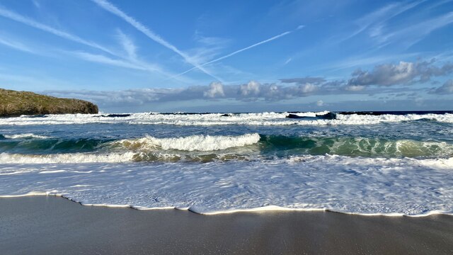
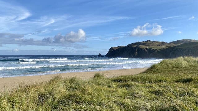
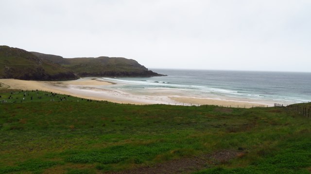
Surrounded by rolling hills and dense woodland, Loch nam Peithirean is a haven for nature enthusiasts and those seeking tranquility. The calm, glassy waters of the lake reflect the surrounding landscape, creating a mesmerizing sight. The area is known for its rich biodiversity, with a variety of plant and animal species calling the loch home.
The lake attracts a wide range of birdlife, making it a popular spot for birdwatchers. Visitors can spot species such as goldeneye, teal, and tufted ducks, as well as the occasional osprey soaring above the water. The marshy areas surrounding the lake are also teeming with life, with reed beds providing a habitat for various amphibians and insects.
A small pier juts out into the lake, offering a vantage point for visitors to take in the panoramic views or cast a fishing line. Loch nam Peithirean is known for its healthy population of brown trout, making it an ideal spot for anglers.
Overall, Loch nam Peithirean is a stunning example of the natural beauty that the Scottish Highlands have to offer. Its tranquil waters, diverse wildlife, and scenic surroundings make it a must-visit destination for anyone exploring the area.
If you have any feedback on the listing, please let us know in the comments section below.
Loch nam Peithirean Images
Images are sourced within 2km of 58.297216/-6.7720508 or Grid Reference NB2044. Thanks to Geograph Open Source API. All images are credited.


Loch nam Peithirean is located at Grid Ref: NB2044 (Lat: 58.297216, Lng: -6.7720508)
Unitary Authority: Na h-Eileanan an Iar
Police Authority: Highlands and Islands
What 3 Words
///states.proofread.blink. Near Carloway, Na h-Eileanan Siar
Related Wikis

Garenin
Garenin (Scottish Gaelic: Na Gearrannan) is a crofting township on the west coast of the Isle of Lewis in the Outer Hebrides of Scotland. Garenin is in...

Carloway
Carloway (Scottish Gaelic: Càrlabhagh [ˈkʰaːɾɫ̪ə.ɤː]) is a crofting township and a district on the west coast of the Isle of Lewis, in the Outer Hebrides...

Borrowston, Lewis
Borrowston (Scottish Gaelic: Borghastan), with a population of about 50, is a crofting township situated on the Isle of Lewis, on the Outer Hebrides of...

Dun Carloway
Dun Carloway (Scottish Gaelic: Dùn Chàrlabhaigh) is a broch situated in the district of Carloway, on the west coast of the Isle of Lewis, Scotland (grid...
Have you been to Loch nam Peithirean?
Leave your review of Loch nam Peithirean below (or comments, questions and feedback).