Cnoc nam Peithirean
Hill, Mountain in Ross-shire
Scotland
Cnoc nam Peithirean

Cnoc nam Peithirean is a prominent hill located in the county of Ross-shire, in the Scottish Highlands. It is situated near the village of Contin, approximately 20 miles west of Inverness. With an elevation of 330 meters (1,083 feet), it offers stunning panoramic views of the surrounding countryside and is a popular destination for hikers and nature enthusiasts.
The hill is known for its distinctive shape, with a rounded summit and gentle slopes covered in heather and grass. It is part of the larger Ben Wyvis range, which includes several other peaks in the area. Cnoc nam Peithirean is often described as a relatively easy climb, suitable for all levels of fitness, although the terrain can become more challenging in certain sections.
As visitors ascend the hill, they will encounter a variety of wildlife, including red deer, mountain hares, and various bird species. The hill is also home to a diverse range of flora, with wildflowers blooming during the spring and summer months.
At the summit of Cnoc nam Peithirean, hikers are rewarded with breathtaking views of the surrounding countryside, including the nearby Black Isle and the Cromarty Firth. On clear days, it is even possible to see the mountains of the Cairngorms National Park in the distance.
Overall, Cnoc nam Peithirean offers a picturesque and accessible outdoor experience for those looking to explore the natural beauty of Ross-shire. Whether it is for a leisurely hike or an opportunity to take in the stunning vistas, this hill provides a memorable experience for all who visit.
If you have any feedback on the listing, please let us know in the comments section below.
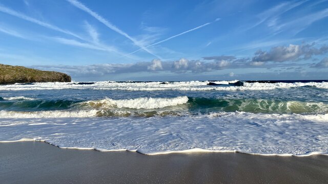
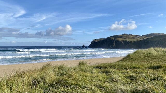
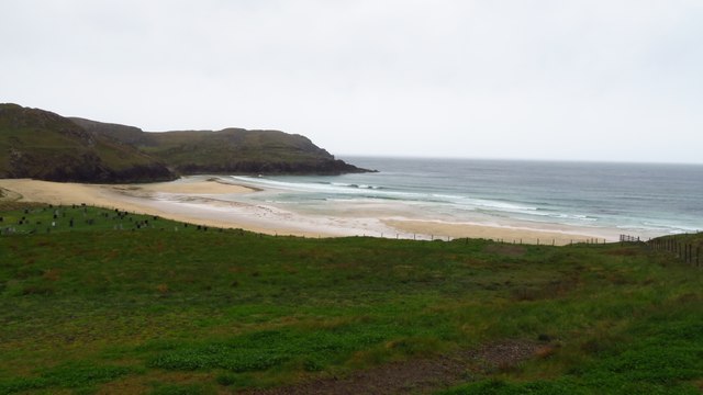
Cnoc nam Peithirean Images
Images are sourced within 2km of 58.30017/-6.7702623 or Grid Reference NB2044. Thanks to Geograph Open Source API. All images are credited.


Cnoc nam Peithirean is located at Grid Ref: NB2044 (Lat: 58.30017, Lng: -6.7702623)
Unitary Authority: Na h-Eileanan an Iar
Police Authority: Highlands and Islands
What 3 Words
///pushy.artichoke.pipes. Near Carloway, Na h-Eileanan Siar
Related Wikis

Garenin
Garenin (Scottish Gaelic: Na Gearrannan) is a crofting township on the west coast of the Isle of Lewis in the Outer Hebrides of Scotland. Garenin is in...

Carloway
Carloway (Scottish Gaelic: Càrlabhagh [ˈkʰaːɾɫ̪ə.ɤː]) is a crofting township and a district on the west coast of the Isle of Lewis, in the Outer Hebrides...

Borrowston, Lewis
Borrowston (Scottish Gaelic: Borghastan), with a population of about 50, is a crofting township situated on the Isle of Lewis, on the Outer Hebrides of...

Dun Carloway
Dun Carloway (Scottish Gaelic: Dùn Chàrlabhaigh) is a broch situated in the district of Carloway, on the west coast of the Isle of Lewis, Scotland (grid...
Have you been to Cnoc nam Peithirean?
Leave your review of Cnoc nam Peithirean below (or comments, questions and feedback).