Loch a' Chàrnain Mhòir
Lake, Pool, Pond, Freshwater Marsh in Ross-shire
Scotland
Loch a' Chàrnain Mhòir

Loch a' Chàrnain Mhòir is a small freshwater loch located in Ross-shire, Scotland. It is nestled within the stunning Scottish Highlands, surrounded by lush greenery and picturesque landscapes. The loch is situated in a remote and tranquil setting, providing visitors with a peaceful retreat away from the bustling cities.
The size of Loch a' Chàrnain Mhòir is relatively small, measuring approximately 1 kilometer in length and half a kilometer in width. Despite its modest size, the loch boasts crystal-clear waters that reflect the serene beauty of its surroundings.
Surrounded by rolling hills and dense forests, Loch a' Chàrnain Mhòir offers breathtaking views from every angle. The area is rich in wildlife, making it a popular spot for nature enthusiasts and birdwatchers. Visitors can often spot a variety of bird species, including ducks, swans, and herons, as well as occasional otters playing along the loch's edge.
The loch is also an ideal location for fishing enthusiasts, with its abundance of freshwater fish, including trout and pike. Fishing permits are required, and anglers can enjoy a peaceful day on the loch while trying their luck at catching a prized fish.
In addition to its natural beauty, Loch a' Chàrnain Mhòir offers several walking trails and picnic spots for visitors to enjoy. The area is easily accessible by car and provides ample parking facilities.
Overall, Loch a' Chàrnain Mhòir is a hidden gem in Ross-shire, offering a serene and idyllic setting for those seeking a peaceful escape in the heart of the Scottish Highlands.
If you have any feedback on the listing, please let us know in the comments section below.
Loch a' Chàrnain Mhòir Images
Images are sourced within 2km of 58.190519/-6.8466788 or Grid Reference NB1532. Thanks to Geograph Open Source API. All images are credited.


Loch a' Chàrnain Mhòir is located at Grid Ref: NB1532 (Lat: 58.190519, Lng: -6.8466788)
Unitary Authority: Na h-Eileanan an Iar
Police Authority: Highlands and Islands
What 3 Words
///intrigued.written.tastes. Near Carloway, Na h-Eileanan Siar
Nearby Locations
Related Wikis

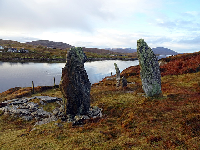
Callanish VIII
The Callanish VIII stone setting is one of many megalithic structures around the better-known (and larger) Calanais I on the west coast of the Isle of...

Dun Bharabhat, Great Bernera
Dun Bharabhat (or Dun Baravat) is an Iron Age galleried dun or "semi-broch" situated on the island of Great Bernera near Lewis in Scotland (grid reference...

Loch Ròg
Loch Ròg or Loch Roag is a large sea loch on the west coast of Lewis, Outer Hebrides. It is broadly divided into East Loch Roag and West Loch Roag with...
Fuaigh Beag
Fuaigh Beag or Vuia Be(a)g is an island in the Outer Hebrides. It is off the west coast of Lewis near Great Bernera in Loch Roag. Its name means "little...
Nearby Amenities
Located within 500m of 58.190519,-6.8466788Have you been to Loch a' Chàrnain Mhòir?
Leave your review of Loch a' Chàrnain Mhòir below (or comments, questions and feedback).