Loch Fuarail

Lake, Pool, Pond, Freshwater Marsh in Ross-shire

Scotland

Loch Fuarail

Gisla Power Station Small HEP station on the western shore of Loch Rog Beag at Giosla.
Gisla Power Station Credit: Colin Smith

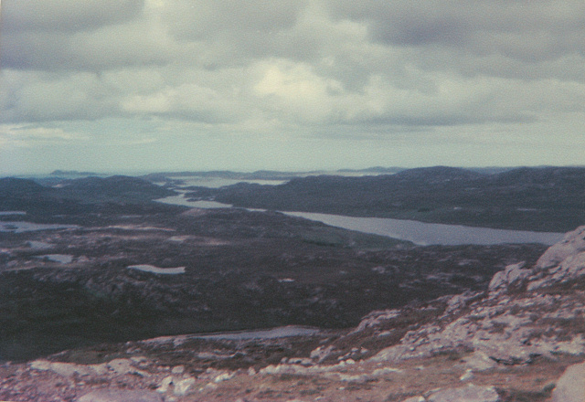
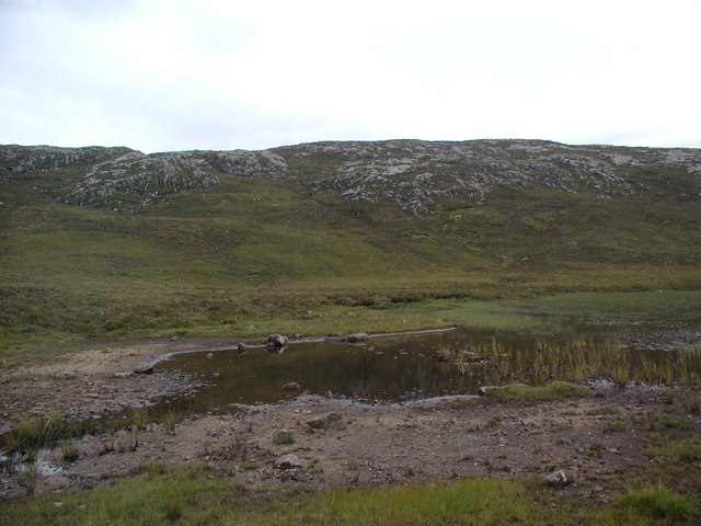
Loch Fuarail is a tranquil freshwater lake located in Ross-shire, Scotland. Nestled amidst the picturesque Highlands, it offers breathtaking views and a serene atmosphere that attracts both locals and tourists alike. With an area of approximately 1.5 hectares, Loch Fuarail is relatively small in size but compensates with its natural beauty.

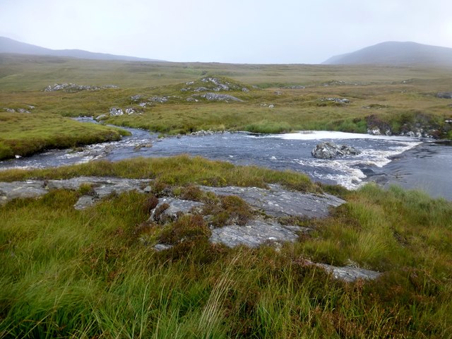
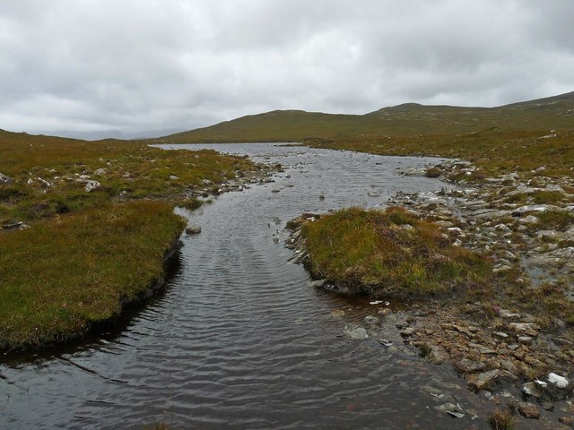
Surrounded by rolling hills and lush greenery, the lake is a haven for nature enthusiasts. Its crystal-clear waters are home to a variety of freshwater fish species, including brown trout and Arctic char, making it a popular spot for anglers. The tranquil environment also provides a perfect habitat for a diverse range of bird species, such as mallards, tufted ducks, and common sandpipers. Birdwatchers can spend hours observing and capturing pictures of these beautiful creatures in their natural habitat.

The distinct feature of Loch Fuarail is the presence of a freshwater marsh on its southern shore. This marshland is a rich ecosystem, supporting various plant species like reeds, rushes, and sedges. It serves as a breeding ground for amphibians and insects, adding to the biodiversity of the area.

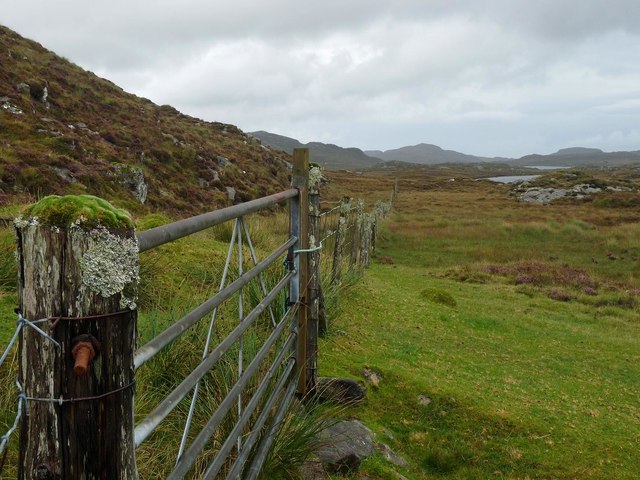
Visitors can enjoy leisurely walks around the lake, taking in the stunning scenery and appreciating the tranquility of the surroundings. The peaceful ambiance and the absence of motorized watercraft make it an ideal location for kayaking and canoeing enthusiasts.

Loch Fuarail's proximity to nearby hiking trails and camping sites also make it a popular destination for outdoor enthusiasts. Whether one seeks a quiet escape or an adventurous experience, Loch Fuarail offers an idyllic setting for all.

If you have any feedback on the listing, please let us know in the comments section below.

Loch Fuarail Images

Images are sourced within 2km of 58.112007/-6.884691 or Grid Reference NB1224. Thanks to Geograph Open Source API. All images are credited.

Gisla Power Station Small HEP station on the western shore of Loch Rog Beag at Giosla.
Gisla Power Station
Small HEP station on the western shore of Loch Rog Beag at Giosla.
B8011 cut through the hillside By the bottom of Loch Ròg Beag
B8011 cut through the hillside
By the bottom of Loch Ròg Beag
Gisla Power Station A small hydroelectric power station, using water piped from Loch Coirceabhat.
Gisla Power Station
A small hydroelectric power station, using water piped from Loch Coirceabhat.
On the northern slopes of Coduinn The rocky hillside offers a view over Loch Ròg Beag, a long sea loch, and, to its west, moorland lochs and lochans.
On the northern slopes of Coduinn
The rocky hillside offers a view over Loch Ròg Beag, a long sea loch, and, to its west, moorland lochs and lochans.
View From Bridge View from the road bridge towards Loch Rog Beag.
View From Bridge
View from the road bridge towards Loch Rog Beag.
River Morsgail The River Morsgail divides again to form another island.
River Morsgail
The River Morsgail divides again to form another island.
River Morsgail View A tributary joins the River Morsgail at a strange angle.
River Morsgail View
A tributary joins the River Morsgail at a strange angle.
Old road bridge at Giosla
Cairn Near Summit Of Codiunn Coduinn, Beinn a' Tuath, Beinn Mheadhanach and Sgeun with Jim Fothergill on a damp grey misty morning.
Name: Coduinn
Hill number: 4940
Height: 241m / 791ft
Parent (Ma/M): 1570 Beinn Mheadhanach [Beinn Mheadhonach]
Section: 24A: Lewis and Nearby Islands
County/UA: Na h-Eileanan Siar [Western Isles] (UA)
Island: Lewis and Harris
Class: HuMP, Tump (200-299m)
Grid ref: NB120232 (est)
Drop: 103m
Col: 138m NB116233
Cairn Near Summit Of Codiunn
Coduinn, Beinn a' Tuath, Beinn Mheadhanach and Sgeun with Jim Fothergill on a damp grey misty morning. Name: Coduinn Hill number: 4940 Height: 241m / 791ft Parent (Ma/M): 1570 Beinn Mheadhanach [Beinn Mheadhonach] Section: 24A: Lewis and Nearby Islands County/UA: Na h-Eileanan Siar [Western Isles] (UA) Island: Lewis and Harris Class: HuMP, Tump (200-299m) Grid ref: NB120232 (est) Drop: 103m Col: 138m NB116233
Outflow of Loch Beag an Fhorsa, Isle of Lewis The outflow is the source of the Allt Dubh which flows into Loch Fuarail below.
Outflow of Loch Beag an Fhorsa, Isle of Lewis
The outflow is the source of the Allt Dubh which flows into Loch Fuarail below.
Gate below Sgeun, Isle of Lewis Looking towards Loch Mòr Ruadh.
Gate below Sgeun, Isle of Lewis
Looking towards Loch Mòr Ruadh.
Fence to the south of Loch Gainmhich, Isle of Lewis The highest hill in the background is Stulabhal.

Although not particularly new looking, the fence is not currently shown on the OS map (as viewed on OS Maps 23/09/16).
Fence to the south of Loch Gainmhich, Isle of Lewis
The highest hill in the background is Stulabhal. Although not particularly new looking, the fence is not currently shown on the OS map (as viewed on OS Maps 23/09/16).
Rock on moorland near Loch Fuarail, Isle of Lewis Looking towards Loch Fuarail and Coduinn.
Rock on moorland near Loch Fuarail, Isle of Lewis
Looking towards Loch Fuarail and Coduinn.
Shieling, Airighean An Fhorsa, Isle of Lewis This shieling was still in use by people from Bhaltos at the time of the writing of the OS Name Book in 1849.
Shieling, Airighean An Fhorsa, Isle of Lewis
This shieling was still in use by people from Bhaltos at the time of the writing of the OS Name Book in 1849.
Looking towards Giosla from the B8011
Road leading to Mhorsgail Lodge
Loch Beag Ruadh with ridge of Sgeun behind
Old road bridge near Giosla. This bridge once carried the B8011 over the river that issues from Loch Morsgail. A new concrete bridge can be seen in the background.
Old road bridge near Giosla.
This bridge once carried the B8011 over the river that issues from Loch Morsgail. A new concrete bridge can be seen in the background.
Show me another place!

Loch Fuarail is located at Grid Ref: NB1224 (Lat: 58.112007, Lng: -6.884691)

Unitary Authority: Na h-Eileanan an Iar

Police Authority: Highlands and Islands

What 3 Words

///logo.importers.doghouse. Near Carloway, Na h-Eileanan Siar

Related Wikis

Gisla Hydro-Electric Scheme

Gisla Hydro-Electric Scheme was a small scheme promoted by the North of Scotland Hydro-Electric Board on the Isle of Lewis, Outer Hebrides, Scotland. It...

Fuaigh Beag

Fuaigh Beag or Vuia Be(a)g is an island in the Outer Hebrides. It is off the west coast of Lewis near Great Bernera in Loch Roag. Its name means "little...

Flodaigh, Lewis

Flodaigh is a small island in Loch Roag on the west coast of Lewis in the Outer Hebrides of Scotland. It is about 33 hectares (82 acres) in extent and...

Eilean Mòr, Loch Langavat

Eilean Mòr is an island in Loch Langavat on the Isle of Lewis in the Outer Hebrides of Scotland. == Footnotes ==

Nearby Amenities

Located within 500m of 58.112007,-6.884691
Gearraidh Beag Fuarail
Place: locality
Lat/Long: 58.1148484/-6.8896781
The data included in this document is from www.openstreetmap.org. The data is made available under ODbL.

Have you been to Loch Fuarail?

Leave your review of Loch Fuarail below (or comments, questions and feedback).