Cnoc na Crich

Hill, Mountain in Ross-shire

Scotland

Cnoc na Crich

Gisla Power Station Small HEP station on the western shore of Loch Rog Beag at Giosla.
Gisla Power Station Credit: Colin Smith

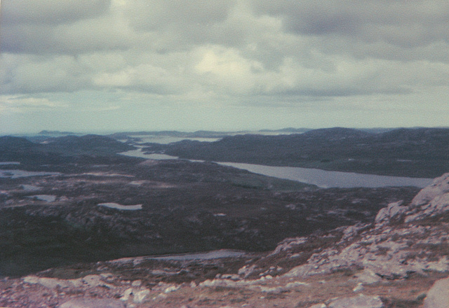
Cnoc na Crich is a prominent hill located in Ross-shire, Scotland. It is situated in the North West Highlands, near the village of Achiltibuie and the Coigach peninsula. Standing at an elevation of approximately 485 meters (1,591 feet), it offers breathtaking panoramic views of the surrounding landscape.

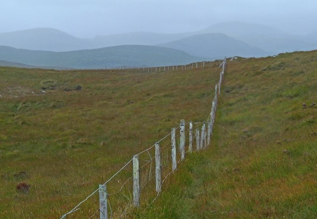
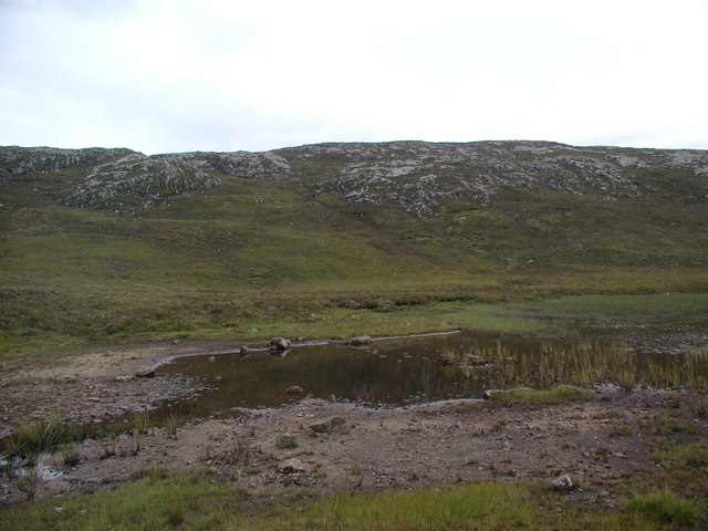
The hill is characterized by its steep and rugged terrain, consisting of rocky outcrops and heather-covered slopes. It is a popular destination for hikers and mountaineers due to its challenging ascent and rewarding vistas. The summit provides a magnificent vantage point, offering sweeping vistas of the surrounding mountains, lochs, and the nearby Summer Isles.

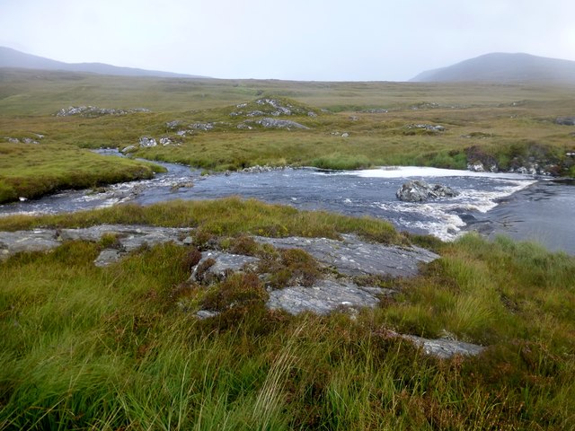
Cnoc na Crich is also home to a diverse range of flora and fauna. The hillside is covered in a tapestry of heather, bracken, and mosses, providing a habitat for various bird species, including golden eagles, buzzards, and peregrine falcons. The surrounding area is also known for its rich marine life, with sightings of seals, dolphins, and porpoises being common in the coastal waters.

The hill is easily accessible, with nearby car parks and well-marked trails leading to the summit. It is recommended to wear appropriate hiking gear and be prepared for changeable weather conditions, as the area is known for its unpredictable climate.

Overall, Cnoc na Crich offers a captivating and challenging outdoor experience, combining stunning natural beauty with a sense of adventure for those who seek to explore Scotland's rugged landscapes.

If you have any feedback on the listing, please let us know in the comments section below.

Cnoc na Crich Images

Images are sourced within 2km of 58.117538/-6.8765074 or Grid Reference NB1224. Thanks to Geograph Open Source API. All images are credited.

Gisla Power Station Small HEP station on the western shore of Loch Rog Beag at Giosla.
Gisla Power Station
Small HEP station on the western shore of Loch Rog Beag at Giosla.
B8011 cut through the hillside By the bottom of Loch Ròg Beag
B8011 cut through the hillside
By the bottom of Loch Ròg Beag
Gisla Power Station A small hydroelectric power station, using water piped from Loch Coirceabhat.
Gisla Power Station
A small hydroelectric power station, using water piped from Loch Coirceabhat.
On the northern slopes of Coduinn The rocky hillside offers a view over Loch Ròg Beag, a long sea loch, and, to its west, moorland lochs and lochans.
On the northern slopes of Coduinn
The rocky hillside offers a view over Loch Ròg Beag, a long sea loch, and, to its west, moorland lochs and lochans.
View From Bridge View from the road bridge towards Loch Rog Beag.
View From Bridge
View from the road bridge towards Loch Rog Beag.
River Morsgail The River Morsgail divides again to form another island.
River Morsgail
The River Morsgail divides again to form another island.
River Morsgail View A tributary joins the River Morsgail at a strange angle.
River Morsgail View
A tributary joins the River Morsgail at a strange angle.
Old road bridge at Giosla
Cairn Near Summit Of Codiunn Coduinn, Beinn a' Tuath, Beinn Mheadhanach and Sgeun with Jim Fothergill on a damp grey misty morning.
Name: Coduinn
Hill number: 4940
Height: 241m / 791ft
Parent (Ma/M): 1570 Beinn Mheadhanach [Beinn Mheadhonach]
Section: 24A: Lewis and Nearby Islands
County/UA: Na h-Eileanan Siar [Western Isles] (UA)
Island: Lewis and Harris
Class: HuMP, Tump (200-299m)
Grid ref: NB120232 (est)
Drop: 103m
Col: 138m NB116233
Cairn Near Summit Of Codiunn
Coduinn, Beinn a' Tuath, Beinn Mheadhanach and Sgeun with Jim Fothergill on a damp grey misty morning. Name: Coduinn Hill number: 4940 Height: 241m / 791ft Parent (Ma/M): 1570 Beinn Mheadhanach [Beinn Mheadhonach] Section: 24A: Lewis and Nearby Islands County/UA: Na h-Eileanan Siar [Western Isles] (UA) Island: Lewis and Harris Class: HuMP, Tump (200-299m) Grid ref: NB120232 (est) Drop: 103m Col: 138m NB116233
The B8011 road from Ardroil An excellent stretch of full width road - the only road which connects Ardroil to the rest of the island.
The B8011 road from Ardroil
An excellent stretch of full width road - the only road which connects Ardroil to the rest of the island.
Outflow of Loch Beag an Fhorsa, Isle of Lewis The outflow is the source of the Allt Dubh which flows into Loch Fuarail below.
Outflow of Loch Beag an Fhorsa, Isle of Lewis
The outflow is the source of the Allt Dubh which flows into Loch Fuarail below.
Gate below Sgeun, Isle of Lewis Looking towards Loch Mòr Ruadh.
Gate below Sgeun, Isle of Lewis
Looking towards Loch Mòr Ruadh.
Fence to the south of Loch Gainmhich, Isle of Lewis The highest hill in the background is Stulabhal.

Although not particularly new looking, the fence is not currently shown on the OS map (as viewed on OS Maps 23/09/16).
Fence to the south of Loch Gainmhich, Isle of Lewis
The highest hill in the background is Stulabhal. Although not particularly new looking, the fence is not currently shown on the OS map (as viewed on OS Maps 23/09/16).
Rock on moorland near Loch Fuarail, Isle of Lewis Looking towards Loch Fuarail and Coduinn.
Rock on moorland near Loch Fuarail, Isle of Lewis
Looking towards Loch Fuarail and Coduinn.
Looking towards Giosla from the B8011
Road leading to Mhorsgail Lodge
Giosla Looking towards Giosla across little loch roag
Giosla
Looking towards Giosla across little loch roag
Loch Beag Ruadh with ridge of Sgeun behind
Show me another place!

Cnoc na Crich is located at Grid Ref: NB1224 (Lat: 58.117538, Lng: -6.8765074)

Unitary Authority: Na h-Eileanan an Iar

Police Authority: Highlands and Islands

What 3 Words

///wobbles.fruits.tensions. Near Carloway, Na h-Eileanan Siar

Related Wikis

Gisla Hydro-Electric Scheme

Gisla Hydro-Electric Scheme was a small scheme promoted by the North of Scotland Hydro-Electric Board on the Isle of Lewis, Outer Hebrides, Scotland. It...

Fuaigh Beag

Fuaigh Beag or Vuia Be(a)g is an island in the Outer Hebrides. It is off the west coast of Lewis near Great Bernera in Loch Roag. Its name means "little...

Flodaigh, Lewis

Flodaigh is a small island in Loch Roag on the west coast of Lewis in the Outer Hebrides of Scotland. It is about 33 hectares (82 acres) in extent and...

Eilean Mòr, Loch Langavat

Eilean Mòr is an island in Loch Langavat on the Isle of Lewis in the Outer Hebrides of Scotland. == Footnotes ==

Nearby Amenities

Located within 500m of 58.117538,-6.8765074
Power: pole
Lat/Long: 58.1180005/-6.8681935
The data included in this document is from www.openstreetmap.org. The data is made available under ODbL.

Have you been to Cnoc na Crich?

Leave your review of Cnoc na Crich below (or comments, questions and feedback).