Loch na Cartach

Lake, Pool, Pond, Freshwater Marsh in Inverness-shire

Scotland

Loch na Cartach

Inlet of Loch Gheocrab
Inlet of Loch Gheocrab Credit: John Allan

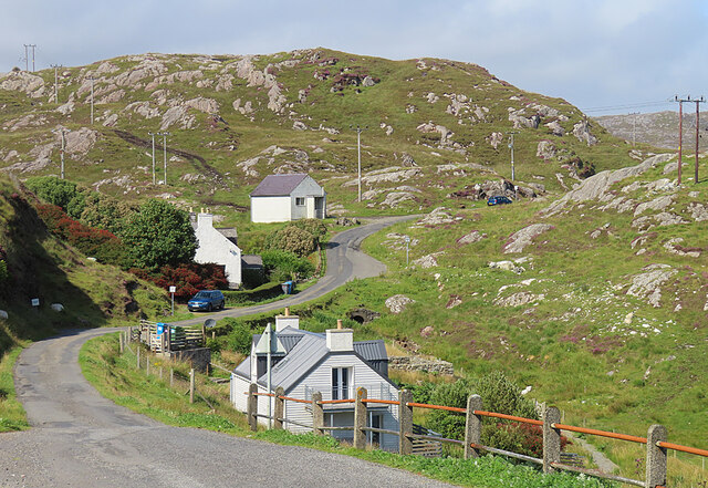
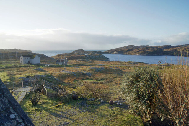
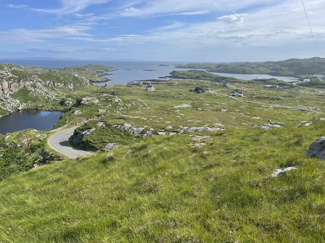
Loch na Cartach is a picturesque freshwater loch located in Inverness-shire, Scotland. It is situated in a remote and serene setting, surrounded by rolling hills and stunning natural beauty. The loch is relatively small in size, spanning approximately 1.5 kilometers in length and 0.5 kilometers in width.

The water in Loch na Cartach is crystal clear and its surface reflects the surrounding landscape, creating a stunning mirror-like effect. The loch is fed by several small streams and springs that flow from the nearby hills, ensuring a constant supply of fresh water.

Surrounding the loch, there is a diverse range of flora and fauna. The surrounding area is home to a variety of bird species, such as ducks, swans, and herons, which can often be seen gliding gracefully across the water. The loch also supports a thriving population of fish, including trout and pike, making it a popular spot for anglers.

In addition to its natural beauty, Loch na Cartach offers a peaceful and tranquil environment for visitors. The calm and serene atmosphere makes it an ideal location for outdoor activities such as fishing, boating, and picnicking. The loch is also a great place for nature enthusiasts, providing an opportunity to observe and appreciate the local wildlife.

Overall, Loch na Cartach is a hidden gem in Inverness-shire, offering a peaceful escape from the hustle and bustle of everyday life. Its stunning natural surroundings, diverse wildlife, and tranquil atmosphere make it a must-visit destination for those seeking a serene and picturesque experience in the Scottish Highlands.

If you have any feedback on the listing, please let us know in the comments section below.

Loch na Cartach Images

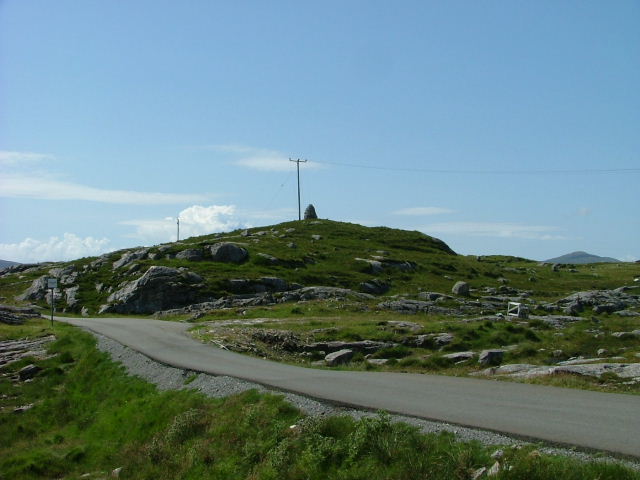
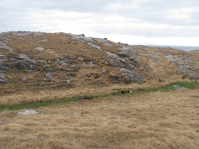
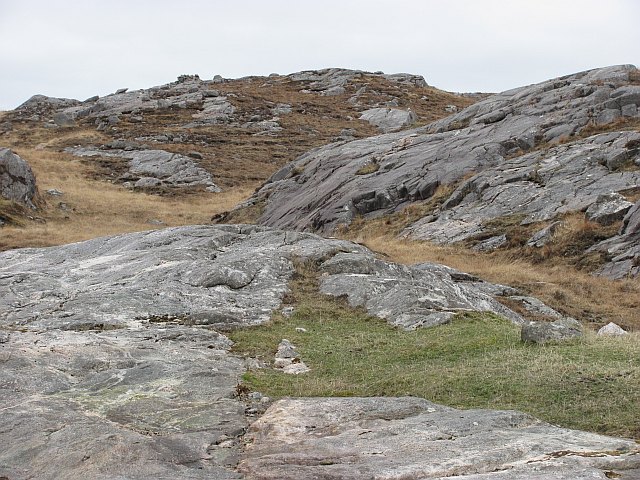
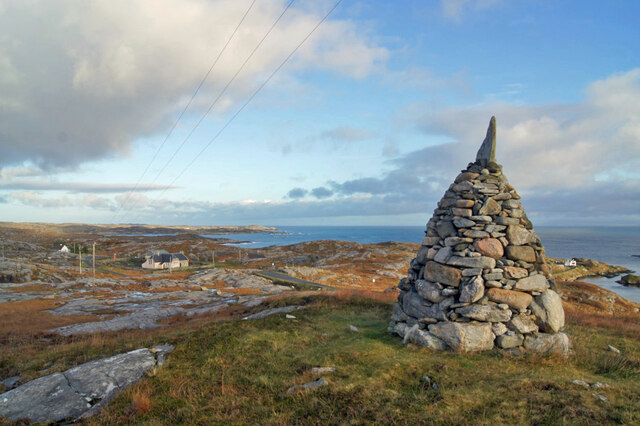
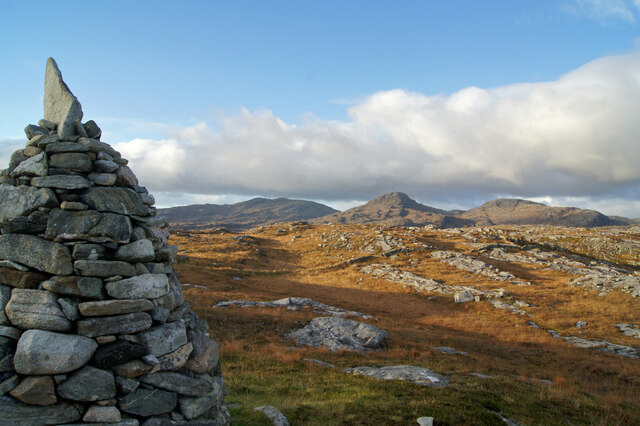
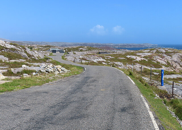
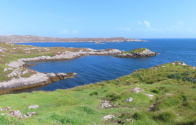
Images are sourced within 2km of 57.816628/-6.8570636 or Grid Reference NG1191. Thanks to Geograph Open Source API. All images are credited.

Inlet of Loch Gheocrab
Turning for Aird Shleibhe
Old school at Manais
Shed at Manais The wood carving looks to be a copy of one of the Lewis Chessmen. The sign to the right of the carving has been taken? borrowed? nicked? from the Roghadal Hotel.
Shed at Manais
The wood carving looks to be a copy of one of the Lewis Chessmen. The sign to the right of the carving has been taken? borrowed? nicked? from the Roghadal Hotel.
Part of the Golden Road at Manais
Old school and Telephone box at Manais
Cairn above Manais
Cairn above Manais
Communications mast
Communications mast
Bus shelter, Àird Shleibhe Seats provided in the bus shelter.
Bus shelter, Àird Shleibhe
Seats provided in the bus shelter.
Rough grazing, Àird Shleibhe
Cnoc na Brathan Large expanses of ice scoured gneiss. A typical landscape in South Harris.
Cnoc na Brathan
Large expanses of ice scoured gneiss. A typical landscape in South Harris.
Cairn and view, Manish Looking east past a neatly built cairn on the hillside just east of Manish.
Cairn and view, Manish
Looking east past a neatly built cairn on the hillside just east of Manish.
North past the cairn A view to the north past a cairn on the hillside just east of Manish.
North past the cairn
A view to the north past a cairn on the hillside just east of Manish.
The Winding Road The Bays road of eastern Harris twists and turns its way through the Lewisian gneiss landscape.
The Winding Road
The Bays road of eastern Harris twists and turns its way through the Lewisian gneiss landscape.
Loch Gheocrab One of the larger sea lochs on the east coast of Harris.
Loch Gheocrab
One of the larger sea lochs on the east coast of Harris.
Beachrabhaic Only a handful of houses make up the hamlet of Beacravik.
Beachrabhaic
Only a handful of houses make up the hamlet of Beacravik.
View south over Leac a' Li Looking from a window of a house in Leac a' Li. 
A few sheep graze the poor vegetation between the exposed bedrock. 
The water is Loch Stocanais.
View south over Leac a' Li
Looking from a window of a house in Leac a' Li. A few sheep graze the poor vegetation between the exposed bedrock. The water is Loch Stocanais.
Landscape of Harris
Landscape of Harris
Show me another place!

Loch na Cartach is located at Grid Ref: NG1191 (Lat: 57.816628, Lng: -6.8570636)

Unitary Authority: Na h-Eileanan an Iar

Police Authority: Highlands and Islands

What 3 Words

///respected.eating.craftsmen. Near Tarbert, Na h-Eileanan Siar

Related Wikis

Stockinish Island

Stockinish Island (Scottish Gaelic: Eilean Stocainis) is an uninhabited island off Harris, in the Outer Hebrides. == Geography and geology == Stockinish...

Borsham

Borsham (Scottish Gaelic: Boirseam) is a village in the 'Bays' area of Harris in the Outer Hebrides, Scotland. Borsham is within the parish of Harris....

Lingarabay

Lingarabay (also Lingerabay or Lingerbay; Scottish Gaelic: Lingreabhagh) is a small coastal settlement on Harris, in the Outer Hebrides of Scotland. It...

Harris Superquarry

The Harris Super Quarry was a super quarry at Lingerbay, Harris, Scotland proposed by Redland Aggregates in 1991. The plan was to surface mine aggregate...

Nearby Amenities

Located within 500m of 57.816628,-6.8570636
Created By: dmgroom_coastlines
Lat/Long: 57.81385/-6.85414
Passing Place
Lat/Long: 57.8130784/-6.8619207
Passing Place
Lat/Long: 57.8132987/-6.8613012
Passing Place
Lat/Long: 57.8148717/-6.8599348
Passing Place
Lat/Long: 57.8166071/-6.8584203
Passing Place
Lat/Long: 57.8188936/-6.8557841
Passing Place
Lat/Long: 57.8198236/-6.8550307
Bus Stop
Geocrab
Naptan AtcoCode: 6010731660
Naptan Bearing: N
Naptan CommonName: Geocrab
Naptan Indicator: Village
Naptan Landmark: Village
Naptan NaptanCode: 94723636
Naptan Street: Village
Naptan Verified: no
Source: naptan_import
Lat/Long: 57.8152702/-6.8576016
Post Box
Operator: Royal Mail
Operator Wikidata: Q638098
Post Box Mounting: pier
Post Box Type: lamp
Ref: HS3 122
Royal Cypher: scottish_crown
Lat/Long: 57.8155797/-6.8576352
Passing Place
Lat/Long: 57.814301/-6.8545414
Barrier: cattle_grid
Lat/Long: 57.813923/-6.8525872
Passing Place
Lat/Long: 57.8138563/-6.8529341
Cafe
Skoon Gallery & Studio
Addr City: Na Hearadh
Addr City En: Isle of Harris
Addr Country: GB
Addr Housenumber: 4
Addr Postcode: HS3 3HB
Addr Street: Geocrab
Fhrs Id: 806578
Opening Hours: Tu-Sa 10:00-16:30
Website: http://www.skoon.com/
Lat/Long: 57.8144493/-6.8526897
Geocrab
Alt Name: Geòcrab
Place: village
Source: OS_OpenData_StreetView
Lat/Long: 57.8151949/-6.8588303
Passing Place
Lat/Long: 57.8137537/-6.8609737
Passing Place
Lat/Long: 57.8145861/-6.8609542
Barrier: cattle_grid
Lat/Long: 57.8198185/-6.8563708
Power: pole
Lat/Long: 57.8184272/-6.8593475
Power: pole
Lat/Long: 57.8203007/-6.8579043
Power: pole
Lat/Long: 57.8194108/-6.8585152
Power: pole
Lat/Long: 57.8168958/-6.860522
Turning Circle
Lat/Long: 57.8150928/-6.8555458
Barrier: cattle_grid
Lat/Long: 57.8153364/-6.856266
Access: private
Entrance: yes
Lat/Long: 57.8143993/-6.8528079
Access: customers
Entrance: yes
Lat/Long: 57.8144205/-6.8527053
Access: private
Entrance: yes
Lat/Long: 57.8142987/-6.8519538
Generator Method: wind_turbine
Generator Source: wind
Power: generator
Lat/Long: 57.8197628/-6.8573245
Generator Method: wind_turbine
Generator Source: wind
Power: generator
Lat/Long: 57.8196198/-6.8570197
Generator Method: wind_turbine
Generator Source: wind
Power: generator
Lat/Long: 57.8196991/-6.8566866
Material: wood
Power: pole
Lat/Long: 57.8146245/-6.8556045
Material: wood
Power: pole
Lat/Long: 57.8149581/-6.8560552
Material: wood
Power: pole
Lat/Long: 57.8153625/-6.8562
Material: wood
Power: pole
Lat/Long: 57.8155353/-6.8568062
Material: wood
Power: pole
Lat/Long: 57.8159154/-6.8579193
Material: wood
Power: pole
Lat/Long: 57.8162039/-6.8586033
Material: wood
Power: pole
Lat/Long: 57.8164861/-6.859357
Material: wood
Power: pole
Lat/Long: 57.8140707/-6.854337
Material: wood
Power: pole
Lat/Long: 57.8139531/-6.8535634
Material: wood
Power: pole
Lat/Long: 57.8131351/-6.8520654
Material: wood
Power: pole
Lat/Long: 57.8134965/-6.8521754
Material: wood
Power: pole
Lat/Long: 57.8148308/-6.8549566
Passing Place
Lat/Long: 57.8149076/-6.8586637
Passing Place
Lat/Long: 57.8155977/-6.8575751
Passing Place
Lat/Long: 57.8173071/-6.8585438
Turning Circle
Lat/Long: 57.8170941/-6.8604413
Generator Method: photovoltaic
Generator Output Electricity: small_installation
Generator Source: solar
Generator Type: solar_photovoltaic_panel
Power: generator
Lat/Long: 57.8144166/-6.8600107
Material: wood
Power: pole
Lat/Long: 57.8186747/-6.8559587
Material: wood
Power: pole
Lat/Long: 57.8179653/-6.8557964
Material: wood
Power: pole
Lat/Long: 57.8175746/-6.8563463
Material: wood
Power: pole
Lat/Long: 57.8173433/-6.8566923
Material: wood
Power: pole
Lat/Long: 57.8172239/-6.8570316
Material: wood
Power: pole
Lat/Long: 57.816979/-6.8574567
Material: wood
Power: pole
Lat/Long: 57.8166439/-6.8578162
Material: wood
Power: pole
Lat/Long: 57.8162996/-6.8580804
Material: wood
Power: pole
Lat/Long: 57.8190442/-6.8556304
Material: wood
Power: pole
Lat/Long: 57.8196732/-6.8552916
Material: wood
Power: pole
Lat/Long: 57.8199568/-6.8551493
Material: wood
Power: pole
Lat/Long: 57.8203592/-6.8551817
Material: wood
Power: pole
Lat/Long: 57.8209199/-6.8551902
Material: wood
Power: pole
Lat/Long: 57.8193961/-6.8555075
Material: wood
Power: pole
Lat/Long: 57.8182532/-6.8558742
Passing Place
Lat/Long: 57.8172284/-6.8573005
Material: wood
Power: pole
Lat/Long: 57.8170142/-6.8620772
Material: wood
Power: pole
Lat/Long: 57.8173487/-6.8613155
Material: wood
Power: pole
Lat/Long: 57.8164736/-6.8625091
Material: wood
Power: pole
Lat/Long: 57.8145285/-6.8641385
Material: wood
Power: pole
Lat/Long: 57.8151672/-6.8635524
Material: wood
Power: pole
Lat/Long: 57.8159222/-6.8629624
Material: wood
Power: pole
Lat/Long: 57.8176362/-6.8605403
Material: wood
Power: pole
Lat/Long: 57.8179312/-6.8597933
Material: wood
Power: pole
Lat/Long: 57.8145748/-6.8604647
Power: pole
Lat/Long: 57.819915/-6.8580804
Power: pole
Lat/Long: 57.8207321/-6.8577406
Power: pole
Lat/Long: 57.8133294/-6.8621016
Power: pole
Lat/Long: 57.8134749/-6.8629442
Power: pole
Lat/Long: 57.8139366/-6.8629427
Power: pole
Lat/Long: 57.8142119/-6.8620686
Power: pole
Lat/Long: 57.8144364/-6.8631496
Power: pole
Lat/Long: 57.81479/-6.8611363
Power: pole
Lat/Long: 57.8146072/-6.8565389
Power: pole
Lat/Long: 57.8146027/-6.8574759
Power: pole
Lat/Long: 57.8145905/-6.8588588
Power: pole
Lat/Long: 57.8141663/-6.8523402
Power: pole
Lat/Long: 57.8201777/-6.856285
Barrier: cattle_grid
Lat/Long: 57.8146175/-6.8599927
The data included in this document is from www.openstreetmap.org. The data is made available under ODbL.

Have you been to Loch na Cartach?

Leave your review of Loch na Cartach below (or comments, questions and feedback).