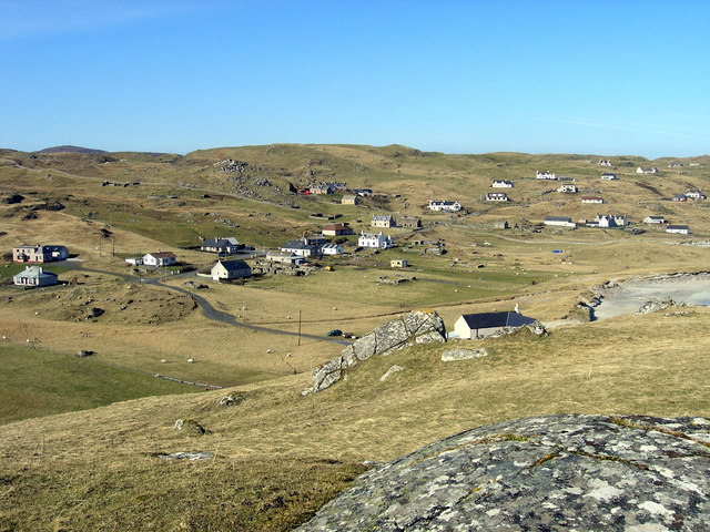
Loch Dubh Bhàcasaigh
Lake, Pool, Pond, Freshwater Marsh in Ross-shire
Scotland
Loch Dubh Bhàcasaigh
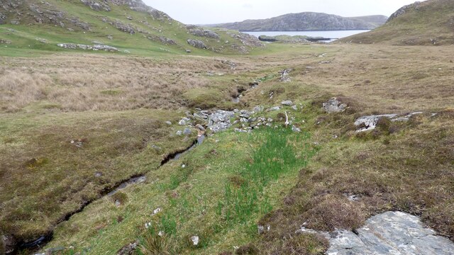
Loch Dubh Bhàcasaigh is a picturesque freshwater loch located in Ross-shire, Scotland. Nestled amidst the stunning Scottish Highlands, it is a serene and tranquil body of water that attracts nature enthusiasts and tourists alike.
Covering an area of approximately 50 acres, Loch Dubh Bhàcasaigh is surrounded by rolling hills and verdant vegetation, offering a breathtaking backdrop for visitors. The loch is fed by several small streams that trickle down from the surrounding mountains, ensuring a constant supply of fresh water.
The water in Loch Dubh Bhàcasaigh is known for its clarity and purity, providing a home for a variety of aquatic plant and animal life. The loch is home to an abundance of fish species, including brown trout and salmon, making it a popular spot for fishing enthusiasts.
The surrounding area of Loch Dubh Bhàcasaigh is a haven for wildlife. Birdwatchers will be delighted by the numerous species of birds that inhabit the area, such as golden eagles, ospreys, and various waterfowl. The loch also provides a habitat for otters, which can occasionally be spotted swimming and playing in the water.
For those seeking outdoor activities, Loch Dubh Bhàcasaigh offers opportunities for boating, kayaking, and canoeing. The calm and peaceful atmosphere makes it a perfect spot for leisurely water-based adventures.
Overall, Loch Dubh Bhàcasaigh is a natural gem in the Scottish Highlands, offering visitors a chance to immerse themselves in the beauty of Scotland's landscape and observe its diverse wildlife.
If you have any feedback on the listing, please let us know in the comments section below.
Loch Dubh Bhàcasaigh Images
Images are sourced within 2km of 58.227186/-6.9129427 or Grid Reference NB1137. Thanks to Geograph Open Source API. All images are credited.
Loch Dubh Bhàcasaigh is located at Grid Ref: NB1137 (Lat: 58.227186, Lng: -6.9129427)
Unitary Authority: Na h-Eileanan an Iar
Police Authority: Highlands and Islands
What 3 Words
///familiar.musically.loved. Near Carloway, Na h-Eileanan Siar
Nearby Locations
Related Wikis
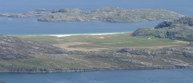
Vacsay
Vacsay (Scottish Gaelic: Bhacsaigh from Old Norse "bakkiey" meaning "peat bank island") is one of the Outer Hebrides. It is off the west coast of Lewis...
Pabaigh Mòr
Pabay Mòr or Pabaigh Mòr is an uninhabited island in the Outer Hebrides of Scotland. == History == The island's name comes from papey, an Old Norse name...
Kneep
Kneep (Scottish Gaelic: Cnìp) is a village on the Isle of Lewis, in the Outer Hebrides, Scotland. Kneep is within the parish of Uig.Various archaeological...
Loch na Berie
Loch Na Berie is a broch in the Outer Hebrides of Scotland, located approximately 400 yards from the shore, and is thought to have been located on an island...
Fuaigh Mòr
Fuaigh Mòr (sometimes anglicised as Vuia Mor) is an island in the Outer Hebrides of Scotland. It is off the west coast of Lewis near Great Bernera in...
Bernera Riot
The Bernera Riot occurred in 1874, on the island of Great Bernera, in Scotland in response to the Highland Clearances. The use of the term 'Bernera Riot...
Loch Ròg
Loch Ròg or Loch Roag is a large sea loch on the west coast of Lewis, Outer Hebrides. It is broadly divided into East Loch Roag and West Loch Roag with...
Cliff, Lewis
Cliff (Scottish Gaelic: Cliobh) is a small settlement on the Isle of Lewis, in the Outer Hebrides, Scotland. Cliff is within the parish of Uig. The settlement...
Have you been to Loch Dubh Bhàcasaigh?
Leave your review of Loch Dubh Bhàcasaigh below (or comments, questions and feedback).
