Geodha Ruadh
Coastal Feature, Headland, Point in Ross-shire
Scotland
Geodha Ruadh

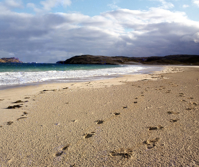
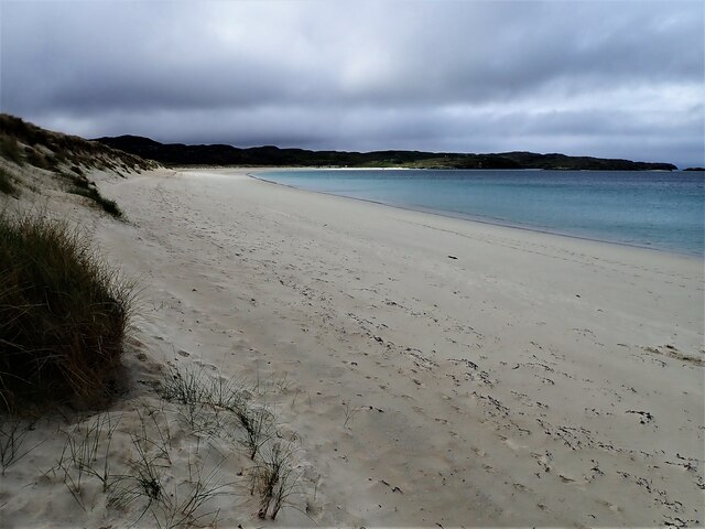
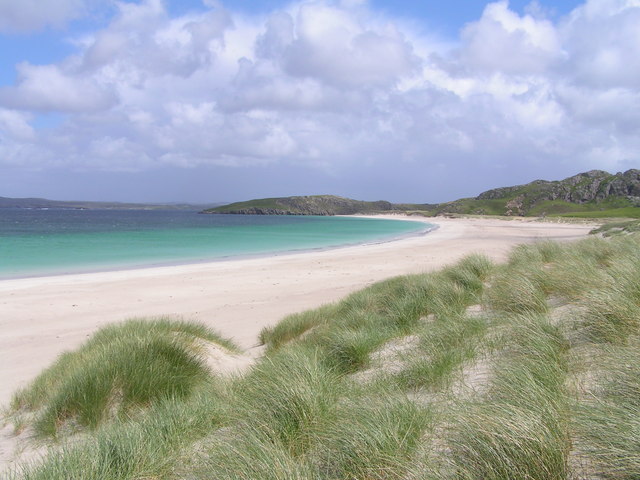
Geodha Ruadh, located in Ross-shire, Scotland, is a prominent coastal feature that is characterized as a headland or point. Situated on the northwest coast, it is known for its stunning natural beauty and rugged landscape. Geodha Ruadh is surrounded by the vast waters of the North Atlantic Ocean, providing visitors with breathtaking panoramic views of the sea and the surrounding cliffs.
The headland is marked by towering cliffs that rise steeply from the water's edge, forming an impressive coastal defense against the powerful waves of the ocean. The cliffs are predominantly composed of rugged, reddish-brown sandstone, which gives Geodha Ruadh its name, translating to "red cove" in Scottish Gaelic.
The point is also home to a diverse array of wildlife. Seabirds, such as gannets, kittiwakes, and fulmars, can be spotted nesting on the cliff ledges, while seals can be seen basking on the nearby rocks or swimming in the crystal-clear waters. Geodha Ruadh is a haven for nature enthusiasts and photographers, providing ample opportunities to capture the beauty of Scotland's coastal wildlife.
Visitors to Geodha Ruadh can explore the area by following the walking trails that snake along the cliff tops, offering breathtaking views of the rugged coastline. As a designated Site of Special Scientific Interest, the headland is protected for its geological and ecological significance, ensuring the preservation of its natural beauty for future generations to enjoy.
In conclusion, Geodha Ruadh is a stunning coastal feature in Ross-shire, Scotland, renowned for its dramatic cliffs, abundant wildlife, and picturesque views. It is a must-visit destination for nature lovers and those seeking a tranquil escape in the midst of Scotland's rugged coastline.
If you have any feedback on the listing, please let us know in the comments section below.
Geodha Ruadh Images
Images are sourced within 2km of 58.228108/-6.9109558 or Grid Reference NB1137. Thanks to Geograph Open Source API. All images are credited.


Geodha Ruadh is located at Grid Ref: NB1137 (Lat: 58.228108, Lng: -6.9109558)
Unitary Authority: Na h-Eileanan an Iar
Police Authority: Highlands and Islands
What 3 Words
///crest.echo.hack. Near Carloway, Na h-Eileanan Siar
Related Wikis

Vacsay
Vacsay (Scottish Gaelic: Bhacsaigh from Old Norse "bakkiey" meaning "peat bank island") is one of the Outer Hebrides. It is off the west coast of Lewis...

Pabaigh Mòr
Pabay Mòr or Pabaigh Mòr is an uninhabited island in the Outer Hebrides of Scotland. == History == The island's name comes from papey, an Old Norse name...

Kneep
Kneep (Scottish Gaelic: Cnìp) is a village on the Isle of Lewis, in the Outer Hebrides, Scotland. Kneep is within the parish of Uig.Various archaeological...

Loch na Berie
Loch Na Berie is a broch in the Outer Hebrides of Scotland, located approximately 400 yards from the shore, and is thought to have been located on an island...
Have you been to Geodha Ruadh?
Leave your review of Geodha Ruadh below (or comments, questions and feedback).