Loch Dubh

Lake, Pool, Pond, Freshwater Marsh in Inverness-shire

Scotland

Loch Dubh

Inlet of Loch Gheocrab
Inlet of Loch Gheocrab Credit: John Allan

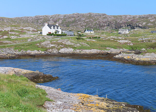
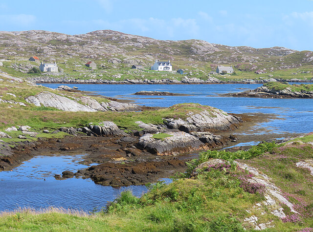
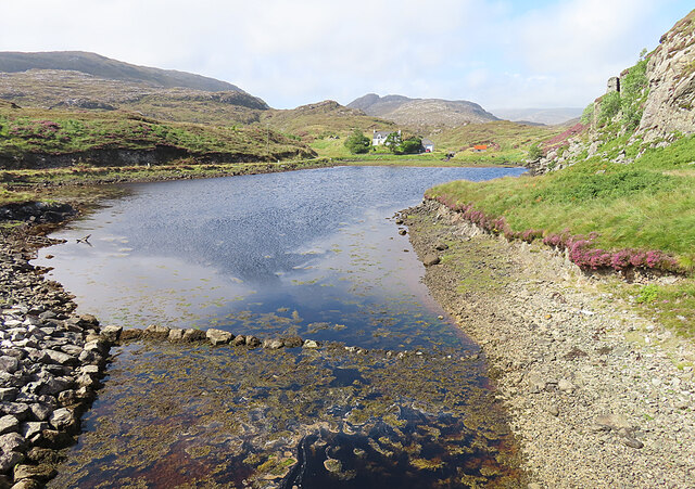
Loch Dubh is a picturesque freshwater loch located in Inverness-shire, Scotland. Nestled amidst the stunning Scottish Highlands, this natural beauty spot is a popular destination for locals and tourists alike, offering a serene and tranquil environment.

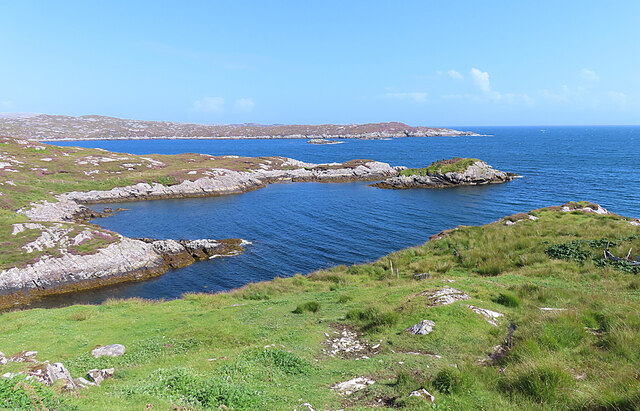
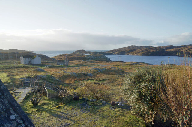
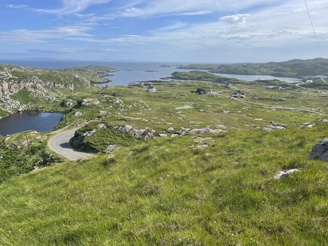
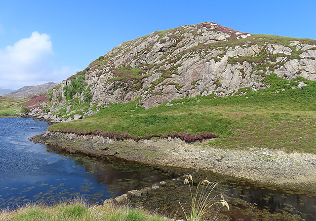
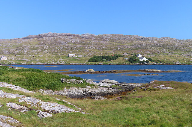
Covering an area of approximately 100 acres, Loch Dubh boasts crystal clear waters that reflect the surrounding lush greenery and majestic mountains. The loch is surrounded by dense forests and rolling hills, adding to its charm and providing a habitat for a variety of wildlife species.

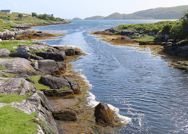
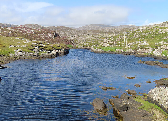
The water in Loch Dubh is sourced from nearby streams and underground springs, ensuring its purity and making it a perfect home for various freshwater fish species, including trout and salmon. Anglers often visit the loch for fishing opportunities, attracted by the abundance of fish in its depths.

Surrounding the loch, there is a small stretch of marshland, which adds to the biodiversity of the area. This freshwater marsh provides a habitat for numerous plant species, including reeds and sedges, as well as a variety of bird species, such as ducks, herons, and swans. Birdwatchers can often be seen in the area, trying to catch a glimpse of the diverse avian life.

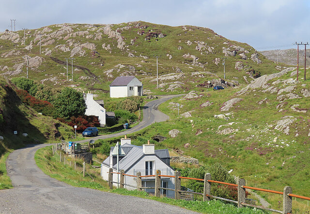
The peaceful atmosphere of Loch Dubh makes it an ideal spot for leisurely walks, picnics, and nature exploration. The surrounding trails provide visitors with the opportunity to immerse themselves in the beauty of the Scottish Highlands, offering breathtaking views at every turn.

Overall, Loch Dubh is a hidden gem in Inverness-shire, offering a combination of stunning natural landscapes, diverse wildlife, and a tranquil ambiance for all who visit.

If you have any feedback on the listing, please let us know in the comments section below.

Loch Dubh Images

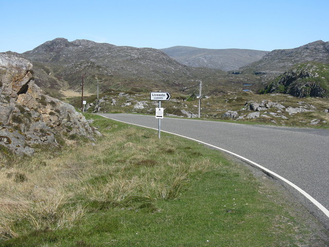
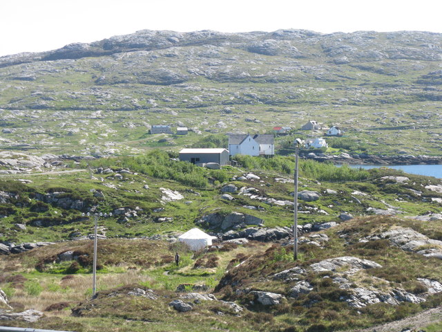
Images are sourced within 2km of 57.82103/-6.8635411 or Grid Reference NG1191. Thanks to Geograph Open Source API. All images are credited.

Inlet of Loch Gheocrab
Shed at Manais The wood carving looks to be a copy of one of the Lewis Chessmen. The sign to the right of the carving has been taken? borrowed? nicked? from the Roghadal Hotel.
Shed at Manais
The wood carving looks to be a copy of one of the Lewis Chessmen. The sign to the right of the carving has been taken? borrowed? nicked? from the Roghadal Hotel.
Part of the Golden Road at Manais
Communications mast
Communications mast
Loch Gheocrab One of the larger sea lochs on the east coast of Harris.
Loch Gheocrab
One of the larger sea lochs on the east coast of Harris.
Beachrabhaic Only a handful of houses make up the hamlet of Beacravik.
Beachrabhaic
Only a handful of houses make up the hamlet of Beacravik.
View south over Leac a' Li Looking from a window of a house in Leac a' Li. 
A few sheep graze the poor vegetation between the exposed bedrock. 
The water is Loch Stocanais.
View south over Leac a' Li
Looking from a window of a house in Leac a' Li. A few sheep graze the poor vegetation between the exposed bedrock. The water is Loch Stocanais.
Landscape of Harris
Landscape of Harris
Loch Bheacrabhaig Loch Beacravik is an arm of the sea loch Loch Geocrab.
Loch Bheacrabhaig
Loch Beacravik is an arm of the sea loch Loch Geocrab.
Geocrab A dispersed settlement around the head of Loch Geocrab.
Geocrab
A dispersed settlement around the head of Loch Geocrab.
Bus Shelter The bus shelter is above the turning to Liceasto. I was pleasantly surprised to find a timetable suggesting that there are six buses a day from Roghadal via here to Tarbert.
Bus Shelter
The bus shelter is above the turning to Liceasto. I was pleasantly surprised to find a timetable suggesting that there are six buses a day from Roghadal via here to Tarbert.
Ceann a' Bhàigh Mhòr The name means 'head of the big bay'; the 'big bay' seems to be Loch Stockinish.
Ceann a' Bhàigh Mhòr
The name means 'head of the big bay'; the 'big bay' seems to be Loch Stockinish.
Ceann a' Bhàigh Mhòr The sea-loch in the foreground is the 'head of the big bay' but the rock face appears not to have a name of its own.
Ceann a' Bhàigh Mhòr
The sea-loch in the foreground is the 'head of the big bay' but the rock face appears not to have a name of its own.
Leac a' Li across Ob Liath Leac a' Li or Lackalee is on the shore of Loch Stockinish, and the head of the loch is Ob Liath, the 'grey bay'.
Leac a' Li across Ob Liath
Leac a' Li or Lackalee is on the shore of Loch Stockinish, and the head of the loch is Ob Liath, the 'grey bay'.
Unnamed Inlet The map suggests that this inlet dries at low tide. It opens into Ob Liath, and then into Loch Stocanais.
Unnamed Inlet
The map suggests that this inlet dries at low tide. It opens into Ob Liath, and then into Loch Stocanais.
Landlocked Inlet This inlet of the sea near Àird Mhìghe is almost completely landlocked.
Landlocked Inlet
This inlet of the sea near Àird Mhìghe is almost completely landlocked.
The road to Liceasto/Lickisto One of several turnings off into the rocky landscape of the Golden Road area of Harris.
The road to Liceasto/Lickisto
One of several turnings off into the rocky landscape of the Golden Road area of Harris.
Lickisto and Ãird Mhìghe With a tent of Lickisto Blackhouse Camping in the dip in the foreground.
Lickisto and Ãird Mhìghe
With a tent of Lickisto Blackhouse Camping in the dip in the foreground.
Show me another place!

Loch Dubh is located at Grid Ref: NG1191 (Lat: 57.82103, Lng: -6.8635411)

Unitary Authority: Na h-Eileanan an Iar

Police Authority: Highlands and Islands

What 3 Words

///punters.noises.rollers. Near Tarbert, Na h-Eileanan Siar

Related Wikis

Stockinish Island

Stockinish Island (Scottish Gaelic: Eilean Stocainis) is an uninhabited island off Harris, in the Outer Hebrides. == Geography and geology == Stockinish...

Borsham

Borsham (Scottish Gaelic: Boirseam) is a village in the 'Bays' area of Harris in the Outer Hebrides, Scotland. Borsham is within the parish of Harris....

Lingarabay

Lingarabay (also Lingerabay or Lingerbay; Scottish Gaelic: Lingreabhagh) is a small coastal settlement on Harris, in the Outer Hebrides of Scotland. It...

Harris Superquarry

The Harris Super Quarry was a super quarry at Lingerbay, Harris, Scotland proposed by Redland Aggregates in 1991. The plan was to surface mine aggregate...

Nearby Amenities

Located within 500m of 57.82103,-6.8635411
Passing Place
Lat/Long: 57.8220021/-6.855362
Barrier: cattle_grid
Lat/Long: 57.8198185/-6.8563708
Cnoc Geumasgairbhe
Alt Name: Knock Geimisgarave
Ele: 134
Natural: peak
Lat/Long: 57.8227725/-6.8643918
Power: pole
Lat/Long: 57.8184272/-6.8593475
Power: pole
Lat/Long: 57.8203007/-6.8579043
Power: pole
Lat/Long: 57.8214297/-6.857449
Power: pole
Lat/Long: 57.822929/-6.8572324
Power: pole
Lat/Long: 57.82365/-6.8573223
Power: pole
Lat/Long: 57.8221833/-6.857164
Power: pole
Lat/Long: 57.8194108/-6.8585152
Power: pole
Lat/Long: 57.8168958/-6.860522
Generator Method: wind_turbine
Generator Source: wind
Power: generator
Lat/Long: 57.8197628/-6.8573245
Generator Method: wind_turbine
Generator Source: wind
Power: generator
Lat/Long: 57.8196198/-6.8570197
Generator Method: wind_turbine
Generator Source: wind
Power: generator
Lat/Long: 57.8196991/-6.8566866
Turning Circle
Lat/Long: 57.8170941/-6.8604413
Material: wood
Power: pole
Lat/Long: 57.8221118/-6.8554248
Power: pole
Lat/Long: 57.8216871/-6.8553139
Material: wood
Power: pole
Lat/Long: 57.8209199/-6.8551902
Material: wood
Power: pole
Lat/Long: 57.8170142/-6.8620772
Material: wood
Power: pole
Lat/Long: 57.8173487/-6.8613155
Material: wood
Power: pole
Lat/Long: 57.8176362/-6.8605403
Material: wood
Power: pole
Lat/Long: 57.8179312/-6.8597933
Power: pole
Lat/Long: 57.819915/-6.8580804
Power: pole
Lat/Long: 57.8207321/-6.8577406
Power: pole
Lat/Long: 57.8201777/-6.856285
The data included in this document is from www.openstreetmap.org. The data is made available under ODbL.

Have you been to Loch Dubh?

Leave your review of Loch Dubh below (or comments, questions and feedback).