Loch Nighe

Lake, Pool, Pond, Freshwater Marsh in Inverness-shire

Scotland

Loch Nighe

Flodda causeway
Flodda causeway Credit: Catherine Morgan

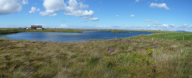
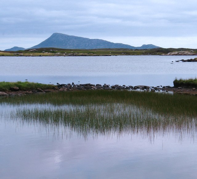
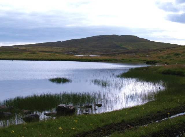
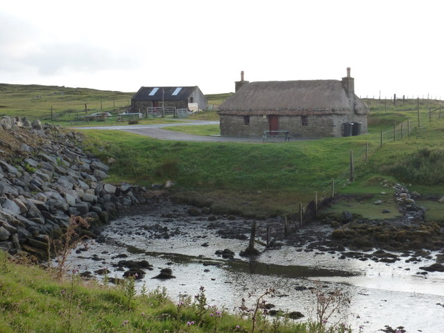
Loch Nighe is a freshwater loch located in Inverness-shire, Scotland. Nestled amidst the picturesque Scottish Highlands, it is a popular destination for locals and tourists alike. Spanning an area of approximately 150 acres, Loch Nighe is a serene and tranquil water body that offers breathtaking views and a peaceful atmosphere.

Surrounded by lush greenery, the loch is home to a variety of flora and fauna. The waters of Loch Nighe are crystal clear, providing a habitat for numerous species of fish and other aquatic life. Anglers are often seen casting their lines, hoping to catch trout, pike, or perch, which are abundant in the loch.

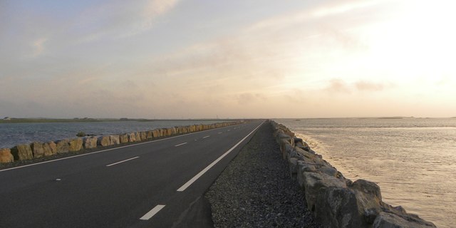
The surrounding area is dotted with several walking and cycling trails, making it a haven for outdoor enthusiasts. Visitors can explore the beautiful countryside, taking in the stunning views of rolling hills and forests that encompass the loch. Birdwatchers will be delighted to spot various species of birds, including ducks, swans, and herons, which frequent the shores of Loch Nighe.

The tranquil atmosphere and breathtaking scenery make Loch Nighe an ideal spot for relaxation and picnics. Visitors can unwind on the grassy banks, enjoying a peaceful day by the water. The loch also offers opportunities for water activities such as kayaking and canoeing, allowing visitors to explore its calm waters.

Overall, Loch Nighe in Inverness-shire is a hidden gem in the Scottish Highlands, offering a perfect blend of natural beauty and tranquility. It is a must-visit destination for nature lovers and those seeking a peaceful escape amidst the stunning Scottish landscape.

If you have any feedback on the listing, please let us know in the comments section below.
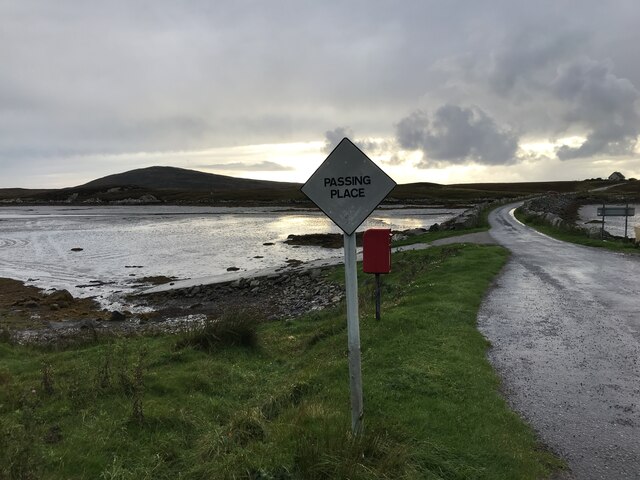
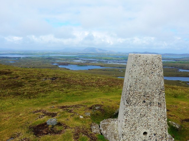
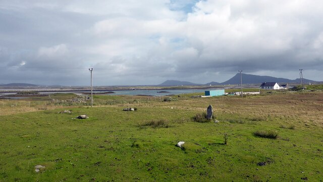
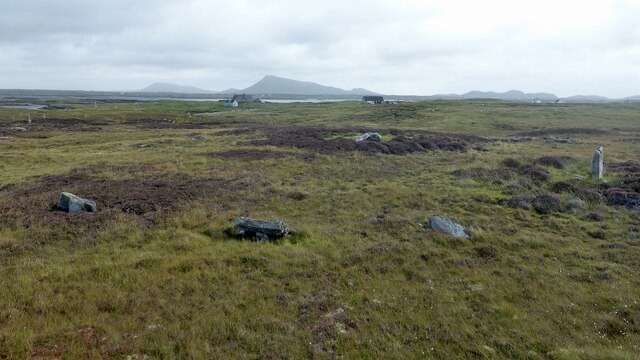
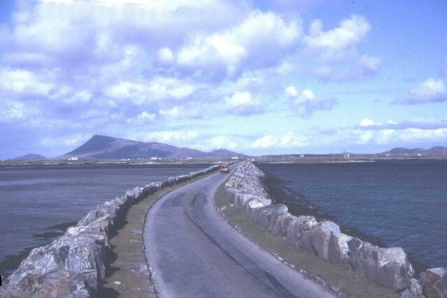
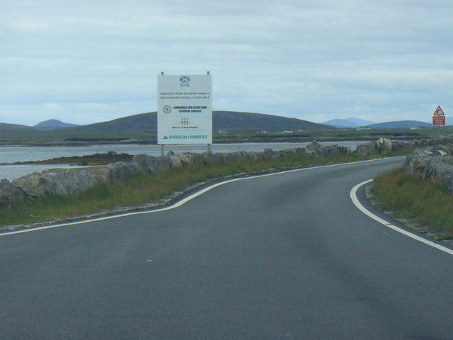
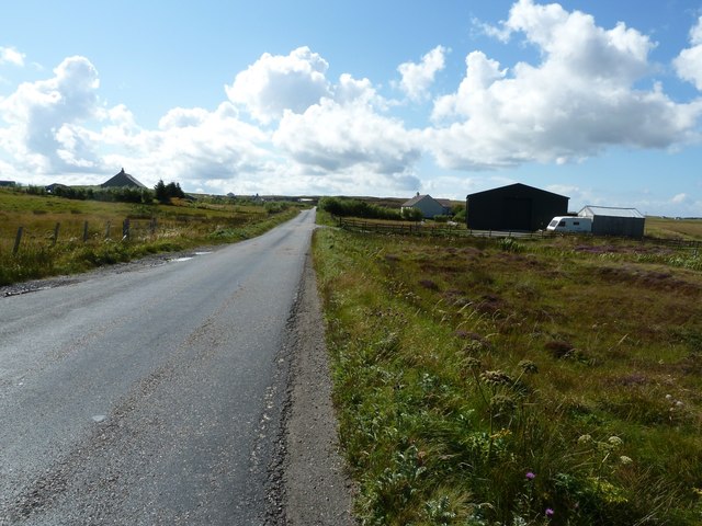
Loch Nighe Images

Images are sourced within 2km of 57.477528/-7.3016627 or Grid Reference NF8255. Thanks to Geograph Open Source API. All images are credited.

Flodda causeway
Flodda causeway
Summit trig on Ruabhal Looking towards Grimsay and North Uist.
Summit trig on Ruabhal
Looking towards Grimsay and North Uist.
Oitir Mhòr
Oitir Mhòr
Gramisdale stone circle Rather mutilated prehistoric stone circle. <span class="nowrap"><a title="https://canmore.org.uk/site/10186/benbecula-gramisdale" rel="nofollow ugc noopener" href="https://canmore.org.uk/site/10186/benbecula-gramisdale">Link</a><img style="margin-left:2px;" alt="External link" title="External link - shift click to open in new window" src="https://s1.geograph.org.uk/img/external.png" width="10" height="10"/></span>
Gramisdale stone circle
Rather mutilated prehistoric stone circle. LinkExternal link
Suidheachadh Beag stone circle and chambered cairn Two large stones inside the stone circle may represent the remains of a chambered cairn. <span class="nowrap"><a title="https://canmore.org.uk/site/10187/benbecula-suidheachadh-beag" rel="nofollow ugc noopener" href="https://canmore.org.uk/site/10187/benbecula-suidheachadh-beag">Link</a><img style="margin-left:2px;" alt="External link" title="External link - shift click to open in new window" src="https://s1.geograph.org.uk/img/external.png" width="10" height="10"/></span>
Suidheachadh Beag stone circle and chambered cairn
Two large stones inside the stone circle may represent the remains of a chambered cairn. LinkExternal link
Causeway between Grimsay and Benbecula
North Ford Causeway On the north edge of Benbecula, the modern causeway leads across the Oitir Mhor to Grimsay and North Uist.
<span class="nowrap"><a title="http://www.isle-of-benbecula.co.uk/" rel="nofollow ugc noopener" href="http://www.isle-of-benbecula.co.uk/">Link</a><img style="margin-left:2px;" alt="External link" title="External link - shift click to open in new window" src="https://s1.geograph.org.uk/img/external.png" width="10" height="10"/></span>
North Ford Causeway
On the north edge of Benbecula, the modern causeway leads across the Oitir Mhor to Grimsay and North Uist. LinkExternal link
A865 south of Loch na Smalaig, Benbecula The A865 runs through the centre of the loch-laced flat isle of Benbecula. The large dark green shed or barn seen on the right is just beyond the track to Ardgarbh, and must be quite recent as it does not appear on Google's Streetview (see <span class="nowrap"><a title="http://maps.google.com/maps?q=Gramsdale,+Benbecula&hl=en&ll=57.47317,-7.32846&spn=0.000023,0.027788&sll=41.890062,12.492549&sspn=0.004394,0.006947&vpsrc=6&hnear=Gramsdale,+Isle+Of+Benbecula,+Eilean+Siar,+United+Kingdom&t=h&z=16&layer=c&cbll=57.473554,-7.3282&panoid=nm1zCQ5DOfBW2LblAN-U4g&cbp=12,203.83,,0,13.56" rel="nofollow ugc noopener" href="http://maps.google.com/maps?q=Gramsdale,+Benbecula&hl=en&ll=57.47317,-7.32846&spn=0.000023,0.027788&sll=41.890062,12.492549&sspn=0.004394,0.006947&vpsrc=6&hnear=Gramsdale,+Isle+Of+Benbecula,+Eilean+Siar,+United+Kingdom&t=h&z=16&layer=c&cbll=57.473554,-7.3282&panoid=nm1zCQ5DOfBW2LblAN-U4g&cbp=12,203.83,,0,13.56">Link</a><img style="margin-left:2px;" alt="External link" title="External link - shift click to open in new window" src="https://s1.geograph.org.uk/img/external.png" width="10" height="10"/></span> ) 
Note: The maps show "Shieling" just south of this point, but that simply means roughly constructed hut or pasture for cattle, and is not a placename.
A865 south of Loch na Smalaig, Benbecula
The A865 runs through the centre of the loch-laced flat isle of Benbecula. The large dark green shed or barn seen on the right is just beyond the track to Ardgarbh, and must be quite recent as it does not appear on Google's Streetview (see LinkExternal link ) Note: The maps show "Shieling" just south of this point, but that simply means roughly constructed hut or pasture for cattle, and is not a placename.
Loch na Smalaig Benbecula doesn't get rave reviews in most of the guidebooks, which generally urge the visitor on to the delights of the Uists to north and south. But on a beautiful sunny day like this, the inky blue lochs and lochans have a distinct charm.
The house on the left is Ardgarbh with its track forming the southern border of the loch.
Loch na Smalaig
Benbecula doesn't get rave reviews in most of the guidebooks, which generally urge the visitor on to the delights of the Uists to north and south. But on a beautiful sunny day like this, the inky blue lochs and lochans have a distinct charm. The house on the left is Ardgarbh with its track forming the southern border of the loch.
Loch Olabhat A shallow loch, almost at sea level and with numerous small islands. Looking towards the distinctive profile of Eabhal on North Uist.
Loch Olabhat
A shallow loch, almost at sea level and with numerous small islands. Looking towards the distinctive profile of Eabhal on North Uist.
Loch Olabhat An unpleasantly wet track leads from the road down to this reedy loch.
Loch Olabhat
An unpleasantly wet track leads from the road down to this reedy loch.
North Ford Causeway Looking towards Benbecula along the causeway, which has recently been strengthened and widened to take a double lane road.
North Ford Causeway
Looking towards Benbecula along the causeway, which has recently been strengthened and widened to take a double lane road.
Gramsdale: postbox № HS6 40 and phone One of several postboxes which seem to have a prefix misnomer - being on Benbecula, this box is actually in the HS7, not HS6, postcode district. It stands alongside a red telephone box and this may be evidence that the post office, which opened in the summer of 1935 and closed on 5 October 1974, was in the adjacent house.
Gramsdale: postbox № HS6 40 and phone
One of several postboxes which seem to have a prefix misnomer - being on Benbecula, this box is actually in the HS7, not HS6, postcode district. It stands alongside a red telephone box and this may be evidence that the post office, which opened in the summer of 1935 and closed on 5 October 1974, was in the adjacent house.
Island Flodda: postbox № HS7 79 A small postbox serving this small island, just off the coast of Benbecula - we look across the Flodda Sound (Caolas Fhlodaigh) between the two. The box is emptied at 11am on weekdays and at 8:30am on Saturdays.
Island Flodda: postbox № HS7 79
A small postbox serving this small island, just off the coast of Benbecula - we look across the Flodda Sound (Caolas Fhlodaigh) between the two. The box is emptied at 11am on weekdays and at 8:30am on Saturdays.
Gramsdale: North Ford Causeway The A865 crosses from the island of Grimsay to Benbecula by way of this causeway, which has recently been upgraded from a single-carriageway road with passing places.
Gramsdale: North Ford Causeway
The A865 crosses from the island of Grimsay to Benbecula by way of this causeway, which has recently been upgraded from a single-carriageway road with passing places.
Grimsay: view alongside the North Ford Causeway Looking alongside the causeway linking the islands of Benbecula and Grimsay.
Grimsay: view alongside the North Ford Causeway
Looking alongside the causeway linking the islands of Benbecula and Grimsay.
Gramsdale: view across Grimsay towards North Uist The hills of the southeast corner of the ise of North Uist, Eaval being the highest, are viewed across a narrow inlet at the northern end of the isle of Benbecula. Grimsay is sandwiched between the two islands.
Gramsdale: view across Grimsay towards North Uist
The hills of the southeast corner of the ise of North Uist, Eaval being the highest, are viewed across a narrow inlet at the northern end of the isle of Benbecula. Grimsay is sandwiched between the two islands.
Kyles Flodda: a thatched croft An attractive little building by the head of an inlet, across which we look, on the north coast of Benbecula.
Kyles Flodda: a thatched croft
An attractive little building by the head of an inlet, across which we look, on the north coast of Benbecula.
Show me another place!

Loch Nighe is located at Grid Ref: NF8255 (Lat: 57.477528, Lng: -7.3016627)

Unitary Authority: Na h-Eileanan an Iar

Police Authority: Highlands and Islands

What 3 Words

///yards.runner.barrel. Near Balivanich, Na h-Eileanan Siar

Related Wikis

Uachdar

Uachdar (Scottish Gaelic: An t-Uachdar [ən̪ˠ ˈt̪ʰuəxkəɾ]) is a settlement on the Outer Hebridean Island of Benbecula. Uachdar is within the parish of South...

Flodaigh

Flodaigh is a tidal island lying to the north of Benbecula and south of Grimsay in the Outer Hebrides, Scotland. It is connected to Benbecula by a causeway...

Baile Glas

Baile Glas or Ballaglasa (Scottish Gaelic: Am Baile Glas) is a settlement on Grimsay in the Outer Hebrides, Scotland. Ballaglasa is within the parish of...

Uist

Uist is a group of six islands that are part of the Outer Hebridean Archipelago, which is part of the Outer Hebrides of Scotland. North Uist and South...

Benbecula

Benbecula ( ; Scottish Gaelic: Beinn nam Fadhla or Beinn na Faoghla) is an island of the Outer Hebrides in the Atlantic Ocean off the west coast of Scotland...

Benbecula Airport

Benbecula Airport (Scottish Gaelic: Port-adhair Bheinn na Faoghla) (IATA: BEB, ICAO: EGPL) is located on the island of Benbecula in the Outer Hebrides...

Grimsay

Grimsay (Scottish Gaelic: Griomasaigh) is a tidal island in the Outer Hebrides of Scotland. == Geography == Grimsay is the largest of the low-lying stepping...

Bail' Iochdrach

Bail' Iochdrach or Baliochrach (Scottish Gaelic: Am Baile Ìochdrach) is a village on Benbecula in the Outer Hebrides, Scotland. Baliochrach is within the...

Nearby Amenities

Located within 500m of 57.477528,-7.3016627
Bus Stop
Gramsdale
Bus: yes
Naptan AtcoCode: 6010731664
Naptan Bearing: N
Naptan CommonName: Gramsdale
Naptan Indicator: Flodda Turn
Naptan Landmark: Flodda Turn
Naptan NaptanCode: 94723525
Naptan Street: Flodda Turn
Naptan Verified: no
Public Transport: platform
Source: naptan_import
Lat/Long: 57.4791283/-7.3086434
Passing Place
Lat/Long: 57.4782165/-7.3070301
Passing Place
Lat/Long: 57.478388/-7.3018239
Passing Place
Lat/Long: 57.4797969/-7.3076029
Gramsdal
Alt Name En: Gramisdale
Alt Name Gd: Gramasdail
Name En: Gramsdale
Name Gd: Gramsdal
Place: hamlet
Lat/Long: 57.4789499/-7.3092235
Description: Hebridean Way - Pointing S Rueval (Ruaidheabhal) 1.4 miles - Pointing W Grimsay (Griomasaigh) 2.1 miles
Hiking: yes
Information: guidepost
Tourism: information
Lat/Long: 57.4782173/-7.3044705
Description: Hebridean Way - Pointing SE Rueval (Ruaidheabhal) 1.6 m - Pointing NE Grimsay (Griomasaigh) 1.9 miles
Hiking: yes
Information: guidepost
Tourism: information
Lat/Long: 57.4791128/-7.3085157
Passing Place
Lat/Long: 57.4781729/-7.3044732
Passing Place
Lat/Long: 57.480427/-7.3071732
Barrier: cattle_grid
Lat/Long: 57.4783023/-7.3062265
Barrier: cattle_grid
Lat/Long: 57.4783231/-7.3055274
Power: pole
Lat/Long: 57.4813478/-7.2983766
Power: pole
Lat/Long: 57.481019/-7.2994119
Power: pole
Lat/Long: 57.4805951/-7.3007235
Power: pole
Lat/Long: 57.4802404/-7.3018339
Power: pole
Lat/Long: 57.4798049/-7.303218
Power: pole
Lat/Long: 57.4779347/-7.2967163
Power: pole
Lat/Long: 57.4780385/-7.2976792
Power: pole
Lat/Long: 57.4781625/-7.298618
Power: pole
Lat/Long: 57.4782822/-7.2996613
Power: pole
Lat/Long: 57.4784668/-7.3010883
Power: pole
Lat/Long: 57.4784502/-7.3022819
Power: pole
Lat/Long: 57.4784567/-7.3047066
Power: pole
Lat/Long: 57.4793608/-7.3083678
Power: pole
Lat/Long: 57.4794632/-7.306037
Power: pole
Lat/Long: 57.4795108/-7.3050445
Power: pole
Lat/Long: 57.4810882/-7.3059833
Power: pole
Lat/Long: 57.4806009/-7.3064715
Power: pole
Lat/Long: 57.4800746/-7.3069462
Power: pole
Lat/Long: 57.4793983/-7.3076087
Power: pole
Lat/Long: 57.4788864/-7.3070106
Power: pole
Lat/Long: 57.4784567/-7.3059136
Generator Method: photovoltaic
Generator Output Electricity: yes
Generator Source: solar
Generator Type: solar_photovoltaic_panel
Location: roof
Power: generator
Lat/Long: 57.4784293/-7.3066726
Power: pole
Lat/Long: 57.4795641/-7.3039448
Power: pole
Lat/Long: 57.4791041/-7.3054013
Power: pole
Lat/Long: 57.4787768/-7.3063642
Power: pole
Lat/Long: 57.478451/-7.3074813
Power: pole
Lat/Long: 57.4782527/-7.3090061
Passing Place
Lat/Long: 57.4779986/-7.2990464
Passing Place
Lat/Long: 57.477918/-7.295227
The data included in this document is from www.openstreetmap.org. The data is made available under ODbL.

Have you been to Loch Nighe?

Leave your review of Loch Nighe below (or comments, questions and feedback).