Suidheachadh Sealg

Coastal Feature, Headland, Point in Inverness-shire

Scotland

Suidheachadh Sealg

Flodda causeway
Flodda causeway Credit: Catherine Morgan

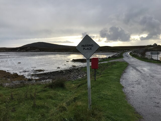
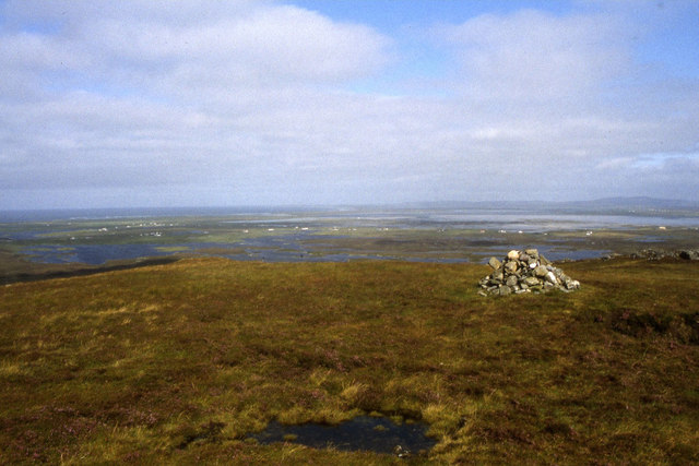
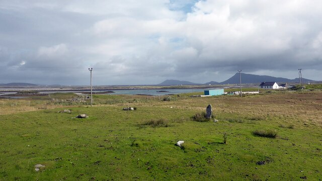
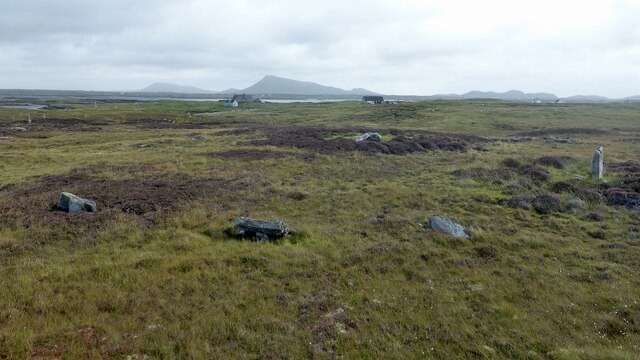
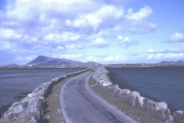
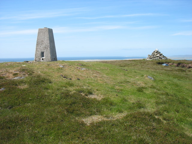
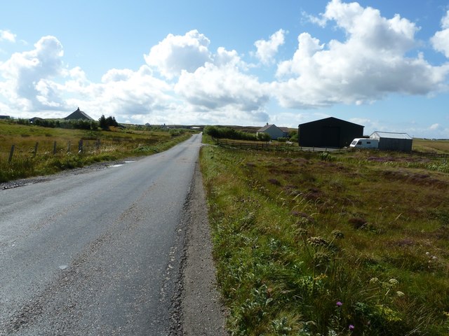
Suidheachadh Sealg is a prominent coastal feature located in Inverness-shire, Scotland. It is classified as a headland or point due to its distinct geographical formation. The headland is situated on the eastern coast of Scotland, overlooking the North Sea.

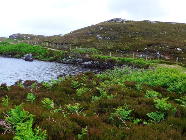
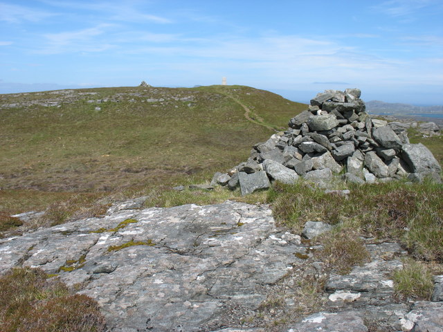
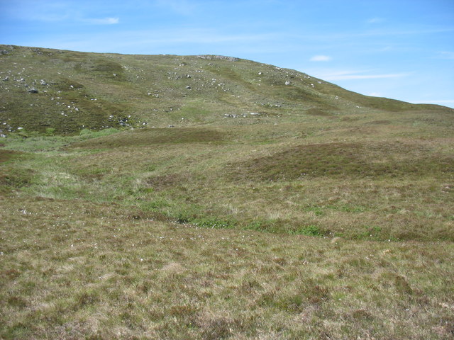
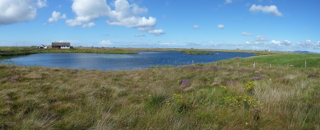
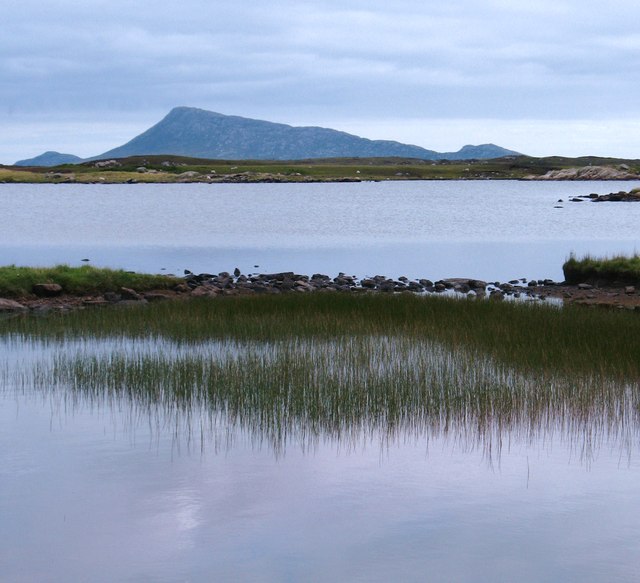
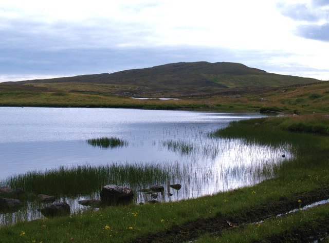
Suidheachadh Sealg is known for its rugged and dramatic cliffs that drop steeply into the sea, providing breathtaking views of the surrounding landscape. The headland is formed by layers of sedimentary rock, which have been shaped over millions of years by the erosive forces of the sea and wind. This geological composition gives the headland its unique appearance and contributes to its significance as a natural landmark.

The headland is also home to a diverse range of flora and fauna. The cliffs provide nesting sites for a variety of seabirds, including puffins, gannets, and guillemots. The surrounding waters are teeming with marine life, and it is not uncommon to spot seals, dolphins, and even whales swimming offshore.

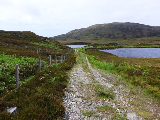
Suidheachadh Sealg is a popular destination for nature lovers, hikers, and photographers. The headland offers numerous walking trails that allow visitors to explore its rugged terrain and enjoy panoramic views of the coastline. It is also a favorite spot for birdwatchers, who flock to the area to observe the nesting seabirds and their fascinating behaviors.

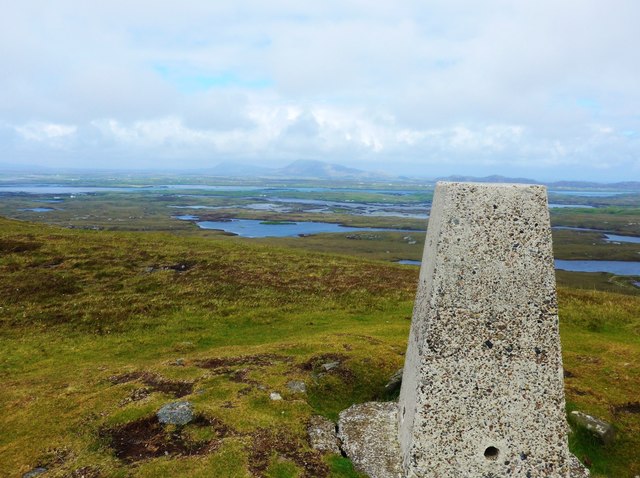
Overall, Suidheachadh Sealg is a remarkable coastal feature in Inverness-shire, known for its striking cliffs, diverse wildlife, and stunning natural beauty. It serves as a testament to the power of nature and provides a unique opportunity to immerse oneself in Scotland's rugged coastal landscape.

If you have any feedback on the listing, please let us know in the comments section below.

Suidheachadh Sealg Images

Images are sourced within 2km of 57.475336/-7.29944 or Grid Reference NF8255. Thanks to Geograph Open Source API. All images are credited.

Flodda causeway
Flodda causeway
Small causeway between two lochs This is on the track to Sgaraileod and the loch in the photo is Loch na Deighe fo Thuath;  to the right, off image, lies Loch na Deighe fo Dheas.
Small causeway between two lochs
This is on the track to Sgaraileod and the loch in the photo is Loch na Deighe fo Thuath; to the right, off image, lies Loch na Deighe fo Dheas.
The track back from Sgaraileod The track here crosses a small causeway between, on the right, Loch na Deighe fo Thuath and on the left, Loch na Deighe fo Dheas.
The track back from Sgaraileod
The track here crosses a small causeway between, on the right, Loch na Deighe fo Thuath and on the left, Loch na Deighe fo Dheas.
Summit trig on Ruabhal Looking towards Grimsay and North Uist.
Summit trig on Ruabhal
Looking towards Grimsay and North Uist.
Oitir Mhòr
Oitir Mhòr
Summit of Ruabhal, Benbecula
Gramisdale stone circle Rather mutilated prehistoric stone circle. <span class="nowrap"><a title="https://canmore.org.uk/site/10186/benbecula-gramisdale" rel="nofollow ugc noopener" href="https://canmore.org.uk/site/10186/benbecula-gramisdale">Link</a><img style="margin-left:2px;" alt="External link" title="External link - shift click to open in new window" src="https://s1.geograph.org.uk/img/external.png" width="10" height="10"/></span>
Gramisdale stone circle
Rather mutilated prehistoric stone circle. LinkExternal link
Suidheachadh Beag stone circle and chambered cairn Two large stones inside the stone circle may represent the remains of a chambered cairn. <span class="nowrap"><a title="https://canmore.org.uk/site/10187/benbecula-suidheachadh-beag" rel="nofollow ugc noopener" href="https://canmore.org.uk/site/10187/benbecula-suidheachadh-beag">Link</a><img style="margin-left:2px;" alt="External link" title="External link - shift click to open in new window" src="https://s1.geograph.org.uk/img/external.png" width="10" height="10"/></span>
Suidheachadh Beag stone circle and chambered cairn
Two large stones inside the stone circle may represent the remains of a chambered cairn. LinkExternal link
Causeway between Grimsay and Benbecula
Ruaval (Ruabhal) summit Near the summit of Ruaval are a trig point and two fairly large cairns. This photo suggests, though it does not prove, that the trig point is at the true highest point. Taken in conjunction with <a href="https://www.geograph.org.uk/photo/2537593">NF8253 : Ruaval (Ruabhal) from the lower cairn</a>, I think that the supremacy of the trig point is beyond doubt.
Ruaval is the highest point of Benbecula. As this island is mostly low-lying, it gives excellent views in all directions.
Ruaval (Ruabhal) summit
Near the summit of Ruaval are a trig point and two fairly large cairns. This photo suggests, though it does not prove, that the trig point is at the true highest point. Taken in conjunction with NF8253 : Ruaval (Ruabhal) from the lower cairn, I think that the supremacy of the trig point is beyond doubt. Ruaval is the highest point of Benbecula. As this island is mostly low-lying, it gives excellent views in all directions.
Ruaval (Ruabhal) from the lower cairn I think that this image, in conjunction with <a href="https://www.geograph.org.uk/photo/2537563">NF8253 : Ruaval (Ruabhal) summit</a>, is conclusive evidence that the trig point is at the summit of the hill.
Cairns, especially on hills which are not major attractions for hillwalkers, are often in locations prominent from below rather than at true summits. This may explain the position of these two cairns.
Ruaval (Ruabhal) from the lower cairn
I think that this image, in conjunction with NF8253 : Ruaval (Ruabhal) summit, is conclusive evidence that the trig point is at the summit of the hill. Cairns, especially on hills which are not major attractions for hillwalkers, are often in locations prominent from below rather than at true summits. This may explain the position of these two cairns.
The eastern slopes of Ruaval (Ruabhal) I have submitted this because, though there are many photos in this square, none appears to show the less often visited east side of Ruaval.
The eastern slopes of Ruaval (Ruabhal)
I have submitted this because, though there are many photos in this square, none appears to show the less often visited east side of Ruaval.
North Ford Causeway On the north edge of Benbecula, the modern causeway leads across the Oitir Mhor to Grimsay and North Uist.
<span class="nowrap"><a title="http://www.isle-of-benbecula.co.uk/" rel="nofollow ugc noopener" href="http://www.isle-of-benbecula.co.uk/">Link</a><img style="margin-left:2px;" alt="External link" title="External link - shift click to open in new window" src="https://s1.geograph.org.uk/img/external.png" width="10" height="10"/></span>
North Ford Causeway
On the north edge of Benbecula, the modern causeway leads across the Oitir Mhor to Grimsay and North Uist. LinkExternal link
A865 south of Loch na Smalaig, Benbecula The A865 runs through the centre of the loch-laced flat isle of Benbecula. The large dark green shed or barn seen on the right is just beyond the track to Ardgarbh, and must be quite recent as it does not appear on Google's Streetview (see <span class="nowrap"><a title="http://maps.google.com/maps?q=Gramsdale,+Benbecula&hl=en&ll=57.47317,-7.32846&spn=0.000023,0.027788&sll=41.890062,12.492549&sspn=0.004394,0.006947&vpsrc=6&hnear=Gramsdale,+Isle+Of+Benbecula,+Eilean+Siar,+United+Kingdom&t=h&z=16&layer=c&cbll=57.473554,-7.3282&panoid=nm1zCQ5DOfBW2LblAN-U4g&cbp=12,203.83,,0,13.56" rel="nofollow ugc noopener" href="http://maps.google.com/maps?q=Gramsdale,+Benbecula&hl=en&ll=57.47317,-7.32846&spn=0.000023,0.027788&sll=41.890062,12.492549&sspn=0.004394,0.006947&vpsrc=6&hnear=Gramsdale,+Isle+Of+Benbecula,+Eilean+Siar,+United+Kingdom&t=h&z=16&layer=c&cbll=57.473554,-7.3282&panoid=nm1zCQ5DOfBW2LblAN-U4g&cbp=12,203.83,,0,13.56">Link</a><img style="margin-left:2px;" alt="External link" title="External link - shift click to open in new window" src="https://s1.geograph.org.uk/img/external.png" width="10" height="10"/></span> ) 
Note: The maps show "Shieling" just south of this point, but that simply means roughly constructed hut or pasture for cattle, and is not a placename.
A865 south of Loch na Smalaig, Benbecula
The A865 runs through the centre of the loch-laced flat isle of Benbecula. The large dark green shed or barn seen on the right is just beyond the track to Ardgarbh, and must be quite recent as it does not appear on Google's Streetview (see LinkExternal link ) Note: The maps show "Shieling" just south of this point, but that simply means roughly constructed hut or pasture for cattle, and is not a placename.
Loch na Smalaig Benbecula doesn't get rave reviews in most of the guidebooks, which generally urge the visitor on to the delights of the Uists to north and south. But on a beautiful sunny day like this, the inky blue lochs and lochans have a distinct charm.
The house on the left is Ardgarbh with its track forming the southern border of the loch.
Loch na Smalaig
Benbecula doesn't get rave reviews in most of the guidebooks, which generally urge the visitor on to the delights of the Uists to north and south. But on a beautiful sunny day like this, the inky blue lochs and lochans have a distinct charm. The house on the left is Ardgarbh with its track forming the southern border of the loch.
Loch Olabhat A shallow loch, almost at sea level and with numerous small islands. Looking towards the distinctive profile of Eabhal on North Uist.
Loch Olabhat
A shallow loch, almost at sea level and with numerous small islands. Looking towards the distinctive profile of Eabhal on North Uist.
Loch Olabhat An unpleasantly wet track leads from the road down to this reedy loch.
Loch Olabhat
An unpleasantly wet track leads from the road down to this reedy loch.
North Ford Causeway Looking towards Benbecula along the causeway, which has recently been strengthened and widened to take a double lane road.
North Ford Causeway
Looking towards Benbecula along the causeway, which has recently been strengthened and widened to take a double lane road.
Show me another place!

Suidheachadh Sealg is located at Grid Ref: NF8255 (Lat: 57.475336, Lng: -7.29944)

Unitary Authority: Na h-Eileanan an Iar

Police Authority: Highlands and Islands

What 3 Words

///dentistry.diamonds.rankings. Near Balivanich, Na h-Eileanan Siar

Related Wikis

Flodaigh

Flodaigh is a tidal island lying to the north of Benbecula and south of Grimsay in the Outer Hebrides, Scotland. It is connected to Benbecula by a causeway...

Uachdar

Uachdar (Scottish Gaelic: An t-Uachdar [ən̪ˠ ˈt̪ʰuəxkəɾ]) is a settlement on the Outer Hebridean Island of Benbecula. Uachdar is within the parish of South...

Baile Glas

Baile Glas or Ballaglasa (Scottish Gaelic: Am Baile Glas) is a settlement on Grimsay in the Outer Hebrides, Scotland. Ballaglasa is within the parish of...

Uist

Uist is a group of six islands that are part of the Outer Hebridean Archipelago, which is part of the Outer Hebrides of Scotland. North Uist and South...

Nearby Amenities

Located within 500m of 57.475336,-7.29944
Passing Place
Lat/Long: 57.478388/-7.3018239
Description: Hebridean Way - Pointing S Rueval (Ruaidheabhal) 1.4 miles - Pointing W Grimsay (Griomasaigh) 2.1 miles
Hiking: yes
Information: guidepost
Tourism: information
Lat/Long: 57.4782173/-7.3044705
Passing Place
Lat/Long: 57.4781729/-7.3044732
Barrier: cattle_grid
Lat/Long: 57.4783231/-7.3055274
Power: pole
Lat/Long: 57.4779347/-7.2967163
Power: pole
Lat/Long: 57.4780385/-7.2976792
Power: pole
Lat/Long: 57.4781625/-7.298618
Power: pole
Lat/Long: 57.4782822/-7.2996613
Power: pole
Lat/Long: 57.4784668/-7.3010883
Power: pole
Lat/Long: 57.4784502/-7.3022819
Power: pole
Lat/Long: 57.4784567/-7.3047066
Passing Place
Lat/Long: 57.4779986/-7.2990464
Passing Place
Lat/Long: 57.4780196/-7.2933267
Barrier: cattle_grid
Lat/Long: 57.4776444/-7.29227
Passing Place
Lat/Long: 57.477918/-7.295227
The data included in this document is from www.openstreetmap.org. The data is made available under ODbL.

Have you been to Suidheachadh Sealg?

Leave your review of Suidheachadh Sealg below (or comments, questions and feedback).