Caolas Fhlodaigh

Settlement in Inverness-shire

Scotland

Caolas Fhlodaigh

Flodda causeway
Flodda causeway Credit: Catherine Morgan

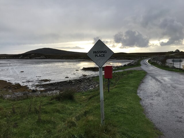
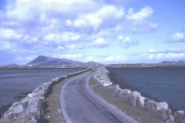
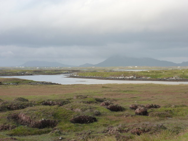
Caolas Fhlodaigh, also known as Flodigarry, is a small coastal village located on the northeastern coast of the Isle of Skye in Inverness-shire, Scotland. Nestled between the Trotternish Ridge and the Minch, Caolas Fhlodaigh offers breathtaking views of its rugged landscape and the surrounding sea.

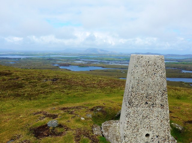
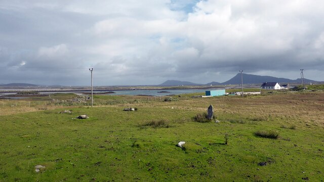
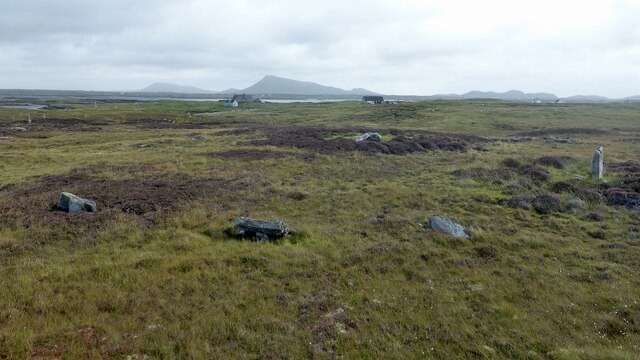
The village is renowned for its unspoiled beauty and peaceful atmosphere, making it a popular destination for nature lovers and those seeking a tranquil retreat. Visitors are greeted by dramatic cliffs, pristine beaches, and rolling hills, creating a picturesque backdrop for outdoor activities such as hiking, birdwatching, and photography.

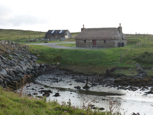
Caolas Fhlodaigh is also home to the Flodigarry Hotel, a historic establishment that offers accommodation, dining, and a chance to experience traditional Scottish hospitality. The hotel is surrounded by lush gardens, providing a serene setting for relaxation and contemplation.

In addition to its natural beauty, Caolas Fhlodaigh is steeped in history and folklore. The area is dotted with ancient ruins, including the remains of Duntulm Castle, a former stronghold of the Macdonald clan. Visitors can explore these historical sites and learn about the rich heritage of the region.

Although Caolas Fhlodaigh is a secluded village, it is within driving distance of other attractions on the Isle of Skye, such as the Old Man of Storr and the Quiraing. This makes it an ideal base for exploring the island's diverse landscapes and cultural treasures.

Overall, Caolas Fhlodaigh is a hidden gem on the Isle of Skye, offering visitors a peaceful escape and a chance to immerse themselves in the breathtaking beauty of the Scottish Highlands.

If you have any feedback on the listing, please let us know in the comments section below.

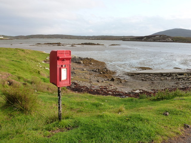
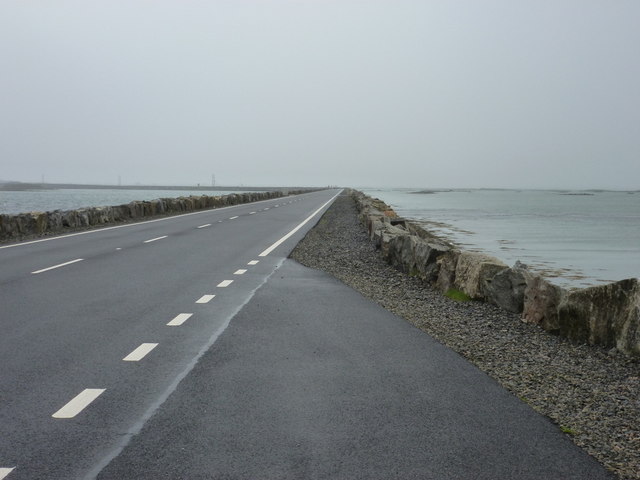
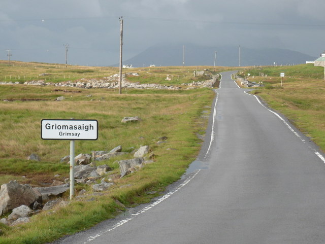
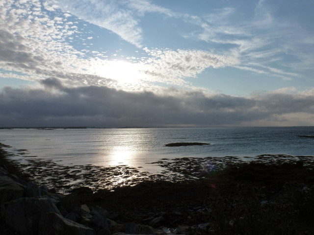
Caolas Fhlodaigh Images

Images are sourced within 2km of 57.478065/-7.2934046 or Grid Reference NF8255. Thanks to Geograph Open Source API. All images are credited.

Flodda causeway
Flodda causeway
Summit trig on Ruabhal Looking towards Grimsay and North Uist.
Summit trig on Ruabhal
Looking towards Grimsay and North Uist.
Oitir Mhòr
Oitir Mhòr
Gramisdale stone circle Rather mutilated prehistoric stone circle. <span class="nowrap"><a title="https://canmore.org.uk/site/10186/benbecula-gramisdale" rel="nofollow ugc noopener" href="https://canmore.org.uk/site/10186/benbecula-gramisdale">Link</a><img style="margin-left:2px;" alt="External link" title="External link - shift click to open in new window" src="https://s1.geograph.org.uk/img/external.png" width="10" height="10"/></span>
Gramisdale stone circle
Rather mutilated prehistoric stone circle. LinkExternal link
Suidheachadh Beag stone circle and chambered cairn Two large stones inside the stone circle may represent the remains of a chambered cairn. <span class="nowrap"><a title="https://canmore.org.uk/site/10187/benbecula-suidheachadh-beag" rel="nofollow ugc noopener" href="https://canmore.org.uk/site/10187/benbecula-suidheachadh-beag">Link</a><img style="margin-left:2px;" alt="External link" title="External link - shift click to open in new window" src="https://s1.geograph.org.uk/img/external.png" width="10" height="10"/></span>
Suidheachadh Beag stone circle and chambered cairn
Two large stones inside the stone circle may represent the remains of a chambered cairn. LinkExternal link
Causeway between Grimsay and Benbecula
North Ford Causeway On the north edge of Benbecula, the modern causeway leads across the Oitir Mhor to Grimsay and North Uist.
<span class="nowrap"><a title="http://www.isle-of-benbecula.co.uk/" rel="nofollow ugc noopener" href="http://www.isle-of-benbecula.co.uk/">Link</a><img style="margin-left:2px;" alt="External link" title="External link - shift click to open in new window" src="https://s1.geograph.org.uk/img/external.png" width="10" height="10"/></span>
North Ford Causeway
On the north edge of Benbecula, the modern causeway leads across the Oitir Mhor to Grimsay and North Uist. LinkExternal link
Road on Eilean na h-Airigh Leaving the causeway from Benbecula and heading for Grimsay and North Uist. Eaval / Eabhal is the North Uist mountain in the distance.
<span class="nowrap"><a title="http://www.isle-of-benbecula.co.uk/" rel="nofollow ugc noopener" href="http://www.isle-of-benbecula.co.uk/">Link</a><img style="margin-left:2px;" alt="External link" title="External link - shift click to open in new window" src="https://s1.geograph.org.uk/img/external.png" width="10" height="10"/></span>
Road on Eilean na h-Airigh
Leaving the causeway from Benbecula and heading for Grimsay and North Uist. Eaval / Eabhal is the North Uist mountain in the distance. LinkExternal link
North Ford Causeway Looking towards Benbecula along the causeway, which has recently been strengthened and widened to take a double lane road.
North Ford Causeway
Looking towards Benbecula along the causeway, which has recently been strengthened and widened to take a double lane road.
Gramsdale: postbox № HS6 40 and phone One of several postboxes which seem to have a prefix misnomer - being on Benbecula, this box is actually in the HS7, not HS6, postcode district. It stands alongside a red telephone box and this may be evidence that the post office, which opened in the summer of 1935 and closed on 5 October 1974, was in the adjacent house.
Gramsdale: postbox № HS6 40 and phone
One of several postboxes which seem to have a prefix misnomer - being on Benbecula, this box is actually in the HS7, not HS6, postcode district. It stands alongside a red telephone box and this may be evidence that the post office, which opened in the summer of 1935 and closed on 5 October 1974, was in the adjacent house.
Island Flodda: postbox № HS7 79 A small postbox serving this small island, just off the coast of Benbecula - we look across the Flodda Sound (Caolas Fhlodaigh) between the two. The box is emptied at 11am on weekdays and at 8:30am on Saturdays.
Island Flodda: postbox № HS7 79
A small postbox serving this small island, just off the coast of Benbecula - we look across the Flodda Sound (Caolas Fhlodaigh) between the two. The box is emptied at 11am on weekdays and at 8:30am on Saturdays.
Gramsdale: North Ford Causeway The A865 crosses from the island of Grimsay to Benbecula by way of this causeway, which has recently been upgraded from a single-carriageway road with passing places.
Gramsdale: North Ford Causeway
The A865 crosses from the island of Grimsay to Benbecula by way of this causeway, which has recently been upgraded from a single-carriageway road with passing places.
Grimsay: a bilingual welcome A bilingual sign welcomes motorists arriving on the island from Benbecula on the A865.
Grimsay: a bilingual welcome
A bilingual sign welcomes motorists arriving on the island from Benbecula on the A865.
Grimsay: view alongside the North Ford Causeway Looking alongside the causeway linking the islands of Benbecula and Grimsay.
Grimsay: view alongside the North Ford Causeway
Looking alongside the causeway linking the islands of Benbecula and Grimsay.
Gramsdale: view across Grimsay towards North Uist The hills of the southeast corner of the ise of North Uist, Eaval being the highest, are viewed across a narrow inlet at the northern end of the isle of Benbecula. Grimsay is sandwiched between the two islands.
Gramsdale: view across Grimsay towards North Uist
The hills of the southeast corner of the ise of North Uist, Eaval being the highest, are viewed across a narrow inlet at the northern end of the isle of Benbecula. Grimsay is sandwiched between the two islands.
Kyles Flodda: a thatched croft An attractive little building by the head of an inlet, across which we look, on the north coast of Benbecula.
Kyles Flodda: a thatched croft
An attractive little building by the head of an inlet, across which we look, on the north coast of Benbecula.
Island Flodda: a not-so-reliant An old three-wheeler has reached the end of the road - literally and figuratively.
Island Flodda: a not-so-reliant
An old three-wheeler has reached the end of the road - literally and figuratively.
Gramsdale: Welcome to Benbecula A bilingual welcome to motorists travelling southward on the A865 as they arrive on the isle of Benbecula on the causeway from Grimsay.
Gramsdale: Welcome to Benbecula
A bilingual welcome to motorists travelling southward on the A865 as they arrive on the isle of Benbecula on the causeway from Grimsay.
Show me another place!

Caolas Fhlodaigh is located at Grid Ref: NF8255 (Lat: 57.478065, Lng: -7.2934046)

Unitary Authority: Na h-Eileanan an Iar

Police Authority: Highlands and Islands

Also known as: Kyles Flodda

What 3 Words

///daunted.dilute.hoops. Near Balivanich, Na h-Eileanan Siar

Related Wikis

Flodaigh

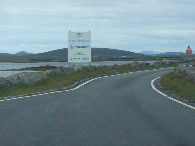
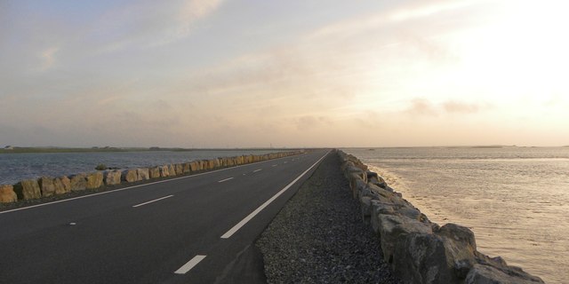
Flodaigh is a tidal island lying to the north of Benbecula and south of Grimsay in the Outer Hebrides, Scotland. It is connected to Benbecula by a causeway...

Uachdar

Uachdar (Scottish Gaelic: An t-Uachdar [ən̪ˠ ˈt̪ʰuəxkəɾ]) is a settlement on the Outer Hebridean Island of Benbecula. Uachdar is within the parish of South...

Baile Glas

Baile Glas or Ballaglasa (Scottish Gaelic: Am Baile Glas) is a settlement on Grimsay in the Outer Hebrides, Scotland. Ballaglasa is within the parish of...

Grimsay

Grimsay (Scottish Gaelic: Griomasaigh) is a tidal island in the Outer Hebrides of Scotland. == Geography == Grimsay is the largest of the low-lying stepping...

Nearby Amenities

Located within 500m of 57.478065,-7.2934046
Passing Place
Lat/Long: 57.4770095/-7.286884
Caolas Fhlodaigh
Name En: Kyles Flodda
Name Gd: Caolas Fhlodaigh
Place: hamlet
Lat/Long: 57.4770282/-7.2887995
Power: pole
Lat/Long: 57.4821797/-7.2950211
Power: pole
Lat/Long: 57.4819764/-7.2961181
Power: pole
Lat/Long: 57.4817342/-7.2971642
Power: pole
Lat/Long: 57.4813478/-7.2983766
Power: pole
Lat/Long: 57.481019/-7.2994119
Power: pole
Lat/Long: 57.4779347/-7.2967163
Power: pole
Lat/Long: 57.4780385/-7.2976792
Power: pole
Lat/Long: 57.4781625/-7.298618
Power: pole
Lat/Long: 57.4782822/-7.2996613
Power: pole
Lat/Long: 57.4784668/-7.3010883
Power: pole
Lat/Long: 57.4779835/-7.2852359
Power: pole
Lat/Long: 57.4780563/-7.2867263
Power: pole
Lat/Long: 57.478079/-7.2881981
Power: pole
Lat/Long: 57.4781198/-7.2894862
Power: pole
Lat/Long: 57.478146/-7.2907004
Power: pole
Lat/Long: 57.4781416/-7.2919761
Power: pole
Lat/Long: 57.4781685/-7.2928586
Passing Place
Lat/Long: 57.4779986/-7.2990464
Passing Place
Lat/Long: 57.4774633/-7.2913121
Passing Place
Lat/Long: 57.4780196/-7.2933267
Barrier: cattle_grid
Lat/Long: 57.4776444/-7.29227
Passing Place
Lat/Long: 57.477918/-7.295227
Passing Place
Lat/Long: 57.4769233/-7.2896505
The data included in this document is from www.openstreetmap.org. The data is made available under ODbL.

Have you been to Caolas Fhlodaigh?

Leave your review of Caolas Fhlodaigh below (or comments, questions and feedback).