Loch Musgriob

Lake, Pool, Pond, Freshwater Marsh in Inverness-shire

Scotland

Loch Musgriob

Southwest down the upper part of Maireabhal Looking southwest across the extensive moorland, towards the coast near Chirceboist.
Southwest down the upper part of Maireabhal Credit: Richard Law

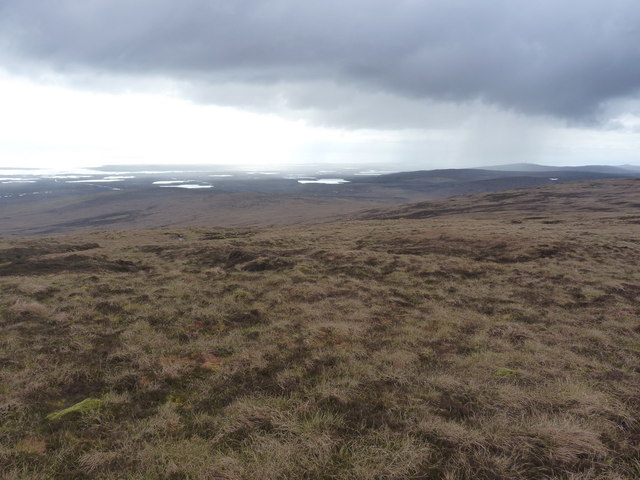
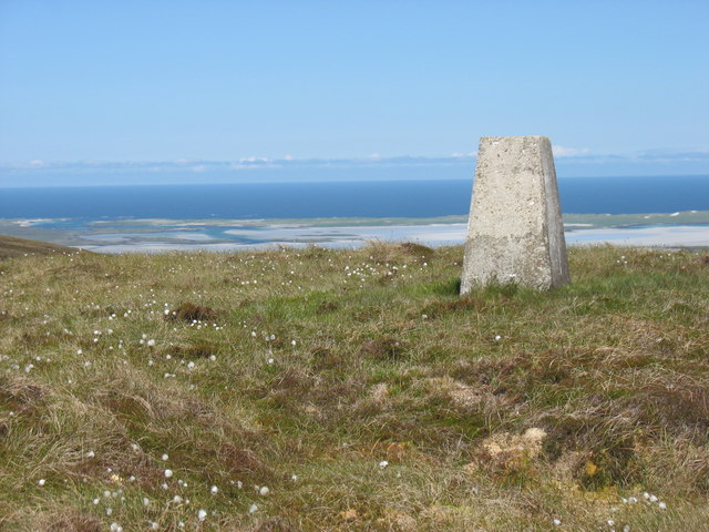
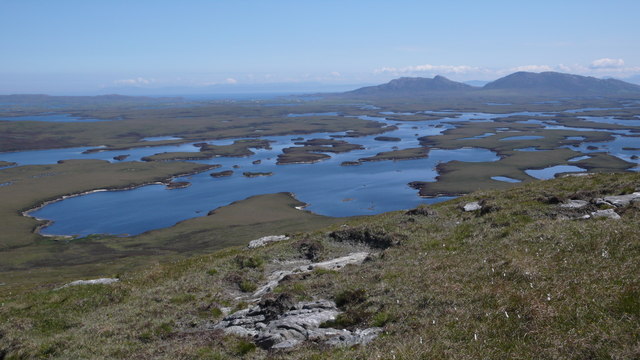
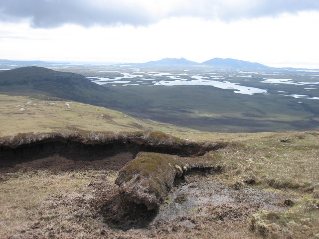
Loch Musgriob is a freshwater loch located in Inverness-shire, Scotland. Situated in the picturesque Highlands, it offers a tranquil and stunning natural setting. The loch is surrounded by lush green hills, providing a beautiful backdrop for visitors.

Covering an area of approximately 100 hectares, Loch Musgriob is a relatively small body of water. It is characterized by its clear, pristine waters, which are fed by small streams and springs flowing from the nearby hills. The loch is also renowned for its diverse aquatic plants and vegetation, including water lilies and reeds, which thrive in the nutrient-rich waters.

The loch is home to a variety of freshwater fish species, such as brown trout and pike, making it a popular destination for fishing enthusiasts. Its calm waters also attract waterfowl, such as mallards and swans, which can often be spotted gracefully gliding across the surface.

Surrounding the loch is a freshwater marsh, which serves as a vital habitat for numerous species of birds and other wildlife. The marshland is teeming with life, with an abundance of insects, amphibians, and small mammals making it their home.

Due to its natural beauty and ecological importance, Loch Musgriob is a designated Site of Special Scientific Interest (SSSI), ensuring its preservation and protection for future generations to enjoy. Visitors to the loch can take advantage of the peaceful atmosphere, taking leisurely walks along the shoreline or engaging in recreational activities such as boating or birdwatching.

Overall, Loch Musgriob offers a serene and captivating experience for nature lovers, with its scenic surroundings, diverse wildlife, and peaceful ambiance.

If you have any feedback on the listing, please let us know in the comments section below.

Loch Musgriob Images

Images are sourced within 2km of 57.615691/-7.3224952 or Grid Reference NF8270. Thanks to Geograph Open Source API. All images are credited.

Southwest down the upper part of Maireabhal Looking southwest across the extensive moorland, towards the coast near Chirceboist.
Southwest down the upper part of Maireabhal
Looking southwest across the extensive moorland, towards the coast near Chirceboist.
The southern side of Maireabhal Looking across the wet moorlands, with Lochs Ferma and Dubh (in <a href="https://www.geograph.org.uk/gridref/NF7968">NF7968</a>) prominent in the middle distance.
The southern side of Maireabhal
Looking across the wet moorlands, with Lochs Ferma and Dubh (in NF7968) prominent in the middle distance.
Rocks on the moor, high on Maireabhal A small cairn, apparently marking nothing very much in particular, on a glaciated slab high up near the summit of Maireabhal.
Rocks on the moor, high on Maireabhal
A small cairn, apparently marking nothing very much in particular, on a glaciated slab high up near the summit of Maireabhal.
Southwards from Maireabhal Looking into the wet moorland south of Maireabhal, where scattered lochans dominate the landscape. Unfortunately the low sun means that some of the distant detail has been lost in this picture.
Southwards from Maireabhal
Looking into the wet moorland south of Maireabhal, where scattered lochans dominate the landscape. Unfortunately the low sun means that some of the distant detail has been lost in this picture.
Tiny lochan near the summit of Maireabhal Just to prove it doesn't always blow a complete hoolie on North Uist, here's a high-level lochan with barely a ripple on it. The summit trig is just poking over the peat bank beyond.
Tiny lochan near the summit of Maireabhal
Just to prove it doesn't always blow a complete hoolie on North Uist, here's a high-level lochan with barely a ripple on it. The summit trig is just poking over the peat bank beyond.
On Maireabhal The hill was once covered in peat, but it has been all but eroded away now. A pillar of dry peat is a remnant. Lower parts of the island are covered in deep peat deposits.
On Maireabhal
The hill was once covered in peat, but it has been all but eroded away now. A pillar of dry peat is a remnant. Lower parts of the island are covered in deep peat deposits.
Feeder loch for Loch an t-Searraich North Uist is described as a land containing 10,000 lochs - a fishermans paradise.
Feeder loch for Loch an t-Searraich
North Uist is described as a land containing 10,000 lochs - a fishermans paradise.
Loch Musgriob A distant Loch Musgriob viewed from near the summit of Marrogh
Loch Musgriob
A distant Loch Musgriob viewed from near the summit of Marrogh
Marrival trig OS name for the trig.
Marrival trig
OS name for the trig.
The summit trig point on Maireaval
The north-east slopes of Maireaval, North Uist
Loch Scadabhagh, North Uist A small bay on this large and complex loch.  There were many brown trout (Salmo Trutta) rising in this area.
Loch Scadabhagh, North Uist
A small bay on this large and complex loch. There were many brown trout (Salmo Trutta) rising in this area.
Approaching Marrogh Very easy walking on short turf as you reach the higher ground.
Approaching Marrogh
Very easy walking on short turf as you reach the higher ground.
Summit cairn, Marrogh Looking to the top of Maireabhal (230m)
Summit cairn, Marrogh
Looking to the top of Maireabhal (230m)
Hillside on Marrogh View from the top of Marrogh looking onto Loch Scadabhagh with North and South Lee in the distance.
Hillside on Marrogh
View from the top of Marrogh looking onto Loch Scadabhagh with North and South Lee in the distance.
Lochan on the upper slopes of Maireaval
The south-east slopes of Maireaval, North Uist
The northern slopes of Beinn Amhlasaraigh Looking down the moorland, across the Srath Amhlasaraigh, towards lochans in the Bogach Mhic-fhearguis.
The northern slopes of Beinn Amhlasaraigh
Looking down the moorland, across the Srath Amhlasaraigh, towards lochans in the Bogach Mhic-fhearguis.
Show me another place!

Loch Musgriob is located at Grid Ref: NF8270 (Lat: 57.615691, Lng: -7.3224952)

Unitary Authority: Na h-Eileanan an Iar

Police Authority: Highlands and Islands

What 3 Words

///summaries.flirts.horizons. Near Lochmaddy, Na h-Eileanan Siar

Nearby Locations

Loch Musgriob

Related Wikis

North Uist

North Uist (Scottish Gaelic: Uibhist a Tuath; Scots: North Uise) is an island and community in the Outer Hebrides of Scotland. == Etymology == In Donald...

Sollas

Sollas (Scottish Gaelic: Solas) is a small crofting township on the northern coast of the island of North Uist, Scotland. == History == === The Battle... ===

Loch Sgadabhagh

Loch Sgadabhagh or Loch Scadavay is a body of water on the island of North Uist, Scotland. The name may be of Old Norse derivation meaning "lake of tax...

Oronsay, Outer Hebrides

Oronsay (Gaelic Orasaigh) is a tidal island off North Uist in the Outer Hebrides. Lying to the north of Vallaquie Strand, the island has been uninhabited...

Have you been to Loch Musgriob?

Leave your review of Loch Musgriob below (or comments, questions and feedback).