Loch nan Crointean

Lake, Pool, Pond, Freshwater Marsh in Inverness-shire

Scotland

Loch nan Crointean

Daliburgh Co-op Largest food shop on South Uist.
Daliburgh Co-op Credit: Hugh Venables

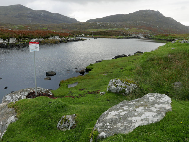
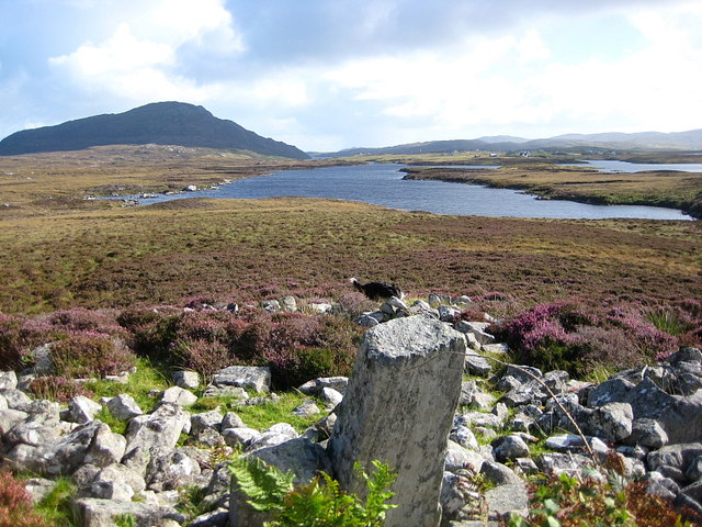
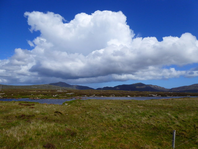
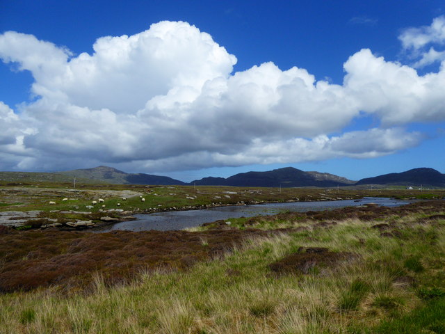
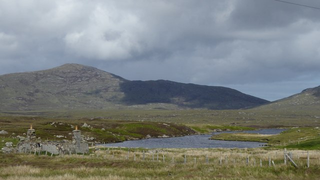
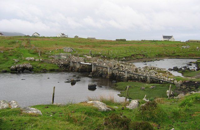
Loch nan Crointean is a freshwater loch located in Inverness-shire, Scotland. It is situated near the village of Cannich and lies within the Glen Affric National Nature Reserve. The loch is relatively small in size, with a surface area of approximately 2.5 hectares.

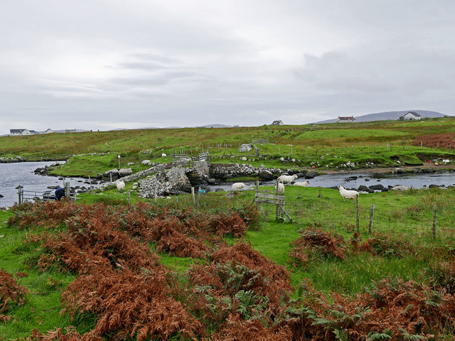
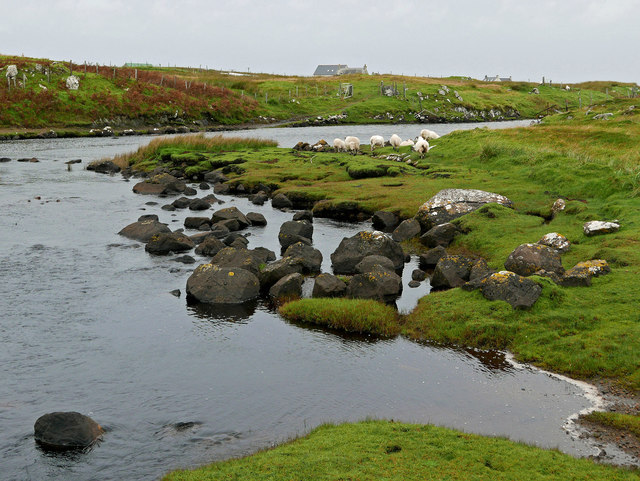
Surrounded by dense forests and rolling hills, Loch nan Crointean offers a picturesque and tranquil setting for visitors to enjoy. The loch is known for its clear, calm waters, making it an ideal spot for fishing and birdwatching. It is home to a variety of bird species, including herons, ducks, and swans.

The loch is also a popular destination for outdoor enthusiasts, with opportunities for hiking, cycling, and picnicking in the surrounding area. Visitors can take in stunning views of the Scottish Highlands and possibly catch a glimpse of local wildlife such as red deer and otters.

Overall, Loch nan Crointean is a hidden gem in Inverness-shire, offering a peaceful escape from the hustle and bustle of everyday life. Whether you are looking to relax by the water's edge or explore the natural beauty of the Scottish countryside, this loch has something to offer for everyone.

If you have any feedback on the listing, please let us know in the comments section below.

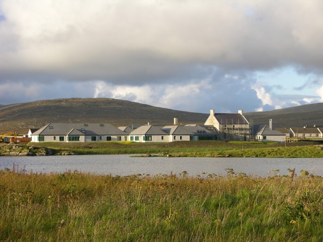
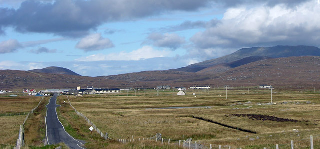
Loch nan Crointean Images

Images are sourced within 2km of 57.16277/-7.3449225 or Grid Reference NF7720. Thanks to Geograph Open Source API. All images are credited.

Daliburgh Co-op Largest food shop on South Uist.
Daliburgh Co-op
Largest food shop on South Uist.
Permit fishing only By the footbridge at Oratobht.  The distant hills are Triuirebheinn (left) and Beinn Ruigh Choinnich (right).  There is a ford here also.
Permit fishing only
By the footbridge at Oratobht. The distant hills are Triuirebheinn (left) and Beinn Ruigh Choinnich (right). There is a ford here also.
Footbridge at Clachan Mora There is a ford here too for vehicles. The access for vehicles from Lochboisdale is the brown terrace to the west of the far side of the bridge.
Footbridge at Clachan Mora
There is a ford here too for vehicles. The access for vehicles from Lochboisdale is the brown terrace to the west of the far side of the bridge.
Downstream from Loch a Bharp Looking upstream from by the footbridge at Oratobht.
Downstream from Loch a Bharp
Looking upstream from by the footbridge at Oratobht.
Loch Bharp Looking down on L. Bharp from the large chambered cairn that overlooks it.
Loch Bharp
Looking down on L. Bharp from the large chambered cairn that overlooks it.
The Co-op at Dalabrog
Sgoil Dhalabroig/Daliburgh School
Loch nan Geadh
Loch nan Geadh
Co-op Supermarket, Daliburgh
Loch nan Geadh
Loch nan Geadh
Ruin by Loch a' Bharp
Old school at Lochboisdale
Old Milestone by the A888, Daliburgh, South Uist Parish Granite column by the B888, in parish of South Uist (South Uist District), Daliburgh, near lamppost just South of 'The co-operative Dalabrog'.

Inscription reads:- : 3 : (To Lochboisdale Pier)

Surveyed

Milestone Society National ID: WI_SULBS03.
Old Milestone by the A888, Daliburgh, South Uist Parish
Granite column by the B888, in parish of South Uist (South Uist District), Daliburgh, near lamppost just South of 'The co-operative Dalabrog'. Inscription reads:- : 3 : (To Lochboisdale Pier) Surveyed Milestone Society National ID: WI_SULBS03.
Brae Lea house B&B The parking area at Brae Lea with a view over to the hill in the distance. We stayed at this B&B for two nights whilst on South Uist, great place to stay, observe wildlife  and explore the area.
Brae Lea house B&B
The parking area at Brae Lea with a view over to the hill in the distance. We stayed at this B&B for two nights whilst on South Uist, great place to stay, observe wildlife and explore the area.
Bridge, Oratobht Bridge at the end of the tidal part of Loch Baghasdail/Loch Boisdale. The pipeline carries the village water supply from Loch na Smalag.
Bridge, Oratobht
Bridge at the end of the tidal part of Loch Baghasdail/Loch Boisdale. The pipeline carries the village water supply from Loch na Smalag.
Old school at Lochboisdale This former school is now empty and boarded up. What a pity that so many lovely buildings are allowed to crumble.
Old school at Lochboisdale
This former school is now empty and boarded up. What a pity that so many lovely buildings are allowed to crumble.
The new South Uist Care Hospital at Daliburgh The new hospital will replace the existing Uist House on the other side of the road.
The new South Uist Care Hospital at Daliburgh
The new hospital will replace the existing Uist House on the other side of the road.
Daliburgh School from the south, on B888 Beinn Mhor, highest hill in South Uist, in background. The school is one of the largest buildings in this small village.
Daliburgh School from the south, on B888
Beinn Mhor, highest hill in South Uist, in background. The school is one of the largest buildings in this small village.
Show me another place!

Loch nan Crointean is located at Grid Ref: NF7720 (Lat: 57.16277, Lng: -7.3449225)

Unitary Authority: Na h-Eileanan an Iar

Police Authority: Highlands and Islands

What 3 Words

///ample.windows.blackouts. Near Lochboisdale, Na h-Eileanan Siar

Related Wikis

Papar

The Papar (Icelandic pronunciation: [ˈpʰaːpar̥]; from Latin papa, via Old Irish, meaning "father" or "pope") were, according to early Icelandic sagas,...
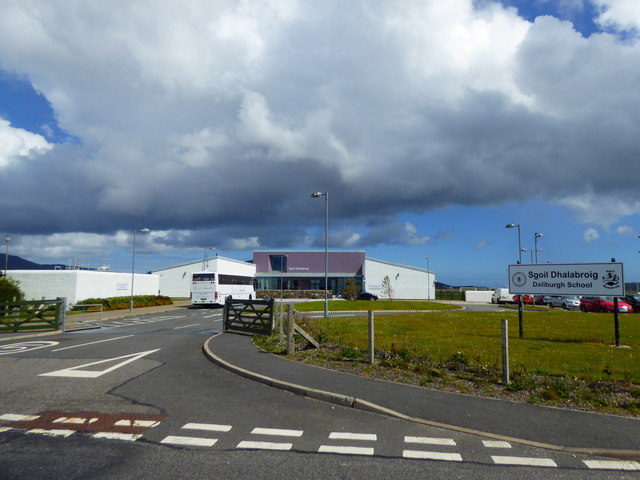
Daliburgh

Daliburgh (Scottish Gaelic: Dalabrog) is a crofting township on South Uist, in the Outer Hebrides, Scotland. Daliburgh is situated 1+1⁄2 miles (2.5 kilometres...

Auratote

Auratote (Scottish Gaelic: Oratobht) is a location on South Uist in the Outer Hebrides, Scotland. Auratote is within the parish of South Uist. == References... ==

Lochboisdale

Lochboisdale (Scottish Gaelic: Loch Baghasdail [ɫ̪ɔx ˈbɤːs̪t̪ɪl]) is the main village and port on the island of South Uist, Outer Hebrides, Scotland. Lochboisdale...
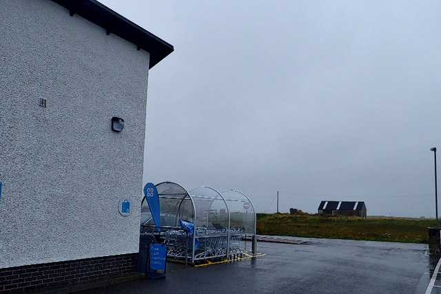
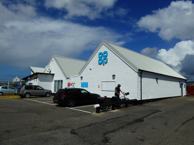
Nearby Amenities

Located within 500m of 57.16277,-7.3449225
Post Box
Collection Times: Mo-Fr 12:30; Sa 07:30
Operator: Royal Mail
Ref: HS8 69
Lat/Long: 57.1610842/-7.3414404
Source: www.npemap.org.uk
Uk Postcode Centroid: HS8
Lat/Long: 57.161995/-7.351744
Bus Stop
North Boisdale
Naptan AtcoCode: 6010731765
Naptan Bearing: NW
Naptan CommonName: North Boisdale
Naptan Indicator: Village
Naptan Landmark: Village
Naptan NaptanCode: 94723295
Naptan Street: Village
Naptan Verified: no
Source: naptan_import
Lat/Long: 57.1611044/-7.3467389
Passing Place
Lat/Long: 57.1610412/-7.3385604
Barrier: cattle_grid
Lat/Long: 57.1609296/-7.3523405
Power: pole
Lat/Long: 57.1611742/-7.3412101
Power: pole
Lat/Long: 57.1611829/-7.3422508
Power: pole
Lat/Long: 57.161183/-7.3432902
Power: pole
Lat/Long: 57.1611793/-7.3439969
Power: pole
Lat/Long: 57.1613699/-7.3451087
Power: pole
Lat/Long: 57.1615633/-7.3462392
Power: pole
Lat/Long: 57.1617655/-7.3474623
Power: pole
Lat/Long: 57.1619248/-7.3484185
Power: pole
Lat/Long: 57.1624476/-7.34879
Power: pole
Lat/Long: 57.1628243/-7.3490582
Power: pole
Lat/Long: 57.1631952/-7.3493157
Power: pole
Lat/Long: 57.1635719/-7.3495705
Power: pole
Lat/Long: 57.1640861/-7.3508164
Power: pole
Lat/Long: 57.1645005/-7.3520127
Power: pole
Lat/Long: 57.16117/-7.3379281
Power: pole
Lat/Long: 57.1611729/-7.3390439
Power: pole
Lat/Long: 57.1611773/-7.3400685
Barrier: cattle_grid
Lat/Long: 57.161399/-7.3381455
Power: pole
Lat/Long: 57.1611688/-7.3476129
Power: pole
Lat/Long: 57.1606663/-7.3477457
Power: pole
Lat/Long: 57.1601158/-7.3479026
Power: pole
Lat/Long: 57.1594874/-7.3486576
Barrier: cattle_grid
Lat/Long: 57.1611791/-7.3502467
Power: pole
Lat/Long: 57.1617834/-7.3498194
Generator Method: photovoltaic
Generator Output Electricity: small_installation
Generator Source: solar
Generator Type: solar_photovoltaic_panel
Power: generator
Lat/Long: 57.1609508/-7.3499557
Barrier: cattle_grid
Lat/Long: 57.1628127/-7.3523901
Generator Method: photovoltaic
Generator Output Electricity: small_installation
Generator Source: solar
Generator Type: solar_photovoltaic_panel
Power: generator
Lat/Long: 57.1605017/-7.345014
Passing Place
Lat/Long: 57.1623848/-7.3506291
Power: pole
Lat/Long: 57.1609395/-7.3516122
Power: pole
Lat/Long: 57.1611697/-7.350681
Power: pole
Lat/Long: 57.1613563/-7.3499377
Cill Eireabhagh
Name En: Kilerivagh
Name Gd: Cill Eireabhagh
Place: hamlet
Lat/Long: 57.1601424/-7.350097
The data included in this document is from www.openstreetmap.org. The data is made available under ODbL.

Have you been to Loch nan Crointean?

Leave your review of Loch nan Crointean below (or comments, questions and feedback).