Butt of Lewis
Coastal Feature, Headland, Point in Ross-shire
Scotland
Butt of Lewis
The Butt of Lewis is a prominent coastal feature located in Ross-shire, Scotland. It is a headland that juts out into the Atlantic Ocean, forming the northernmost point of the Isle of Lewis. The name "Butt" is derived from the Gaelic word "bùth" which means a shop or booth.
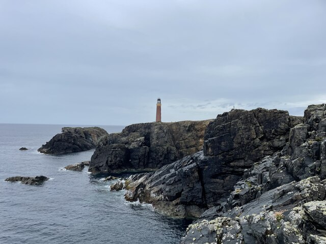
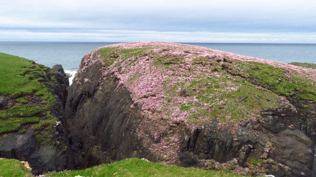
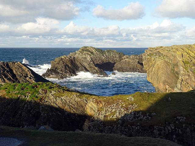
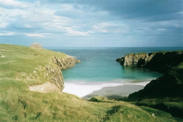
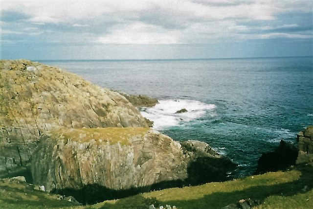
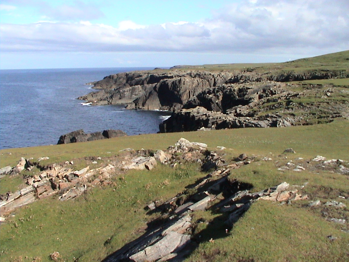
This rugged headland is characterized by towering cliffs that reach up to 60 meters in height, providing spectacular views of the surrounding coastline. The cliffs are composed of ancient Lewisian gneiss, one of the oldest rocks in Europe, dating back over three billion years.
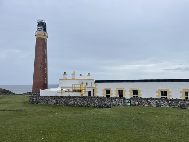
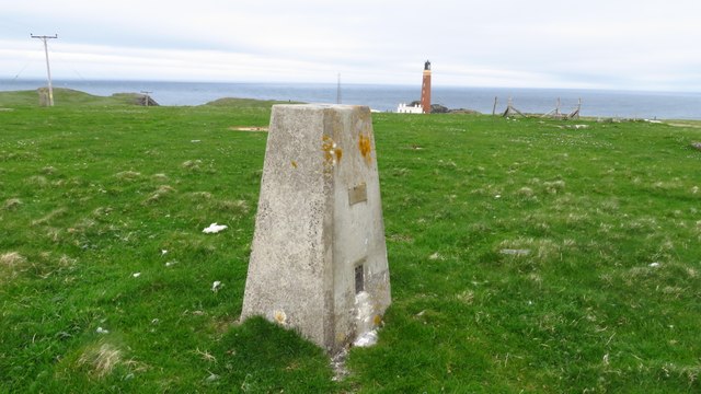
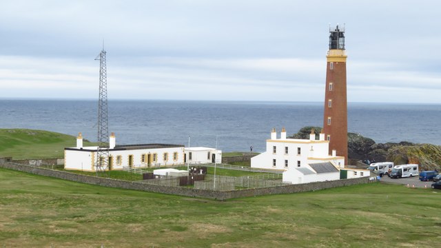
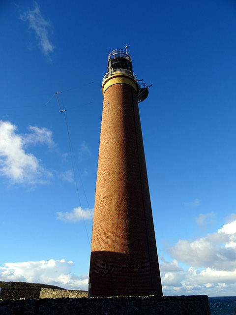
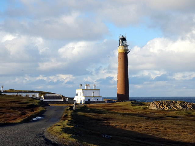
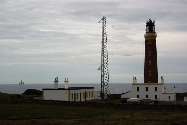
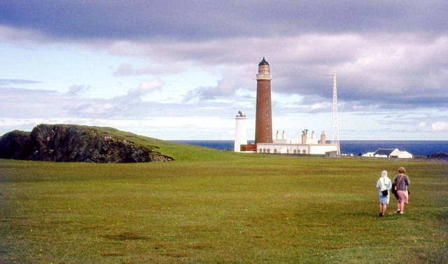
At the tip of the Butt of Lewis, there is a striking white lighthouse that was built in 1862 by David and Thomas Stevenson, members of a famous Scottish lighthouse engineering dynasty. The lighthouse stands at 37 meters tall, and its powerful light can be seen up to 24 nautical miles away. It was manned until 1998 when it was automated, and it now serves as a visitor attraction.
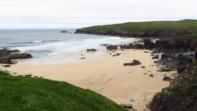
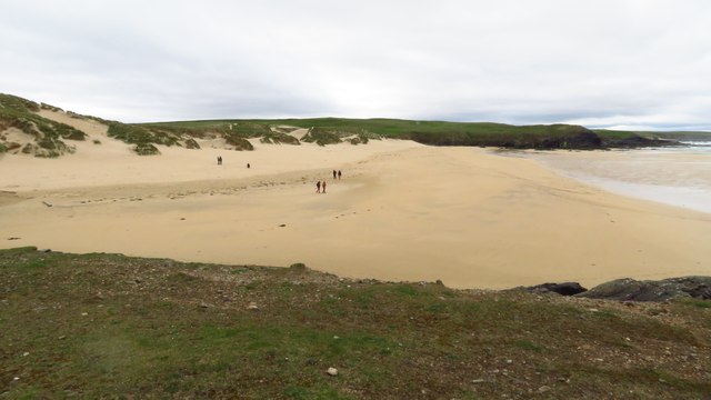
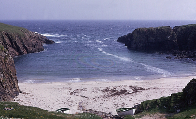
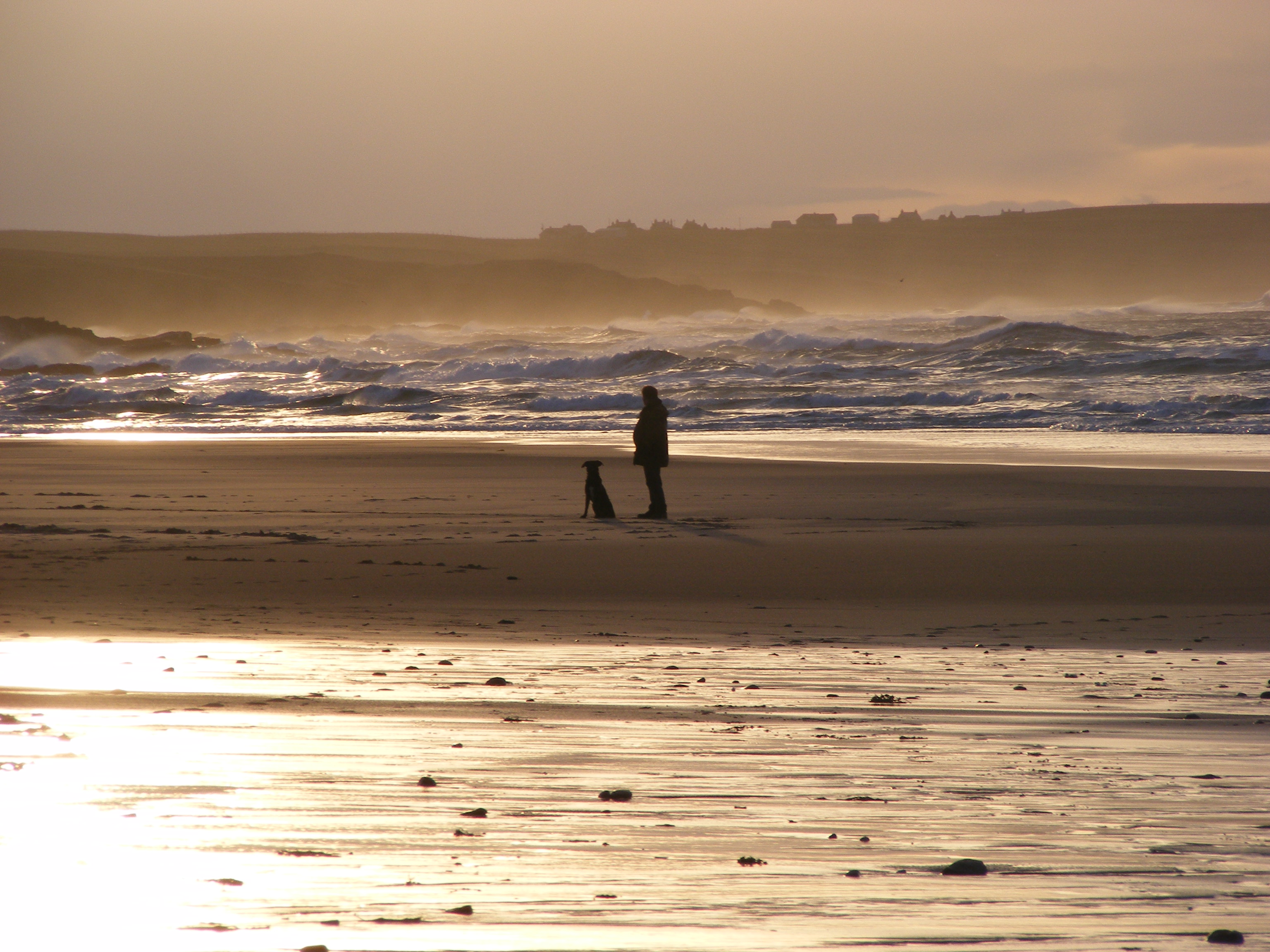
The area surrounding the Butt of Lewis is known for its wild and untamed beauty. The headland is frequently battered by strong winds and powerful waves, making it a popular spot for surfers and photographers seeking dramatic shots of the crashing waves. Seabirds, including puffins, fulmars, and guillemots, can often be spotted nesting on the cliffs, adding to the area's natural charm.
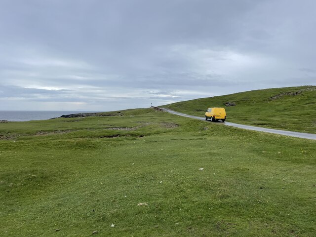
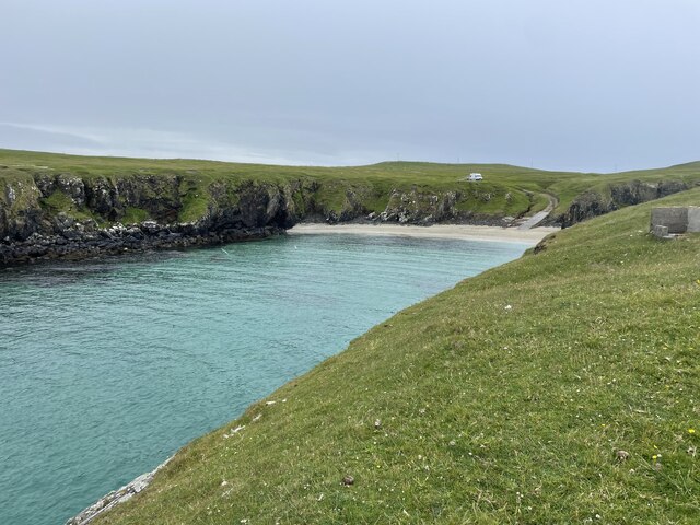
Visitors to the Butt of Lewis can take in the awe-inspiring scenery, explore the lighthouse, and enjoy peaceful walks along the coastal paths. It is a unique and captivating destination that showcases the raw beauty of Scotland's coastline.
If you have any feedback on the listing, please let us know in the comments section below.
Butt of Lewis Images
Images are sourced within 2km of 58.513033/-6.2620374 or Grid Reference NB5166. Thanks to Geograph Open Source API. All images are credited.


Butt of Lewis is located at Grid Ref: NB5166 (Lat: 58.513033, Lng: -6.2620374)
Unitary Authority: Na h-Eileanan an Iar
Police Authority: Highlands and Islands
Also known as: Rubha Robhanais
What 3 Words
///arrive.energetic.shippers. Near North Tolsta, Na h-Eileanan Siar
Nearby Locations
Related Wikis
Butt of Lewis
The Butt of Lewis (Scottish Gaelic: Rubha Robhanais) is the most northerly point of Lewis in the Outer Hebrides. The headland, which lies in the North...
Port Stoth
Port Stoth, known locally as Stoth and pronounced Stow, is a sheltered inlet just southeast of the Butt of Lewis in the Outer Hebrides, Scotland. It is...

Teampall Mholuaidh
St Moluag's church (Scottish Gaelic: Teampall Mholuaidh) is a church in the village of Eoropie in Ness in the Isle of Lewis in Scotland. It is one of the...
Eoropie
Eoropie (Scottish Gaelic: Eòrapaidh) is the most northerly village on the Isle of Lewis in the parish of Ness, in the Outer Hebrides, Scotland. Eoropie...

Fivepenny
Fivepenny (Scottish Gaelic: Na Còig Peighinnean) is one of the many villages in the Lewis district of Ness (Nis in Gaelic) and part of the Isle of Lewis...

Dùn Èistean
Dùn Èistean is a multi-period archaeological site on an inter-tidal sea stack on the north east coast of the Isle of Lewis, near the village of Knockaird...

Knockaird
Knockaird (Scottish Gaelic: An Cnoc Àrd) is a village on the Isle of Lewis in the parish of Ness, in the Outer Hebrides, Scotland. It is the highest point...

Lionel, Lewis
Lionel (Scottish Gaelic: Lìonal) is a village in the Ness area of the Isle of Lewis. Lionel is within the parish of Barvas. Lionel is situated near the...
Nearby Amenities
Located within 500m of 58.513033,-6.2620374Have you been to Butt of Lewis?
Leave your review of Butt of Lewis below (or comments, questions and feedback).