Buaile nan Caorach

Coastal Feature, Headland, Point in Ross-shire

Scotland

Buaile nan Caorach

Butt of Lewis Lighthouse The Butt of Lewis is the northernmost point of the Isle of Lewis in the Outer Hebrides. There is a lighthouse designed and built by David & Thomas Stevenson (sons of Robert and brother of Alan - all lighthouse engineers) and constructed in 1862. It is 37m (121ft) tall at an elevation of 52m (170ft) with a nominal range of 25 nautical miles. It flashes a white light every five seconds, and since 1998 is fully automated, being one of the last four Scottish lighthouses to dispense with the services of their keepers. It is looked after by the Northern Lighthouse Board (the Scottish equivalent to Trinity House) and is monitored remotely from Edinburgh.
The Butt of Lewis has appeared in the Guinness Book of Records as the windiest place in the United Kingdom, sticking out as it does into the North Atlantic.
Butt of Lewis Lighthouse Credit: Ralph Greig

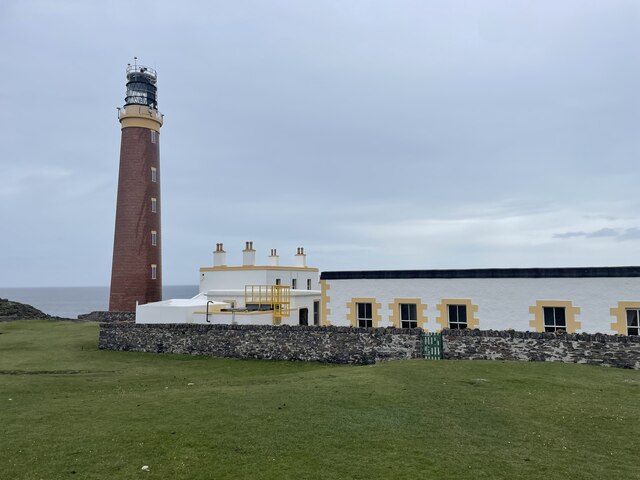
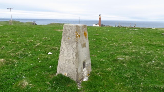
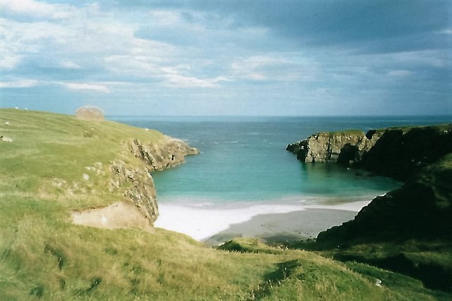
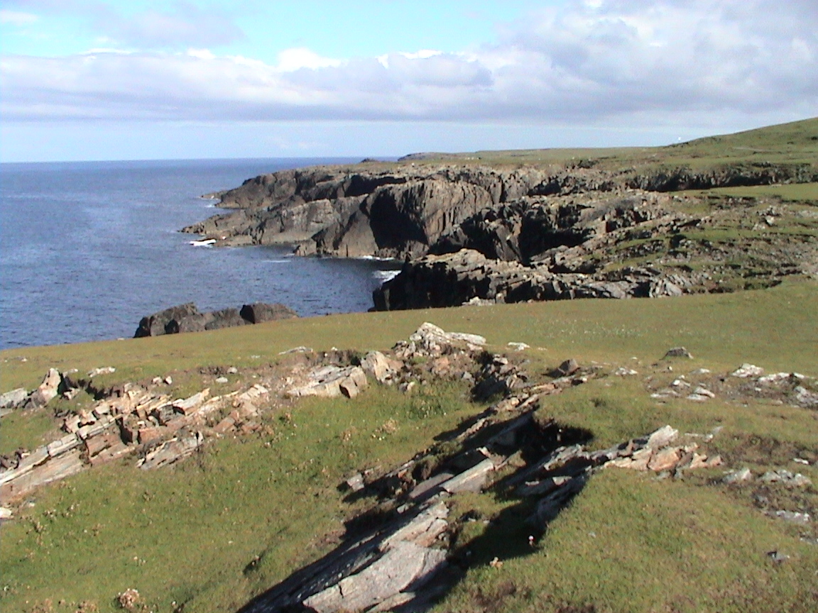
Buaile nan Caorach, located in Ross-shire, Scotland, is a stunning coastal feature known for its picturesque headland and prominent point. The name Buaile nan Caorach translates to "sheepfold of the sheep" in Gaelic, reflecting the historical significance of the area as a grazing ground for local sheep farmers.

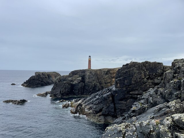
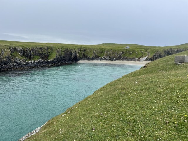
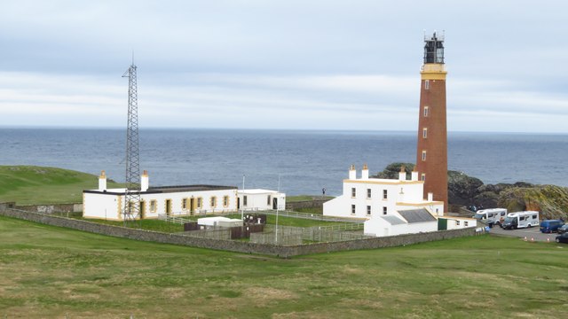
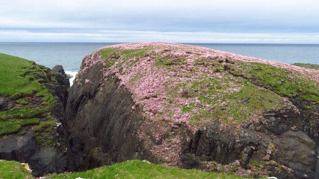
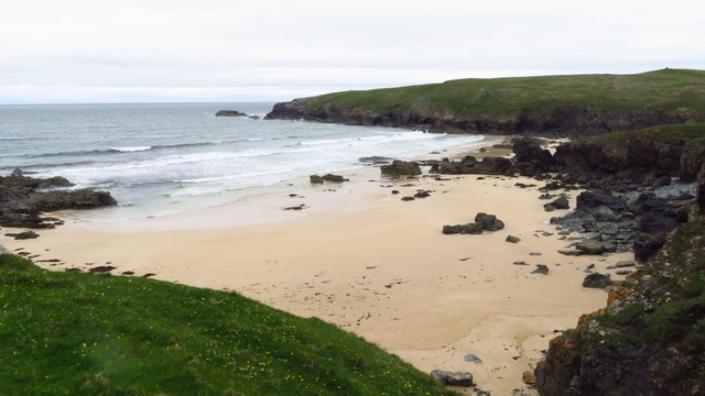
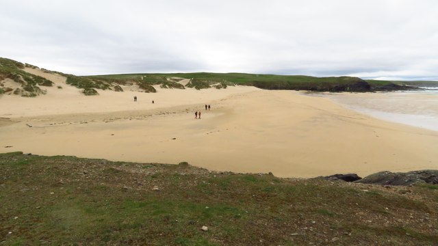
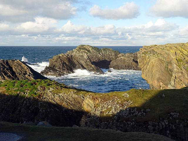
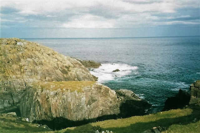
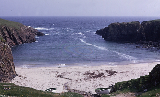
Situated on the rugged and dramatic coastline, Buaile nan Caorach offers breathtaking views of the surrounding landscape. The headland, with its steep cliffs and jagged rocks, provides a natural barrier against the powerful waves of the North Sea. This geographical feature not only adds to the beauty of the area but also serves as a protective shield for the nearby coastal communities.

The point of Buaile nan Caorach juts out into the sea, offering visitors a perfect vantage point to observe the crashing waves and the diverse marine life that inhabits the waters. Seabirds, such as gannets and puffins, can often be spotted nesting in the cliffs, creating a vibrant and lively atmosphere.

The area is also rich in history, with traces of ancient settlements and archaeological sites scattered throughout the landscape. These remnants indicate that Buaile nan Caorach has been a significant location for human activity for centuries, possibly dating back to prehistoric times.

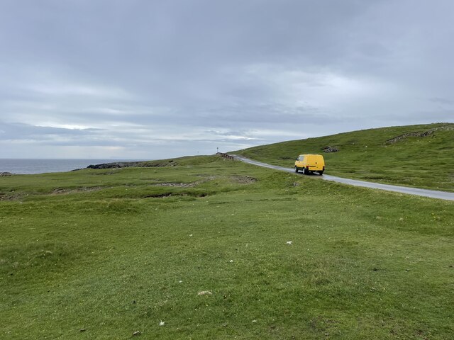
Access to Buaile nan Caorach is relatively easy, with a well-maintained footpath leading from the nearby village. Visitors can explore the headland and point, take in the breathtaking views, and immerse themselves in the natural beauty and historical significance of this enchanting coastal feature.

If you have any feedback on the listing, please let us know in the comments section below.

Buaile nan Caorach Images

Images are sourced within 2km of 58.514609/-6.268983 or Grid Reference NB5166. Thanks to Geograph Open Source API. All images are credited.

Butt of Lewis Lighthouse The Butt of Lewis is the northernmost point of the Isle of Lewis in the Outer Hebrides. There is a lighthouse designed and built by David & Thomas Stevenson (sons of Robert and brother of Alan - all lighthouse engineers) and constructed in 1862. It is 37m (121ft) tall at an elevation of 52m (170ft) with a nominal range of 25 nautical miles. It flashes a white light every five seconds, and since 1998 is fully automated, being one of the last four Scottish lighthouses to dispense with the services of their keepers. It is looked after by the Northern Lighthouse Board (the Scottish equivalent to Trinity House) and is monitored remotely from Edinburgh.
The Butt of Lewis has appeared in the Guinness Book of Records as the windiest place in the United Kingdom, sticking out as it does into the North Atlantic.
Butt of Lewis Lighthouse
The Butt of Lewis is the northernmost point of the Isle of Lewis in the Outer Hebrides. There is a lighthouse designed and built by David & Thomas Stevenson (sons of Robert and brother of Alan - all lighthouse engineers) and constructed in 1862. It is 37m (121ft) tall at an elevation of 52m (170ft) with a nominal range of 25 nautical miles. It flashes a white light every five seconds, and since 1998 is fully automated, being one of the last four Scottish lighthouses to dispense with the services of their keepers. It is looked after by the Northern Lighthouse Board (the Scottish equivalent to Trinity House) and is monitored remotely from Edinburgh. The Butt of Lewis has appeared in the Guinness Book of Records as the windiest place in the United Kingdom, sticking out as it does into the North Atlantic.
Road to the lighthouse The Butt of Lewis is the northernmost point of the Isle of Lewis in the Outer Hebrides. There is a lighthouse designed and built by David & Thomas Stevenson (sons of Robert and brother of Alan - all lighthouse engineers) and constructed in 1862. It is 37m (121ft) tall at an elevation of 52m (170ft) with a nominal range of 25 nautical miles. It flashes a white light every five seconds, and since 1998 is fully automated, being one of the last four Scottish lighthouses to dispense with the services of their keepers. It is looked after by the Northern Lighthouse Board (the Scottish equivalent to Trinity House) and is monitored remotely from Edinburgh.
The Butt of Lewis has appeared in the Guinness Book of Records as the windiest place in the United Kingdom, sticking out as it does into the North Atlantic.
Road to the lighthouse
The Butt of Lewis is the northernmost point of the Isle of Lewis in the Outer Hebrides. There is a lighthouse designed and built by David & Thomas Stevenson (sons of Robert and brother of Alan - all lighthouse engineers) and constructed in 1862. It is 37m (121ft) tall at an elevation of 52m (170ft) with a nominal range of 25 nautical miles. It flashes a white light every five seconds, and since 1998 is fully automated, being one of the last four Scottish lighthouses to dispense with the services of their keepers. It is looked after by the Northern Lighthouse Board (the Scottish equivalent to Trinity House) and is monitored remotely from Edinburgh. The Butt of Lewis has appeared in the Guinness Book of Records as the windiest place in the United Kingdom, sticking out as it does into the North Atlantic.
Port Stoth Geocaching is a type of global treasure hunt of people looking for caches, or hidden stashes of objects. Geocaching may also be described as a series of hide-and-seek games, where hiders provide online clues for seekers. Seekers use global positioning system (GPS) devices to find hidden caches
Port Stoth
Geocaching is a type of global treasure hunt of people looking for caches, or hidden stashes of objects. Geocaching may also be described as a series of hide-and-seek games, where hiders provide online clues for seekers. Seekers use global positioning system (GPS) devices to find hidden caches
St Molveg's Church, Eoropie
Trig point at Butt of Lewis
Butt of Lewis Lighthouse
Sea thrift on islet at Geodha nan Each, Butt of Lewis
Beach at Cunndal, Eoropie
Cunndal Drownings Memorial, Eoropie This is a memorial to the men lost here on 5th March 1885, when the local fishing fleet was caught in a terrible gale. Two boats attempted to seek shelter at Cunndal, just north of this point. Both boats and twelve men – all from Eoropie - were lost.
Cunndal Drownings Memorial, Eoropie
This is a memorial to the men lost here on 5th March 1885, when the local fishing fleet was caught in a terrible gale. Two boats attempted to seek shelter at Cunndal, just north of this point. Both boats and twelve men – all from Eoropie - were lost.
Traigh Shanndaigh, Eoropie
Butt of Lewis Lighthouse I did consider correcting the converging verticals in this shot but then I got an attack of acrophobia so could no longer look at it!
Butt of Lewis Lighthouse
I did consider correcting the converging verticals in this shot but then I got an attack of acrophobia so could no longer look at it!
Cleite Gile Rocks at the Butt of Lewis.
Cleite Gile
Rocks at the Butt of Lewis.
Butt of Lewis lighthouse
Port Stoth Port Stoth is the most northerly beach on the Western Isles. All the materials for the construction of the Butt of Lewis lighthouse were landed here between 1851 and 1862. As it was a sheltered spot the beach continued to be used to bring supplies to the lighthouse until the 1960s. 
On 22nd January 1901 a wooden lugsail (Lugger) in ballast was stranded at Port Stoth. Surprisingly, no name is recorded of the unregistered vessel but its date of building was known to be 1893 and the master was a Captain Gunn.
Port Stoth
Port Stoth is the most northerly beach on the Western Isles. All the materials for the construction of the Butt of Lewis lighthouse were landed here between 1851 and 1862. As it was a sheltered spot the beach continued to be used to bring supplies to the lighthouse until the 1960s. On 22nd January 1901 a wooden lugsail (Lugger) in ballast was stranded at Port Stoth. Surprisingly, no name is recorded of the unregistered vessel but its date of building was known to be 1893 and the master was a Captain Gunn.
Cleite Gile, Rubha Robhanais Cliffs at Butt of Lewis
Cleite Gile, Rubha Robhanais
Cliffs at Butt of Lewis
Butt of Lewis lighthouse with Transocean Winner offshore The ineptly-named oilrig slowly rounds the Butt at a safe distance, having been refloated from Dalmore beach the previous evening.  See <a href="https://www.geograph.org.uk/photo/5088125">NB5268 : Transocean Winner rounds the Butt</a>.
Butt of Lewis lighthouse with Transocean Winner offshore
The ineptly-named oilrig slowly rounds the Butt at a safe distance, having been refloated from Dalmore beach the previous evening. See NB5268 : Transocean Winner rounds the Butt.
The Northwest extremity of Scotland, Butt of Lewis
Show me another place!

Buaile nan Caorach is located at Grid Ref: NB5166 (Lat: 58.514609, Lng: -6.268983)

Unitary Authority: Na h-Eileanan an Iar

Police Authority: Highlands and Islands

What 3 Words

///hunter.stilted.easels. Near North Tolsta, Na h-Eileanan Siar

Related Wikis

Butt of Lewis

The Butt of Lewis (Scottish Gaelic: Rubha Robhanais) is the most northerly point of Lewis in the Outer Hebrides. The headland, which lies in the North...

Port Stoth

Port Stoth, known locally as Stoth and pronounced Stow, is a sheltered inlet just southeast of the Butt of Lewis in the Outer Hebrides, Scotland. It is...

Teampall Mholuaidh

St Moluag's church (Scottish Gaelic: Teampall Mholuaidh) is a church in the village of Eoropie in Ness in the Isle of Lewis in Scotland. It is one of the...

Eoropie

Eoropie (Scottish Gaelic: Eòrapaidh) is the most northerly village on the Isle of Lewis in the parish of Ness, in the Outer Hebrides, Scotland. Eoropie...

Fivepenny

Fivepenny (Scottish Gaelic: Na Còig Peighinnean) is one of the many villages in the Lewis district of Ness (Nis in Gaelic) and part of the Isle of Lewis...

Dùn Èistean

Dùn Èistean is a multi-period archaeological site on an inter-tidal sea stack on the north east coast of the Isle of Lewis, near the village of Knockaird...

Knockaird

Knockaird (Scottish Gaelic: An Cnoc Àrd) is a village on the Isle of Lewis in the parish of Ness, in the Outer Hebrides, Scotland. It is the highest point...

Lionel, Lewis

Lionel (Scottish Gaelic: Lìonal) is a village in the Ness area of the Isle of Lewis. Lionel is within the parish of Barvas. Lionel is situated near the...

Nearby Amenities

Located within 500m of 58.514609,-6.268983
Buaile nan Caorach
Place: locality
Lat/Long: 58.5143828/-6.2692976
Ford: yes
Lat/Long: 58.5136312/-6.2668177
Material: wood
Power: pole
Lat/Long: 58.5135194/-6.261308
Material: wood
Power: pole
Lat/Long: 58.5140047/-6.261872
Geodha Beag
Natural: bay
Lat/Long: 58.5147629/-6.2670451
Man Made: mast
Tower Construction: lattice
Tower Type: communication
Lat/Long: 58.5149074/-6.2614601
Access: no
Entrance: yes
Lat/Long: 58.515555/-6.2609309
The data included in this document is from www.openstreetmap.org. The data is made available under ODbL.

Have you been to Buaile nan Caorach?

Leave your review of Buaile nan Caorach below (or comments, questions and feedback).