Taingar
Coastal Feature, Headland, Point in Shetland
Scotland
Taingar
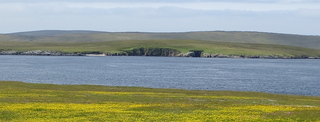
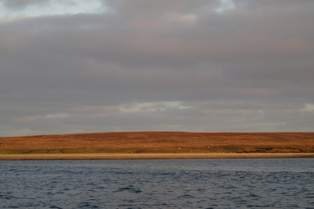
Taingar is a prominent and picturesque coastal feature located in the Shetland Islands, off the north coast of Scotland. It is a headland that juts out into the North Atlantic Ocean, forming a distinctive point along the rugged coastline.
The landscape of Taingar is characterized by steep cliffs that rise dramatically from the sea, reaching heights of up to 100 meters. These cliffs are composed of rugged, weathered rocks, showcasing a variety of colors and textures. The point is also dotted with small caves and crevices, formed through centuries of erosion by the relentless waves.
The area surrounding Taingar is renowned for its rich biodiversity. The headland provides a habitat for a wide range of seabirds, including puffins, guillemots, and fulmars. Visitors to the area can often witness these birds soaring gracefully above the cliffs or nesting in the rocky ledges. The waters around Taingar are also home to various marine species, such as seals, dolphins, and even occasional sightings of whales.
Aside from its natural beauty, Taingar also holds historical significance. The headland is believed to have been inhabited by humans for thousands of years, with archaeological evidence suggesting the presence of ancient settlements. It is not uncommon to come across remnants of prehistoric structures, such as stone circles or burial mounds, during explorations of the area.
Overall, Taingar is a captivating coastal feature that offers both stunning natural scenery and a glimpse into the rich history of the Shetland Islands. It is a must-visit destination for nature enthusiasts, birdwatchers, and those interested in the region's fascinating past.
If you have any feedback on the listing, please let us know in the comments section below.
Taingar Images
Images are sourced within 2km of 60.617462/-0.99820311 or Grid Reference HU5493. Thanks to Geograph Open Source API. All images are credited.


Taingar is located at Grid Ref: HU5493 (Lat: 60.617462, Lng: -0.99820311)
Unitary Authority: Shetland Islands
Police Authority: Highlands and Islands
What 3 Words
///rare.urge.decimals. Near Gutcher, Shetland Islands
Nearby Locations
Related Wikis

Hascosay
Hascosay (Scots: Hascosay; Old Norse "Hafskotsey") is a small island lying between Yell and Fetlar in the Shetland Islands, Scotland. == Geography and... ==

Burra Ness Broch
Burra Ness Broch is an iron-age broch located on the east coast of the island of Yell, Shetland, Scotland. == Location == Burra Ness Broch (grid reference...

Basta, Shetland
Basta is a hamlet on the island of Yell in the Shetland islands of Scotland. It is on the shores of Basta Voe and is in the parish of Yell. == References... ==

Brough Lodge
Brough Lodge is a 19th-century Gothic mansion on Fetlar, one of the Shetland Islands, in northern Scotland. Built by the Nicolson family, who were responsible...

Hamars Ness
Hamars Ness is a headland on the island of Fetlar in Shetland, Scotland. The name is from the Old Norse Hamarsnes meaning "craggy headland". A ro-ro ferry...

Mid Yell
Mid Yell is a coastal settlement on the island of Yell, the second largest of Shetland Islands, Scotland. Mid Yell, the largest settlement on the island...

Urie Lingey
For other islands with similar names, see Linga (disambiguation) Urie Lingey is one of the Shetland Islands. It is between Fetlar and Unst, and Yell is...

Sound Gruney
For other islands with similar names, see Gruney (disambiguation) Sound Gruney is one of the Shetland islands. It lies about 1.5 kilometres (0.93 mi)...
Have you been to Taingar?
Leave your review of Taingar below (or comments, questions and feedback).