Wadbister Ness

Coastal Feature, Headland, Point in Shetland

Scotland

Wadbister Ness

Boat on the shore of a frozen Loch of Girlsta
Boat on the shore of a frozen Loch of Girlsta Credit: Mike Pennington

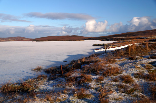
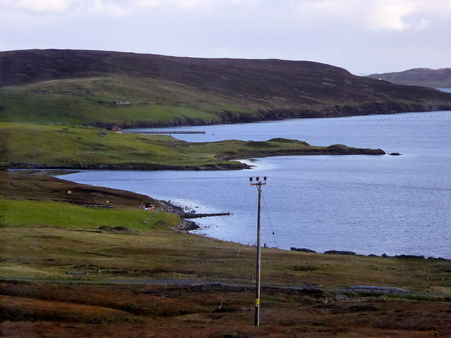
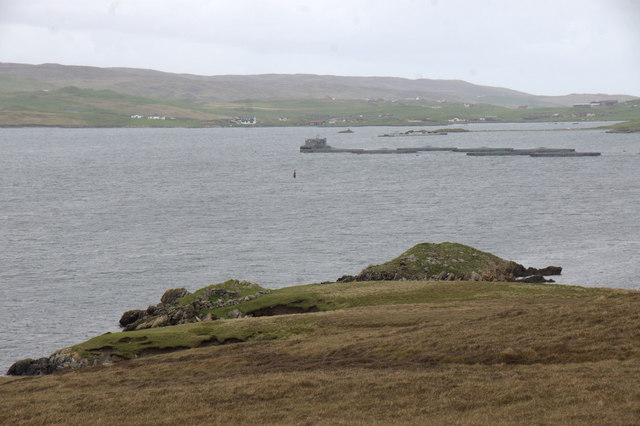
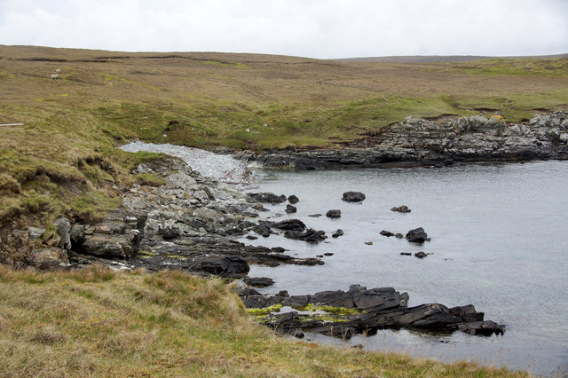
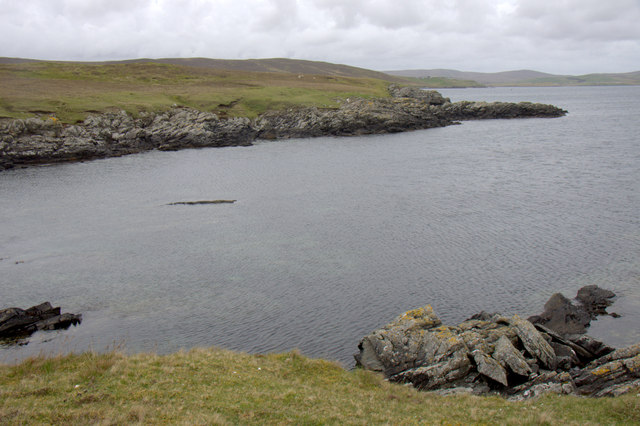
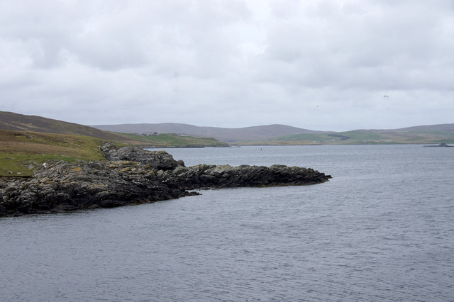
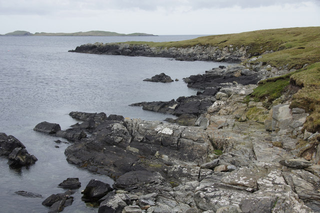
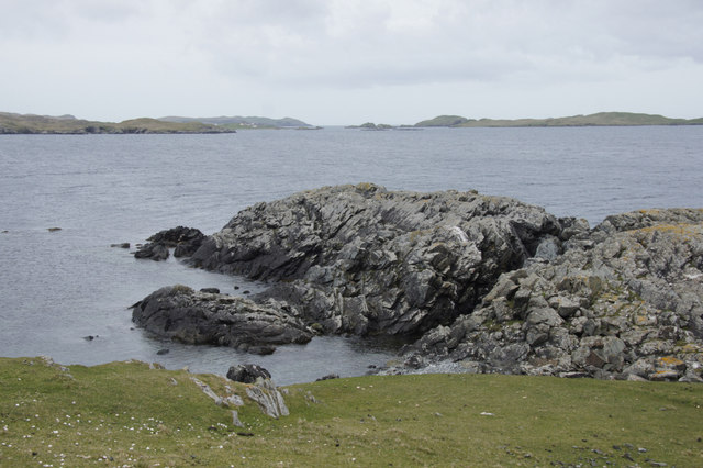
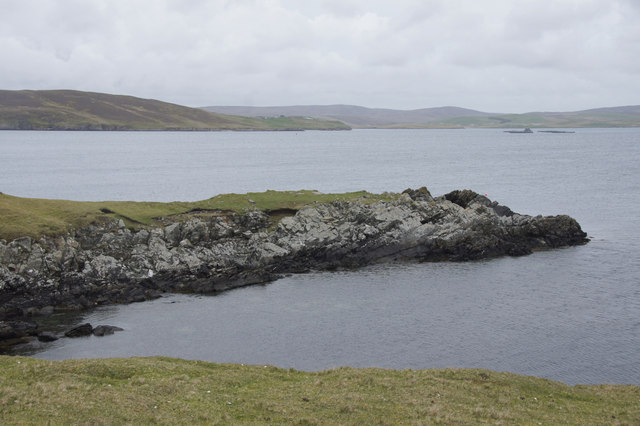
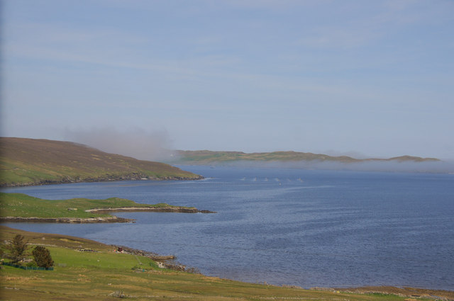
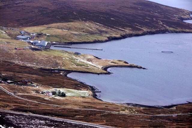
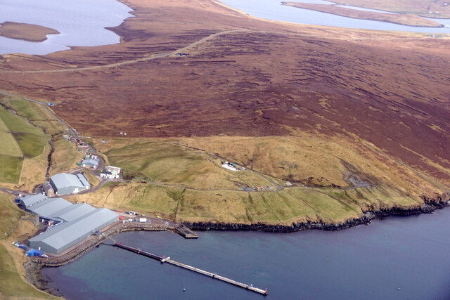
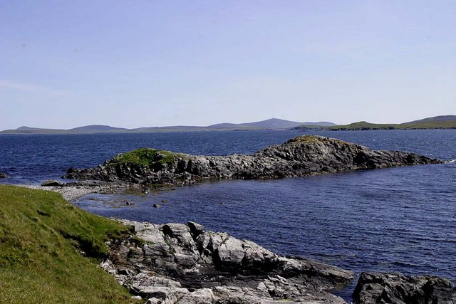
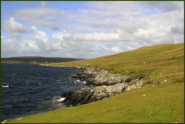
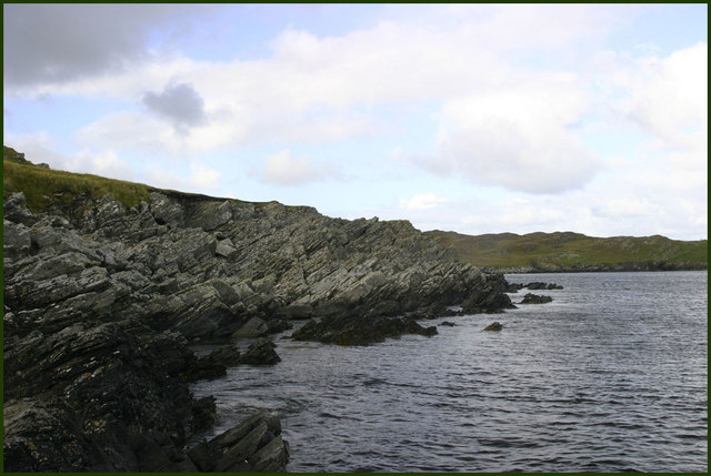
Wadbister Ness is a prominent headland located on the north coast of the island of Yell in the Shetland Islands, Scotland. The headland forms the northernmost point of the island and overlooks the North Sea. Wadbister Ness is known for its rugged and rocky coastline, with steep cliffs that jut out into the sea.

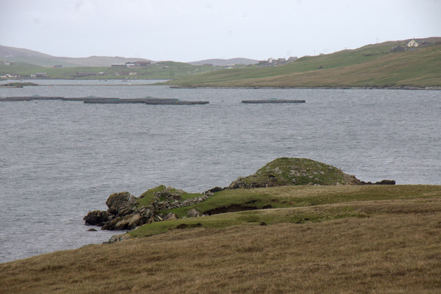
The headland is home to a variety of seabirds, including puffins, fulmars, and guillemots, making it a popular spot for birdwatchers and wildlife enthusiasts. The surrounding waters are also teeming with marine life, with seals often seen basking on the rocks and otters occasionally spotted swimming in the nearby coves.

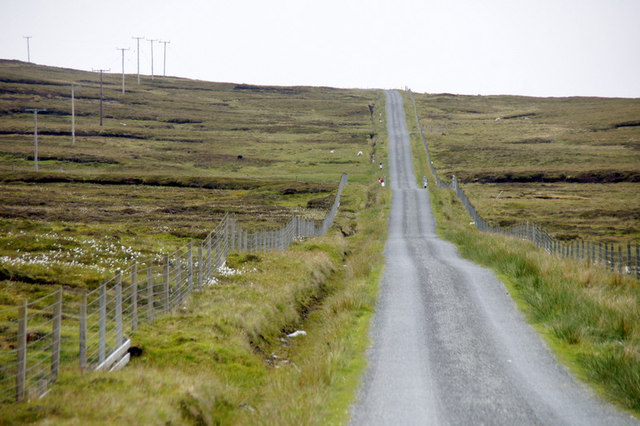
Wadbister Ness is accessible by a narrow road that leads to a small parking area at the tip of the headland. From there, visitors can take in sweeping views of the surrounding coastline and the open sea. The headland is a peaceful and remote spot, perfect for those looking to escape the hustle and bustle of everyday life and immerse themselves in the natural beauty of the Shetland Islands.

If you have any feedback on the listing, please let us know in the comments section below.

Wadbister Ness Images

Images are sourced within 2km of 60.231703/-1.1950278 or Grid Reference HU4449. Thanks to Geograph Open Source API. All images are credited.

Boat on the shore of a frozen Loch of Girlsta
Wadbister Voe
Wadbister Voe
The road to Brunt Hamarsland
Broch at the end of Wadbister Ness Although on a small holm nowadays, the broch was probably on the mainland in the Iron Age as sea levels were lower at that time. In the background are various settlements in South Nesting.
Broch at the end of Wadbister Ness
Although on a small holm nowadays, the broch was probably on the mainland in the Iron Age as sea levels were lower at that time. In the background are various settlements in South Nesting.
Broch at the end of Wadbister Ness Salmon farm and South Nesting in the background.
Broch at the end of Wadbister Ness
Salmon farm and South Nesting in the background.
Small beach at the end of Wadbister Ness
Mitten, Wadbister Ness Mitten appears to be the name of the headland.
Mitten, Wadbister Ness
Mitten appears to be the name of the headland.
Mitten, Wadbister Ness Apparently, this is the name of this headland.
Mitten, Wadbister Ness
Apparently, this is the name of this headland.
Coast just west of Lambgarth Head, Wadbister Ness
Lambgarth Head, Wadbister Ness
Small headland just west of Lambgarth Head, Wadbister Ness
Haar over Wadbister Voe Chalder Ness in the foreground, haar over Ritta Taing in the background.
Haar over Wadbister Voe
Chalder Ness in the foreground, haar over Ritta Taing in the background.
Girlsta from the air
Girlsta pier from the air
Girlsta burn The outflow burn from the loch of Girlsta. In the past a large mill was in operation at Girlsta and the crofters came here with their corn to be ground into flour.
Girlsta burn
The outflow burn from the loch of Girlsta. In the past a large mill was in operation at Girlsta and the crofters came here with their corn to be ground into flour.
Headland below Hill of Taing The headland at the end of the Hill of Taing is the home of a family of otters. The land is almost cut off at high tide and is so on the highest tides of year.
Headland below Hill of Taing
The headland at the end of the Hill of Taing is the home of a family of otters. The land is almost cut off at high tide and is so on the highest tides of year.
Shoreline below Hill of the Taing Shoreline at high tide on Catfirth Voe with distant houses at the head of Vassa Voe.
Shoreline below Hill of the Taing
Shoreline at high tide on Catfirth Voe with distant houses at the head of Vassa Voe.
Rocky shoreline Rocks at the shoreline of South Voe of Gletness
Rocky shoreline
Rocks at the shoreline of South Voe of Gletness
Show me another place!

Wadbister Ness is located at Grid Ref: HU4449 (Lat: 60.231703, Lng: -1.1950278)

Unitary Authority: Shetland Islands

Police Authority: Highlands and Islands

What 3 Words

///curiosity.kiosk.unrated. Near Lerwick, Shetland Islands

Related Wikis

South Isle of Gletness

The South Isle of Gletness is an islet off Gletness, in Nesting in east central, Mainland, Shetland. It is 30m at its highest point. Amongst its features...

Breiwick

Breiwick is a village on the island of Mainland in Shetland, Scotland. Breiwick is in the parish of Tingwall, and is 1.6 mi (2.5 km) north-east of Gott...

Freester

Freester is a settlement on Mainland, Shetland, Scotland. It is in the parish of Nesting. == References == == External links == Canmore - Hard Knowe site...

North Isle of Gletness

The North Isle of Gletness is one of the Shetland Islands. It is east of the Shetland Mainland, near Gletness in Nesting parish, and is so called in contradistinction...

Have you been to Wadbister Ness?

Leave your review of Wadbister Ness below (or comments, questions and feedback).