Atla Ness

Coastal Feature, Headland, Point in Shetland

Scotland

Atla Ness

Hamnavoe: Andrew Halcrow’s Shop Hamnavoe village store also houses the post office.
Hamnavoe: Andrew Halcrow’s Shop Credit: Chris Downer

Atla Ness is a prominent coastal feature located in the Shetland Islands, Scotland. It is a picturesque headland that extends into the North Sea, forming a distinctive point on the eastern coast of the Shetland Mainland.

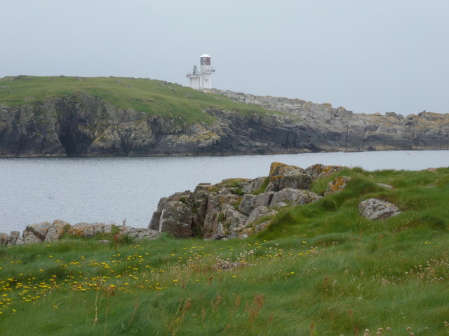
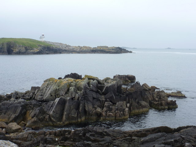
The headland of Atla Ness is characterized by its rugged and dramatic cliffs, rising up to approximately 100 meters above sea level. The cliffs are composed of ancient rock formations, primarily sandstone and shale, which exhibit various layers and textures, adding to the visual appeal of the area. The exposed nature of Atla Ness makes it susceptible to strong winds and turbulent waves, creating an awe-inspiring environment for visitors.

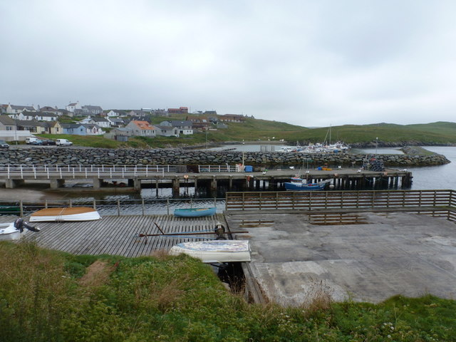
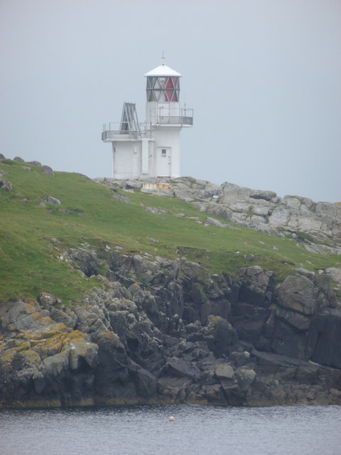
The headland offers breathtaking panoramic views of the surrounding coastal landscape. On clear days, one can see the vast expanse of the North Sea and the neighboring islands, such as Yell and Unst. The diverse marine wildlife in the area is also a notable attraction, with frequent sightings of seabirds, seals, and occasionally, whales and dolphins.

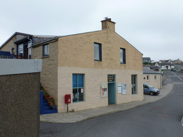
Access to Atla Ness is relatively easy, with a well-maintained footpath leading to the point. The headland is a popular spot for outdoor enthusiasts, offering opportunities for hiking, birdwatching, and photography. There are also several benches strategically placed along the path, providing resting spots for visitors to take in the stunning vistas and appreciate the tranquility of the area.

In summary, Atla Ness is a captivating coastal feature in the Shetland Islands, boasting impressive cliffs, panoramic views, and abundant wildlife. It is a must-visit destination for nature lovers and those seeking a peaceful escape in the rugged beauty of the Scottish coastline.

If you have any feedback on the listing, please let us know in the comments section below.
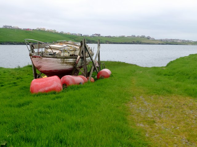
Atla Ness Images

Images are sourced within 2km of 60.107117/-1.3377715 or Grid Reference HU3636. Thanks to Geograph Open Source API. All images are credited.

Hamnavoe: Andrew Halcrow’s Shop Hamnavoe village store also houses the post office.
Hamnavoe: Andrew Halcrow’s Shop
Hamnavoe village store also houses the post office.
Hamnavoe: postbox № ZE2 20 This postbox stands outside <a href="https://www.geograph.org.uk/photo/2701248">HU3635 : Hamnavoe: Andrew Halcrow’s Shop</a> - the postal scales can be seen through the window. The box is emptied at 10am on weekdays and Saturdays.
Hamnavoe: postbox № ZE2 20
This postbox stands outside HU3635 : Hamnavoe: Andrew Halcrow’s Shop - the postal scales can be seen through the window. The box is emptied at 10am on weekdays and Saturdays.
Hamnavoe: across the harbour Looking across the head of Hamna Voe, which forms the little harbour, with the marina in the background.
Hamnavoe: across the harbour
Looking across the head of Hamna Voe, which forms the little harbour, with the marina in the background.
Hamnavoe: view across Hamna Voe to Fugla Ness Looking across the entrance to the voe, with the light of Fugla Ness across the water.
Hamnavoe: view across Hamna Voe to Fugla Ness
Looking across the entrance to the voe, with the light of Fugla Ness across the water.
Hamnavoe: rocks below Scarva Stack Looking out from the western tip of Scarva Stack, across the entrance of Hamna Voe with Skeggies visible faintly in the background, beyond the tip of Fugla Ness with its navigation light.
Hamnavoe: rocks below Scarva Stack
Looking out from the western tip of Scarva Stack, across the entrance of Hamna Voe with Skeggies visible faintly in the background, beyond the tip of Fugla Ness with its navigation light.
Hamnavoe: Fugla Ness light A navigational aid for vessels entering Hamna Voe, the sea inlet in the foreground.
Hamnavoe: Fugla Ness light
A navigational aid for vessels entering Hamna Voe, the sea inlet in the foreground.
West Burra: postbox № ZE2 8, Southerhouse A small postbox serving the Southerhouse hamlet, emptied on weekdays and Saturdays at 7:30am. The backdrop is the Clift Hills, on the western edge of the Shetland mainland, rising into the mist.
West Burra: postbox № ZE2 8, Southerhouse
A small postbox serving the Southerhouse hamlet, emptied on weekdays and Saturdays at 7:30am. The backdrop is the Clift Hills, on the western edge of the Shetland mainland, rising into the mist.
Hamnavoe: Sands of Meal Looking across this short sandy beach in a bay to the south of Hamnavoe.
Hamnavoe: Sands of Meal
Looking across this short sandy beach in a bay to the south of Hamnavoe.
Hamnavoe: Meal Kirk A small, simple parish church in the eastern part of Hamnavoe.
Hamnavoe: Meal Kirk
A small, simple parish church in the eastern part of Hamnavoe.
Lang Sound
Lang Sound
Hamnavoe marina One or two inshore fishing boats, but mainly pleasure craft.
Hamnavoe marina
One or two inshore fishing boats, but mainly pleasure craft.
Meal Kirk, Hamnavoe Built in 1907 as a mission church of the Church of Scotland. Small grey-harled church with white painted window surrounds and quoins. Simple bellcote on east gable. Improvements are planned to increase use of the building by the community.
Meal Kirk, Hamnavoe
Built in 1907 as a mission church of the Church of Scotland. Small grey-harled church with white painted window surrounds and quoins. Simple bellcote on east gable. Improvements are planned to increase use of the building by the community.
Bruna Ness Bagged with Tricky Speirs with view towards the bridge that connect Trondra to West Burra.
Name: Bruna Ness
Hill number: 104041
Height: 59m / 194ft
Area:22: Shetland Islands
Class:0
Grid ref: HU382368 (est)
Drop: 43m
Col: 16m
Bruna Ness
Bagged with Tricky Speirs with view towards the bridge that connect Trondra to West Burra. Name: Bruna Ness Hill number: 104041 Height: 59m / 194ft Area:22: Shetland Islands Class:0 Grid ref: HU382368 (est) Drop: 43m Col: 16m
Old Boat Near Setter Old boat near hamlet of Setter with view across to Hamnavoe.
Old Boat Near Setter
Old boat near hamlet of Setter with view across to Hamnavoe.
Brough Hill Bagged with Tricky Speirs.
Name: Brough Hill
Hill number: 104033
Height: 61m / 200ft
Area:22: Shetland Islands
Class: 0
Grid ref: HU377351 (est)
Drop: 49m
Col: 12m
Brough Hill
Bagged with Tricky Speirs. Name: Brough Hill Hill number: 104033 Height: 61m / 200ft Area:22: Shetland Islands Class: 0 Grid ref: HU377351 (est) Drop: 49m Col: 12m
Hamnavoe: lifebuoy at Meal Beach This lifebuoy is both functional and artistic, and is hooked to the kissing gate at the top of the path leading down to the beach.
Hamnavoe: lifebuoy at Meal Beach
This lifebuoy is both functional and artistic, and is hooked to the kissing gate at the top of the path leading down to the beach.
Hamnavoe: across Meal Beach Looking across the <a href="https://www.geograph.org.uk/photo/2701583">HU3735 : Hamnavoe: Sands of Meal</a> from rocks at the back of the beach.
Hamnavoe: across Meal Beach
Looking across the HU3735 : Hamnavoe: Sands of Meal from rocks at the back of the beach.
Hamnavoe: sandcastle on Meal Beach Clearly the <a href="https://www.geograph.org.uk/photo/2701583">HU3735 : Hamnavoe: Sands of Meal</a> have provided some youthful enjoyment today.
Hamnavoe: sandcastle on Meal Beach
Clearly the HU3735 : Hamnavoe: Sands of Meal have provided some youthful enjoyment today.
Show me another place!

Atla Ness is located at Grid Ref: HU3636 (Lat: 60.107117, Lng: -1.3377715)

Unitary Authority: Shetland Islands

Police Authority: Highlands and Islands

What 3 Words

///weaved.recur.clashes. Near Scalloway, Shetland Islands

Related Wikis

Papa, Shetland

Papa (Scots: Papa; Old Norse: Papey, meaning "the island of the priests") is an uninhabited island in the Scalloway Islands, Shetland, Scotland. Papa lies...

Oxna

Oxna is one of the Scalloway Islands, lying north west of Burra in Shetland, Scotland. Oxna has an area of 68 hectares (170 acres). The island has been...

West Head of Papa

West Head of Papa is a small tidal island off Papa in Shetland, and is one of the Scalloway Islands. It is 21m at its highest point. East Head of Papa...

Green Holm

Green Holm, (HU382379), is a small uninhabited island 500 metres north of Burra Ness at the north end of the island of Burra and on the west side of the...

Scalloway Islands

The Scalloway Islands are in Shetland opposite Scalloway on south west of the Mainland. They form a mini-archipelago and include: Burra (two islands linked...

East Burra

East Burra (Scots: East Burra; Old Norse: "Barrey") is one of the Scalloway Islands, a subgroup of the Shetland Islands in Scotland. It is connected by...

Trondra

Trondra (Scots: Trondra) is one of the Scalloway Islands, a subgroup of the Shetland Islands in Scotland. It shelters the harbour of Scalloway and has...

Langa, Shetland

Langa (Old Norse: Langey ) is the collective name for two uninhabited islands off Hildasay, in Shetland, Scotland. The islands are connected by a tombolo...

Nearby Amenities

Located within 500m of 60.107117,-1.3377715
Opening Hours: Mo-Sa 09:00-18:00
Source: OS OpenData StreetView
Lat/Long: 60.1058282/-1.3376509
Barrier: stile
Foot: yes
Lat/Long: 60.1031643/-1.3396094
Toilets
Lat/Long: 60.1054566/-1.3372229
Leisure: slipway
Seamark Information: by car
Seamark Small Craft Facility Category: slipway
Seamark Type: small_craft_facility
Lat/Long: 60.1054987/-1.338323
Post Box
Operator: Royal Mail
Ref: ZE2 20
Lat/Long: 60.1058072/-1.3378905
Shetland Sea Adventures
Description: Charter Boat
Website: https://www.shetlandseaadventures.com
Lat/Long: 60.1043886/-1.3382898
Power: pole
Lat/Long: 60.1067449/-1.3352412
Power: pole
Lat/Long: 60.1067442/-1.3343158
Power: pole
Lat/Long: 60.1065437/-1.3336185
Power: pole
Lat/Long: 60.1063044/-1.3327119
Power: pole
Lat/Long: 60.1060611/-1.331926
Power: pole
Lat/Long: 60.1055638/-1.33136
Power: pole
Lat/Long: 60.1055064/-1.3308531
Power: pole
Lat/Long: 60.1027749/-1.3359606
Power: pole
Lat/Long: 60.1029392/-1.3354559
Power: pole
Lat/Long: 60.1032642/-1.3353568
Power: pole
Lat/Long: 60.1035491/-1.3352716
Power: pole
Lat/Long: 60.1039327/-1.3351564
Power: pole
Lat/Long: 60.1039591/-1.3341447
Power: pole
Lat/Long: 60.1057658/-1.3338406
Power: pole
Lat/Long: 60.1067052/-1.3355527
Bus Stop
Hamnavoe
Bus: yes
Fixme: Location unknown
Public Transport: platform
Lat/Long: 60.1055805/-1.3372824
Post Office
Hamnavoe Post Office
Addr City: Shetland
Addr Country: GB
Addr Housename: Burra Public Hall
Addr Postcode: ZE2 9LA
Addr Street: Roadside
Addr Suburb: Hamnavoe
Brand: Post Office
Brand Wikidata: Q1783168
Opening Hours: We,Fr 09:30-13:00
Ref Pol Id: 131448
Website: https://www.postoffice.co.uk/branch-finder/3384713/hamnavoe
Lat/Long: 60.1052903/-1.332116
The data included in this document is from www.openstreetmap.org. The data is made available under ODbL.

Have you been to Atla Ness?

Leave your review of Atla Ness below (or comments, questions and feedback).