Atla Sound

Sea, Estuary, Creek in Shetland

Scotland

Atla Sound

Hamnavoe: Andrew Halcrow’s Shop Hamnavoe village store also houses the post office.
Hamnavoe: Andrew Halcrow’s Shop Credit: Chris Downer

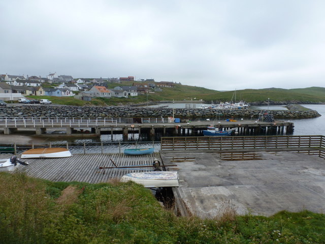
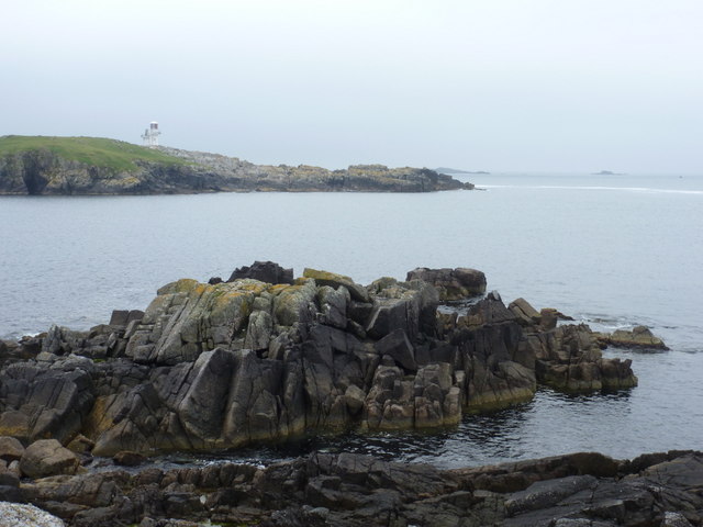
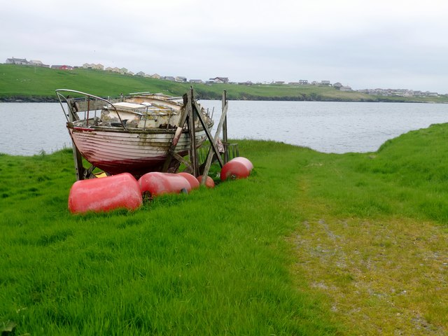
Atla Sound is a picturesque body of water located in the Shetland Islands, a remote archipelago in Scotland. It is situated between the mainland of Shetland and the island of Yell, forming a natural estuary and connecting the North Sea to the Atlantic Ocean. The Sound is relatively narrow, with a width of approximately 1.5 kilometers at its widest point.

The water in Atla Sound is influenced by the strong tidal currents that characterize the region. The ebb and flow of the tides create a dynamic environment, resulting in varying water levels and currents throughout the day. This tidal action also affects the salinity of the water, as it mixes with the freshwater flowing from the surrounding creeks and rivers.

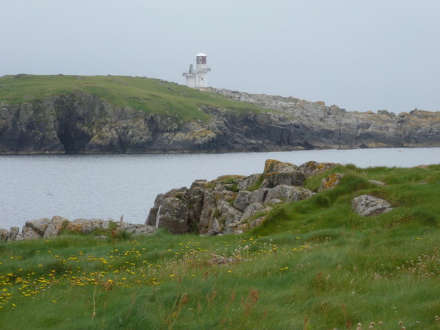
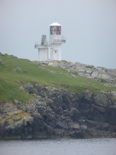
The rugged and picturesque coastline surrounding Atla Sound is home to a diverse range of marine and bird life. Seals, otters, and various species of seabirds can often be spotted in the area, taking advantage of the abundant food sources found in the waters. The intertidal zone along the shoreline is rich in marine plants and invertebrates, contributing to the overall biodiversity of the ecosystem.

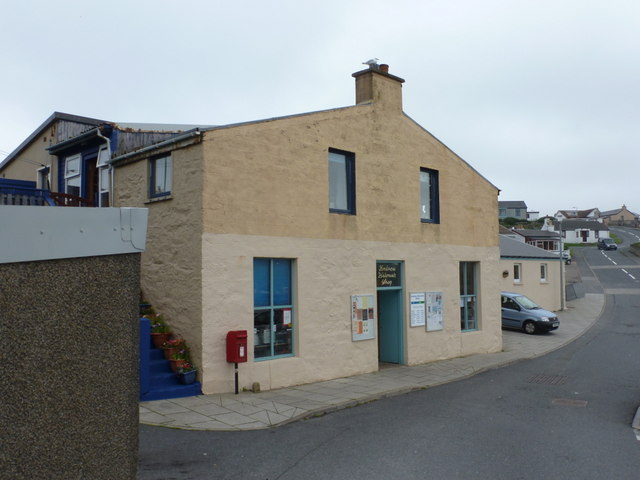
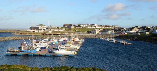
Atla Sound provides a beautiful setting for recreational activities such as fishing, boating, and wildlife watching. Its calm and sheltered waters make it an ideal spot for kayaking and sailing. The scenic views of the surrounding landscape, including rolling hills and rocky cliffs, add to the appeal of this natural gem.

Overall, Atla Sound in Shetland offers visitors and locals alike a unique and enchanting experience, showcasing the stunning beauty and natural diversity of this remote island region.

If you have any feedback on the listing, please let us know in the comments section below.

Atla Sound Images

Images are sourced within 2km of 60.110102/-1.3421727 or Grid Reference HU3636. Thanks to Geograph Open Source API. All images are credited.

Hamnavoe: Andrew Halcrow’s Shop Hamnavoe village store also houses the post office.
Hamnavoe: Andrew Halcrow’s Shop
Hamnavoe village store also houses the post office.
Hamnavoe: postbox № ZE2 20 This postbox stands outside <a href="https://www.geograph.org.uk/photo/2701248">HU3635 : Hamnavoe: Andrew Halcrow’s Shop</a> - the postal scales can be seen through the window. The box is emptied at 10am on weekdays and Saturdays.
Hamnavoe: postbox № ZE2 20
This postbox stands outside HU3635 : Hamnavoe: Andrew Halcrow’s Shop - the postal scales can be seen through the window. The box is emptied at 10am on weekdays and Saturdays.
Hamnavoe: across the harbour Looking across the head of Hamna Voe, which forms the little harbour, with the marina in the background.
Hamnavoe: across the harbour
Looking across the head of Hamna Voe, which forms the little harbour, with the marina in the background.
Hamnavoe: view across Hamna Voe to Fugla Ness Looking across the entrance to the voe, with the light of Fugla Ness across the water.
Hamnavoe: view across Hamna Voe to Fugla Ness
Looking across the entrance to the voe, with the light of Fugla Ness across the water.
Hamnavoe: rocks below Scarva Stack Looking out from the western tip of Scarva Stack, across the entrance of Hamna Voe with Skeggies visible faintly in the background, beyond the tip of Fugla Ness with its navigation light.
Hamnavoe: rocks below Scarva Stack
Looking out from the western tip of Scarva Stack, across the entrance of Hamna Voe with Skeggies visible faintly in the background, beyond the tip of Fugla Ness with its navigation light.
Hamnavoe: Fugla Ness light A navigational aid for vessels entering Hamna Voe, the sea inlet in the foreground.
Hamnavoe: Fugla Ness light
A navigational aid for vessels entering Hamna Voe, the sea inlet in the foreground.
West Burra: postbox № ZE2 8, Southerhouse A small postbox serving the Southerhouse hamlet, emptied on weekdays and Saturdays at 7:30am. The backdrop is the Clift Hills, on the western edge of the Shetland mainland, rising into the mist.
West Burra: postbox № ZE2 8, Southerhouse
A small postbox serving the Southerhouse hamlet, emptied on weekdays and Saturdays at 7:30am. The backdrop is the Clift Hills, on the western edge of the Shetland mainland, rising into the mist.
Hamnavoe: Sands of Meal Looking across this short sandy beach in a bay to the south of Hamnavoe.
Hamnavoe: Sands of Meal
Looking across this short sandy beach in a bay to the south of Hamnavoe.
Hamnavoe: Meal Kirk A small, simple parish church in the eastern part of Hamnavoe.
Hamnavoe: Meal Kirk
A small, simple parish church in the eastern part of Hamnavoe.
Lang Sound
Lang Sound
Hamnavoe marina One or two inshore fishing boats, but mainly pleasure craft.
Hamnavoe marina
One or two inshore fishing boats, but mainly pleasure craft.
Meal Kirk, Hamnavoe Built in 1907 as a mission church of the Church of Scotland. Small grey-harled church with white painted window surrounds and quoins. Simple bellcote on east gable. Improvements are planned to increase use of the building by the community.
Meal Kirk, Hamnavoe
Built in 1907 as a mission church of the Church of Scotland. Small grey-harled church with white painted window surrounds and quoins. Simple bellcote on east gable. Improvements are planned to increase use of the building by the community.
Bruna Ness Bagged with Tricky Speirs with view towards the bridge that connect Trondra to West Burra.
Name: Bruna Ness
Hill number: 104041
Height: 59m / 194ft
Area:22: Shetland Islands
Class:0
Grid ref: HU382368 (est)
Drop: 43m
Col: 16m
Bruna Ness
Bagged with Tricky Speirs with view towards the bridge that connect Trondra to West Burra. Name: Bruna Ness Hill number: 104041 Height: 59m / 194ft Area:22: Shetland Islands Class:0 Grid ref: HU382368 (est) Drop: 43m Col: 16m
Old Boat Near Setter Old boat near hamlet of Setter with view across to Hamnavoe.
Old Boat Near Setter
Old boat near hamlet of Setter with view across to Hamnavoe.
Brough Hill Bagged with Tricky Speirs.
Name: Brough Hill
Hill number: 104033
Height: 61m / 200ft
Area:22: Shetland Islands
Class: 0
Grid ref: HU377351 (est)
Drop: 49m
Col: 12m
Brough Hill
Bagged with Tricky Speirs. Name: Brough Hill Hill number: 104033 Height: 61m / 200ft Area:22: Shetland Islands Class: 0 Grid ref: HU377351 (est) Drop: 49m Col: 12m
Hamnavoe: lifebuoy at Meal Beach This lifebuoy is both functional and artistic, and is hooked to the kissing gate at the top of the path leading down to the beach.
Hamnavoe: lifebuoy at Meal Beach
This lifebuoy is both functional and artistic, and is hooked to the kissing gate at the top of the path leading down to the beach.
Hamnavoe: across Meal Beach Looking across the <a href="https://www.geograph.org.uk/photo/2701583">HU3735 : Hamnavoe: Sands of Meal</a> from rocks at the back of the beach.
Hamnavoe: across Meal Beach
Looking across the HU3735 : Hamnavoe: Sands of Meal from rocks at the back of the beach.
Hamnavoe: sandcastle on Meal Beach Clearly the <a href="https://www.geograph.org.uk/photo/2701583">HU3735 : Hamnavoe: Sands of Meal</a> have provided some youthful enjoyment today.
Hamnavoe: sandcastle on Meal Beach
Clearly the HU3735 : Hamnavoe: Sands of Meal have provided some youthful enjoyment today.
Show me another place!

Atla Sound is located at Grid Ref: HU3636 (Lat: 60.110102, Lng: -1.3421727)

Unitary Authority: Shetland Islands

Police Authority: Highlands and Islands

What 3 Words

///diagram.easygoing.pushy. Near Scalloway, Shetland Islands

Related Wikis

Papa, Shetland

Papa (Scots: Papa; Old Norse: Papey, meaning "the island of the priests") is an uninhabited island in the Scalloway Islands, Shetland, Scotland. Papa lies...

Oxna

Oxna is one of the Scalloway Islands, lying north west of Burra in Shetland, Scotland. Oxna has an area of 68 hectares (170 acres). The island has been...

West Head of Papa

West Head of Papa is a small tidal island off Papa in Shetland, and is one of the Scalloway Islands. It is 21m at its highest point. East Head of Papa...

Green Holm

Green Holm, (HU382379), is a small uninhabited island 500 metres north of Burra Ness at the north end of the island of Burra and on the west side of the...

Cheynies

The Cheynies are a group of reefs and small islands, between Oxna and Hildasay in the Shetland Islands, Scotland. They have been considerably eroded in...

Scalloway Islands

The Scalloway Islands are in Shetland opposite Scalloway on south west of the Mainland. They form a mini-archipelago and include: Burra (two islands linked...

Langa, Shetland

Langa (Old Norse: Langey ) is the collective name for two uninhabited islands off Hildasay, in Shetland, Scotland. The islands are connected by a tombolo...

East Burra

East Burra (Scots: East Burra; Old Norse: "Barrey") is one of the Scalloway Islands, a subgroup of the Shetland Islands in Scotland. It is connected by...

Nearby Amenities

Located within 500m of 60.110102,-1.3421727
The data included in this document is from www.openstreetmap.org. The data is made available under ODbL.

Have you been to Atla Sound?

Leave your review of Atla Sound below (or comments, questions and feedback).