East Head of Papa

Coastal Feature, Headland, Point in Shetland

Scotland

East Head of Papa

Hamnavoe: Andrew Halcrow’s Shop Hamnavoe village store also houses the post office.
Hamnavoe: Andrew Halcrow’s Shop Credit: Chris Downer

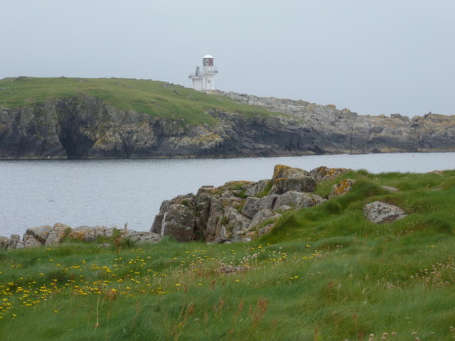
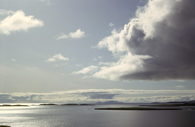
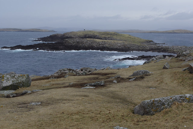
East Head of Papa is a prominent coastal feature located in the Shetland Islands, an archipelago in Scotland. It is a headland or a point that juts out into the North Sea, situated on the southeastern coast of the main island of Papa Stour.

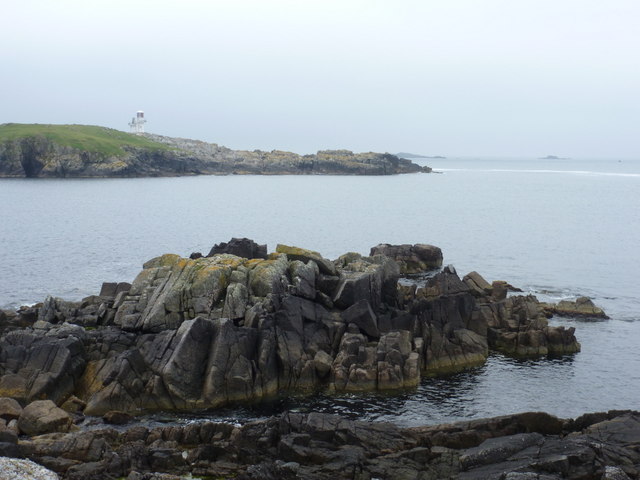
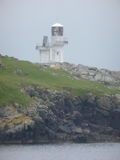
The East Head of Papa is characterized by its rugged and dramatic cliffs, which reach heights of up to 100 meters (328 feet) above sea level. These cliffs are composed of layers of sedimentary rock, showcasing a variety of colors and textures. The headland is known for its striking geological formations, such as stacks and caves, formed through erosion by the relentless action of waves crashing against the coastline.

The area surrounding East Head of Papa is rich in biodiversity and serves as an important habitat for various bird species. The cliffs provide nesting sites for seabirds, including guillemots, puffins, and fulmars. Visitors to the headland can often observe these birds soaring overhead or perched on the cliff ledges.

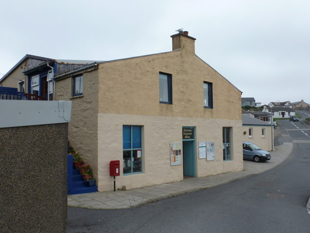
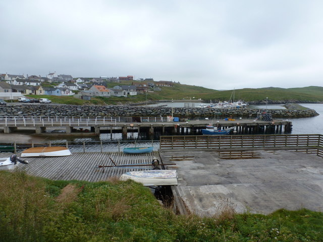
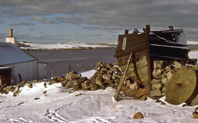
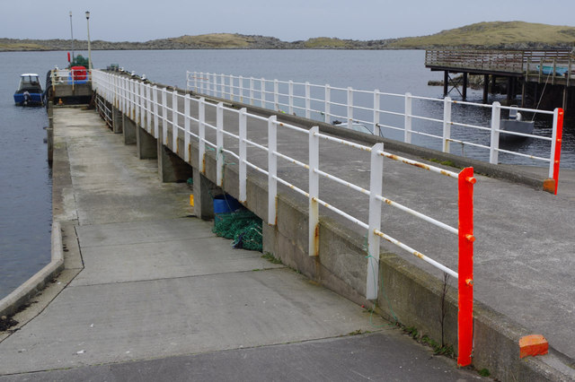
Access to East Head of Papa is primarily by sea, with boat trips available for tourists and nature enthusiasts. The headland can also be seen from a distance by walking along the coastal paths on Papa Stour. Its remote location and untouched natural beauty make it a popular destination for photographers, hikers, and those seeking a tranquil escape.

Overall, East Head of Papa is a breathtaking coastal feature that showcases the power of nature and offers a unique opportunity to experience the untamed beauty of the Shetland Islands.

If you have any feedback on the listing, please let us know in the comments section below.

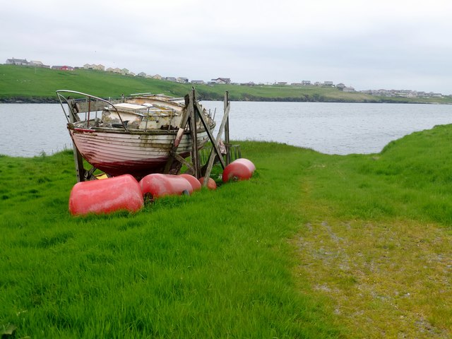
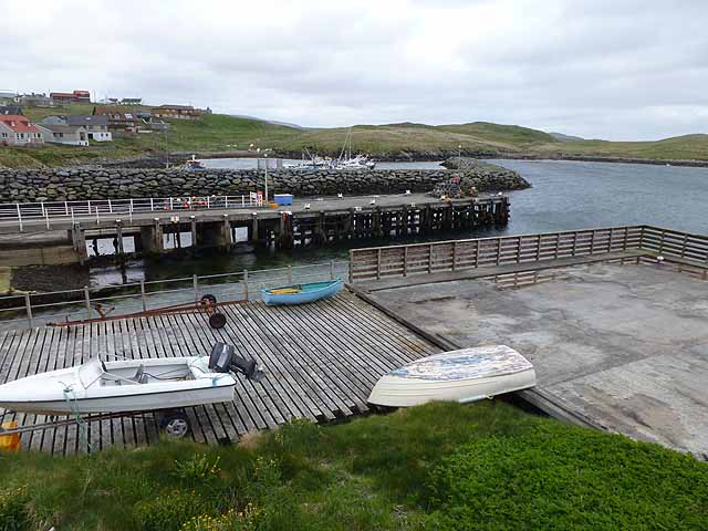
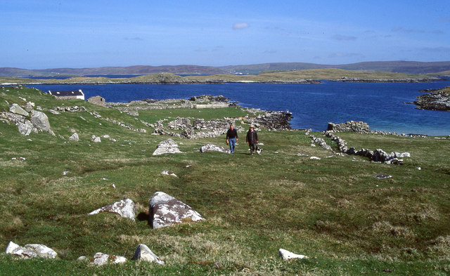
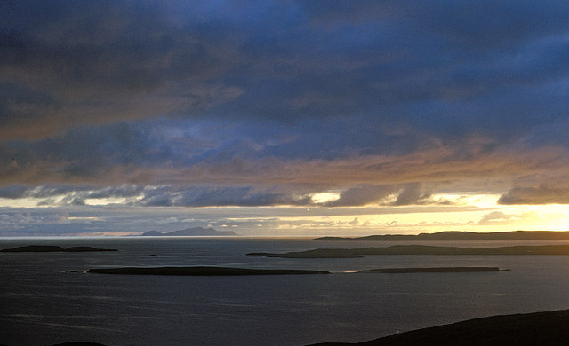
East Head of Papa Images

Images are sourced within 2km of 60.120641/-1.3380218 or Grid Reference HU3637. Thanks to Geograph Open Source API. All images are credited.

Hamnavoe: Andrew Halcrow’s Shop Hamnavoe village store also houses the post office.
Hamnavoe: Andrew Halcrow’s Shop
Hamnavoe village store also houses the post office.
Hamnavoe: postbox № ZE2 20 This postbox stands outside <a href="https://www.geograph.org.uk/photo/2701248">HU3635 : Hamnavoe: Andrew Halcrow’s Shop</a> - the postal scales can be seen through the window. The box is emptied at 10am on weekdays and Saturdays.
Hamnavoe: postbox № ZE2 20
This postbox stands outside HU3635 : Hamnavoe: Andrew Halcrow’s Shop - the postal scales can be seen through the window. The box is emptied at 10am on weekdays and Saturdays.
Hamnavoe: across the harbour Looking across the head of Hamna Voe, which forms the little harbour, with the marina in the background.
Hamnavoe: across the harbour
Looking across the head of Hamna Voe, which forms the little harbour, with the marina in the background.
Hamnavoe: view across Hamna Voe to Fugla Ness Looking across the entrance to the voe, with the light of Fugla Ness across the water.
Hamnavoe: view across Hamna Voe to Fugla Ness
Looking across the entrance to the voe, with the light of Fugla Ness across the water.
Hamnavoe: rocks below Scarva Stack Looking out from the western tip of Scarva Stack, across the entrance of Hamna Voe with Skeggies visible faintly in the background, beyond the tip of Fugla Ness with its navigation light.
Hamnavoe: rocks below Scarva Stack
Looking out from the western tip of Scarva Stack, across the entrance of Hamna Voe with Skeggies visible faintly in the background, beyond the tip of Fugla Ness with its navigation light.
Hamnavoe: Fugla Ness light A navigational aid for vessels entering Hamna Voe, the sea inlet in the foreground.
Hamnavoe: Fugla Ness light
A navigational aid for vessels entering Hamna Voe, the sea inlet in the foreground.
Hamnavoe: Meal Kirk A small, simple parish church in the eastern part of Hamnavoe.
Hamnavoe: Meal Kirk
A small, simple parish church in the eastern part of Hamnavoe.
Hamnavoe marina One or two inshore fishing boats, but mainly pleasure craft.
Hamnavoe marina
One or two inshore fishing boats, but mainly pleasure craft.
Meal Kirk, Hamnavoe Built in 1907 as a mission church of the Church of Scotland. Small grey-harled church with white painted window surrounds and quoins. Simple bellcote on east gable. Improvements are planned to increase use of the building by the community.
Meal Kirk, Hamnavoe
Built in 1907 as a mission church of the Church of Scotland. Small grey-harled church with white painted window surrounds and quoins. Simple bellcote on east gable. Improvements are planned to increase use of the building by the community.
Bruna Ness Bagged with Tricky Speirs with view towards the bridge that connect Trondra to West Burra.
Name: Bruna Ness
Hill number: 104041
Height: 59m / 194ft
Area:22: Shetland Islands
Class:0
Grid ref: HU382368 (est)
Drop: 43m
Col: 16m
Bruna Ness
Bagged with Tricky Speirs with view towards the bridge that connect Trondra to West Burra. Name: Bruna Ness Hill number: 104041 Height: 59m / 194ft Area:22: Shetland Islands Class:0 Grid ref: HU382368 (est) Drop: 43m Col: 16m
Old Boat Near Setter Old boat near hamlet of Setter with view across to Hamnavoe.
Old Boat Near Setter
Old boat near hamlet of Setter with view across to Hamnavoe.
Head of Hamna Voe With pier and stone breakwater enclosing marina.
Head of Hamna Voe
With pier and stone breakwater enclosing marina.
Ruins and landing place in Sandy Voe on Oxna Walking up towards the larger of two lochs on the uninhabited island of Oxna. The boat is moored in Sandy Voe, close to the ruins of a small settlement. The island of Papa is in the background.
Ruins and landing place in Sandy Voe on Oxna
Walking up towards the larger of two lochs on the uninhabited island of Oxna. The boat is moored in Sandy Voe, close to the ruins of a small settlement. The island of Papa is in the background.
Evening view west from the Ness of Westshore Once the ridge is climbed to the west of Scalloway the view extends over the nearby islands of Lunga, Linga and Hildasay before the long stretch of sea to Foula on the western horizon.
Evening view west from the Ness of Westshore
Once the ridge is climbed to the west of Scalloway the view extends over the nearby islands of Lunga, Linga and Hildasay before the long stretch of sea to Foula on the western horizon.
Islands west from Point of the Pund, Mainland West to Foula over Langa and the islets south of Hildasay.
Islands west from Point of the Pund, Mainland
West to Foula over Langa and the islets south of Hildasay.
Setter, Burra Isle The old boat serves as a chicken hut and an old millstone lies abandoned in this crofter's yard. The houses of Hamnavoe are visible and in the distance is the snow-clad island of Foula.
Setter, Burra Isle
The old boat serves as a chicken hut and an old millstone lies abandoned in this crofter's yard. The houses of Hamnavoe are visible and in the distance is the snow-clad island of Foula.
Hamnavoe Pier The pier stretches out into the sheltered waters of Hamna Voe, a facility for the fishing village which was only connected by road to the Shetland mainland in 1971.
Hamnavoe Pier
The pier stretches out into the sheltered waters of Hamna Voe, a facility for the fishing village which was only connected by road to the Shetland mainland in 1971.
Fugla Ness Looking from Pundsar to the headland and lighthouse at Fugla Ness, reached across a boulder-strewn causeway.
Fugla Ness
Looking from Pundsar to the headland and lighthouse at Fugla Ness, reached across a boulder-strewn causeway.
Show me another place!

East Head of Papa is located at Grid Ref: HU3637 (Lat: 60.120641, Lng: -1.3380218)

Unitary Authority: Shetland Islands

Police Authority: Highlands and Islands

What 3 Words

///departure.acrobats.mute. Near Scalloway, Shetland Islands

Related Wikis

Papa, Shetland

Papa (Scots: Papa; Old Norse: Papey, meaning "the island of the priests") is an uninhabited island in the Scalloway Islands, Shetland, Scotland. Papa lies...

West Head of Papa

West Head of Papa is a small tidal island off Papa in Shetland, and is one of the Scalloway Islands. It is 21m at its highest point. East Head of Papa...

Green Holm

Green Holm, (HU382379), is a small uninhabited island 500 metres north of Burra Ness at the north end of the island of Burra and on the west side of the...

Oxna

Oxna is one of the Scalloway Islands, lying north west of Burra in Shetland, Scotland. Oxna has an area of 68 hectares (170 acres). The island has been...

Have you been to East Head of Papa?

Leave your review of East Head of Papa below (or comments, questions and feedback).