Cowhythe Head
Coastal Feature, Headland, Point in Banffshire
Scotland
Cowhythe Head

Cowhythe Head is a prominent headland located in Banffshire, Scotland. Situated along the northeast coast, this coastal feature is known for its stunning cliffs and panoramic views of the North Sea. Rising approximately 40 meters above sea level, Cowhythe Head offers visitors a commanding vantage point to observe the surrounding coastal landscape.
The headland is composed of rugged sandstone rocks, which have been shaped by erosion over thousands of years. The cliffs display intricate patterns and layers, showcasing the geological history of the area. Furthermore, the exposed rocks provide a habitat for various species of seabirds, including guillemots and kittiwakes, which nest along the sheer cliff faces.
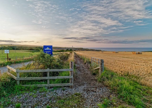
The coastal path running along Cowhythe Head offers a picturesque route for hikers and nature enthusiasts. It provides an opportunity to enjoy the breathtaking scenery, with the sound of crashing waves and the fresh sea breeze adding to the overall experience. Along the path, visitors may encounter wildflowers, such as sea thrift and poppies, adding vibrant colors to the landscape.
At low tide, Cowhythe Head reveals a rocky beach, providing access to explore the intertidal zone and discover marine life in rock pools. This area is teeming with diverse organisms, including crabs, anemones, and small fish, offering a unique glimpse into the coastal ecosystem.
Cowhythe Head is a popular destination for birdwatchers, geology enthusiasts, and those seeking solitude in nature. Its dramatic cliffs, coastal path, and diverse wildlife make it a must-visit location for anyone exploring the Banffshire coastline.
If you have any feedback on the listing, please let us know in the comments section below.
Cowhythe Head Images
Images are sourced within 2km of 57.686717/-2.6494706 or Grid Reference NJ6166. Thanks to Geograph Open Source API. All images are credited.


Cowhythe Head is located at Grid Ref: NJ6166 (Lat: 57.686717, Lng: -2.6494706)
Unitary Authority: Aberdeenshire
Police Authority: North East
What 3 Words
///convinces.flatten.serve. Near Portsoy, Aberdeenshire
Nearby Locations
Related Wikis

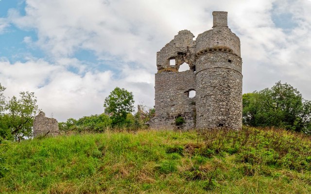
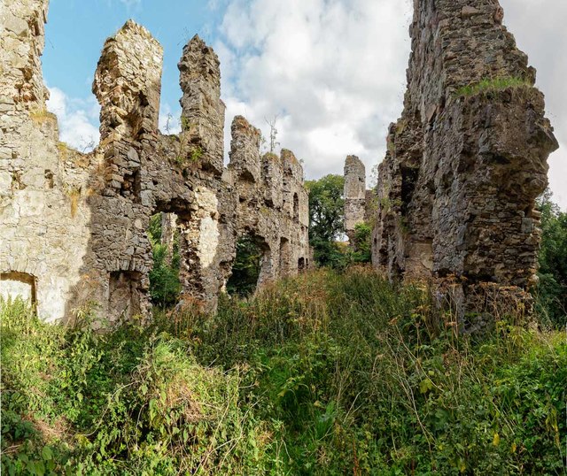
Boyne Castle
Boyne Castle (also known as the Palace of Boyne) is a 16th-century quadrangular castle about 1.5 miles (2.4 km) east of Portsoy, Aberdeenshire, Scotland...

RAF Banff
Royal Air Force Banff or more simply RAF Banff is a former Royal Air Force station located 4 miles (6 km) west of Banff, Aberdeenshire, Scotland and 14...

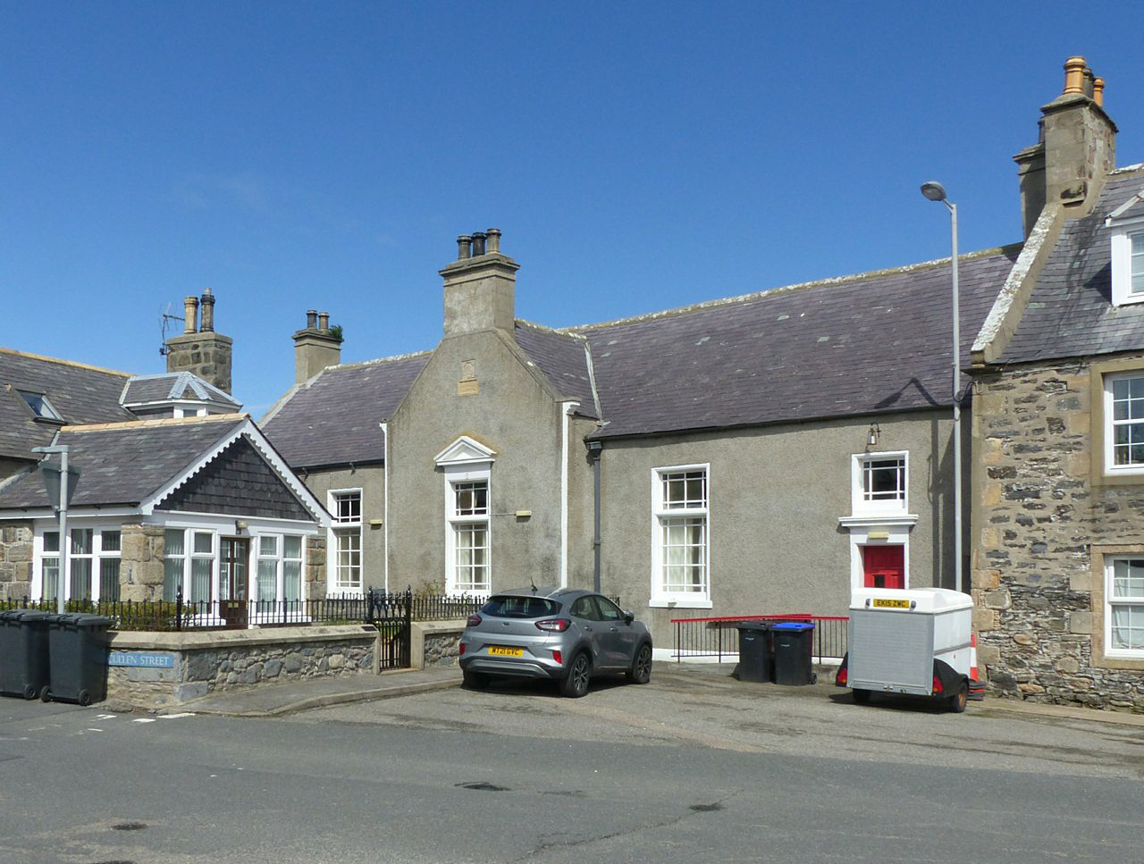
Portsoy
Portsoy (Scottish Gaelic: Port Saoidh) is a village in Aberdeenshire, Scotland. Historically, Portsoy was in Banffshire. The original name may come from...
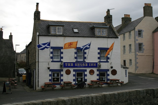
Shore Inn
The Shore Inn is a public house in Portsoy, Aberdeenshire, Scotland. Dating to the mid-18th century, it is now a Category C listed building. It is two...
Old Town Hall, Portsoy
The Old Town Hall is a municipal building on the north side of The Square in Portsoy, Aberdeenshire, Scotland. The structure, which is used for religious...

Portsoy railway station
Portsoy railway station was a railway station in Portsoy, in current day Aberdeenshire. Opened in 1859 by the Banff, Portsoy and Strathisla Railway, it...
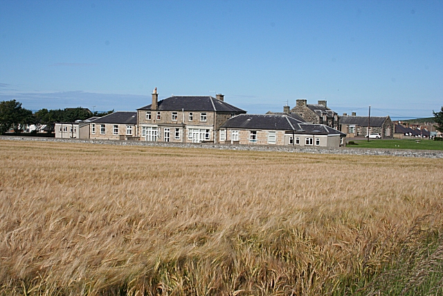
Campbell Hospital, Portsoy
Campbell Hospital was a National Health Service hospital in Portsoy, Aberdeenshire, Scotland. It was administered by NHS Grampian. == History == The hospital...
Boyndie
Boyndie is a village in Aberdeenshire, Scotland. == History == Boyndie was once home to RAF Banff Strike Wing, which played a pivotal role in protecting...
Nearby Amenities
Located within 500m of 57.686717,-2.6494706Have you been to Cowhythe Head?
Leave your review of Cowhythe Head below (or comments, questions and feedback).