Craig of Boyne

Coastal Feature, Headland, Point in Banffshire

Scotland

Craig of Boyne

Coastal path, by East Head A narrow path, along the slope.
Coastal path, by East Head Credit: Craig Wallace

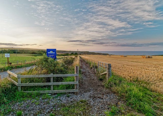
Craig of Boyne is a prominent coastal feature located in Banffshire, Scotland. Situated along the North Sea coast, it is a headland that extends out into the ocean, forming a distinct and picturesque point. The rugged cliffs of Craig of Boyne offer breathtaking views of the surrounding seascape and provide a dramatic backdrop to the adjacent sandy beaches.

Standing at an elevation of approximately 90 meters, this headland offers visitors a panoramic vista of the coastal region. The cliffs are composed of a mixture of sedimentary rocks, including sandstone and shale, which have been eroded over millions of years by the relentless force of the waves. Fossils can sometimes be found within the layers of rock, providing a glimpse into the geological history of the area.

Craig of Boyne is a popular destination for nature enthusiasts and hikers, who can explore the network of trails that wind along the rugged coastline. The headland is home to a diverse array of plant and animal species, including seabirds such as fulmars and kittiwakes that nest in the cliffs. During certain times of the year, lucky visitors may even spot seals or dolphins swimming in the waters below.

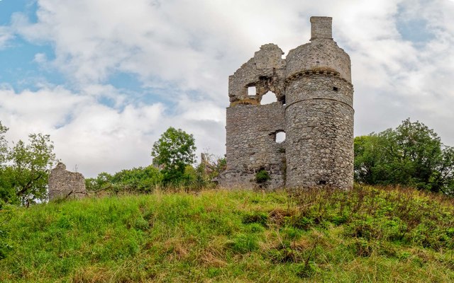
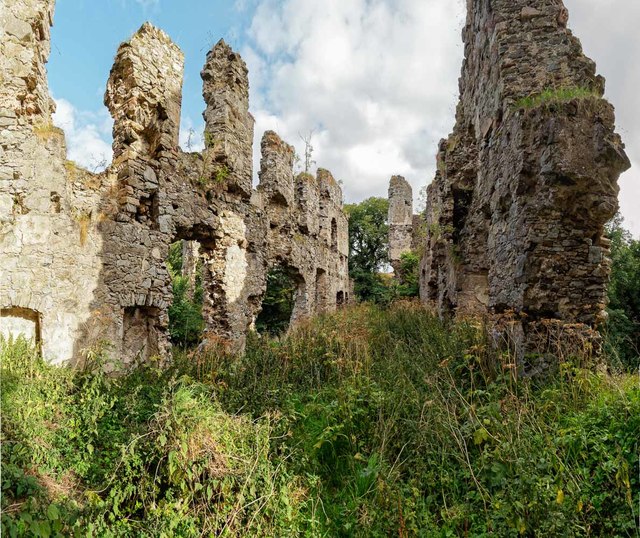
The area around Craig of Boyne is also rich in history. Ancient ruins of a castle, known as Boyne Castle, can be found nearby, dating back to the 15th century. These remnants serve as a reminder of the area's past and add to the allure and charm of this coastal feature.

Overall, Craig of Boyne is a captivating headland that offers a unique blend of natural beauty, geological wonders, and historical significance, making it a must-visit destination for those exploring the Banffshire coastline.

If you have any feedback on the listing, please let us know in the comments section below.

Craig of Boyne Images

Images are sourced within 2km of 57.68419/-2.6449309 or Grid Reference NJ6166. Thanks to Geograph Open Source API. All images are credited.

Coastal path, by East Head A narrow path, along the slope.
Coastal path, by East Head
A narrow path, along the slope.
Rocky coastline, East Head
Site of Coastguard Lookout Hut, East Head Marked with white posts and a sign.

Another view. <a href="https://www.geograph.org.uk/photo/6465141">NJ6066 : Site of Coastguard lookout hut</a>
Site of Coastguard Lookout Hut, East Head
Marked with white posts and a sign. Another view. NJ6066 : Site of Coastguard lookout hut
View from East Head Looking east along the coast.
View from East Head
Looking east along the coast.
Red Admiral (Vanessa atalanta) 2017 has been a good year for Red Admirals. I don't think I have ever seen so many before.
Red Admiral (Vanessa atalanta)
2017 has been a good year for Red Admirals. I don't think I have ever seen so many before.
Boyne Bay Limeworks The remains of the 19th-century limekilns can clearly be seen amongst all the modern day machinery of the current Boyne Bay Quarry <span class="nowrap"><a title="https://canmore.org.uk/site/138547/boyne-bay-limeworks" rel="nofollow ugc noopener" href="https://canmore.org.uk/site/138547/boyne-bay-limeworks">Link</a><img style="margin-left:2px;" alt="External link" title="External link - shift click to open in new window" src="https://s1.geograph.org.uk/img/external.png" width="10" height="10"/></span>
Boyne Bay Limeworks
The remains of the 19th-century limekilns can clearly be seen amongst all the modern day machinery of the current Boyne Bay Quarry LinkExternal link
Path to Boyne Bay This newish path runs down to Boyne Bay parallel with a private road to the quarry
Path to Boyne Bay
This newish path runs down to Boyne Bay parallel with a private road to the quarry
The B9139 down to Scotsmill Bridge The single track B9139 runs from Portsoy to the outskirts of Banff, seen here on the downhill approach to Scotsmill Bridge
The B9139 down to Scotsmill Bridge
The single track B9139 runs from Portsoy to the outskirts of Banff, seen here on the downhill approach to Scotsmill Bridge
Scotsmill Bridge The category B listed Scotsmill Bridge over the Burn of Boyne dates from the late 18th-century. Difficult to photograph, as the southern arch is part of the garden of Scotsmill Mill and the northern arch is in a deep gorge that could only be approached through another private residence.
<span class="nowrap"><a title="https://britishlistedbuildings.co.uk/200334225-scotsmill-mill-and-former-steading-banff-and-district-ward#.W40JaMInZaQ" rel="nofollow ugc noopener" href="https://britishlistedbuildings.co.uk/200334225-scotsmill-mill-and-former-steading-banff-and-district-ward#.W40JaMInZaQ">Link</a><img style="margin-left:2px;" alt="External link" title="External link - shift click to open in new window" src="https://s1.geograph.org.uk/img/external.png" width="10" height="10"/></span>
Scotsmill Bridge
The category B listed Scotsmill Bridge over the Burn of Boyne dates from the late 18th-century. Difficult to photograph, as the southern arch is part of the garden of Scotsmill Mill and the northern arch is in a deep gorge that could only be approached through another private residence. LinkExternal link
Boyne Castle The late 16th century Boyne Castle is in a ruinous state and gradually being overwhelmed by trees and vegetation. Looking up at the north facade of the castle from where the Burn of Boyne flows around the castle grounds in a deep gorge.
<span class="nowrap"><a title="https://canmore.org.uk/site/18436/boyne-castle" rel="nofollow ugc noopener" href="https://canmore.org.uk/site/18436/boyne-castle">Link</a><img style="margin-left:2px;" alt="External link" title="External link - shift click to open in new window" src="https://s1.geograph.org.uk/img/external.png" width="10" height="10"/></span>
Boyne Castle
The late 16th century Boyne Castle is in a ruinous state and gradually being overwhelmed by trees and vegetation. Looking up at the north facade of the castle from where the Burn of Boyne flows around the castle grounds in a deep gorge. LinkExternal link
Plaque on Boyne Castle This plaque on Boyne Castle refers to the Ancient Monuments Acts of 1913 and 1931. Judging by the ruinous state of the castle no remedial care has ever been carried out to the remains of the castle which is gradually being subsumed by trees and vegetation.
Plaque on Boyne Castle
This plaque on Boyne Castle refers to the Ancient Monuments Acts of 1913 and 1931. Judging by the ruinous state of the castle no remedial care has ever been carried out to the remains of the castle which is gradually being subsumed by trees and vegetation.
Boyne Castle The late 16th century Boyne Castle is in a ruinous state and gradually being overwhelmed by trees and vegetation. A plaque on one of the walls of the castle suggests little has been done to maintain the castle since the 1930s <a href="https://www.geograph.org.uk/photo/5893365">NJ6165 : Plaque on Boyne Castle</a>

<span class="nowrap"><a title="https://canmore.org.uk/site/18436/boyne-castle" rel="nofollow ugc noopener" href="https://canmore.org.uk/site/18436/boyne-castle">Link</a><img style="margin-left:2px;" alt="External link" title="External link - shift click to open in new window" src="https://s1.geograph.org.uk/img/external.png" width="10" height="10"/></span>
Boyne Castle
The late 16th century Boyne Castle is in a ruinous state and gradually being overwhelmed by trees and vegetation. A plaque on one of the walls of the castle suggests little has been done to maintain the castle since the 1930s NJ6165 : Plaque on Boyne Castle LinkExternal link
Boyne Castle Interior view of one of the barrel vaulted rooms on the ground level of the late 16th century Boyne Castle.
Boyne Castle
Interior view of one of the barrel vaulted rooms on the ground level of the late 16th century Boyne Castle.
Boyne Castle The main western end of the late 16th century Boyne Castle. There are numerous rooms under this part of the castle still in relatively good condition, as in here <a href="https://www.geograph.org.uk/photo/5893778">NJ6165 : Boyne Castle</a>
Boyne Castle
The main western end of the late 16th century Boyne Castle. There are numerous rooms under this part of the castle still in relatively good condition, as in here NJ6165 : Boyne Castle
Path to Boyne Bay After walking down the path from the road end here <a href="https://www.geograph.org.uk/photo/5891712">NJ6165 : Path to Boyne Bay</a>, one arrives at Boyne Bay. The building on the left of a small pool where the Burn of Boyne flows into the sea is part of the Boyne Quarry
Path to Boyne Bay
After walking down the path from the road end here NJ6165 : Path to Boyne Bay, one arrives at Boyne Bay. The building on the left of a small pool where the Burn of Boyne flows into the sea is part of the Boyne Quarry
The beach at Boyne Bay
Rocky coastline at Boyne Bay Folded rocks at the edge of the sandy beach at Boyne Bay
Rocky coastline at Boyne Bay
Folded rocks at the edge of the sandy beach at Boyne Bay
Burn of Boyne The Burn of Boyne forms a pool here just before it flows into the sea. the stone arch bridge originally served a 19th century limeworks here <a href="https://www.geograph.org.uk/photo/5890974">NJ6165 : Boyne Bay Limeworks</a>, but now is used by the modern quarry as the main lorry access over the burn into the quarry
Burn of Boyne
The Burn of Boyne forms a pool here just before it flows into the sea. the stone arch bridge originally served a 19th century limeworks here NJ6165 : Boyne Bay Limeworks, but now is used by the modern quarry as the main lorry access over the burn into the quarry
Show me another place!

Craig of Boyne is located at Grid Ref: NJ6166 (Lat: 57.68419, Lng: -2.6449309)

Unitary Authority: Aberdeenshire

Police Authority: North East

What 3 Words

///health.caravans.cared. Near Portsoy, Aberdeenshire

Related Wikis

Boyne Castle

Boyne Castle (also known as the Palace of Boyne) is a 16th-century quadrangular castle about 1.5 miles (2.4 km) east of Portsoy, Aberdeenshire, Scotland...

RAF Banff

Royal Air Force Banff or more simply RAF Banff is a former Royal Air Force station located 4 miles (6 km) west of Banff, Aberdeenshire, Scotland and 14...
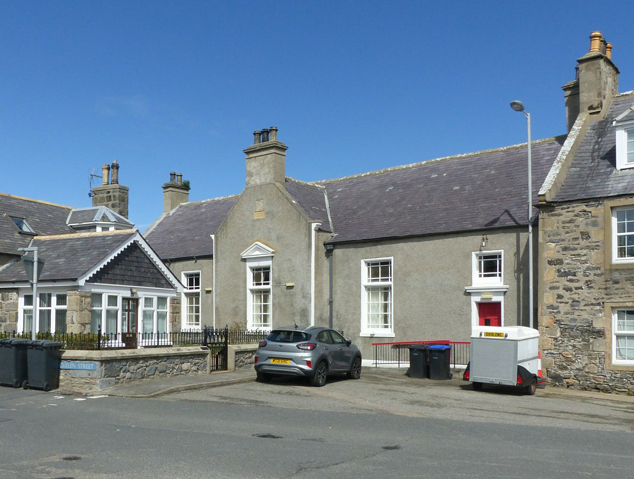
Portsoy

Portsoy (Scottish Gaelic: Port Saoidh) is a village in Aberdeenshire, Scotland. Historically, Portsoy was in Banffshire. The original name may come from...
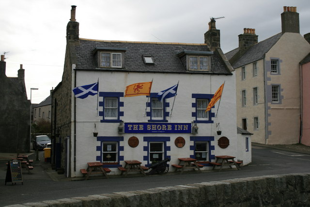
Shore Inn

The Shore Inn is a public house in Portsoy, Aberdeenshire, Scotland. Dating to the mid-18th century, it is now a Category C listed building. It is two...

Portsoy railway station

Portsoy railway station was a railway station in Portsoy, in current day Aberdeenshire. Opened in 1859 by the Banff, Portsoy and Strathisla Railway, it...

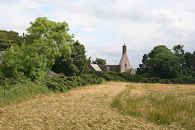
Old Town Hall, Portsoy

The Old Town Hall is a municipal building on the north side of The Square in Portsoy, Aberdeenshire, Scotland. The structure, which is used for religious...

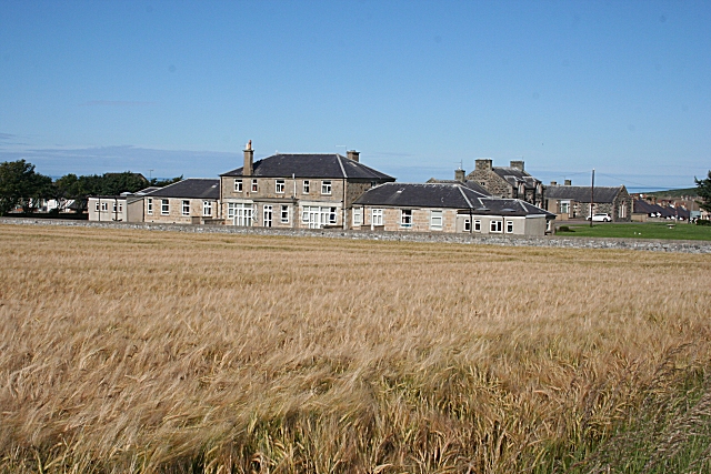
Campbell Hospital, Portsoy

Campbell Hospital was a National Health Service hospital in Portsoy, Aberdeenshire, Scotland. It was administered by NHS Grampian. == History == The hospital...

Boyndie

Boyndie is a village in Aberdeenshire, Scotland. == History == Boyndie was once home to RAF Banff Strike Wing, which played a pivotal role in protecting...

Nearby Amenities

Located within 500m of 57.68419,-2.6449309
Source: PGS
Lat/Long: 57.6806664/-2.6400796
Created By: almien_coastlines
Source: PGS
Lat/Long: 57.68096/-2.6403
Source: PGS
Lat/Long: 57.681396/-2.6398681
Source: PGS
Lat/Long: 57.6819535/-2.6418218
Source: PGS
Lat/Long: 57.6821233/-2.6417204
Source: PGS
Lat/Long: 57.6825841/-2.6420026
Source: PGS
Lat/Long: 57.6822908/-2.6425519
Source: PGS
Lat/Long: 57.6824015/-2.6438372
Source: PGS
Lat/Long: 57.6820298/-2.6441924
Created By: almien_coastlines
Source: PGS
Lat/Long: 57.682124/-2.64459
Source: PGS
Lat/Long: 57.6826048/-2.645895
Source: PGS
Lat/Long: 57.6828953/-2.646034
Source: PGS
Lat/Long: 57.6831224/-2.6449874
Created By: almien_coastlines
Source: PGS
Lat/Long: 57.683277/-2.644818
Created By: almien_coastlines
Source: PGS
Lat/Long: 57.683404/-2.644577
Created By: almien_coastlines
Source: PGS
Lat/Long: 57.683532/-2.644338
Created By: almien_coastlines
Source: PGS
Lat/Long: 57.683788/-2.644335
Created By: almien_coastlines
Source: PGS
Lat/Long: 57.684045/-2.644571
Source: PGS
Lat/Long: 57.6840117/-2.6454739
Created By: almien_coastlines
Source: PGS
Lat/Long: 57.683923/-2.646962
Source: PGS
Lat/Long: 57.6839409/-2.6476229
Source: PGS
Lat/Long: 57.6840648/-2.6480805
Source: PGS
Lat/Long: 57.6845113/-2.6484732
Created By: almien_coastlines
Source: PGS
Lat/Long: 57.684823/-2.648387
Source: PGS
Lat/Long: 57.6849879/-2.6477935
Source: PGS
Lat/Long: 57.6855987/-2.6472571
Source: PGS
Lat/Long: 57.6855996/-2.6479217
Source: PGS
Lat/Long: 57.685962/-2.6481803
Source: PGS
Lat/Long: 57.6863348/-2.647831
Created By: almien_coastlines
Source: PGS
Lat/Long: 57.686613/-2.647654
Created By: almien_coastlines
Source: PGS
Lat/Long: 57.686869/-2.647651
Created By: almien_coastlines
Source: PGS
Lat/Long: 57.687127/-2.648127
Created By: almien_coastlines
Source: PGS
Lat/Long: 57.687384/-2.648602
Created By: almien_coastlines
Source: PGS
Lat/Long: 57.68764/-2.648838
Created By: almien_coastlines
Source: PGS
Lat/Long: 57.687771/-2.649793
Power: pole
Lat/Long: 57.6803163/-2.6477851
The data included in this document is from www.openstreetmap.org. The data is made available under ODbL.

Have you been to Craig of Boyne?

Leave your review of Craig of Boyne below (or comments, questions and feedback).