Beachley Point

Coastal Feature, Headland, Point in Gloucestershire Forest of Dean

England

Beachley Point

Severn Bridge and Aust Cliff The first Severn motorway bridge, looking east to Aust Cliff, with the motorway services building visible beyond the bridge tower.
Severn Bridge and Aust Cliff Credit: Martin Clark

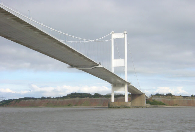
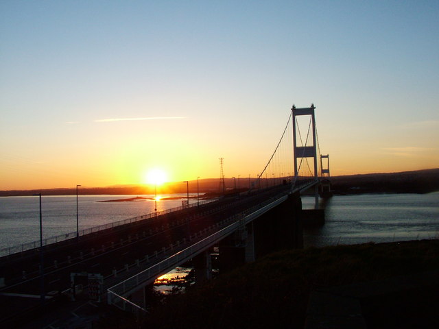
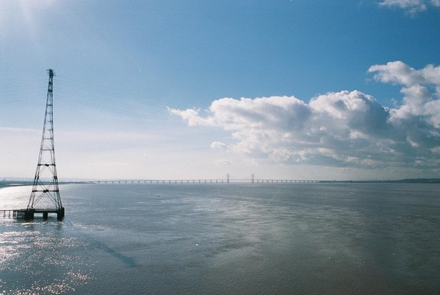
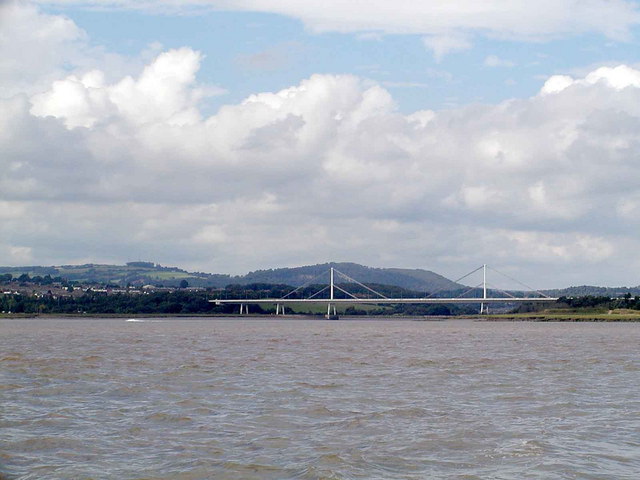
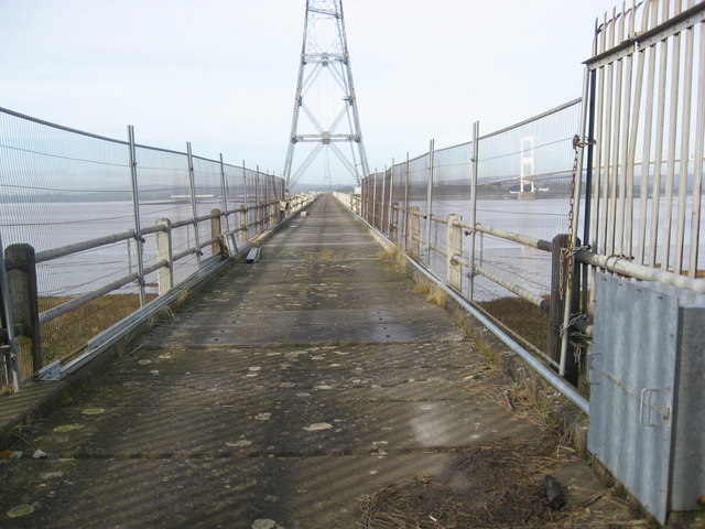
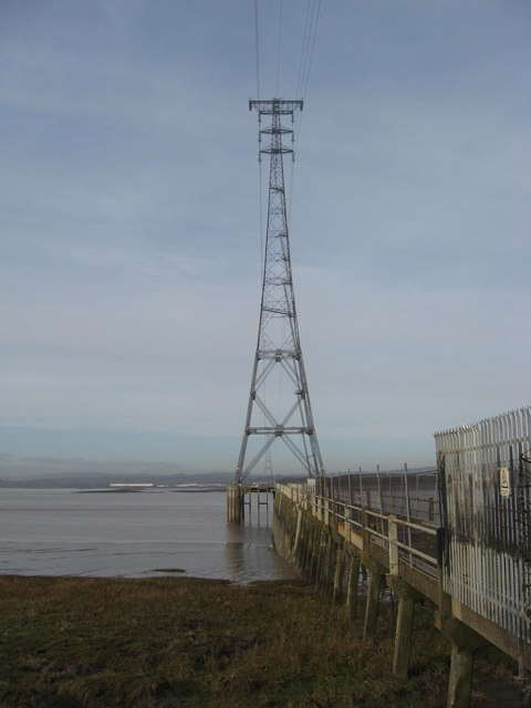
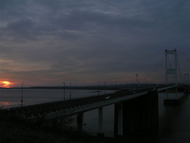
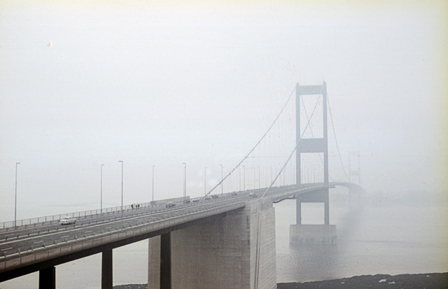
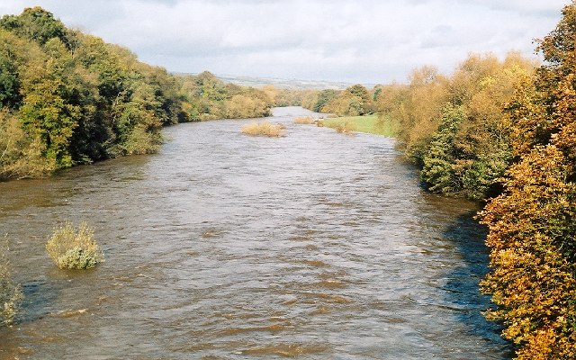
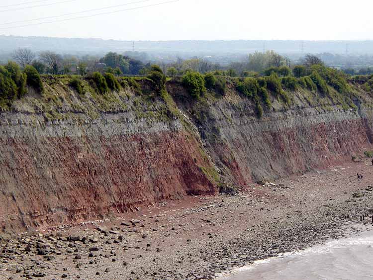
Beachley Point is a prominent coastal feature located in Gloucestershire, England. It is a headland that juts out into the River Severn, forming a distinctive point that offers stunning views of the surrounding landscape.

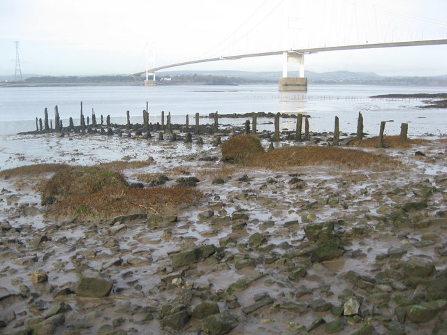
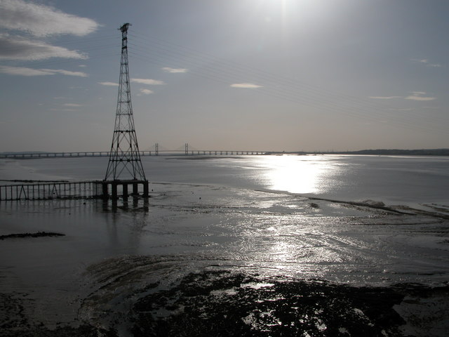
Situated at the southernmost tip of the Forest of Dean, Beachley Point is a popular destination for locals and tourists alike. Its strategic location provides a vantage point for observing the tidal movements of the river and the vast expanse of water that stretches out towards the Severn Estuary.

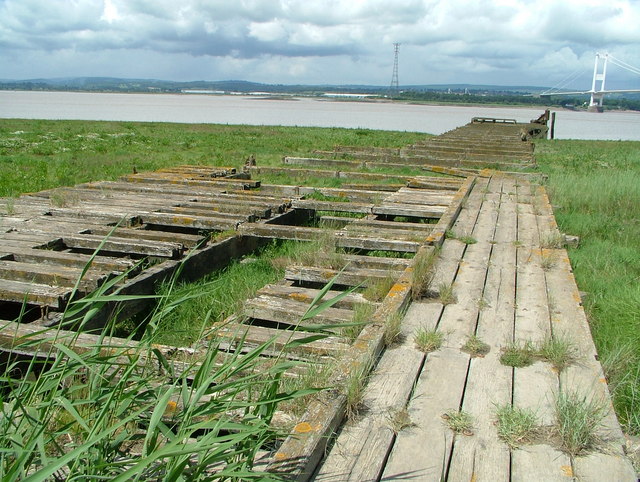
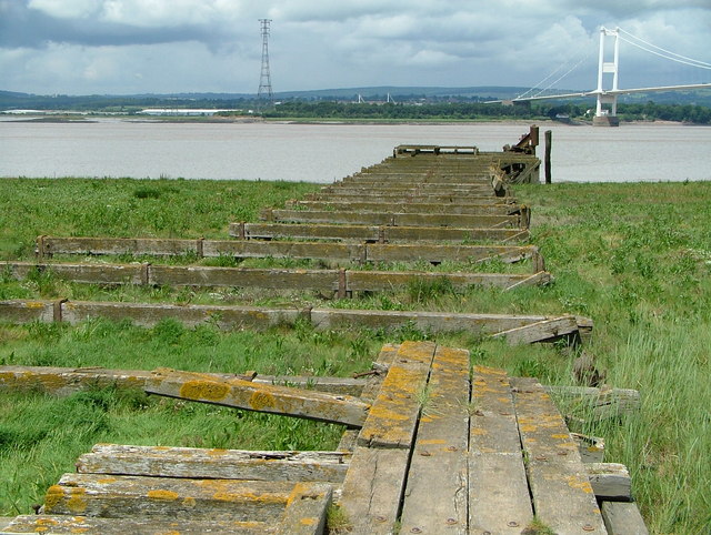
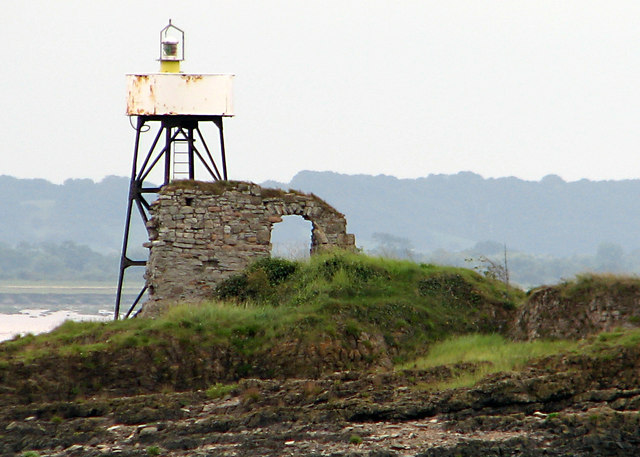
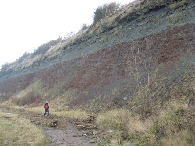
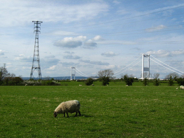
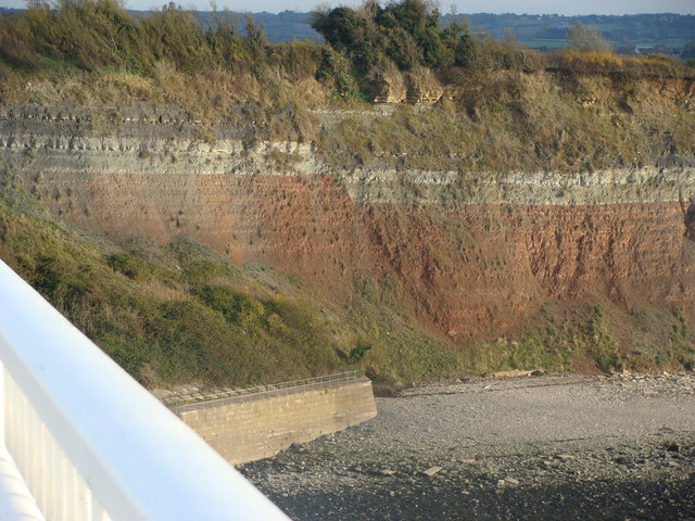
The headland itself is characterized by grassy slopes, rocky outcrops, and a rugged coastline. Its elevation allows for breathtaking panoramas of the River Severn and the Welsh countryside across the water. On clear days, visitors can even catch a glimpse of the Bristol Channel and the distant hills of the Brecon Beacons.

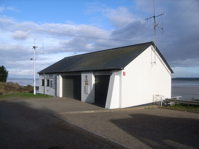
Beachley Point is also of historical significance. It was once home to a military establishment that played a vital role in the defense of the area during World War II. Remnants of military structures, including bunkers and gun emplacements, can still be seen along the headland, providing a glimpse into the past.

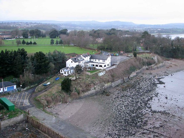
Today, Beachley Point is a haven for nature enthusiasts and outdoor enthusiasts. The area is rich in wildlife, with various bird species and marine life inhabiting the surrounding waters. The headland offers opportunities for hiking, birdwatching, and picnicking, making it a popular spot for families and nature lovers to enjoy the beauty of the Gloucestershire coastline.

If you have any feedback on the listing, please let us know in the comments section below.

Beachley Point Images

Images are sourced within 2km of 51.610675/-2.6530999 or Grid Reference ST5490. Thanks to Geograph Open Source API. All images are credited.

Severn Bridge and Aust Cliff The first Severn motorway bridge, looking east to Aust Cliff, with the motorway services building visible beyond the bridge tower.
Severn Bridge and Aust Cliff
The first Severn motorway bridge, looking east to Aust Cliff, with the motorway services building visible beyond the bridge tower.
The First Severn Road Bridge Taken on the Severn View Path just before sunset.
The First Severn Road Bridge
Taken on the Severn View Path just before sunset.
The Old Severn Bridge The east tower viewed from the cycleway on the south side of the bridge.
The Old Severn Bridge
The east tower viewed from the cycleway on the south side of the bridge.
The Severn Estuary Power cable pylon and new Severn Bridge viewed from the old Severn Bridge.
The Severn Estuary
Power cable pylon and new Severn Bridge viewed from the old Severn Bridge.
Severn estuary: the big pylon The pylon is this big because the cables hung from it cross the Severn and have to reach the next pylon, about a mile away.
Severn estuary: the big pylon
The pylon is this big because the cables hung from it cross the Severn and have to reach the next pylon, about a mile away.
Wye Bridge, Beachley This carries the M48 over the Wye from Wales to England.  The old Severn Bridge is in England.  The Forest of Dean lies beyond.
Wye Bridge, Beachley
This carries the M48 over the Wye from Wales to England. The old Severn Bridge is in England. The Forest of Dean lies beyond.
Aust Ferry (Looking along the pier to the slipway) Much of the wood has rotted away but the pier and slipway can be clearly seen.
Aust Ferry (Looking along the pier to the slipway)
Much of the wood has rotted away but the pier and slipway can be clearly seen.
Aust Ferry (Looking along the pier to the slipway) This is about as close as one can get to the water.
Aust Ferry (Looking along the pier to the slipway)
This is about as close as one can get to the water.
St Twrog's Chapel ruins on Chapel Rock The Beachley Point light is right next to the ruins.
St Twrog's Chapel ruins on Chapel Rock
The Beachley Point light is right next to the ruins.
Approach to the Severn Bridge Looking west along the M4 [as it was then] towards the recently completed bridge. One is hard pressed to remember the toll charges from the time, but it was probably less than the 12/6d [62.5p] charged on the old Aust ferry. Note the amount of traffic. Not many dared venture into Wales in those days.
Approach to the Severn Bridge
Looking west along the M4 [as it was then] towards the recently completed bridge. One is hard pressed to remember the toll charges from the time, but it was probably less than the 12/6d [62.5p] charged on the old Aust ferry. Note the amount of traffic. Not many dared venture into Wales in those days.
Pier to pylons where the National Grid crosses the River Severn A tour-de-force of technology in its day (1958) when the National Grid crossed the Severn in a single span, the cables were fabricated from aluminium to improve the strength to weight ratio.
Pier to pylons where the National Grid crosses the River Severn
A tour-de-force of technology in its day (1958) when the National Grid crossed the Severn in a single span, the cables were fabricated from aluminium to improve the strength to weight ratio.
Aust Cliff The alternating layers of rock in this rapidly eroding cliff are a rich source of marine fossils
Aust Cliff
The alternating layers of rock in this rapidly eroding cliff are a rich source of marine fossils
Pilings, all that remains of an earlier Putcher fishing weir The Severn Bridge in the background.
Pilings, all that remains of an earlier Putcher fishing weir
The Severn Bridge in the background.
Pylon where the National Grid crosses the Severn in single span
Severn bridge at sun down
Landscape near Aust Looking northwest to the large electricity pylon and the old Severn Bridge.
Landscape near Aust
Looking northwest to the large electricity pylon and the old Severn Bridge.
Severn bridge in the mist This is scanned from a rather old slide, so there are still a few artefacts (horizontal lines) I cannot shift. I don't think that they detract from the ethereal effect of the shot though.

<a href="https://www.geograph.org.uk/photo/2119804">ST5689 : Severn bridge in the mist</a> shows the bridge with more of the foreshore.
Severn bridge in the mist
This is scanned from a rather old slide, so there are still a few artefacts (horizontal lines) I cannot shift. I don't think that they detract from the ethereal effect of the shot though. ST5689 : Severn bridge in the mist shows the bridge with more of the foreshore.
Fault in Aust Cliff from the Severn Bridge A good demonstration of displacement at a fault line - small scale in comparison with the Great Glen of Scotland, but an "event" none-the-less!
Fault in Aust Cliff from the Severn Bridge
A good demonstration of displacement at a fault line - small scale in comparison with the Great Glen of Scotland, but an "event" none-the-less!
Show me another place!

Beachley Point is located at Grid Ref: ST5490 (Lat: 51.610675, Lng: -2.6530999)

Administrative County: Gloucestershire

District: Forest of Dean

Police Authority: Gloucestershire

What 3 Words

///secretly.pumpkin.inversion. Near Chepstow, Monmouthshire

Related Wikis

Related Videos

Walking Wales (Offa's Dyke - 177mi in twelve days)

Following the Offa's Dyke & Wye Valley paths from North to South Wales.

Offa’s Dyke Path - Day One

Offa's Dyke Path a coast to coast Thru-hike starting at Chepstow and hiking 177 (ish) miles to Prestatyn in north Wales ...

Hiking John O’ Groats to Land’s End | Daily Vlog | Day 50

Me and Di (my girlfriend) are hiking from John O' Groats to Land's End and wild camping all the way. This is a daily vlog of our ...

Deep Dub Techno Session | Severn Bridge Between England and Wales | Yugla Podcast 007 #technomix

Experience the might of the Severn bridge as it connects England and Wales while you drift away into an atmospheric journey ...

Nearby Amenities

Located within 500m of 51.610675,-2.6530999
Source: PGS
Lat/Long: 51.6069106/-2.6536478
Source: PGS
Lat/Long: 51.6070046/-2.6539831
Source: PGS
Lat/Long: 51.6071353/-2.654016
Source: PGS
Lat/Long: 51.6074002/-2.6537886
Source: PGS
Lat/Long: 51.6073129/-2.6531653
Source: PGS
Lat/Long: 51.6072145/-2.6531502
Source: PGS
Lat/Long: 51.6070972/-2.6531492
Source: PGS
Lat/Long: 51.6069553/-2.6533375
Barrier: swing_gate
Lat/Long: 51.6128204/-2.6487129
Parking
SARA
Access: private
Capacity: 30
Fee: no
Parking: surface
Lat/Long: 51.6128611/-2.6486196
Place Of Worship
Saint Twrog
Religion: christian
Source: NPE
Wikidata: Q26631888
Lat/Long: 51.6071804/-2.6534746
Families Office
Naptan AtcoCode: 1600GLA06421
Naptan Bearing: NW
Naptan BusStopType: CUS
Naptan CommonName: Families Office
Naptan NaptanCode: glogptdt
Naptan Street: Beachley Barracks
Naptan Verified: no
Source: naptan_import
Lat/Long: 51.61515/-2.6529994
Bus Stop
Beachley Bcks Families Office
Naptan AtcoCode: 1600GLF766
Naptan Bearing: SE
Naptan CommonName: Beachley Bcks Families Office
Naptan NaptanCode: gloadgda
Naptan Street: Pavilion Rd
Naptan Verified: no
Source: naptan_import
Lat/Long: 51.6129915/-2.6547016
Beachley Point Pylon
Design: three-level
Height: 148.75
Manufacturer: J. L. Eve Construction
Material: steel
Operator: Babcock International
Power: tower
Tower Type: crossing
Lat/Long: 51.6102637/-2.6530182
Seamark Light 1 Character: Fl
Seamark Light 1 Colour: white
Seamark Light 1 Height: 6
Seamark Light 1 Period: 2.6
Seamark Light 1 Range: 8
Seamark Light 1 Sector End: 284
Seamark Light 1 Sector Start: 213
Seamark Light 1 Sequence: 0.4+(2.2)
Seamark Light 2 Character: Fl
Seamark Light 2 Colour: red
Seamark Light 2 Height: 6
Seamark Light 2 Period: 2.6
Seamark Light 2 Range: 8
Seamark Light 2 Sector End: 49
Seamark Light 2 Sector Start: 284
Seamark Light 2 Sequence: 0.4+(2.2)
Seamark Light 3 Character: Fl
Seamark Light 3 Colour: white
Seamark Light 3 Height: 6
Seamark Light 3 Period: 2.6
Seamark Light 3 Range: 8
Seamark Light 3 Sector End: 51.5
Seamark Light 3 Sector Start: 49
Seamark Light 3 Sequence: 0.4+(2.2)
Seamark Light 4 Character: Fl
Seamark Light 4 Colour: green
Seamark Light 4 Height: 6
Seamark Light 4 Period: 2.6
Seamark Light 4 Range: 8
Seamark Light 4 Sector End: 160
Seamark Light 4 Sector Start: 51.5
Seamark Light 4 Sequence: 0.4+(2.2)
Seamark Light Reference: A 5541
Seamark Name: Chapel Rock
Seamark Type: light_minor
Lat/Long: 51.6072/-2.6534167
Leisure: slipway
Lat/Long: 51.6133312/-2.6478825
The data included in this document is from www.openstreetmap.org. The data is made available under ODbL.

Have you been to Beachley Point?

Leave your review of Beachley Point below (or comments, questions and feedback).