Garnswllt

Settlement in Glamorgan

Wales

Garnswllt

Footpath gate
Footpath gate Credit: Alan Hughes

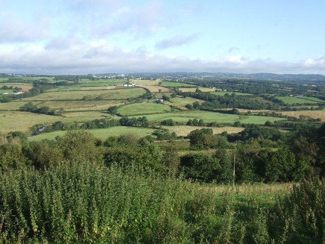
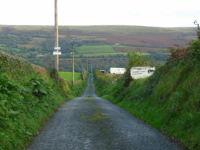
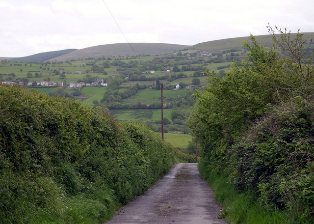
Garnswllt is a small village located in the county of Glamorgan, Wales. Situated in the picturesque Amman Valley, it is surrounded by rolling hills and beautiful countryside. With a population of around 1,500 residents, it exudes a close-knit community atmosphere.

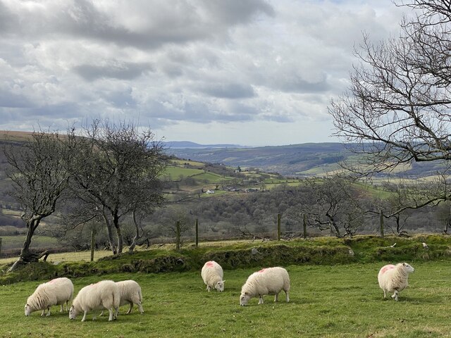
Historically, Garnswllt was primarily an agricultural village, with many residents being employed in farming and related industries. However, in recent years, there has been a shift towards a more diversified economy, with a growing number of residents commuting to nearby towns and cities for work.

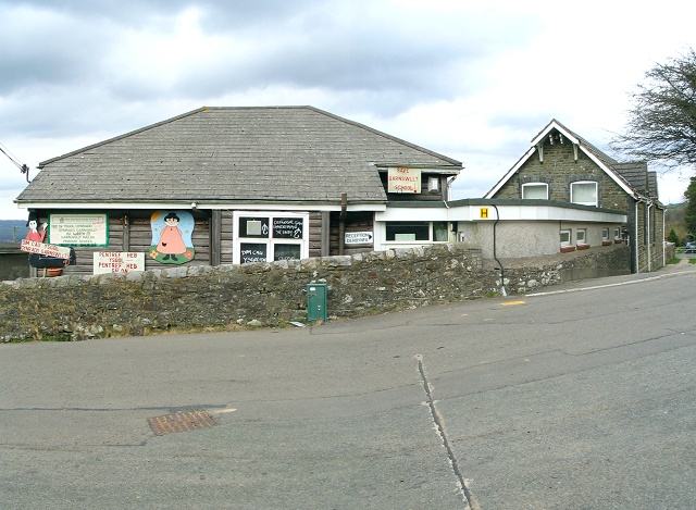
The village offers a range of amenities to its residents. There is a primary school, providing education to local children, and a community center that hosts various events and activities throughout the year. Additionally, there is a small convenience store and a pub, which serves as a popular meeting place for locals.

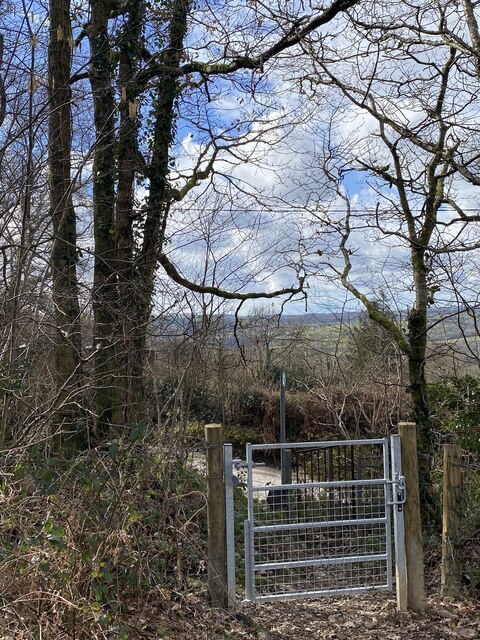
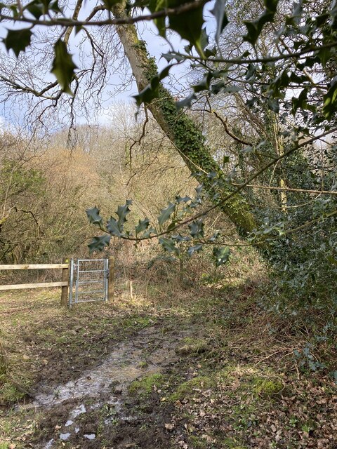
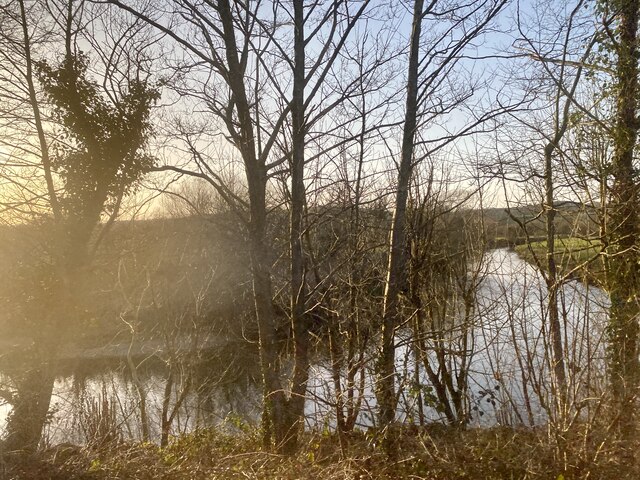
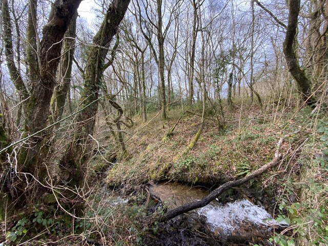
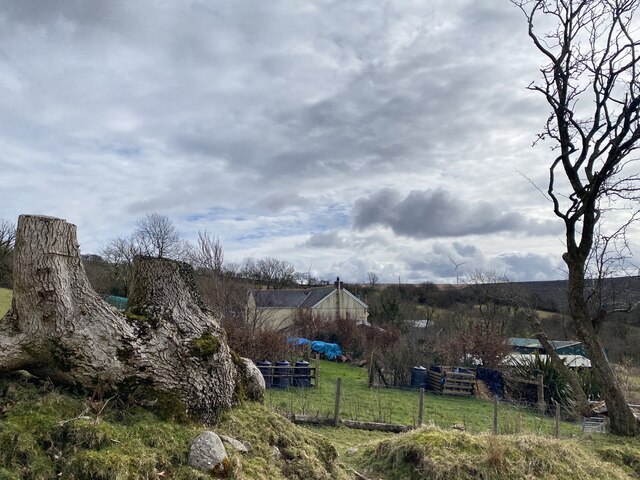
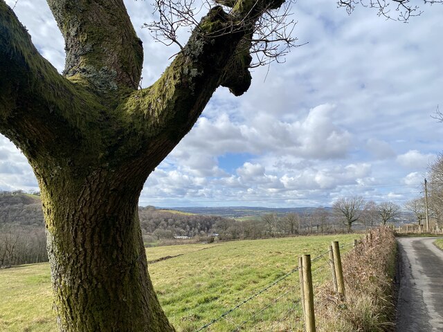
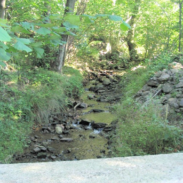
Garnswllt is also known for its natural beauty and outdoor recreational opportunities. The surrounding area offers numerous walking and hiking trails, allowing residents and visitors to explore the stunning countryside. The nearby Brecon Beacons National Park is a haven for outdoor enthusiasts, offering opportunities for activities such as mountain biking, fishing, and birdwatching.

Overall, Garnswllt is a charming village in Glamorgan, Wales, that combines a rich history with a close-knit community spirit. With its stunning natural surroundings and range of amenities, it offers a high quality of life for its residents.

If you have any feedback on the listing, please let us know in the comments section below.
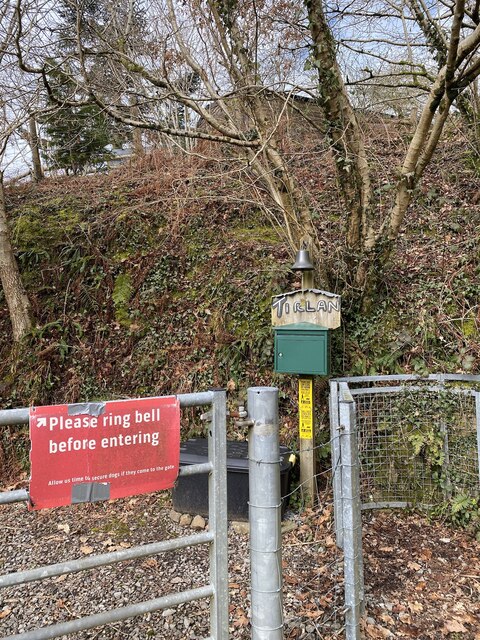
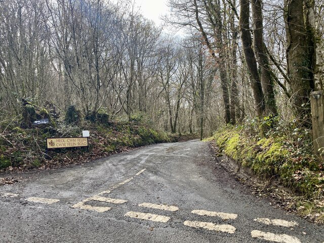
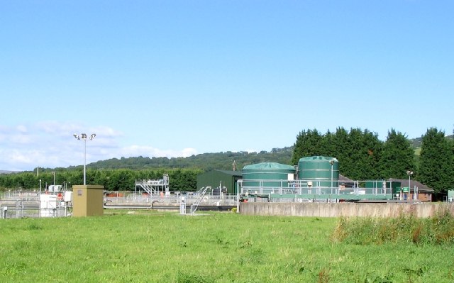
Garnswllt Images

Images are sourced within 2km of 51.763493/-3.99014 or Grid Reference SN6209. Thanks to Geograph Open Source API. All images are credited.

Footpath gate
Footpath gate
Woodland footpath Towards Pen yr Heol.
Woodland footpath
Towards Pen yr Heol.
Sharp bend in Afon Llwchwr The river is also the County boundary: Carmarthenshire lies across the river from Swansea.
Sharp bend in Afon Llwchwr
The river is also the County boundary: Carmarthenshire lies across the river from Swansea.
Sheep grazing above Nant y Cadno A tributary of Afon Aman on the western slopes of the Black Mountain, Brecon Beacons.  In the distance is the North Gower peninsula with Whiteford Point jutting out into the Loughor Estuary.
Sheep grazing above Nant y Cadno
A tributary of Afon Aman on the western slopes of the Black Mountain, Brecon Beacons. In the distance is the North Gower peninsula with Whiteford Point jutting out into the Loughor Estuary.
Nant y Cadno
Nant y Cadno
Farm buildings at Blaenant Cadno
A timely warning
A timely warning
Heol Cwm Felin Road junction above Cwm Cathan and the mill.
Heol Cwm Felin
Road junction above Cwm Cathan and the mill.
Un, dau … tree! A tree with three large limbs beside the lane towards Ty-côch.
Un, dau … tree!
A tree with three large limbs beside the lane towards Ty-côch.
Twmpath llosg Graig Fawr / Graig Fawr burnt mound Ychydig y tu hwnt i'r cwrs dwr saif twmpath llosg o'r Oes Efydd. Fe'i hadwaenir hefyd fel tomenni coginio a phan oedd ein hynafiaid yn coginio cig yn ystod y cyfnod hwn byddent yn twymo cerrig mewn tân cyn eu rhoi nhw i mewn cafn llawn dŵr i ferwi'r cig. Pan mewn cysylltiad â dŵr oer byddai llawer o'r cerrig hyn yn chwalu. Mae'r domen yn ganlyniad i groniad dros amser o gerrig wedi'u chwalu a malurion tân fel siarcol. Men gwirionedd mae dau dwmpath llosg yn y lleoliad hwn ond dyma'r enghraifft orau. Damcaniaethau eraill yw eu bod nhw'n rhyw fath o sona neu ar gyfer berweddu cwrw. 

In the foreground above a small watercourse is a Bronze Age burnt mound. Also known as cooking mounds, when our ancestors cooked meat during this period they would heat stones on a fire before putting them in a trough full of water to boil meat. When in contact with cold water many of the stones would shatter.  The mound is a result of an accumulation over time of discarded shattered stones and fire debris such as charcoal. In fact there are two burnt mounds at this location but the one shown is the best example. Other theories are that they were used as a sauna or for brewing beer.
Twmpath llosg Graig Fawr / Graig Fawr burnt mound
Ychydig y tu hwnt i'r cwrs dwr saif twmpath llosg o'r Oes Efydd. Fe'i hadwaenir hefyd fel tomenni coginio a phan oedd ein hynafiaid yn coginio cig yn ystod y cyfnod hwn byddent yn twymo cerrig mewn tân cyn eu rhoi nhw i mewn cafn llawn dŵr i ferwi'r cig. Pan mewn cysylltiad â dŵr oer byddai llawer o'r cerrig hyn yn chwalu. Mae'r domen yn ganlyniad i groniad dros amser o gerrig wedi'u chwalu a malurion tân fel siarcol. Men gwirionedd mae dau dwmpath llosg yn y lleoliad hwn ond dyma'r enghraifft orau. Damcaniaethau eraill yw eu bod nhw'n rhyw fath o sona neu ar gyfer berweddu cwrw. In the foreground above a small watercourse is a Bronze Age burnt mound. Also known as cooking mounds, when our ancestors cooked meat during this period they would heat stones on a fire before putting them in a trough full of water to boil meat. When in contact with cold water many of the stones would shatter. The mound is a result of an accumulation over time of discarded shattered stones and fire debris such as charcoal. In fact there are two burnt mounds at this location but the one shown is the best example. Other theories are that they were used as a sauna or for brewing beer.
Sewage Works for Ammanford The sewage works has been built just down river from the town, across the border in the next borough. Let the county of Swansea deal with it.
Sewage Works for Ammanford
The sewage works has been built just down river from the town, across the border in the next borough. Let the county of Swansea deal with it.
Mountain Stream on the road from Garnswllt to Pontardulais This is the view upstream from the road bridge.
Mountain Stream on the road from Garnswllt to Pontardulais
This is the view upstream from the road bridge.
Mountain Chapel south of Garnswllt Not quite as lonely as the one at SN6807, but still not too much around.
Mountain Chapel south of Garnswllt
Not quite as lonely as the one at SN6807, but still not too much around.
Garnswllt School The school (and the whole village) is covered in "save our school" slogans. Garnswllt is a small community on the distant edge of the City & County of Swansea and the school is probably facing closure.
Garnswllt School
The school (and the whole village) is covered in "save our school" slogans. Garnswllt is a small community on the distant edge of the City & County of Swansea and the school is probably facing closure.
Pentwyn Mawr near Garnswllt The summit of most hills around here have some remains of circular earthworks and/or cairns. There are a couple of small, bumpy, raised circular areas here and some exposed stones - but not enough to rate a marking on the OS 50k map.
The Carmarthen Fans and the Black Mountain can be seen on the horizon.
Pentwyn Mawr near Garnswllt
The summit of most hills around here have some remains of circular earthworks and/or cairns. There are a couple of small, bumpy, raised circular areas here and some exposed stones - but not enough to rate a marking on the OS 50k map. The Carmarthen Fans and the Black Mountain can be seen on the horizon.
Loughor valley Taken from the Garnswllt-Pontarddulais road one morning. The river can be seen meandering in the middle distance, with the line of the railway a little closer. Plas Uchaf is the building on the far side of the valley, above and to the left of centre. Tycroes is in the far distance.
Loughor valley
Taken from the Garnswllt-Pontarddulais road one morning. The river can be seen meandering in the middle distance, with the line of the railway a little closer. Plas Uchaf is the building on the far side of the valley, above and to the left of centre. Tycroes is in the far distance.
Road to Plas Farm and Plas Mawr A straight road downhill to two farms in the Loughor valley.
Beyond is the ridge of Pen y Cwar (286m).
Road to Plas Farm and Plas Mawr
A straight road downhill to two farms in the Loughor valley. Beyond is the ridge of Pen y Cwar (286m).
Road to Plas Mawr from Plas Uchaf
Show me another place!

Garnswllt is located at Grid Ref: SN6209 (Lat: 51.763493, Lng: -3.99014)

Unitary Authority: Swansea

Police Authority: South Wales

Also known as: Garn-swllt

What 3 Words

///flasks.backtrack.bunny. Near Tycroes, Carmarthenshire

Related Wikis

Garnswllt

Garnswllt () is a rural village in the City and County of Swansea, Wales falling within the Mawr ward. It lies in the far north of Swansea near the border...

Lliw Valley

Lliw Valley (Welsh: Dyffryn Lliw) was a local government district with borough status in West Glamorgan, Wales from 1974 to 1996. == History == The borough...

Amman Valley Railway

The Amman Valley Railway Society (Welsh: Rheilffordd Dyffryn Aman) is situated near the former Gwaun Cae Gurwen branch line, that runs alongside the River...

Pantyffynnon railway station

Pantyffynnon railway station is a railway station serving the village of Pantyffynnon, in Carmarthenshire, Wales. It is situated on the Heart of Wales...

Nearby Amenities

Located within 500m of 51.763493,-3.99014
Bus Stop
Garnswllt Square (SW)
Naptan AtcoCode: 5810AWG60367
Naptan Bearing: SW
Naptan CommonName: Garnswllt Square (SW)
Naptan Crossing: Heol y Mynydd
Naptan NaptanCode: swagajp
Naptan Street: Heol y Garn
Naptan Verified: no
Source: naptan_import
Lat/Long: 51.7630339/-3.9934997
Garnswllt
Place: village
Wikidata: Q5523716
Lat/Long: 51.7629733/-3.9923514
Post Box
Collection Times: Mo-Fr 16:00; Sa 11:00
Post Box Type: lamp
Ref: SA18 293
Royal Cypher: EIIR
Royal Cypher Wikidata: Q33102113
Lat/Long: 51.7630164/-3.9935246
The data included in this document is from www.openstreetmap.org. The data is made available under ODbL.

Have you been to Garnswllt?

Leave your review of Garnswllt below (or comments, questions and feedback).