Haafs Hellia

Coastal Feature, Headland, Point in Orkney

Scotland

Haafs Hellia

Inyamehellya (Inyama Hellier on OS map) A large geo near Costa Head with a rock stack called Standard
Inyamehellya (Inyama Hellier on OS map) Credit: John Comloquoy

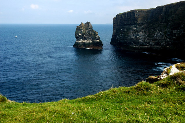
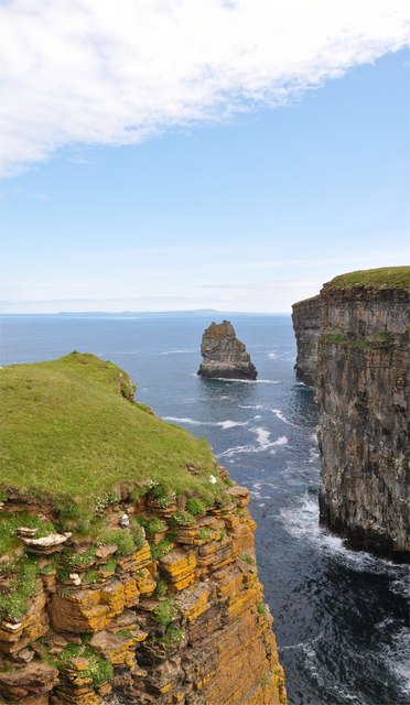
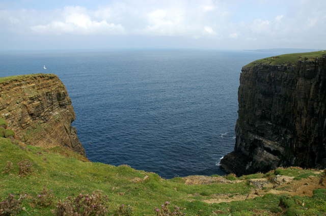
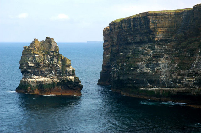
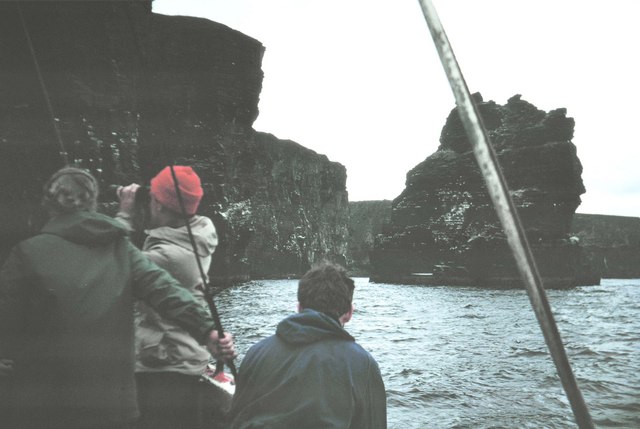
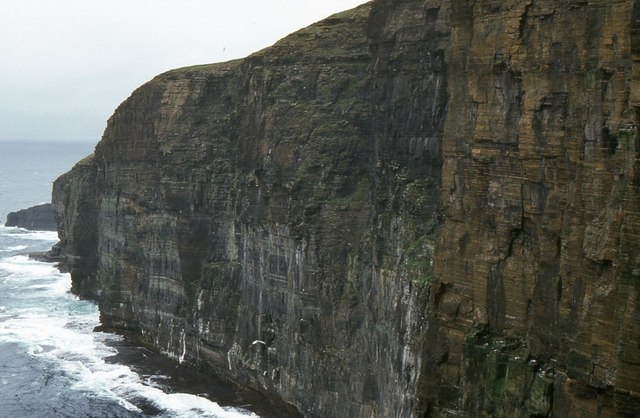
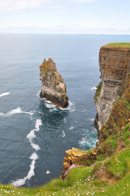
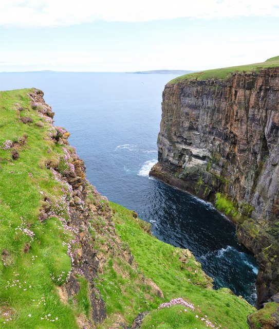
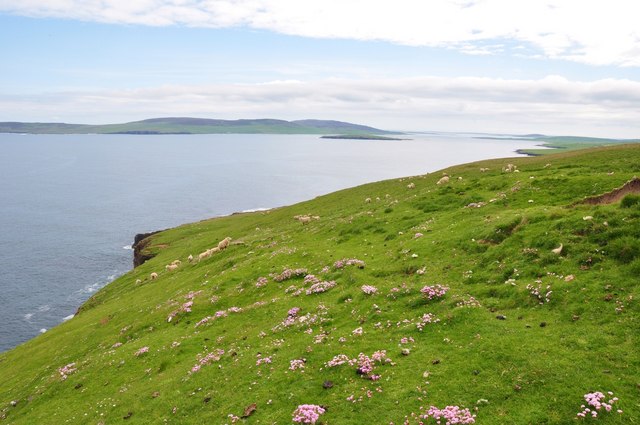
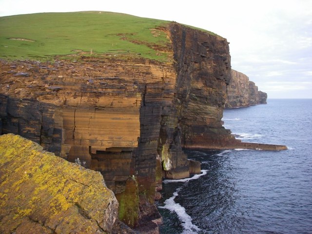
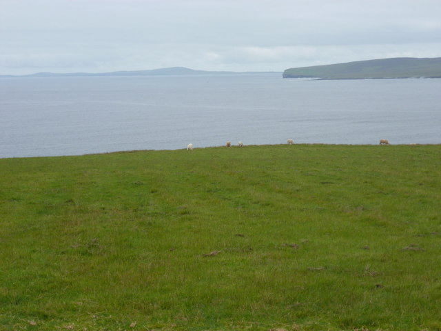
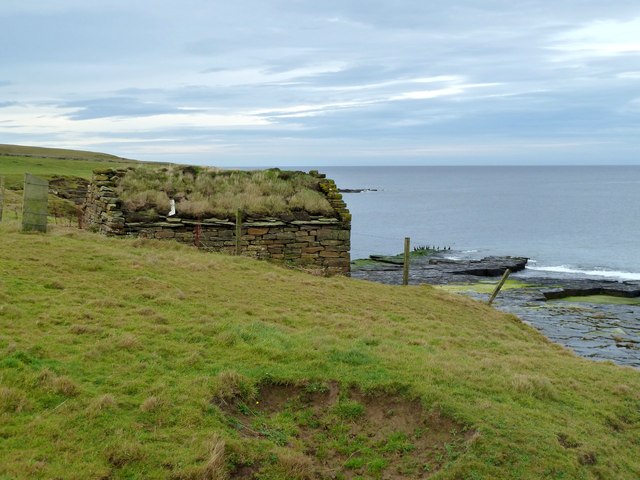
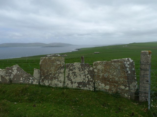
Haafs Hellia is a prominent headland located on the north coast of Orkney, a group of islands off the northeastern coast of Scotland. This coastal feature is situated near the village of Birsay and juts out into the North Atlantic Ocean. Haafs Hellia is characterized by its striking cliffs, which rise dramatically from the sea and offer breathtaking panoramic views of the surrounding landscape.

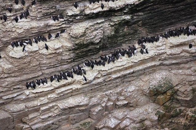
The headland is known for its rugged beauty and is a popular destination for outdoor enthusiasts and nature lovers. It provides a habitat for a variety of seabirds, including puffins, guillemots, and razorbills, making it an important site for birdwatching. The surrounding waters are also rich in marine life, attracting seals and occasionally even whales.

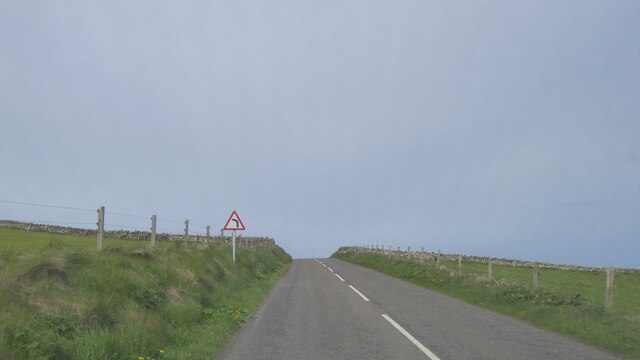
Haafs Hellia features a coastal path that allows visitors to explore the area and enjoy the stunning coastal scenery. The path leads to a lighthouse located at the tip of the headland, providing a historic focal point and adding to the charm of the landscape.

Due to its exposed location, Haafs Hellia can experience strong winds and rough seas, adding to the dramatic atmosphere of the headland. It is advisable for visitors to exercise caution and be aware of the weather conditions when exploring the area.

Overall, Haafs Hellia is a remarkable coastal feature that showcases the natural beauty and ruggedness of Orkney's north coast. Its stunning cliffs, diverse wildlife, and picturesque views make it a must-visit destination for anyone seeking a true Scottish coastal experience.

If you have any feedback on the listing, please let us know in the comments section below.

Haafs Hellia Images

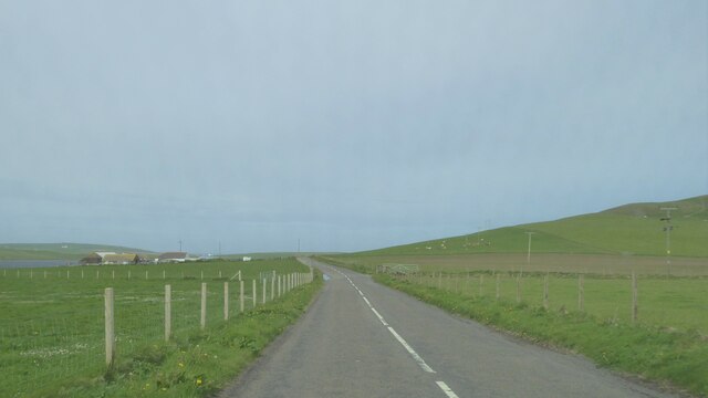
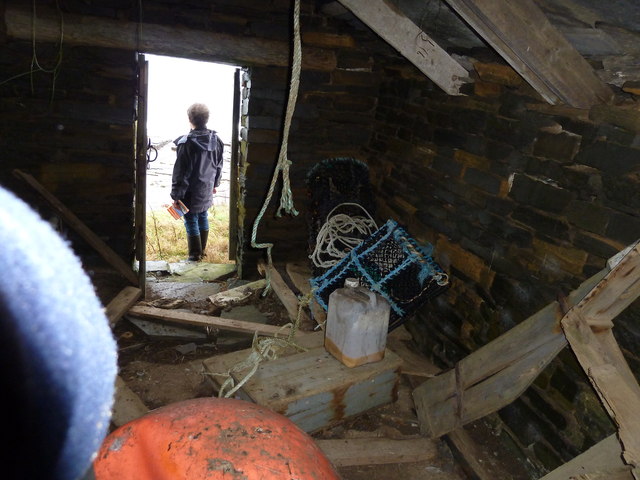
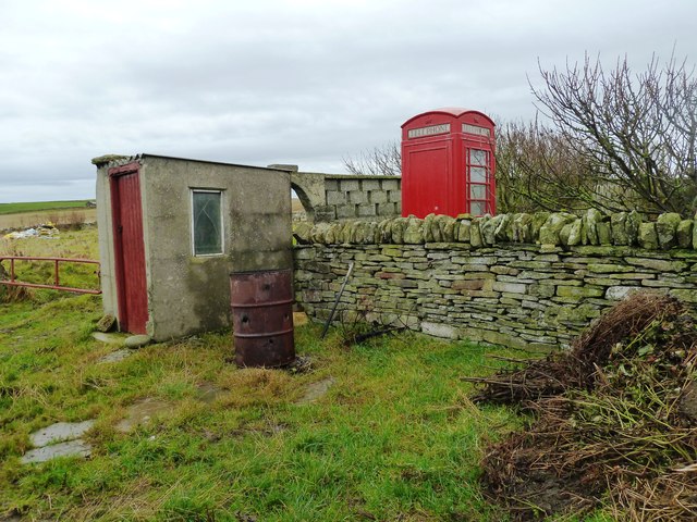
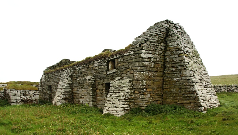
Images are sourced within 2km of 59.153858/-3.1983601 or Grid Reference HY3130. Thanks to Geograph Open Source API. All images are credited.

Inyamehellya (Inyama Hellier on OS map) A large geo near Costa Head with a rock stack called Standard
Inyamehellya (Inyama Hellier on OS map)
A large geo near Costa Head with a rock stack called Standard
Clifftop View Dramatic clifftop view of the geo of Inyama Hellia, sea stack of Standard and far away Westray, with Fulmars and Thrift in the foreground.
Clifftop View
Dramatic clifftop view of the geo of Inyama Hellia, sea stack of Standard and far away Westray, with Fulmars and Thrift in the foreground.
Ramna Geo, below Costa Hill Looking northeast to north isles
Ramna Geo, below Costa Hill
Looking northeast to north isles
Standard A large outlying sea stack at Inyamehellya
Standard
A large outlying sea stack at Inyamehellya
The Standard The Standard photographed from the Shapinsay fishing boat 'Flourish'.
The Standard
The Standard photographed from the Shapinsay fishing boat 'Flourish'.
Costa Head, Orkney Sea cliffs, here 100 m high.
Costa Head, Orkney
Sea cliffs, here 100 m high.
The Standard is High But not as high as me! - Curiously un-orcadian sounding sea stack called Standard which is about 170ft tall - my vantage point is over 300ft.
The Standard is High
But not as high as me! - Curiously un-orcadian sounding sea stack called Standard which is about 170ft tall - my vantage point is over 300ft.
Ramna Geo Looking down into the depths of Ramna Geo from the cliff edge - in the distance is Rousay and Westray.
Ramna Geo
Looking down into the depths of Ramna Geo from the cliff edge - in the distance is Rousay and Westray.
Costa Head Thrift Just east of Costa Head a lovely carpet of thrift amongst the luss grass that the sheep were enjoying. Rousay in the distance.
Costa Head Thrift
Just east of Costa Head a lovely carpet of thrift amongst the luss grass that the sheep were enjoying. Rousay in the distance.
All Lined Up Guillemots on one of the many ledges of the sea stack called Standard.
All Lined Up
Guillemots on one of the many ledges of the sea stack called Standard.
Cliffs at Costa Head Impressive cliffs of Old Red Sandstone drop precipitously into the sea at the northernmost point of Mainland.
Cliffs at Costa Head
Impressive cliffs of Old Red Sandstone drop precipitously into the sea at the northernmost point of Mainland.
A966 near Upper Midhouse, Orkney
A966 near Crismo, Orkney
Costa: grazing cattle and Westray view Looking out across the northwestern end of Eynhallow Sound towards the western tip of the isle of Rousay. In the distance, the outline of Westray can be discerned.
Costa: grazing cattle and Westray view
Looking out across the northwestern end of Eynhallow Sound towards the western tip of the isle of Rousay. In the distance, the outline of Westray can be discerned.
Little Hut This hut, containing fishing gear, is not marked on the map and is only just inside the Grid Square.
This square is one of the three or four very last Orkney Mainland squares to be Geographed
Little Hut
This hut, containing fishing gear, is not marked on the map and is only just inside the Grid Square. This square is one of the three or four very last Orkney Mainland squares to be Geographed
Little Hut Inside the <a href="https://www.geograph.org.uk/photo/2698399">HY3229 : Little Hut</a>.
It is very cosy with even a small hearth. But it is perilously close to the eroding cliff edge.
Little Hut
Inside the HY3229 : Little Hut. It is very cosy with even a small hearth. But it is perilously close to the eroding cliff edge.
The phone at the farm This old public telephone box now sits in the corner of the garden.
What would you use yours for?
The phone at the farm
This old public telephone box now sits in the corner of the garden. What would you use yours for?
Fence, Costa Hill, Orkney Looking towards Eynhallow Sound, Eynhallow and Rousay.

The flagstone fence has been supplemented with a modern wire one.
Fence, Costa Hill, Orkney
Looking towards Eynhallow Sound, Eynhallow and Rousay. The flagstone fence has been supplemented with a modern wire one.
Show me another place!

Haafs Hellia is located at Grid Ref: HY3130 (Lat: 59.153858, Lng: -3.1983601)

Unitary Authority: Orkney Islands

Police Authority: Highlands and Islands

What 3 Words

///poems.orchestra.tastier. Near Birsay, Orkney Islands

Related Wikis

Costa Head

Costa Head is a prominent headland on Eynhallow Sound on the northwestern coast of the Orkney Mainland, Scotland. The tidal indraught of Eynhallow Sound...

Loch of Swannay

The Loch of Swannay is the most northerly loch on the mainland of Orkney and lies within the parish of Birsay in the north west of the island. It is an...

Abune-the-hill

Abune-the-Hill is a place on in the North of the Orkney Mainland (59.13° N 03.25° W HY2828) and just to the west of the Loch of Swannay.Abune-the-Hill...

Eynhallow Church

Eynhallow Church is a ruined medieval church located on the uninhabited island of Eynhallow in Orkney, Scotland. The church dates back to the 12th-century...

Have you been to Haafs Hellia?

Leave your review of Haafs Hellia below (or comments, questions and feedback).