Costa Head

Coastal Feature, Headland, Point in Orkney

Scotland

Costa Head

Inyamehellya (Inyama Hellier on OS map) A large geo near Costa Head with a rock stack called Standard
Inyamehellya (Inyama Hellier on OS map) Credit: John Comloquoy

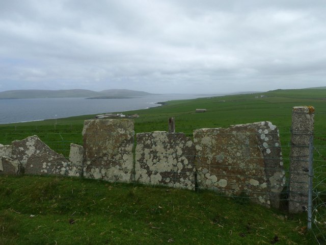
Costa Head is a prominent headland located on the western coast of the Orkney Islands in Scotland. Situated on the island of Westray, it is a notable coastal feature that attracts both locals and tourists alike.

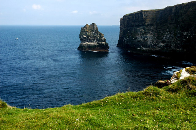
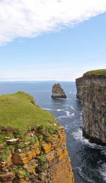
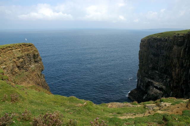
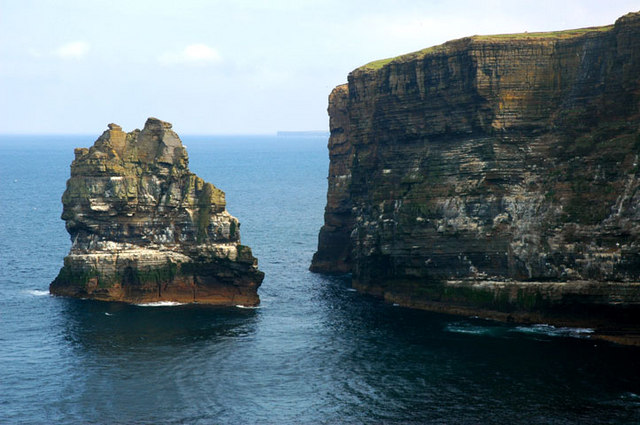
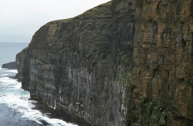
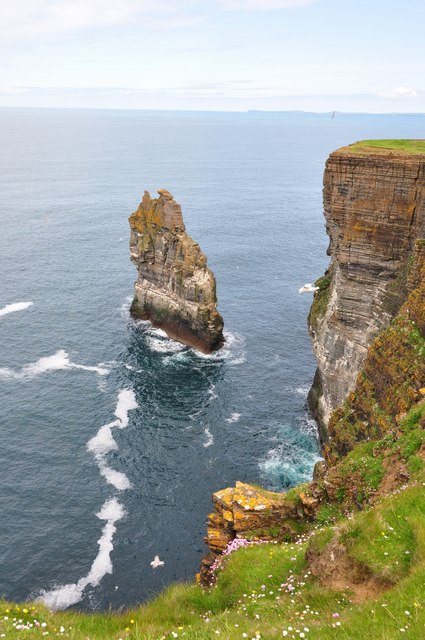
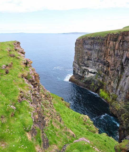
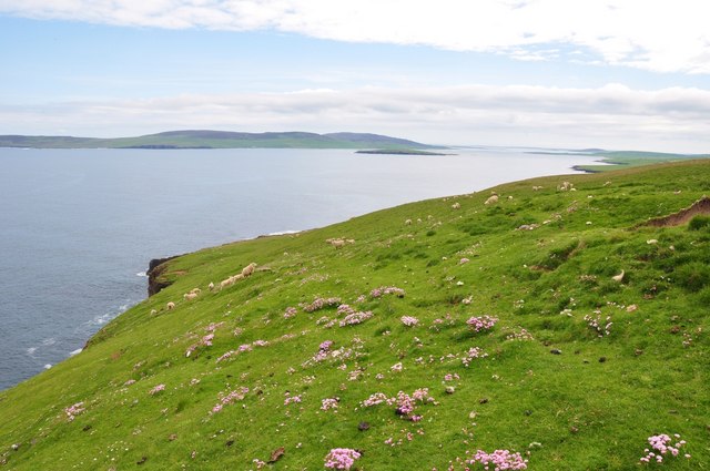
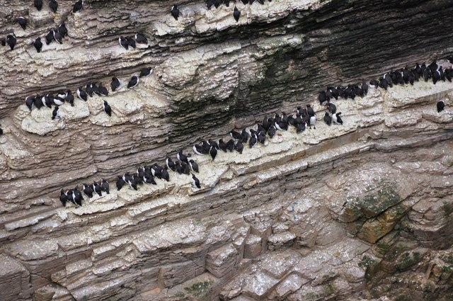
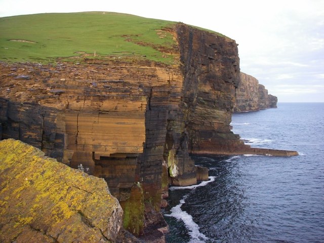
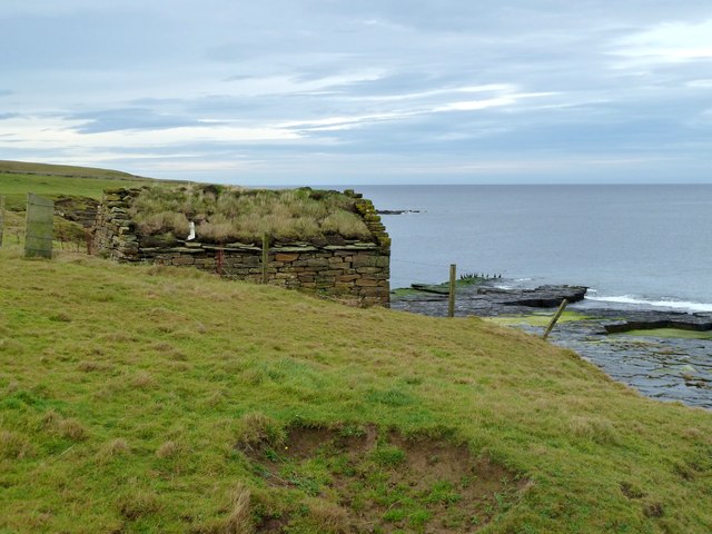
Rising to an elevation of approximately 47 meters (154 feet) above sea level, Costa Head offers stunning panoramic views of the surrounding landscape. The headland is known for its rugged cliffs, which are composed of sandstone and provide a nesting site for various seabirds, including fulmars and kittiwakes.

The headland's geological composition offers visitors a glimpse into the region's ancient past. It is made up of layers of sedimentary rocks, which have been formed over millions of years through various geological processes. Fossilized remains of prehistoric marine life can sometimes be found in the rocks, offering a fascinating insight into the area's geological history.

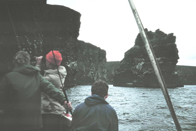
The coastal area around Costa Head is abundant in marine life, making it a popular spot for fishing and birdwatching. The waters off the headland are home to a diverse range of species, including seals, dolphins, and various types of fish. The headland is also a designated Site of Special Scientific Interest (SSSI), as it supports a unique array of flora and fauna.

Aside from its natural beauty, Costa Head is also known for its historical significance. Nearby, there are the remains of an Iron Age broch, a circular stone tower, which is believed to have been used for defensive purposes. This adds an additional layer of intrigue to the headland, attracting history enthusiasts and archaeology lovers.

Overall, Costa Head is a captivating coastal feature in Orkney, offering a combination of stunning natural scenery, geological wonders, and historical significance.

If you have any feedback on the listing, please let us know in the comments section below.

Costa Head Images

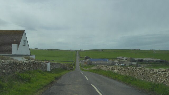
Images are sourced within 2km of 59.153513/-3.2064961 or Grid Reference HY3130. Thanks to Geograph Open Source API. All images are credited.

Inyamehellya (Inyama Hellier on OS map) A large geo near Costa Head with a rock stack called Standard
Inyamehellya (Inyama Hellier on OS map)
A large geo near Costa Head with a rock stack called Standard
Clifftop View Dramatic clifftop view of the geo of Inyama Hellia, sea stack of Standard and far away Westray, with Fulmars and Thrift in the foreground.
Clifftop View
Dramatic clifftop view of the geo of Inyama Hellia, sea stack of Standard and far away Westray, with Fulmars and Thrift in the foreground.
Ramna Geo, below Costa Hill Looking northeast to north isles
Ramna Geo, below Costa Hill
Looking northeast to north isles
Standard A large outlying sea stack at Inyamehellya
Standard
A large outlying sea stack at Inyamehellya
The Standard The Standard photographed from the Shapinsay fishing boat 'Flourish'.
The Standard
The Standard photographed from the Shapinsay fishing boat 'Flourish'.
Costa Head, Orkney Sea cliffs, here 100 m high.
Costa Head, Orkney
Sea cliffs, here 100 m high.
The Standard is High But not as high as me! - Curiously un-orcadian sounding sea stack called Standard which is about 170ft tall - my vantage point is over 300ft.
The Standard is High
But not as high as me! - Curiously un-orcadian sounding sea stack called Standard which is about 170ft tall - my vantage point is over 300ft.
Ramna Geo Looking down into the depths of Ramna Geo from the cliff edge - in the distance is Rousay and Westray.
Ramna Geo
Looking down into the depths of Ramna Geo from the cliff edge - in the distance is Rousay and Westray.
Costa Head Thrift Just east of Costa Head a lovely carpet of thrift amongst the luss grass that the sheep were enjoying. Rousay in the distance.
Costa Head Thrift
Just east of Costa Head a lovely carpet of thrift amongst the luss grass that the sheep were enjoying. Rousay in the distance.
All Lined Up Guillemots on one of the many ledges of the sea stack called Standard.
All Lined Up
Guillemots on one of the many ledges of the sea stack called Standard.
Cliffs at Costa Head Impressive cliffs of Old Red Sandstone drop precipitously into the sea at the northernmost point of Mainland.
Cliffs at Costa Head
Impressive cliffs of Old Red Sandstone drop precipitously into the sea at the northernmost point of Mainland.
A966 near Crismo, Orkney
A966 near Swannay Farm, Orkney
Little Hut This hut, containing fishing gear, is not marked on the map and is only just inside the Grid Square.
This square is one of the three or four very last Orkney Mainland squares to be Geographed
Little Hut
This hut, containing fishing gear, is not marked on the map and is only just inside the Grid Square. This square is one of the three or four very last Orkney Mainland squares to be Geographed
Little Hut Inside the <a href="https://www.geograph.org.uk/photo/2698399">HY3229 : Little Hut</a>.
It is very cosy with even a small hearth. But it is perilously close to the eroding cliff edge.
Little Hut
Inside the HY3229 : Little Hut. It is very cosy with even a small hearth. But it is perilously close to the eroding cliff edge.
The phone at the farm This old public telephone box now sits in the corner of the garden.
What would you use yours for?
The phone at the farm
This old public telephone box now sits in the corner of the garden. What would you use yours for?
Fence, Costa Hill, Orkney Looking towards Eynhallow Sound, Eynhallow and Rousay.

The flagstone fence has been supplemented with a modern wire one.
Fence, Costa Hill, Orkney
Looking towards Eynhallow Sound, Eynhallow and Rousay. The flagstone fence has been supplemented with a modern wire one.
Triangulation pillar, Costa Hill, Orkney Looking towards the strip of land on the northeast corner of Orkney Mainland between the coast (left) and Loch of Swannay (right).
Triangulation pillar, Costa Hill, Orkney
Looking towards the strip of land on the northeast corner of Orkney Mainland between the coast (left) and Loch of Swannay (right).
Show me another place!

Costa Head is located at Grid Ref: HY3130 (Lat: 59.153513, Lng: -3.2064961)

Unitary Authority: Orkney Islands

Police Authority: Highlands and Islands

What 3 Words

///bracelet.showrooms.appealed. Near Birsay, Orkney Islands

Related Wikis

Costa Head

Costa Head is a prominent headland on Eynhallow Sound on the northwestern coast of the Orkney Mainland, Scotland. The tidal indraught of Eynhallow Sound...

Loch of Swannay

The Loch of Swannay is the most northerly loch on the mainland of Orkney and lies within the parish of Birsay in the north west of the island. It is an...

Abune-the-hill

Abune-the-Hill is a place in the North of the Orkney Mainland (59.13° N 03.25° W HY2828) and just to the West of the Loch of Swannay. Abune-the-Hill means...

Loch of Hundland

The Loch of Hundland is a shallow freshwater loch in the parish of Birsay in the north west of the mainland of Orkney, Scotland. The loch lies between...

Have you been to Costa Head?

Leave your review of Costa Head below (or comments, questions and feedback).