Garth Head

Coastal Feature, Headland, Point in Orkney

Scotland

Garth Head

Longhope: heading down to The Ayre The road along the south side of South Walls descends towards The Ayre, the causeway that links South Walls with the neighbouring island of Hoy.
Longhope: heading down to The Ayre Credit: Chris Downer

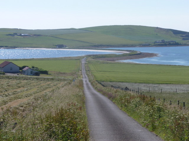
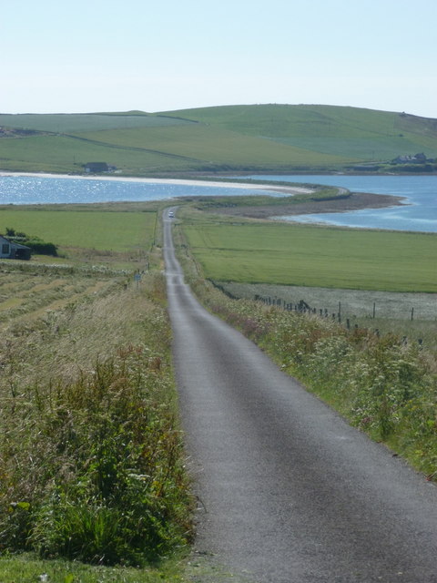
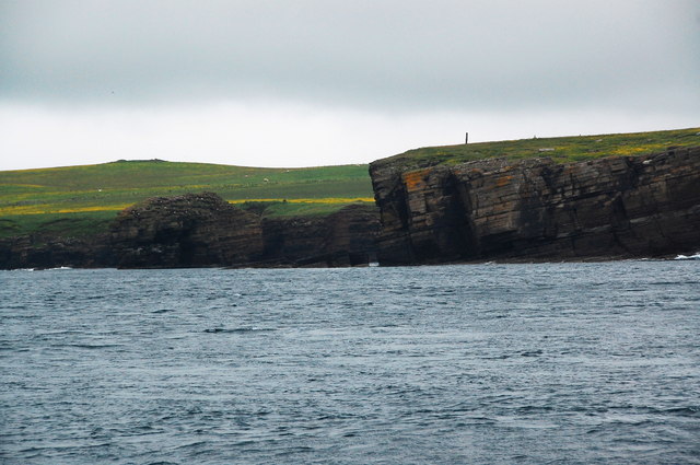
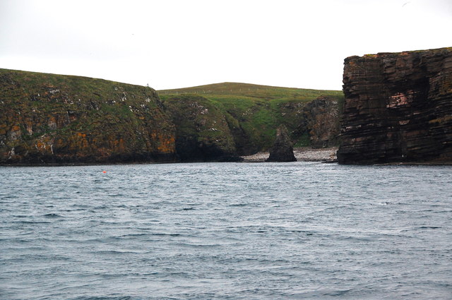
Garth Head is a prominent coastal feature located on the eastern coast of the Orkney Islands in Scotland. It is a headland that extends out into the North Sea, forming a distinctive point along the coastline.

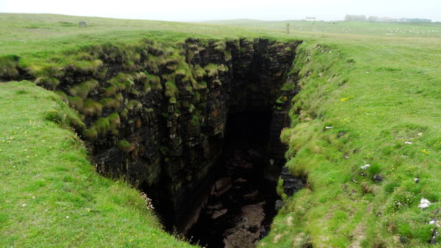
The headland is characterized by its rugged and rocky terrain, with steep cliffs that rise dramatically from the sea. These cliffs provide a nesting habitat for various seabird species, including puffins, guillemots, and kittiwakes. The area is designated as a Special Protection Area due to its importance for breeding seabirds.

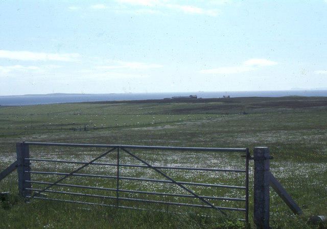
Garth Head offers breathtaking panoramic views of the surrounding coastline and the open sea. On a clear day, visitors can see the neighboring islands of Shapinsay and Stronsay to the east, and the distant mainland of Scotland to the south.

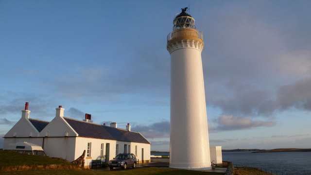
The headland is also home to a lighthouse, which was built in the 19th century to guide ships navigating through the treacherous waters of the Pentland Firth. The lighthouse stands on a high point of the headland, providing a vital navigational aid for vessels passing through this busy shipping lane.

Garth Head is a popular destination for outdoor enthusiasts, offering opportunities for hiking, birdwatching, and photography. The wild and untamed beauty of this coastal feature attracts visitors from near and far, who come to marvel at its natural splendor and immerse themselves in the rich history and wildlife of the Orkney Islands.

If you have any feedback on the listing, please let us know in the comments section below.

Garth Head Images

Images are sourced within 2km of 58.777734/-3.1870869 or Grid Reference ND3188. Thanks to Geograph Open Source API. All images are credited.

Longhope: heading down to The Ayre The road along the south side of South Walls descends towards The Ayre, the causeway that links South Walls with the neighbouring island of Hoy.
Longhope: heading down to The Ayre
The road along the south side of South Walls descends towards The Ayre, the causeway that links South Walls with the neighbouring island of Hoy.
South Walls: dropping down to The Ayre The more minor, southern road across the island heads down towards <a href="https://www.geograph.org.uk/photo/2608323">ND2889 : South Walls: The Ayre</a>, the causeway linking South Walls with the neighbouring island of Hoy.
South Walls: dropping down to The Ayre
The more minor, southern road across the island heads down towards ND2889 : South Walls: The Ayre, the causeway linking South Walls with the neighbouring island of Hoy.
Old Milestone, South Walls, Orkney Milestone by the UC road, in parish of Walls and Flotta (Hoy District), South Walls, West of entrance to Aithsdale.

Inscription reads:- 
L'Ness
5
{arrow->} 
(To Lyness)

HES Grade C(S) listed.
Reference: LB48335 <span class="nowrap"><a title="http://portal.historicenvironment.scot/designation/LB48335" rel="nofollow ugc noopener" href="http://portal.historicenvironment.scot/designation/LB48335">Link</a><img style="margin-left:2px;" alt="External link" title="External link - shift click to open in new window" src="https://s1.geograph.org.uk/img/external.png" width="10" height="10"/></span>

Surveyed

Milestone Society National ID: OR_HYNNKH05
Old Milestone, South Walls, Orkney
Milestone by the UC road, in parish of Walls and Flotta (Hoy District), South Walls, West of entrance to Aithsdale. Inscription reads:- L'Ness 5 {arrow->} (To Lyness) HES Grade C(S) listed. Reference: LB48335 LinkExternal link Surveyed Milestone Society National ID: OR_HYNNKH05
South Walls (Hoy) - Trig point at Gallow Tuag
South Walls (Hoy) - Western of two gloups at Lang Geo
South Walls (Hoy) - Natural arch at Burgh Geo near Snelsetter
South Walls (Hoy) - Natural arch at Red Geos near Snelsetter
South Walls (Hoy) - Birsi Geo & Garth Head
Old Milestone, South Walls, Orkney Milestone by the UC road, in parish of Walls and Flotta (Hoy District), South Walls, West of entrance to Aithsdale.

Inscription reads:- 
L'Ness
5
{arrow->} 
(To Lyness)

HES Grade C(S) listed.
Reference: LB48335 <span class="nowrap"><a title="https://portal.historicenvironment.scot/designation/LB48335" rel="nofollow ugc noopener" href="https://portal.historicenvironment.scot/designation/LB48335">Link</a><img style="margin-left:2px;" alt="External link" title="External link - shift click to open in new window" src="https://s1.geograph.org.uk/img/external.png" width="10" height="10"/></span>

Surveyed

Milestone Society National ID: OR_HYNNKH05
Old Milestone, South Walls, Orkney
Milestone by the UC road, in parish of Walls and Flotta (Hoy District), South Walls, West of entrance to Aithsdale. Inscription reads:- L'Ness 5 {arrow->} (To Lyness) HES Grade C(S) listed. Reference: LB48335 LinkExternal link Surveyed Milestone Society National ID: OR_HYNNKH05
South Walls: postbox № KW17 94, Eastbister A small postbox on the southern road across the island, emptied at 7:45 each weekday and Saturday morning.

Although Hoy and South Walls are postally within KW16 (Stromness), all the postboxes on the two islands are numbered KW17, presumably in error.
South Walls: postbox № KW17 94, Eastbister
A small postbox on the southern road across the island, emptied at 7:45 each weekday and Saturday morning. Although Hoy and South Walls are postally within KW16 (Stromness), all the postboxes on the two islands are numbered KW17, presumably in error.
South Walls, near Eastbister: view south to Snelsetter
Cliffs near Misbister Geo, Hoy With the chimney of Misbister in the background.
Cliffs near Misbister Geo, Hoy
With the chimney of Misbister in the background.
Caves in the cliffs, Helliack, Hoy The buildings of Snelsetter on the horizon.
Caves in the cliffs, Helliack, Hoy
The buildings of Snelsetter on the horizon.
The Candle, near Snelsetter, Hoy A coastline of caves, cliffs, stacks and arches.
The Candle, near Snelsetter, Hoy
A coastline of caves, cliffs, stacks and arches.
The Candle and Snelsetter, Hoy A geography lesson in a photo.
The Candle and Snelsetter, Hoy
A geography lesson in a photo.
The Candle and Snelsetter, Hoy I love the old farm building to left.
The Candle and Snelsetter, Hoy
I love the old farm building to left.
Stack in Birsi Geo Another fantastic piece of physical geography to be found along this stretch of coastline.
Stack in Birsi Geo
Another fantastic piece of physical geography to be found along this stretch of coastline.
Aith Head, Hoy The old Longhope Lifeboat Station in the background.
Aith Head, Hoy
The old Longhope Lifeboat Station in the background.
Show me another place!

Garth Head is located at Grid Ref: ND3188 (Lat: 58.777734, Lng: -3.1870869)

Unitary Authority: Orkney Islands

Police Authority: Highlands and Islands

What 3 Words

///cycles.groomed.sprouting. Near Lyness, Orkney Islands

Related Wikis

South Walls

South Walls (Scots: Sooth Waas), often referred to as Walls, is an inhabited island adjacent to Hoy in Orkney, Scotland. The name is a corruption of "Sooth...

RNLB Thomas McCunn (ON 759)

RNLB Thomas McCunn (ON 759) is a 45ft 6in Watson-class lifeboat stationed at Longhope in Orkney, Scotland, from January 1933 until April 1962. During...

Brims, Orkney

Brims is a village at the southern point of the island of Hoy, in Orkney, Scotland. The settlement is within the parish of Walls and Flotta. The RNLI lifeboat...

Longhope, Orkney

Longhope is a coastal settlement on the island of South Walls, in Orkney, Scotland. South Walls is linked to Hoy by causeway; Longhope is the largest settlement...

Cantick Head Lighthouse

The Cantick Head Lighthouse is an active 19th century lighthouse on the Scottish island of South Walls in the Orkney Islands. It is located at the end...

Hackness Martello Tower and Battery

Hackness Martello Tower and Battery is a British Army barracks and museum located on the island of South Walls, in Orkney, Scotland. == History == The...

Crockness Martello tower

Crockness Martello Tower is a Martello Tower on Hoy, Orkney, Scotland. It was built during the Napoleonic Wars, at the same time as the Martello Tower...

Switha

Switha is a small uninhabited island towards the south of Orkney, Scotland, approximately 41 hectares in area. == Geography and geology == Switha lies...

Have you been to Garth Head?

Leave your review of Garth Head below (or comments, questions and feedback).