Rubha Dubh

Coastal Feature, Headland, Point in Sutherland

Scotland

Rubha Dubh

Old Store, Skerray The ruin of the old store at Skerray.
Old Store, Skerray Credit: David Bremner

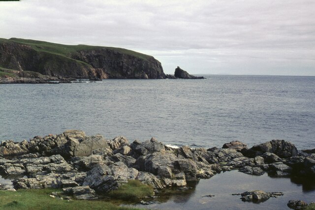
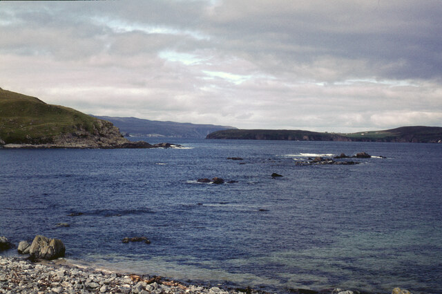
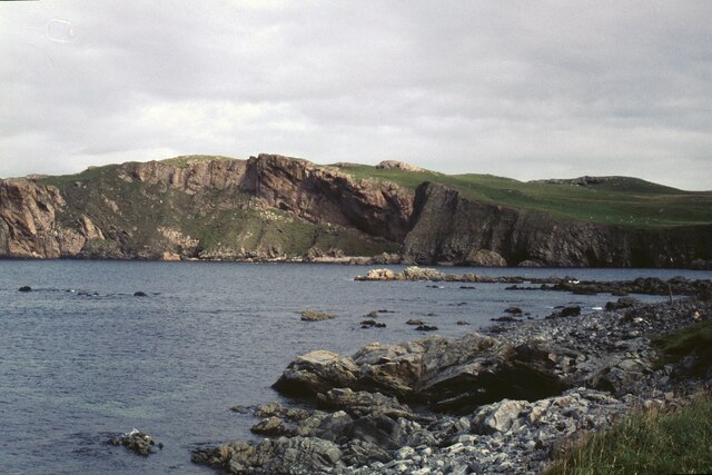
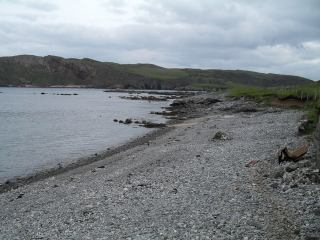
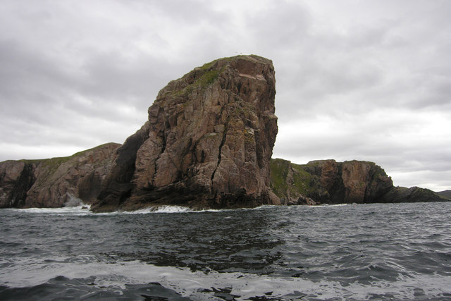
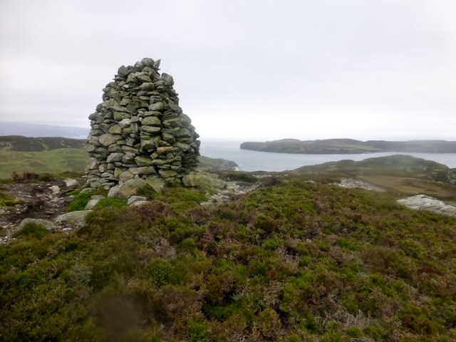
Rubha Dubh is a prominent coastal feature located in Sutherland, Scotland. It is a headland that juts out into the North Atlantic Ocean, forming a distinctive point along the rugged coastline. The name "Rubha Dubh" translates to "black point" in Gaelic, which is fitting given the dark, rocky nature of the headland.

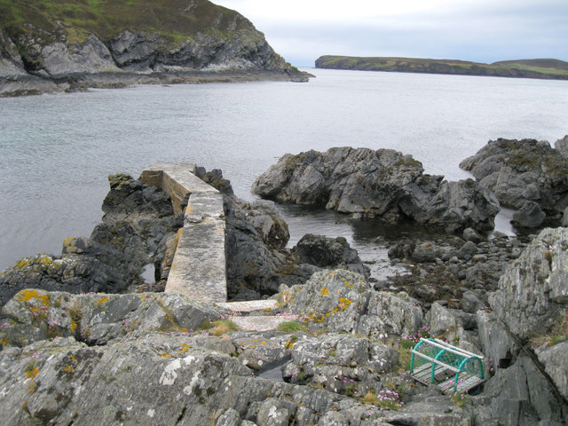
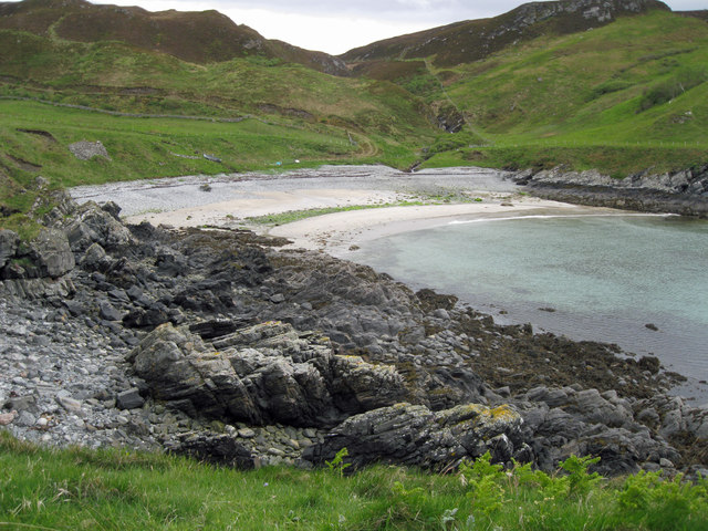
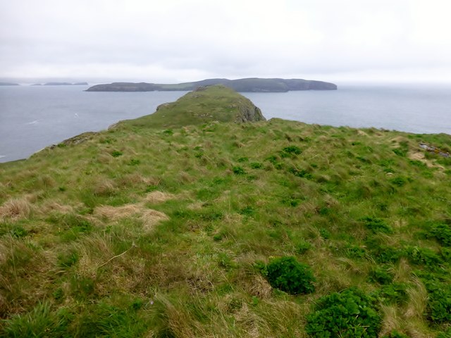
The headland is characterized by its dramatic cliffs that tower above the crashing waves below. These cliffs are composed of ancient rock formations, mainly comprised of gneiss and granite, which have been shaped over millions of years by the relentless forces of erosion. The jagged, black rocks create a stark contrast against the vibrant blue of the ocean, adding to the dramatic beauty of the landscape.

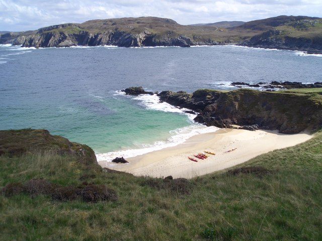
Rubha Dubh is also known for its rich biodiversity. The surrounding waters are home to a diverse array of marine life, including seals, dolphins, and various species of seabirds that nest along the cliffs. The headland itself is covered in a variety of coastal vegetation, such as grasses and shrubs, which provide habitat for numerous bird species.

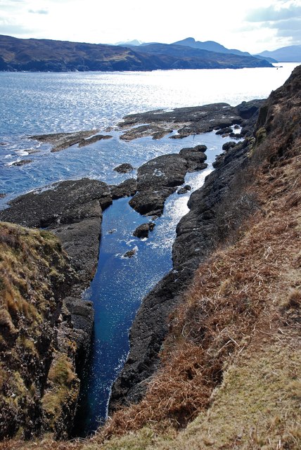
The location of Rubha Dubh offers stunning panoramic views of the surrounding coastline. On a clear day, visitors can see for miles, taking in the vast expanse of the ocean and the rugged beauty of the Scottish Highlands. The headland is a popular spot for hikers and nature enthusiasts, who come to explore the coastal trails and experience the raw power of the sea.

Overall, Rubha Dubh is a remarkable coastal feature that showcases the natural beauty and diversity of the Sutherland coastline. Its towering cliffs, diverse wildlife, and breathtaking views make it a must-visit destination for those seeking an authentic Scottish coastal experience.

If you have any feedback on the listing, please let us know in the comments section below.
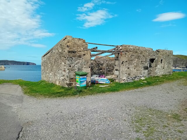
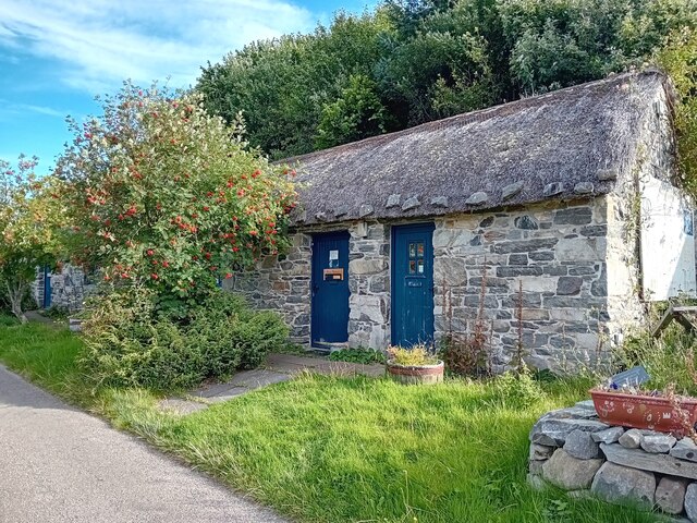
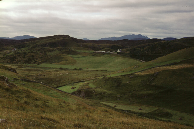
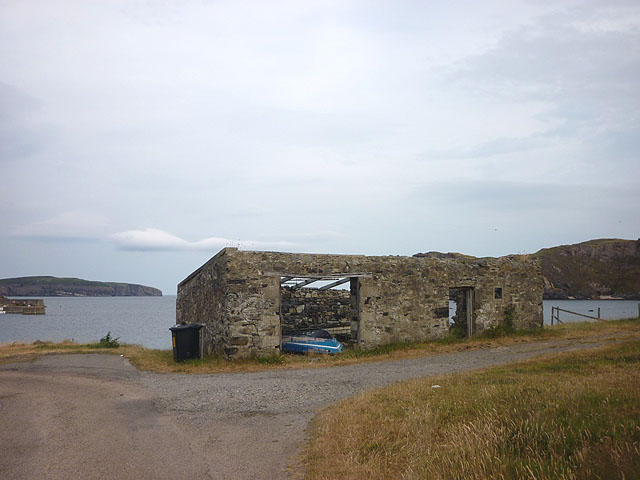
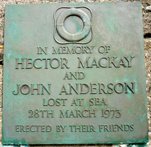
Rubha Dubh Images

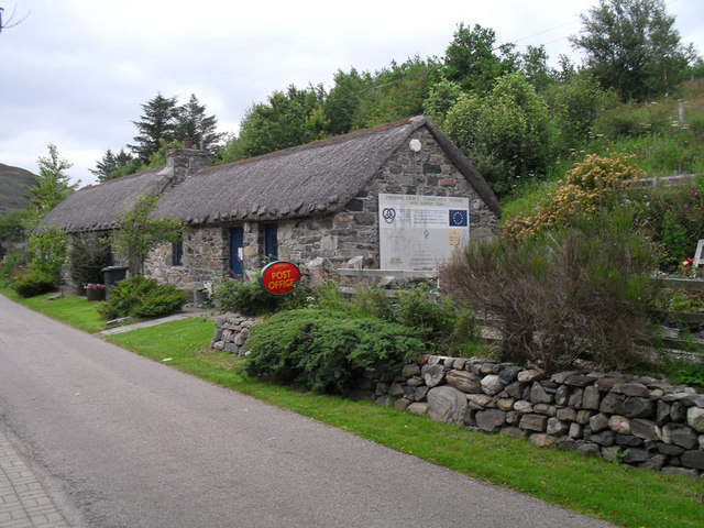
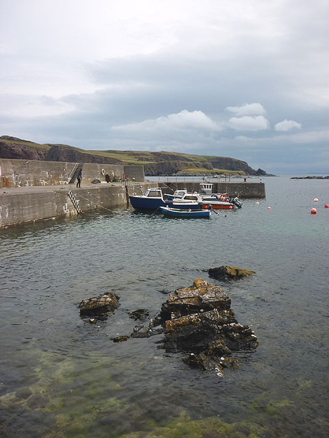
Images are sourced within 2km of 58.542392/-4.3080359 or Grid Reference NC6563. Thanks to Geograph Open Source API. All images are credited.

Old Store, Skerray The ruin of the old store at Skerray.
Old Store, Skerray
The ruin of the old store at Skerray.
Skerray Post Office Village Post Office in a nicely restored building.
Skerray Post Office
Village Post Office in a nicely restored building.
The hamlet of Skerray Looking south-south-west towards Ben Loyal.
The hamlet of Skerray
Looking south-south-west towards Ben Loyal.
Stac an Fhamhair A small stack, perhaps 15m high, at the east end of Neave (or Coomb) Island, seen across Caol Beag.
Stac an Fhamhair
A small stack, perhaps 15m high, at the east end of Neave (or Coomb) Island, seen across Caol Beag.
Skerray Bay Not a bay I would be very happy to navigate into (although there is, or was, a pier on the far side, just out of shot on the left).

The southern part of Eilean nan Ron is beyond the bay, with a few deserted houses visible.
Skerray Bay
Not a bay I would be very happy to navigate into (although there is, or was, a pier on the far side, just out of shot on the left). The southern part of Eilean nan Ron is beyond the bay, with a few deserted houses visible.
Neave or Coomb Island The central part of the island seen at close range (but still across a gridline!) across Caol Beag.
Neave or Coomb Island
The central part of the island seen at close range (but still across a gridline!) across Caol Beag.
Phonebox near Skerray
Stony beach at Skerray
Skerray Post Office
Skerray Post Office
Old jetty in Lamigo Bay The relatively new creel on the rocks indicates that the jetty is still in use, although no boat was visible at this time.
Old jetty in Lamigo Bay
The relatively new creel on the rocks indicates that the jetty is still in use, although no boat was visible at this time.
Lamigo Bay This deserted sandy beach lies at the head of Lamigo Bay.
Lamigo Bay
This deserted sandy beach lies at the head of Lamigo Bay.
Pier at Skerray Harbour Neave (or Coombe) Island beyond across Caol Beag.
Pier at Skerray Harbour
Neave (or Coombe) Island beyond across Caol Beag.
Roofless building, Skerray Bay Eilan nan Ron (left) and Neave (Coombe) Island off shore.
Roofless building, Skerray Bay
Eilan nan Ron (left) and Neave (Coombe) Island off shore.
Memorial plaque, Skerray Pier 'In memory of Hector Mackay and John Anderson lost at sea 28th March 1973. Erected by their friends'.
Memorial plaque, Skerray Pier
'In memory of Hector Mackay and John Anderson lost at sea 28th March 1973. Erected by their friends'.
Creag Ruadh, Neave Island The towering cliff of Creag Ruadh continues underwater. The marine life of this area is just amazing.
Creag Ruadh, Neave Island
The towering cliff of Creag Ruadh continues underwater. The marine life of this area is just amazing.
Geo south of Mol na Coinnle, Eilean nan Ron At low tide water is trapped in this geo making for an interesting snorkel or dive. In the summer months the temperature can rise well above the average sea temperature as the black rock absorbs the suns rays.
Geo south of Mol na Coinnle, Eilean nan Ron
At low tide water is trapped in this geo making for an interesting snorkel or dive. In the summer months the temperature can rise well above the average sea temperature as the black rock absorbs the suns rays.
Carn Lamigo A quick bag after the 6 island TuMP boat trip with Jim Bloomer on a cool grey afternoon.
Name:Carn Lamigo
Hill number:9924
Height:113m / 371ft
Parent (Ma/M):1164  Meall nan Clach Ruadha
Area:16C: Tongue to Wick and Helmsdale
Class:1
Grid ref:NC648629 (est)
Drop:45m
Col:68m
Carn Lamigo
A quick bag after the 6 island TuMP boat trip with Jim Bloomer on a cool grey afternoon. Name:Carn Lamigo Hill number:9924 Height:113m / 371ft Parent (Ma/M):1164 Meall nan Clach Ruadha Area:16C: Tongue to Wick and Helmsdale Class:1 Grid ref:NC648629 (est) Drop:45m Col:68m
Neave Island Bagged on a boat trip with 8 other island TUMP baggers on a grey morning.
Name: Neave Island
Hill number:10043
Height:70m / 230ft
Parent (Ma/M):none
Area:16C: Tongue to Wick and Helmsdale
Class:0
Grid ref:NC662645 (est)
Drop:70m
Col:Sea
Neave Island
Bagged on a boat trip with 8 other island TUMP baggers on a grey morning. Name: Neave Island Hill number:10043 Height:70m / 230ft Parent (Ma/M):none Area:16C: Tongue to Wick and Helmsdale Class:0 Grid ref:NC662645 (est) Drop:70m Col:Sea
Show me another place!

Rubha Dubh is located at Grid Ref: NC6563 (Lat: 58.542392, Lng: -4.3080359)

Unitary Authority: Highland

Police Authority: Highlands and Islands

What 3 Words

///families.curls.nurse. Near Altnaharra, Highland

Related Wikis

Skerray Bay

Skerray Bay is an arm of the Atlantic Ocean, located on the north coast of Sutherland, Highland, Scotland. Small and rocky, it is situated to the north...

Neave Island

Neave Island (Scottish Gaelic: Eilean na Naoimh, "Isle of the Saint") or Coomb(e) Island is an island on the north coast of the Scottish mainland. Neave...

Skerray

Skerray (Scottish Gaelic: Sgeirea) is a remote small crofting hamlet and fishing port on the north coast of Sutherland, Scotland. It is located 7+3⁄4 miles...

Achtoty

Achtoty (Scottish Gaelic: Achadh Toitidh) is a remote hamlet in the Scottish Highland Council area. Achtoty is about 26 miles (42 km) west of Thurso....

Nearby Amenities

Located within 500m of 58.542392,-4.3080359
Source: PGS
Lat/Long: 58.5431933/-4.299562
Source: PGS
Lat/Long: 58.543132/-4.2995513
Source: PGS
Lat/Long: 58.5426026/-4.2994714
Source: PGS
Lat/Long: 58.5422493/-4.2998528
Source: PGS
Lat/Long: 58.5419019/-4.3003077
Source: PGS
Lat/Long: 58.5414464/-4.3008576
Source: PGS
Lat/Long: 58.5414231/-4.3041156
Skerray Bay
Natural: bay
Wikidata: Q7534696
Wikipedia: en:Skerray Bay
Lat/Long: 58.5420621/-4.3030663
Bench
Lat/Long: 58.5409183/-4.3028869
Tubeg
Place: locality
Source: os_opendata_streetview
Lat/Long: 58.5384049/-4.3042803
Drinking Water
Fee: donation
Lat/Long: 58.5410047/-4.301162
The data included in this document is from www.openstreetmap.org. The data is made available under ODbL.

Have you been to Rubha Dubh?

Leave your review of Rubha Dubh below (or comments, questions and feedback).