Highveer Point

Coastal Feature, Headland, Point in Devon North Devon

England

Highveer Point

Heddon's Mouth North Devon - an excellent 4km walk from and to the nearest parking place
Heddon's Mouth Credit: John Phillips

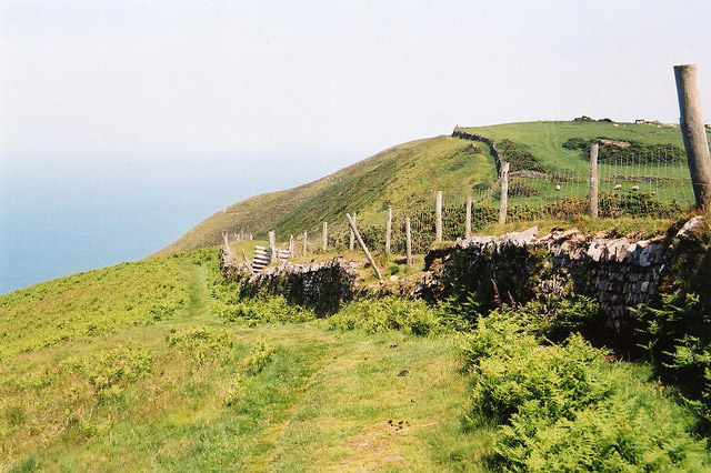
Highveer Point is a prominent coastal feature located in Devon, England. Situated on the southern coast of the county, it is known for its striking headland and picturesque views of the surrounding coastline.

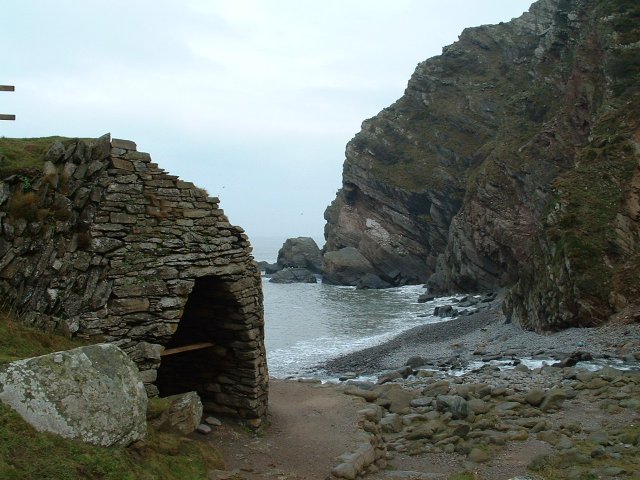
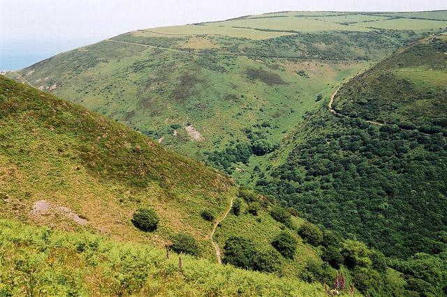
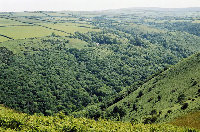
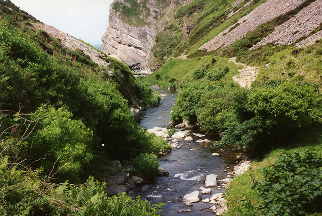
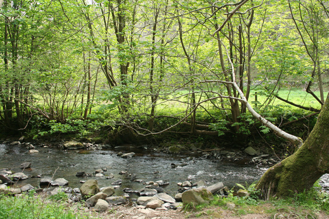
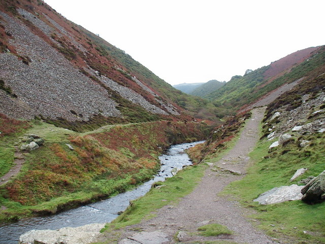
The point is characterized by its rugged cliffs, which rise dramatically from the sea, reaching heights of up to 100 meters. These cliffs are composed of various sedimentary rocks, including limestone and sandstone, which have been shaped by the relentless action of the waves over millions of years. The cliffs are often adorned with vibrant vegetation, adding to the area's natural beauty.

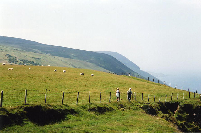
Highveer Point offers visitors a unique opportunity to experience the raw power of the ocean, with crashing waves constantly battering the cliffs below. The point also provides an excellent vantage point for spotting marine wildlife, such as dolphins, seals, and seabirds, which are often seen in the waters surrounding the headland.

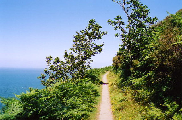
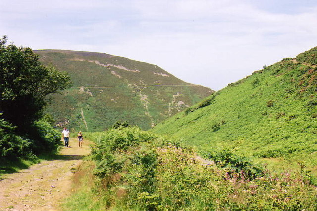
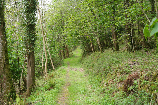
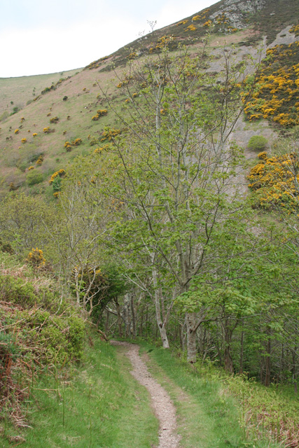
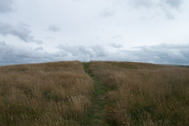
Access to Highveer Point is primarily by foot, with a network of footpaths and trails leading visitors to the site. These paths offer spectacular views of the coastline, and walkers can enjoy the fresh sea air and stunning vistas as they make their way to the point.

Overall, Highveer Point is a captivating coastal feature, offering both natural beauty and wildlife encounters. It is a popular destination for nature enthusiasts, hikers, and photographers, who are drawn to its dramatic cliffs and breathtaking views.

If you have any feedback on the listing, please let us know in the comments section below.

Highveer Point Images

Images are sourced within 2km of 51.231077/-3.9255815 or Grid Reference SS6549. Thanks to Geograph Open Source API. All images are credited.

Heddon's Mouth North Devon - an excellent 4km walk from and to the nearest parking place
Heddon's Mouth
North Devon - an excellent 4km walk from and to the nearest parking place
Martinhoe Church
Martinhoe Church
Martinhoe: coast path The South West Coast Path near West Woody Bay Wood, between Heddon's Mouth and Woody Bay
Martinhoe: coast path
The South West Coast Path near West Woody Bay Wood, between Heddon's Mouth and Woody Bay
Martinhoe: upper path near Heddon's Mouth Cleave The second of two coast paths between Heddon's Mouth and Woody Bay
Martinhoe: upper path near Heddon's Mouth Cleave
The second of two coast paths between Heddon's Mouth and Woody Bay
Trentishoe: the South West Coast Path Looking east
Trentishoe: the South West Coast Path
Looking east
Trentishoe: the South West Coast Path West to Holdstone Down and the Great Hangman
Trentishoe: the South West Coast Path
West to Holdstone Down and the Great Hangman
Trentishoe: overlooking Heddon's Mouth Cleave The South West Coast Path is just visible on both sides of the valley. The higher path on the hills opposite leads to Woody Bay
Trentishoe: overlooking Heddon's Mouth Cleave
The South West Coast Path is just visible on both sides of the valley. The higher path on the hills opposite leads to Woody Bay
Trentishoe: looking south over the Heddon Valley Seen from the footpath that runs around the hill east from Trentishoe church
Trentishoe: looking south over the Heddon Valley
Seen from the footpath that runs around the hill east from Trentishoe church
Wringapeak A natural arch at the west end of Woody Bay. Taken from the Exmoor Coast Cruise boat.
Wringapeak
A natural arch at the west end of Woody Bay. Taken from the Exmoor Coast Cruise boat.
Hunters Inn, Heddons Mouth
Trentishoe: River Heddon Near Heddon’s Mouth
Trentishoe: River Heddon
Near Heddon’s Mouth
Martinhoe: bridleway near Milltown Looking north-north-east. The path or bridleway to Kings Lane
Martinhoe: bridleway near Milltown
Looking north-north-east. The path or bridleway to Kings Lane
Martinhoe: West Woodybay Wood Looking west-north-west on the lower coastal path from Woody Bay to The Hunters Inn
Martinhoe: West Woodybay Wood
Looking west-north-west on the lower coastal path from Woody Bay to The Hunters Inn
Martinhoe: near Heddon’s Mouth Cleave Approaching Heddon’s Mouth Cleave on the lower path from Woody Bay; the path leads on to The Hunters Inn, National Trust shop and car park. Looking south west
Martinhoe: near Heddon’s Mouth Cleave
Approaching Heddon’s Mouth Cleave on the lower path from Woody Bay; the path leads on to The Hunters Inn, National Trust shop and car park. Looking south west
Martinhoe: the Heddon between Hunters Inn and Heddon’s Mouth Seen from the lower path from Woody Bay
Martinhoe: the Heddon between Hunters Inn and Heddon’s Mouth
Seen from the lower path from Woody Bay
Heddon's Mouth, Exmoor Looking up the River Heddon valley showing the loose rocks on the valley side.
Heddon's Mouth, Exmoor
Looking up the River Heddon valley showing the loose rocks on the valley side.
Roman Fort just off the coastal path A worthy short excursion off the coastal path, the views are spectacular from the top.
Roman Fort just off the coastal path
A worthy short excursion off the coastal path, the views are spectacular from the top.
The coast path at Heddon's Mouth The South West Coast Path takes a detour inland just below. The two paths at the bottom are dead ends leading down to the sea and there is no path around the headland to the left.
The coast path at Heddon's Mouth
The South West Coast Path takes a detour inland just below. The two paths at the bottom are dead ends leading down to the sea and there is no path around the headland to the left.
Show me another place!

Highveer Point is located at Grid Ref: SS6549 (Lat: 51.231077, Lng: -3.9255815)

Administrative County: Devon

District: North Devon

Police Authority: Devon and Cornwall

What 3 Words

///napped.outnumber.buyers. Near Lynton, Devon

Related Wikis

Heddon's Mouth

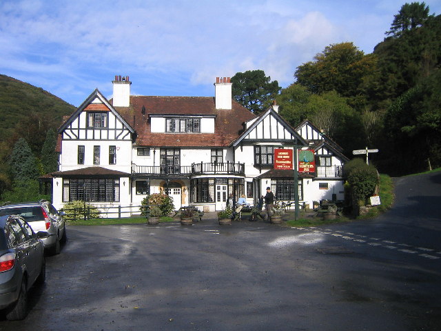
Heddon's Mouth is a rocky cove on the coast of North Devon, England, about a mile down the River Heddon from the Hunter's Inn. It is preserved for the...

Martinhoe

Martinhoe is a small settlement and civil parish in North Devon district of Devon, England. Martinhoe is within the Exmoor National Park, the smallest...

Trentishoe

Trentishoe is a village and civil parish in North Devon, England. The parish lies on the coast of the Bristol Channel. The village is 5 miles (8 km) east...

Woody Bay, Devon

Woody Bay is a bay on the North Devon coast of England, 3 miles (4.8 km) west of Lynton and 8 miles (13 km) east of Combe Martin with a stony beach. It...

Nearby Amenities

Located within 500m of 51.231077,-3.9255815
Source: PGS
Lat/Long: 51.2305901/-3.9195996
Source: PGS
Lat/Long: 51.2307265/-3.9202551
Source: PGS
Lat/Long: 51.2308975/-3.9206987
Source: PGS
Lat/Long: 51.2310163/-3.9216398
Source: PGS
Lat/Long: 51.23148/-3.9228967
Source: PGS
Lat/Long: 51.231541/-3.9230338
Source: PGS
Lat/Long: 51.2316869/-3.923833
Source: PGS
Lat/Long: 51.2317153/-3.9239568
Source: PGS
Lat/Long: 51.2317186/-3.9242211
Source: PGS
Lat/Long: 51.2320229/-3.9254157
Source: PGS
Lat/Long: 51.2320021/-3.9264039
Source: PGS
Lat/Long: 51.2316712/-3.9270402
Source: PGS
Lat/Long: 51.2301846/-3.9284973
Source: PGS
Lat/Long: 51.2300361/-3.9287531
Source: PGS
Lat/Long: 51.229894/-3.9295943
Source: PGS
Lat/Long: 51.2299456/-3.9310405
Source: PGS
Lat/Long: 51.2297532/-3.9321116
Heddon's Mouth
Natural: beach
Surface: pebblestone
Wikidata: Q5697152
Wikipedia: en:Heddon's Mouth
Lat/Long: 51.2302702/-3.929052
Source: PGS
Lat/Long: 51.229755/-3.9278022
Bench
Lat/Long: 51.2288851/-3.9228219
Bench
Lat/Long: 51.2272831/-3.9282206
Bench
Lat/Long: 51.2274333/-3.9282079
Bench
Lat/Long: 51.2288088/-3.9232724
Tourism: viewpoint
Lat/Long: 51.229406/-3.9278326
Tourism: viewpoint
Lat/Long: 51.230023/-3.9243681
The data included in this document is from www.openstreetmap.org. The data is made available under ODbL.

Have you been to Highveer Point?

Leave your review of Highveer Point below (or comments, questions and feedback).