Heddon's Mouth Beach

Beach in Devon North Devon

England

Heddon's Mouth Beach

Heddon's Mouth North Devon - an excellent 4km walk from and to the nearest parking place
Heddon's Mouth Credit: John Phillips

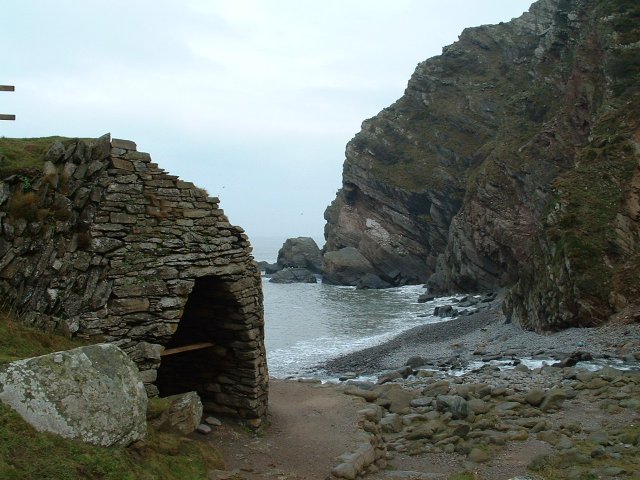
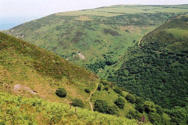
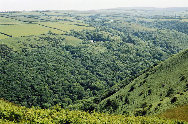
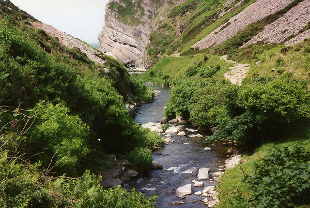
Heddon's Mouth Beach is a picturesque and secluded beach located on the North Devon coast in England. Situated within Exmoor National Park, it offers visitors a tranquil and unspoiled coastal experience. The beach is named after the nearby Heddon Valley, which is known for its stunning natural beauty.

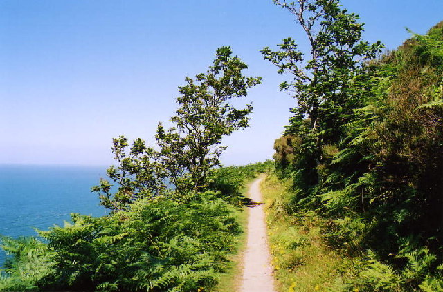
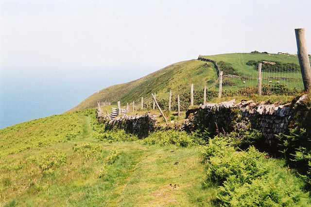
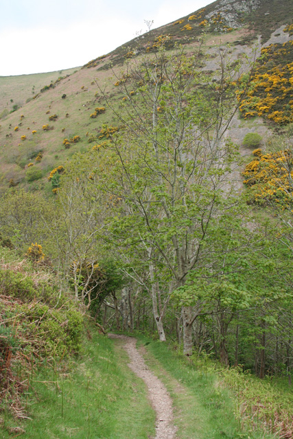
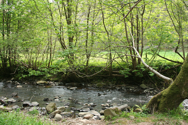
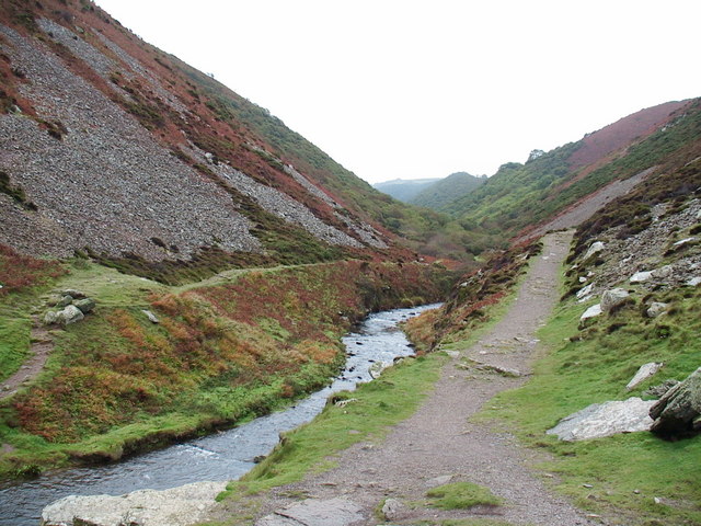
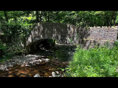
The beach itself is a mixture of pebbles, rocks, and sand, with a small stream running through it and flowing into the sea. The surrounding cliffs provide a dramatic backdrop, creating a sense of seclusion and serenity. The beach is accessible via a steep and winding path that leads down from the nearby car park, adding to its secluded charm.

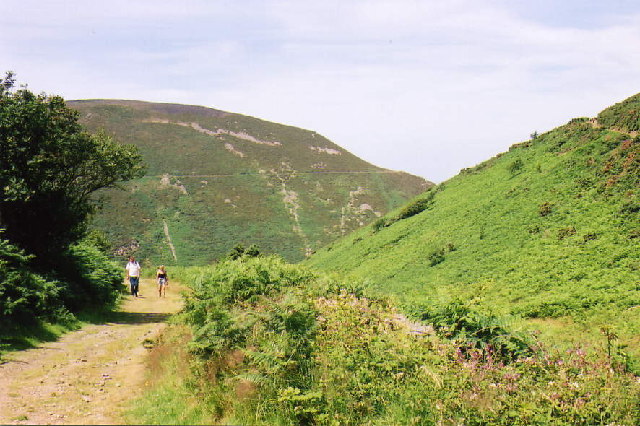
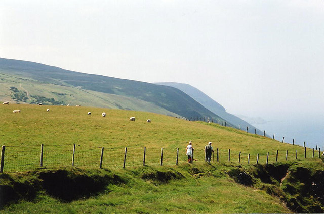
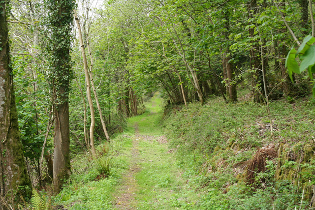
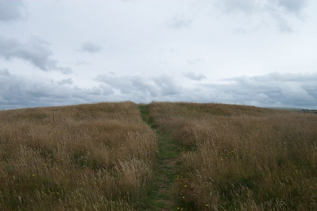
Due to its remote location, Heddon's Mouth Beach is often less crowded than other popular beaches in the area, making it an ideal spot for those seeking peace and quiet. It is popular among walkers, hikers, and nature enthusiasts, as the area offers several scenic coastal and inland trails to explore.

Visitors can enjoy a variety of activities at Heddon's Mouth Beach, including picnicking, sunbathing, and exploring the rock pools that are exposed at low tide. The beach is also a popular spot for fishing, as the sea is teeming with various species of fish.

Overall, Heddon's Mouth Beach is a hidden gem on the North Devon coast, offering visitors a peaceful and scenic escape from the hustle and bustle of everyday life. Its unspoiled beauty and remote location make it a must-visit destination for nature lovers and those seeking a truly authentic coastal experience.

If you have any feedback on the listing, please let us know in the comments section below.

Heddon's Mouth Beach Images

Images are sourced within 2km of 51.230241/-3.9277381 or Grid Reference SS6549. Thanks to Geograph Open Source API. All images are credited.

Heddon's Mouth North Devon - an excellent 4km walk from and to the nearest parking place
Heddon's Mouth
North Devon - an excellent 4km walk from and to the nearest parking place
Martinhoe Church
Martinhoe Church
Martinhoe: coast path The South West Coast Path near West Woody Bay Wood, between Heddon's Mouth and Woody Bay
Martinhoe: coast path
The South West Coast Path near West Woody Bay Wood, between Heddon's Mouth and Woody Bay
Martinhoe: upper path near Heddon's Mouth Cleave The second of two coast paths between Heddon's Mouth and Woody Bay
Martinhoe: upper path near Heddon's Mouth Cleave
The second of two coast paths between Heddon's Mouth and Woody Bay
Trentishoe: the South West Coast Path Looking east
Trentishoe: the South West Coast Path
Looking east
Trentishoe: the South West Coast Path West to Holdstone Down and the Great Hangman
Trentishoe: the South West Coast Path
West to Holdstone Down and the Great Hangman
Trentishoe: overlooking Heddon's Mouth Cleave The South West Coast Path is just visible on both sides of the valley. The higher path on the hills opposite leads to Woody Bay
Trentishoe: overlooking Heddon's Mouth Cleave
The South West Coast Path is just visible on both sides of the valley. The higher path on the hills opposite leads to Woody Bay
Trentishoe: looking south over the Heddon Valley Seen from the footpath that runs around the hill east from Trentishoe church
Trentishoe: looking south over the Heddon Valley
Seen from the footpath that runs around the hill east from Trentishoe church
Wringapeak A natural arch at the west end of Woody Bay. Taken from the Exmoor Coast Cruise boat.
Wringapeak
A natural arch at the west end of Woody Bay. Taken from the Exmoor Coast Cruise boat.
Hunters Inn, Heddons Mouth
Trentishoe: River Heddon Near Heddon’s Mouth
Trentishoe: River Heddon
Near Heddon’s Mouth
Martinhoe: bridleway near Milltown Looking north-north-east. The path or bridleway to Kings Lane
Martinhoe: bridleway near Milltown
Looking north-north-east. The path or bridleway to Kings Lane
Martinhoe: West Woodybay Wood Looking west-north-west on the lower coastal path from Woody Bay to The Hunters Inn
Martinhoe: West Woodybay Wood
Looking west-north-west on the lower coastal path from Woody Bay to The Hunters Inn
Martinhoe: near Heddon’s Mouth Cleave Approaching Heddon’s Mouth Cleave on the lower path from Woody Bay; the path leads on to The Hunters Inn, National Trust shop and car park. Looking south west
Martinhoe: near Heddon’s Mouth Cleave
Approaching Heddon’s Mouth Cleave on the lower path from Woody Bay; the path leads on to The Hunters Inn, National Trust shop and car park. Looking south west
Martinhoe: the Heddon between Hunters Inn and Heddon’s Mouth Seen from the lower path from Woody Bay
Martinhoe: the Heddon between Hunters Inn and Heddon’s Mouth
Seen from the lower path from Woody Bay
Heddon's Mouth, Exmoor Looking up the River Heddon valley showing the loose rocks on the valley side.
Heddon's Mouth, Exmoor
Looking up the River Heddon valley showing the loose rocks on the valley side.
Roman Fort just off the coastal path A worthy short excursion off the coastal path, the views are spectacular from the top.
Roman Fort just off the coastal path
A worthy short excursion off the coastal path, the views are spectacular from the top.
The coast path at Heddon's Mouth The South West Coast Path takes a detour inland just below. The two paths at the bottom are dead ends leading down to the sea and there is no path around the headland to the left.
The coast path at Heddon's Mouth
The South West Coast Path takes a detour inland just below. The two paths at the bottom are dead ends leading down to the sea and there is no path around the headland to the left.
Show me another place!

Heddon's Mouth Beach is located at Grid Ref: SS6549 (Lat: 51.230241, Lng: -3.9277381)

Administrative County: Devon

District: North Devon

Police Authority: Devon and Cornwall

What 3 Words

///gulped.coach.ethic. Near Lynton, Devon

Related Wikis

Heddon's Mouth

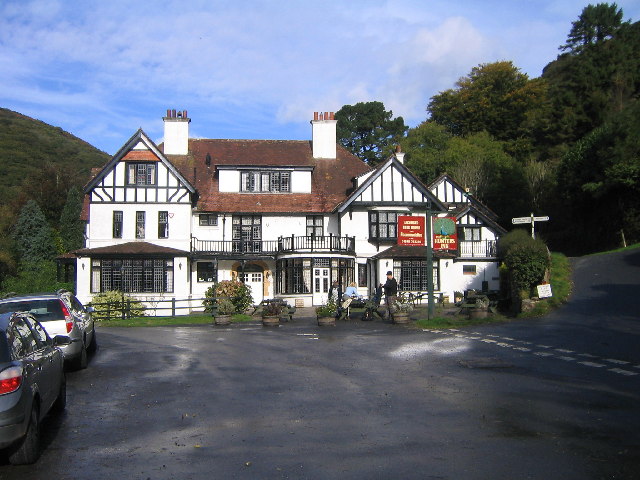
Heddon's Mouth is a rocky cove on the coast of North Devon, England, about a mile down the River Heddon from the Hunter's Inn. It is preserved for the...
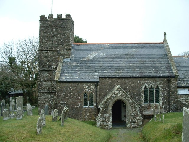
Martinhoe

Martinhoe is a small settlement and civil parish in North Devon district of Devon, England. Martinhoe is within the Exmoor National Park, the smallest...

Trentishoe

Trentishoe is a village and civil parish in North Devon, England. The parish lies on the coast of the Bristol Channel. The village is 5 miles (8 km) east...

Woody Bay, Devon

Woody Bay is a bay on the North Devon coast of England, 3 miles (4.8 km) west of Lynton and 8 miles (13 km) east of Combe Martin with a stony beach. It...

Related Videos

Stunning Heddon’s Mouth - North Devon Coast #Devon #UKDaysOut

This Heddon Valley walk in Exmoor National Park in north Devon to Heddon's Mouth is stunning! The walk starts at the National ...

Woody Bay

https://www.nationaltrust.org.uk/visit/devon/heddon-valley/heddon-valley-to-woody-bay-walk ...

Hedden’s Mouth beach, safety tips you need to see before visiting.

exmoor #devonbeaches #SWCP Welcome to our latest adventure in North Devon! In this 6-minute video, we take you to Heddon's ...

Heddons Mouth

A nice valley and walking through it will take to a rocky beach. Walk is challenging because of stones,,

Nearby Amenities

Located within 500m of 51.230241,-3.9277381
Source: PGS
Lat/Long: 51.2308975/-3.9206987
Source: PGS
Lat/Long: 51.2310163/-3.9216398
Source: PGS
Lat/Long: 51.23148/-3.9228967
Source: PGS
Lat/Long: 51.231541/-3.9230338
Source: PGS
Lat/Long: 51.2316869/-3.923833
Source: PGS
Lat/Long: 51.2317153/-3.9239568
Source: PGS
Lat/Long: 51.2317186/-3.9242211
Source: PGS
Lat/Long: 51.2320229/-3.9254157
Source: PGS
Lat/Long: 51.2320021/-3.9264039
Source: PGS
Lat/Long: 51.2316712/-3.9270402
Source: PGS
Lat/Long: 51.2301846/-3.9284973
Source: PGS
Lat/Long: 51.2300361/-3.9287531
Source: PGS
Lat/Long: 51.229894/-3.9295943
Source: PGS
Lat/Long: 51.2299456/-3.9310405
Source: PGS
Lat/Long: 51.2297532/-3.9321116
Source: PGS
Lat/Long: 51.2295591/-3.9335139
Source: PGS
Lat/Long: 51.2296644/-3.9339624
Heddon's Mouth
Natural: beach
Surface: pebblestone
Wikidata: Q5697152
Wikipedia: en:Heddon's Mouth
Lat/Long: 51.2302702/-3.929052
Source: PGS
Lat/Long: 51.229755/-3.9278022
Bench
Lat/Long: 51.2288851/-3.9228219
Bench
Lat/Long: 51.2272831/-3.9282206
Bench
Lat/Long: 51.2274333/-3.9282079
Bench
Lat/Long: 51.2288088/-3.9232724
Tourism: viewpoint
Lat/Long: 51.229406/-3.9278326
Tourism: viewpoint
Lat/Long: 51.230023/-3.9243681
The data included in this document is from www.openstreetmap.org. The data is made available under ODbL.

Have you been to Heddon's Mouth Beach?

Leave your review of Heddon's Mouth Beach below (or comments, questions and feedback).