Cockleridge Point

Coastal Feature, Headland, Point in Devon South Hams

England

Cockleridge Point

Path to Yarmouth Sand Thurlestone footpath 16, seen from where it is crossed by the coast path.
Path to Yarmouth Sand Credit: Derek Harper

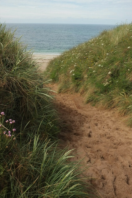
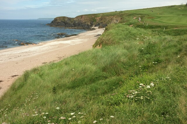
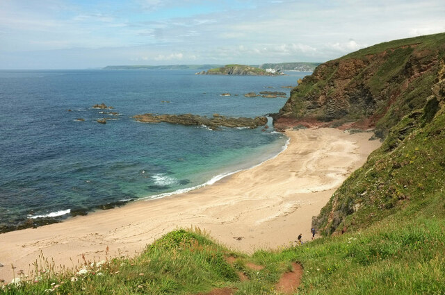
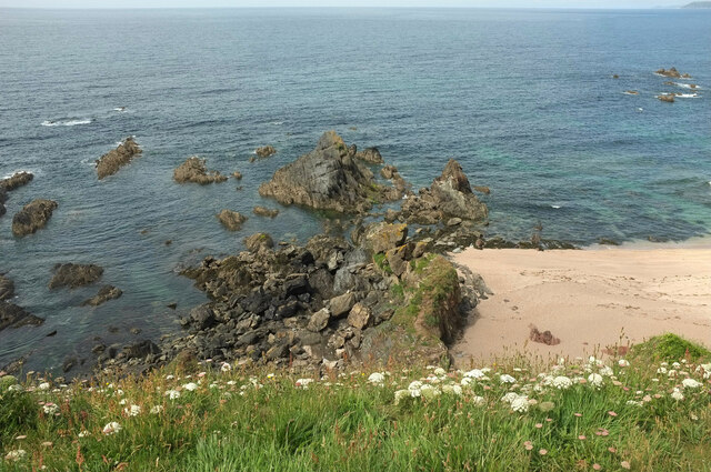
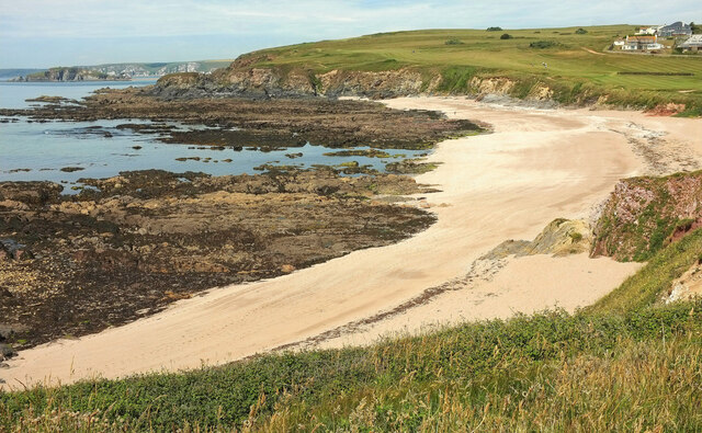
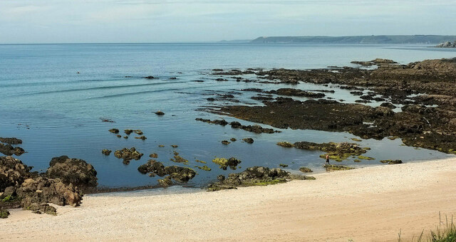
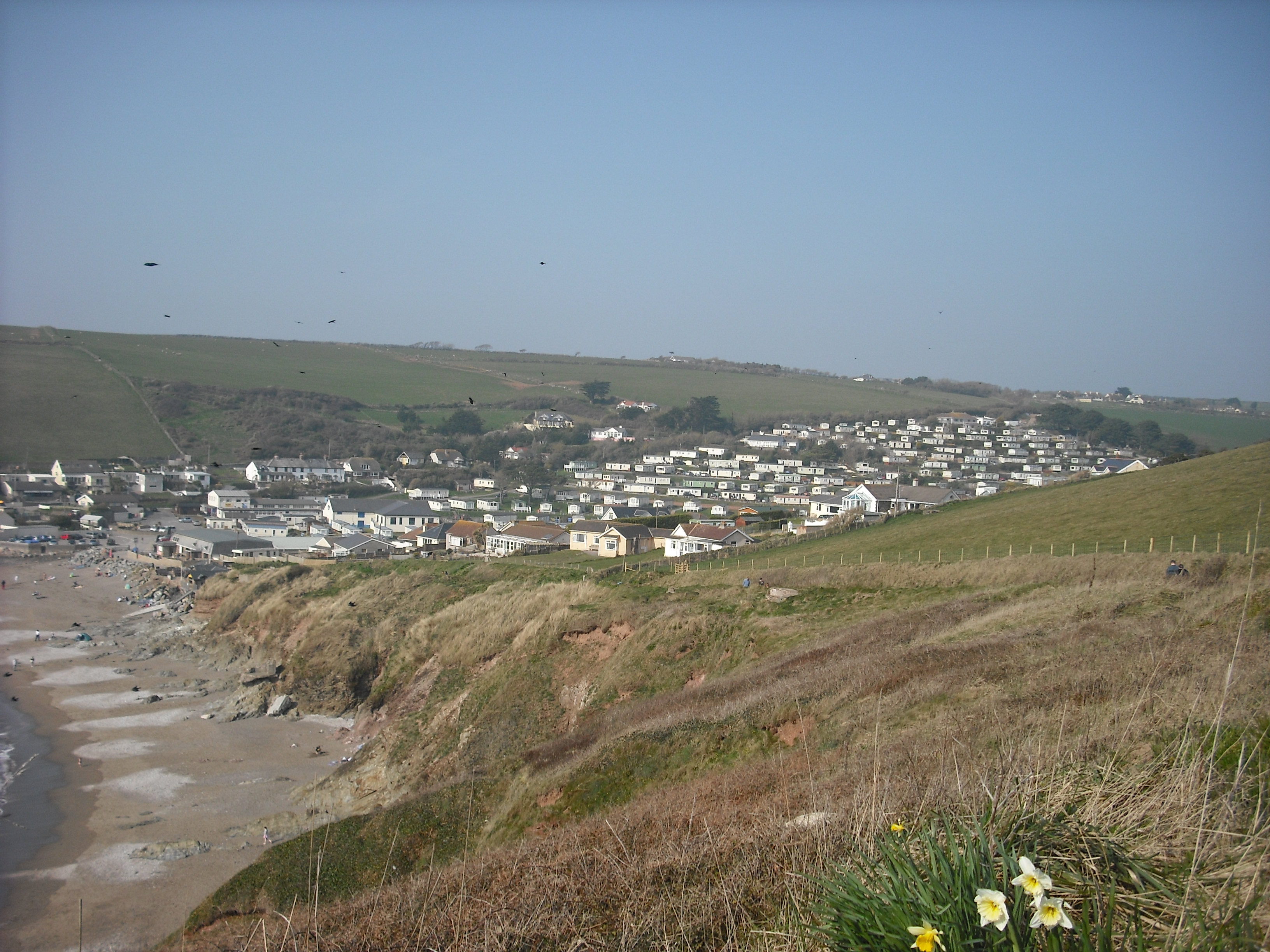
Cockleridge Point is a prominent headland located along the coast of Devon, England. Situated in the southern part of the county, it juts out into the English Channel, offering breathtaking views and unique geological features. This coastal landmark is renowned for its rugged cliffs, diverse wildlife, and historical significance.

The headland is characterized by its dramatic cliffs, which rise steeply from the sea, creating an imposing and picturesque sight. The layers of sedimentary rock found in the cliffs reveal a rich geological history, with fossils dating back millions of years. This makes Cockleridge Point a popular destination for geologists and fossil enthusiasts alike.

The point is also home to a diverse range of wildlife, both on land and in the sea. Seabird colonies, including puffins, gulls, and cormorants, can often be observed nesting on the cliffs during the breeding season. The surrounding waters provide a habitat for various marine species, such as seals, dolphins, and a variety of fish, making it a popular spot for wildlife enthusiasts and birdwatchers.

In addition to its natural beauty, Cockleridge Point holds historical significance. The headland was once a strategic location for coastal defense, with remnants of World War II bunkers and gun emplacements still visible today. These remnants serve as a reminder of the area's military past and attract history enthusiasts.

Overall, Cockleridge Point is a stunning coastal feature that offers a blend of natural beauty, geological importance, and historical interest. Whether one is captivated by its cliffs, fascinated by its fossils, or intrigued by its history, this headland is a must-visit destination for anyone exploring the Devon coastline.

If you have any feedback on the listing, please let us know in the comments section below.

Cockleridge Point Images

Images are sourced within 2km of 50.283678/-3.8756623 or Grid Reference SX6644. Thanks to Geograph Open Source API. All images are credited.

Path to Yarmouth Sand Thurlestone footpath 16, seen from where it is crossed by the coast path.
Path to Yarmouth Sand
Thurlestone footpath 16, seen from where it is crossed by the coast path.
Yarmouth Sand Loam Castle <a title="https://www.geograph.org.uk/search.php?i=155565115" href="https://www.geograph.org.uk/search.php?i=155565115">Link</a> is the headland at the north end of the beach. The distant headlands are Rame Head and Stoke Point.
Yarmouth Sand
Loam Castle Link is the headland at the north end of the beach. The distant headlands are Rame Head and Stoke Point.
Broad Sand A cove between Yarmouth Sand and Bantham Sand. Ahead is Burgh Island with its hotel.
Broad Sand
A cove between Yarmouth Sand and Bantham Sand. Ahead is Burgh Island with its hotel.
Rocks by Broad Sand Looking left from <a href="https://www.geograph.org.uk/photo/7153086">SX6642 : Broad Sand</a>.
Rocks by Broad Sand
Looking left from SX6642 : Broad Sand.
Goatsbeard near Butter Cove Tragopogon pratensis by the clifftop coastal path.
Goatsbeard near Butter Cove
Tragopogon pratensis by the clifftop coastal path.
Headland and Long Stone The long stone is seen from sea level at <a href="https://www.geograph.org.uk/photo/6229771">SX6543 : Long Stone</a>. Here it is seen from the clifftop coast path.
Headland and Long Stone
The long stone is seen from sea level at SX6543 : Long Stone. Here it is seen from the clifftop coast path.
Cliff southeast of Butter Cove And northwest of Broad Sand. A wide grassy shelf has developed a little down from the clifftop.
Cliff southeast of Butter Cove
And northwest of Broad Sand. A wide grassy shelf has developed a little down from the clifftop.
Rocks near Loam Castle The principal stack can be seen on the left of <a href="https://www.geograph.org.uk/photo/5924310">SX6642 : Rocks, Loam Castle</a>.
Rocks near Loam Castle
The principal stack can be seen on the left of SX6642 : Rocks, Loam Castle.
Yarmer Beach A sandy cove with broad wave-cut platforms north of Warren Point, seen from the coast path. Burgh Island is glimpsed on the left.
Yarmer Beach
A sandy cove with broad wave-cut platforms north of Warren Point, seen from the coast path. Burgh Island is glimpsed on the left.
Rocks, Yarmer Beach Across the sandy beach and rocks exposed at low tide.
Rocks, Yarmer Beach
Across the sandy beach and rocks exposed at low tide.
Hole in the coast path near Thurlestone A tripod of poles deters the unwary.
Hole in the coast path near Thurlestone
A tripod of poles deters the unwary.
Path above the Avon estuary Walkers follow Thurlestone footpath 19 along a ridge to meet the coast path above the Long Stone. The tide is out and Burgh Island, partly obscured, is linked to the mainland, while sandbanks predominate in the Avon estuary.
Path above the Avon estuary
Walkers follow Thurlestone footpath 19 along a ridge to meet the coast path above the Long Stone. The tide is out and Burgh Island, partly obscured, is linked to the mainland, while sandbanks predominate in the Avon estuary.
Wave-cut platform near Bantham Sand Looking towards Burgh Island, linked at low tide to Bigbury-on-Sea on the mainland..
Wave-cut platform near Bantham Sand
Looking towards Burgh Island, linked at low tide to Bigbury-on-Sea on the mainland..
Cattle, Bantham A thoroughly bucolic scene by the Buckland Stream next to the car park for Bantham Sand.
Cattle, Bantham
A thoroughly bucolic scene by the Buckland Stream next to the car park for Bantham Sand.
Avon estuary at Bantham From near the payment booth for the car park, looking upstream.
Avon estuary at Bantham
From near the payment booth for the car park, looking upstream.
Buckland Stream valley Thurlestone footpath 4 plunges steeply down the valley side past the corner of a small wood and climbs less steeply into Bantham.
Buckland Stream valley
Thurlestone footpath 4 plunges steeply down the valley side past the corner of a small wood and climbs less steeply into Bantham.
Bantham The village seen across the Buckland Stream valley. Unnamed woods line the slopes across the (almost) entirely hidden Avon estuary.
Bantham
The village seen across the Buckland Stream valley. Unnamed woods line the slopes across the (almost) entirely hidden Avon estuary.
All Saints church, Thurlestone The fine tower of the grade II* listed church also appears in many of the photos at <a title="https://www.geograph.org.uk/search.php?i=159412655" href="https://www.geograph.org.uk/search.php?i=159412655">Link</a> .
All Saints church, Thurlestone
The fine tower of the grade II* listed church also appears in many of the photos at Link .
Show me another place!

Cockleridge Point is located at Grid Ref: SX6644 (Lat: 50.283678, Lng: -3.8756623)

Administrative County: Devon

District: South Hams

Police Authority: Devon and Cornwall

What 3 Words

///filer.picnic.sulked. Near Kingsbridge, Devon

Related Wikis

Bantham

Bantham is a coastal village in south Devon, England. It is in the South Hams district and lies on the estuary of the River Avon a quarter of a mile from...

River Avon, Devon

The River Avon, also known as the River Aune, is a river in the county of Devon in the southwest of England. It rises in the southern half of Dartmoor...

Bigbury-on-Sea

Bigbury-on-Sea is a village in the South Hams district on the south coast of Devon, England. It is part of the civil parish of Bigbury which is centred...

Challaborough

Challaborough is a village and popular surfing beach in the District of South Hams on the south coast of Devon, England. The village is in the parish of...

Burgh Island Hotel

The Burgh Island Hotel is a hotel on Burgh Island, Devon in England. == History == In the 1890s, the music hall star George H. Chirgwin built a prefabricated...

Burgh Island

Burgh Island is a tidal island on the coast of South Devon in England near the small seaside village of Bigbury-on-Sea. There are several buildings on...

Thurlestone

Thurlestone is a village located 5 miles (8.0 km) west of Kingsbridge in the South Hams district in south Devon, England. There is an electoral ward in...

Bigbury

Bigbury is a village and civil parish in the South Hams district of Devon, England. According to the 2001 census the parish had a population of 582, compared...

Nearby Amenities

Located within 500m of 50.283678,-3.8756623
Source: PGS
Lat/Long: 50.2798482/-3.8759327
Source: PGS
Lat/Long: 50.2806411/-3.8771284
Source: PGS
Lat/Long: 50.281225/-3.8761825
Source: PGS
Lat/Long: 50.2811931/-3.8749062
Source: PGS
Lat/Long: 50.2793832/-3.8738098
Source: PGS
Lat/Long: 50.2794417/-3.8743339
Source: PGS
Lat/Long: 50.2809878/-3.8739884
Source: PGS
Lat/Long: 50.2811005/-3.8726143
Source: PGS
Lat/Long: 50.2812231/-3.8718639
Source: PGS
Lat/Long: 50.2813473/-3.8713698
Source: PGS
Lat/Long: 50.2813479/-3.8708024
Source: PGS
Lat/Long: 50.2815333/-3.8703288
Source: PGS
Lat/Long: 50.2817054/-3.8697839
Source: PGS
Lat/Long: 50.2819786/-3.8693331
Source: PGS
Lat/Long: 50.2821706/-3.8690744
Source: PGS
Lat/Long: 50.2815475/-3.8763122
Source: PGS
Lat/Long: 50.2813277/-3.8770608
Source: PGS
Lat/Long: 50.2818426/-3.8777112
Source: PGS
Lat/Long: 50.2818021/-3.8800081
Source: PGS
Lat/Long: 50.2815749/-3.8797289
Source: PGS
Lat/Long: 50.2807511/-3.8795538
Source: PGS
Lat/Long: 50.2805424/-3.8796167
Source: PGS
Lat/Long: 50.2804893/-3.8795845
Source: PGS
Lat/Long: 50.2802452/-3.8794717
Source: PGS
Lat/Long: 50.2797607/-3.8790388
Source: PGS
Lat/Long: 50.2797502/-3.8789711
Barrier: kissing_gate
Lat/Long: 50.2838837/-3.8765667
Source: PGS
Lat/Long: 50.2805296/-3.8794177
Source: PGS
Lat/Long: 50.2818323/-3.8798653
Barrier: kissing_gate
Lat/Long: 50.2861633/-3.8803319
Bench
Backrest: yes
Lat/Long: 50.2856261/-3.8786745
Bench
Backrest: yes
Lat/Long: 50.2854605/-3.8782782
Ferry Terminal
Ferry: yes
Public Transport: station
Lat/Long: 50.2811806/-3.8734787
Information: guidepost
Tourism: information
Lat/Long: 50.2868686/-3.8744084
Information: guidepost
Tourism: information
Lat/Long: 50.2881117/-3.8753294
Bench
Backrest: yes
Lat/Long: 50.2794004/-3.8753445
Bench
Lat/Long: 50.2811108/-3.877357
The data included in this document is from www.openstreetmap.org. The data is made available under ODbL.

Have you been to Cockleridge Point?

Leave your review of Cockleridge Point below (or comments, questions and feedback).