Creepinghole Point

Coastal Feature, Headland, Point in Cornwall

England

Creepinghole Point

Rocks at Trevelgue Head View north from the footbridge joining the promontory to the mainland.
Rocks at Trevelgue Head Credit: David Weston

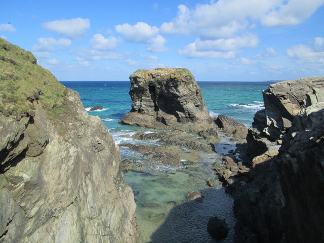
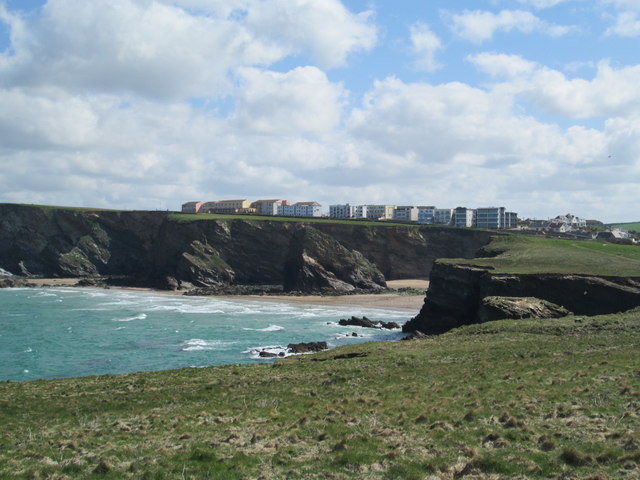
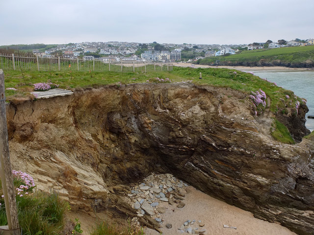
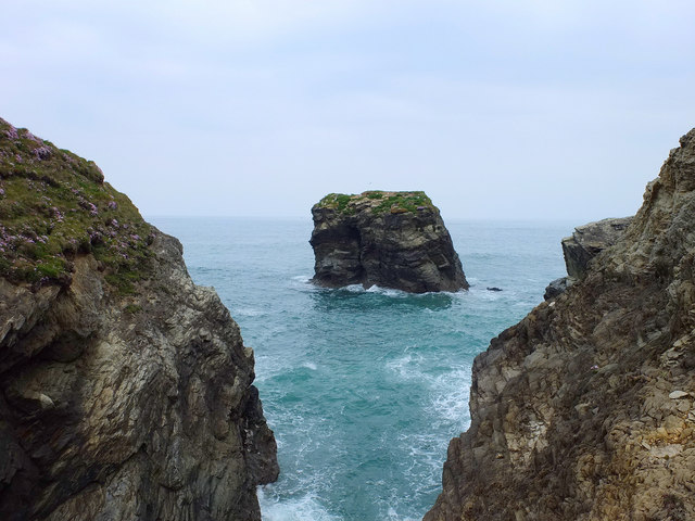
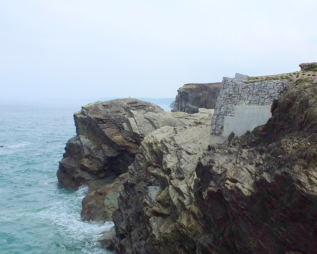
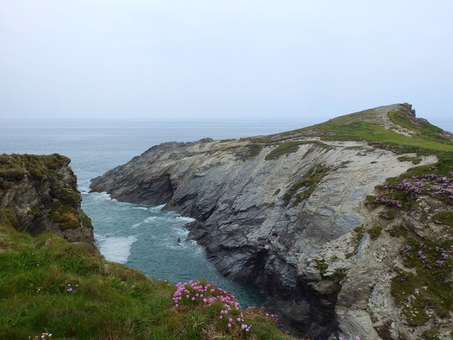
Creepinghole Point is a captivating coastal feature located in Cornwall, England. Positioned as a headland, or point, it juts out into the Atlantic Ocean, offering breathtaking views and a stunning natural landscape.

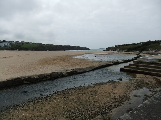
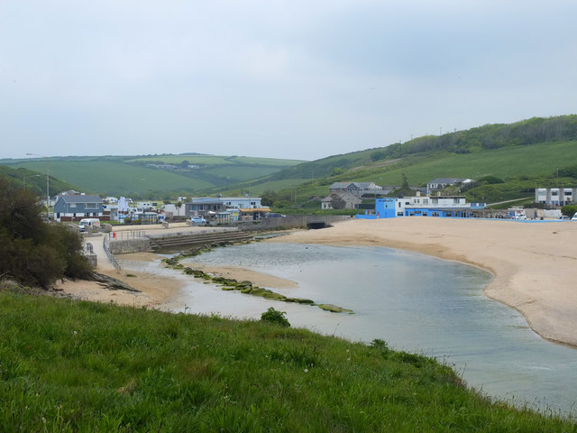
This rocky promontory is nestled in the southwestern part of Cornwall, near the charming village of Zennor. Its strategic location provides visitors with picturesque vistas of the surrounding coastline, characterized by towering cliffs, pristine beaches, and the vast expanse of the ocean.

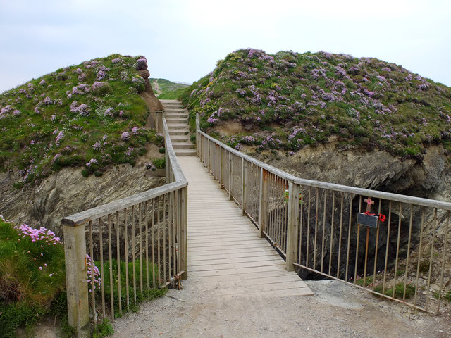
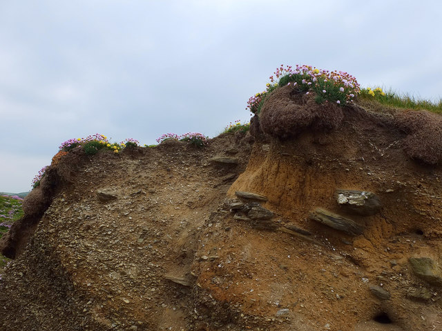
Creepinghole Point is renowned for its rugged beauty and rich biodiversity. The headland is covered in lush vegetation, including hardy grasses and wildflowers that flourish in the salty sea air. These plants provide a habitat for a variety of bird species, making it a popular spot for birdwatchers.

The area is also a haven for marine life, with seals and dolphins often spotted frolicking in the waters offshore. The rocky shoreline boasts numerous tide pools, which are teeming with colorful sea anemones, crabs, and small fish, offering a fascinating opportunity for exploration and discovery.

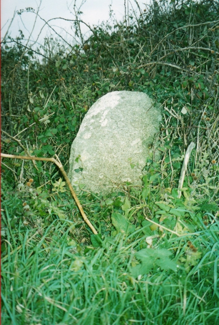
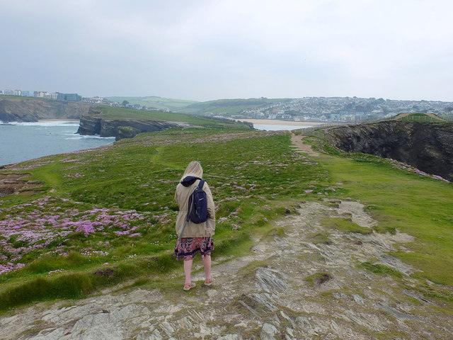
For those seeking outdoor adventures, Creepinghole Point offers several hiking trails that wind through the headland, allowing visitors to fully immerse themselves in its natural splendor. Along these trails, one can find remnants of Bronze Age settlements and old mine workings, providing a glimpse into the rich history of the area.

Overall, Creepinghole Point is a captivating coastal feature that combines stunning natural beauty, abundant wildlife, and a rich cultural heritage, making it an ideal destination for nature enthusiasts and history buffs alike.

If you have any feedback on the listing, please let us know in the comments section below.

Creepinghole Point Images

Images are sourced within 2km of 50.438422/-5.0471796 or Grid Reference SW8364. Thanks to Geograph Open Source API. All images are credited.

Rocks at Trevelgue Head View north from the footbridge joining the promontory to the mainland.
Rocks at Trevelgue Head
View north from the footbridge joining the promontory to the mainland.
View east from Trevelgue Head Seen from Trevelgue Head, the coastline to the north-east.
View east from Trevelgue Head
Seen from Trevelgue Head, the coastline to the north-east.
Northward at Watergate Bay, 1995 Northward on the B3276 road to Stem Point and Griffins Point, past the celebrated Watergate Bay Hotel. {Cf. <a href="https://www.geograph.org.uk/photo/523402">SW8464 : Watergate Bay Hotel</a>}.
Northward at Watergate Bay, 1995
Northward on the B3276 road to Stem Point and Griffins Point, past the celebrated Watergate Bay Hotel. {Cf. SW8464 : Watergate Bay Hotel}.
Beach at Porth
Beach at Porth
Old Milestone by the B3276, Watergate Road Carved stone post by the B3276, in parish of NEWQUAY (RESTORMEL District), in lay-by, to left of footpath sign, on North side of road, remains of white paint (2001). Gravestone, erected by the parish in the 19th century. 

Inscription invisible.

Milestone Society National ID: CW_PSNQ.
Old Milestone by the B3276, Watergate Road
Carved stone post by the B3276, in parish of NEWQUAY (RESTORMEL District), in lay-by, to left of footpath sign, on North side of road, remains of white paint (2001). Gravestone, erected by the parish in the 19th century. Inscription invisible. Milestone Society National ID: CW_PSNQ.
Coastal Erosion at Trevelgue Head
Footbridge to Porth Island
Norwegian Rock North East of Porth Island, Cornwall
Norwegian Rock
North East of Porth Island, Cornwall
Coastal Erosion Prevention at Trevelgue Head Protecting the coastal path
Coastal Erosion Prevention at Trevelgue Head
Protecting the coastal path
Trevelgue Head
Trevelgue Head
Trevelgue Head, Cornwall
Soil Profile, Porth Island
Porth Beach, Cornwall
Porth Reservoir Drain at Porth Beach
Watergate
Watergate
B3276 Tregurrian Village Sign
B3276 Watergate Bay Village Sign
Entering Watergate Bay
Show me another place!

Creepinghole Point is located at Grid Ref: SW8364 (Lat: 50.438422, Lng: -5.0471796)

Unitary Authority: Cornwall

Police Authority: Devon and Cornwall

What 3 Words

///catapult.ages.conjured. Near Newquay, Cornwall

Related Wikis

Boardmasters Festival

Boardmasters Festival is an annual event held in Cornwall, United Kingdom, usually spanning five days on the second weekend of August. The event is a combination...
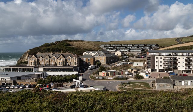
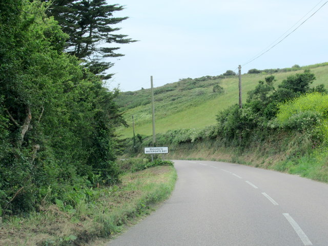
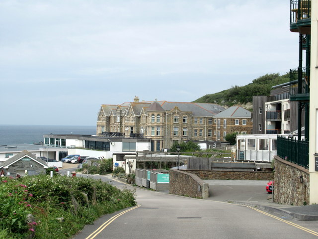
Watergate Beach

Watergate Beach is a two-mile-long stretch of sandy beach on the Atlantic coast of north Cornwall, England, United Kingdom. It is situated in Watergate...
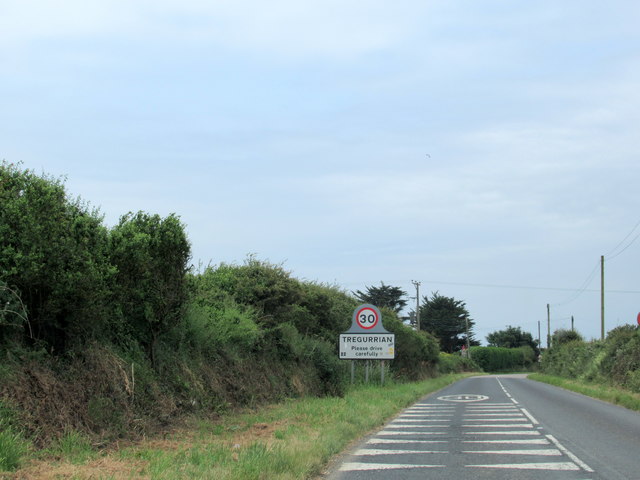
Tregurrian

Tregurrian (Cornish: Tregoryan, meaning Coryan's farm) is a hamlet 2 miles north-northeast of Newquay, on the north coast of Cornwall, England, United...

Trevelgue Head

Trevelgue Head, also known as Porth Island, is a headland north-east of Newquay, Cornwall, England, next to Porth at the eastern end of Newquay Bay. It...

Nearby Amenities

Located within 500m of 50.438422,-5.0471796
Source: PGS
Lat/Long: 50.4421946/-5.0434718
Source: PGS
Lat/Long: 50.4419106/-5.0440291
Source: PGS
Lat/Long: 50.441646/-5.0442082
Source: PGS
Lat/Long: 50.4415569/-5.0445233
Source: PGS
Lat/Long: 50.4413549/-5.044734
Source: PGS
Lat/Long: 50.4413158/-5.0449257
Source: PGS
Lat/Long: 50.441263/-5.0450196
Source: PGS
Lat/Long: 50.4408209/-5.0458596
Source: PGS
Lat/Long: 50.4407865/-5.0459914
Source: PGS
Lat/Long: 50.4406873/-5.0460438
Source: PGS
Lat/Long: 50.4405498/-5.0460084
Source: PGS
Lat/Long: 50.440502/-5.0460854
Source: PGS
Lat/Long: 50.440438/-5.0461884
Source: PGS
Lat/Long: 50.4400265/-5.0466772
Source: PGS
Lat/Long: 50.4385348/-5.0485324
Source: PGS
Lat/Long: 50.4370966/-5.048105
Source: PGS
Lat/Long: 50.4365431/-5.0483303
Source: PGS
Lat/Long: 50.4361057/-5.0488882
Source: PGS
Lat/Long: 50.4356274/-5.0495319
Source: PGS
Lat/Long: 50.435436/-5.0495641
Source: PGS
Lat/Long: 50.4353062/-5.0494461
Bus Stop
Trebelsue Turning
Bench: no
Bin: no
Bus: yes
Naptan AtcoCode: 0800FWX38536
Naptan Bearing: E
Naptan CommonName: Trebelsue Turning
Naptan NaptanCode: cordagdt
Naptan PlusbusZoneRef: NEWQUAY
Naptan Street: Watergate Road
Naptan Verified: no
Public Transport: platform
Shelter: no
Source: naptan_import
Lat/Long: 50.4374798/-5.040796
Bus Stop
Trebelsue Turning
Bench: no
Bus: yes
Naptan AtcoCode: 0800FWX38578
Naptan Bearing: W
Naptan CommonName: Trebelsue Corner
Naptan NaptanCode: cordagdp
Naptan PlusbusZoneRef: NEWQUAY
Naptan Street: Watergate Road
Naptan Verified: no
Public Transport: platform
Shelter: no
Source: naptan_import
Lat/Long: 50.4374003/-5.0408314
Fire Hydrant
Emergency: fire_hydrant
Fire Hydrant Type: underground
Survey Date: 2024-02-18
Lat/Long: 50.4373965/-5.0406406
The data included in this document is from www.openstreetmap.org. The data is made available under ODbL.

Have you been to Creepinghole Point?

Leave your review of Creepinghole Point below (or comments, questions and feedback).