A' Chabag

Coastal Feature, Headland, Point in Ross-shire

Scotland

A' Chabag

Mouth of Loch Odhairn from Tom an Fhuadain
Mouth of Loch Odhairn from Tom an Fhuadain Credit: Alan Reid

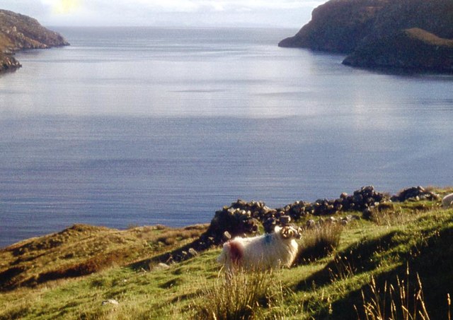
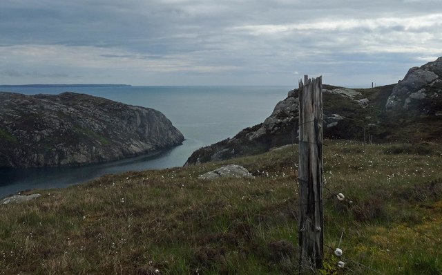
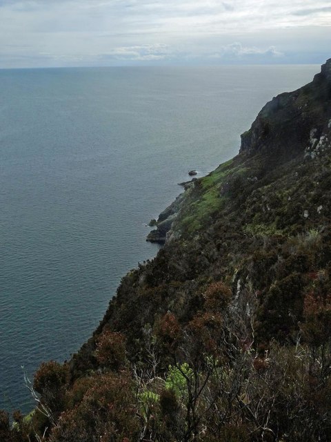
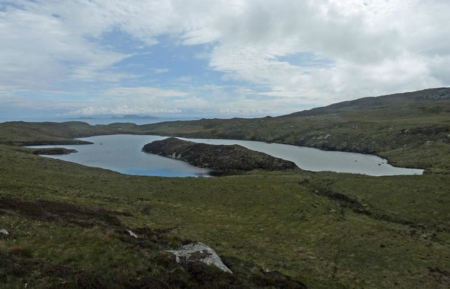
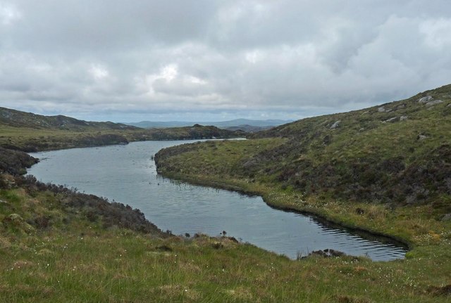
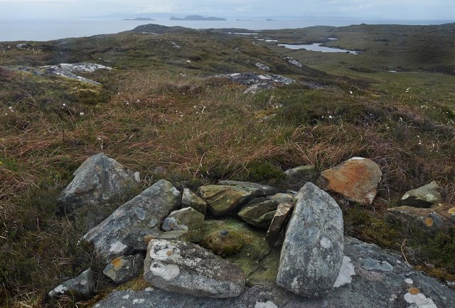
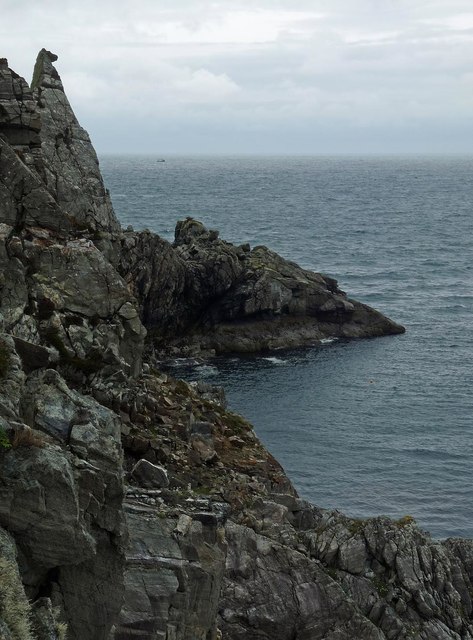
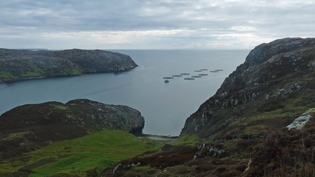
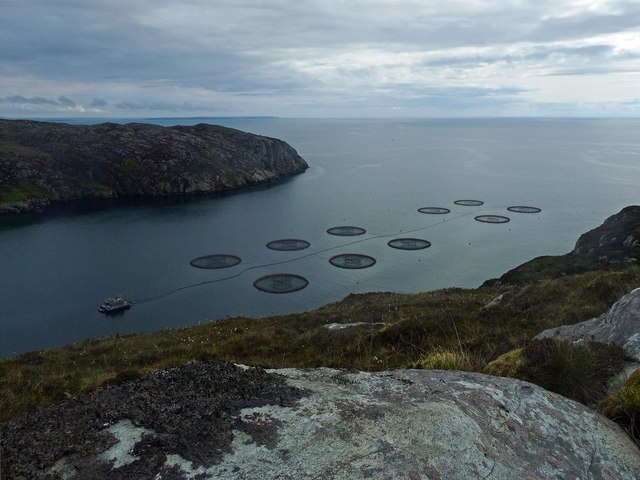
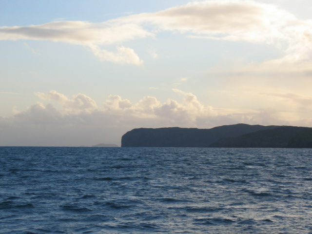
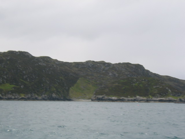
A' Chabag is a prominent coastal feature located in Ross-shire, Scotland. It is an impressive headland that extends into the sea, forming a distinctive point along the coastline. Situated in an area of outstanding natural beauty, A' Chabag offers breathtaking views of the surrounding landscape and the vast expanse of the North Sea.

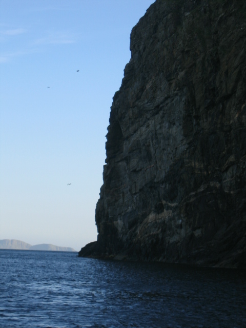
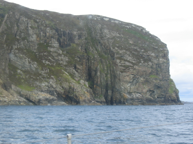
The headland is characterized by its rugged cliffs that rise dramatically from the water, reaching heights of up to 100 meters. These cliffs are composed of a variety of rock types, including sandstone and shale, which have been shaped over millions of years by the relentless forces of erosion. This geological diversity is a testament to the region's rich natural history.

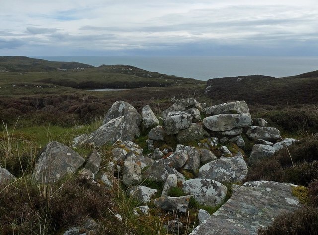
A' Chabag is also home to a diverse range of flora and fauna. The headland's coastal grasslands provide a habitat for a variety of plant species, including sea thrift, sea campion, and wild thyme. Birdwatchers will be delighted by the presence of seabird colonies, such as guillemots, razorbills, and puffins, which nest along the cliffs during the breeding season.

The area surrounding A' Chabag is a haven for outdoor enthusiasts. Visitors can explore the headland on foot, following the well-maintained coastal path that offers stunning panoramic views. The rocky shoreline is also popular with rock climbers, who are drawn to the challenging routes and breathtaking vistas.

Overall, A' Chabag is a captivating coastal feature that showcases the raw beauty of Scotland's coastline. Its towering cliffs, diverse wildlife, and stunning vistas make it a must-visit destination for nature lovers and adventure seekers alike.

If you have any feedback on the listing, please let us know in the comments section below.

A' Chabag Images

Images are sourced within 2km of 58.039553/-6.3605273 or Grid Reference NB4213. Thanks to Geograph Open Source API. All images are credited.

Mouth of Loch Odhairn from Tom an Fhuadain
Fence post above Creag an Easa Dhuibh,  Isle of Lewis Looking across Loch Odhairn to Creag Nèill which also lies within the grid square.
Fence post above Creag an Easa Dhuibh, Isle of Lewis
Looking across Loch Odhairn to Creag Nèill which also lies within the grid square.
Coastline below Druim Chlachan Mòra, Isle of Lewis Looking towards the mouth of Loch Odhairn.
Coastline below Druim Chlachan Mòra, Isle of Lewis
Looking towards the mouth of Loch Odhairn.
Shieling, Gearraidh nam Beidigean, Isle of Lewis The OS Name Book of 1848-1852 describes Gearraidh nam Beidigean as, "A number of shielings, some of which are occupied by the people of Gravir for about six weeks in the summer season, the remainder are in ruins."
Shieling, Gearraidh nam Beidigean, Isle of Lewis
The OS Name Book of 1848-1852 describes Gearraidh nam Beidigean as, "A number of shielings, some of which are occupied by the people of Gravir for about six weeks in the summer season, the remainder are in ruins."
Loch an Eilein Leith, Isle of Lewis Behind the peninsula, not visible in the photo, is a small island from which the loch gets its name, which can be translated as Grey Island Loch.

The Shiant Islands can be seen on the horizon.
Loch an Eilein Leith, Isle of Lewis
Behind the peninsula, not visible in the photo, is a small island from which the loch gets its name, which can be translated as Grey Island Loch. The Shiant Islands can be seen on the horizon.
Unnamed lochan below Sidhean Donn, Isle of Lewis
OS Bolt, Druim Chlachan Mòra, Isle of Lewis The bolt is marked with the triangulation pillar symbol on the OS 1:25,000 map, but is not shown on the 1:50,000.

The Shiant Islands can be seen on the horizon.
OS Bolt, Druim Chlachan Mòra, Isle of Lewis
The bolt is marked with the triangulation pillar symbol on the OS 1:25,000 map, but is not shown on the 1:50,000. The Shiant Islands can be seen on the horizon.
Coastline to the north of Mol an Eich, Isle of Lewis Maybe not so clear in the photo, but the rock on the skyline has the appearance of a horse looking out to sea.
Coastline to the north of Mol an Eich, Isle of Lewis
Maybe not so clear in the photo, but the rock on the skyline has the appearance of a horse looking out to sea.
Mol na Ceannamhoir, Isle of Lewis There used to be a summer settlement of four shieling huts on the edge of the pasture behind the beach.
Mol na Ceannamhoir, Isle of Lewis
There used to be a summer settlement of four shieling huts on the edge of the pasture behind the beach.
Fish farm, Loch Odhairn, Isle of Lewis At the time of uploading, the farm is operated by The Scottish Salmon Company and produces Atlantic salmon.  Also on the farm are wrasse and lumpsucker which are "cleaner fish" used to control sea lice.
Fish farm, Loch Odhairn, Isle of Lewis
At the time of uploading, the farm is operated by The Scottish Salmon Company and produces Atlantic salmon. Also on the farm are wrasse and lumpsucker which are "cleaner fish" used to control sea lice.
Kebock Head Prominent Headland on East Coast of Island of Lewis. The Shiant Islands can be seen in the distance
Kebock Head
Prominent Headland on East Coast of Island of Lewis. The Shiant Islands can be seen in the distance
Creag Mhor A Chabag One of the most prominent Headlands on the East Coast of Lewis,Kebock Head is on the south side of Loch Odhairn. One of the Shiant Islands is visible east of the headland.
Creag Mhor A Chabag
One of the most prominent Headlands on the East Coast of Lewis,Kebock Head is on the south side of Loch Odhairn. One of the Shiant Islands is visible east of the headland.
Ceann Mor Loch Odhairn Very distinctive fence line can be seen running up from beach at Ceannmor where grass has been reseeded to reclaim moorland from heather.
Ceann Mor Loch Odhairn
Very distinctive fence line can be seen running up from beach at Ceannmor where grass has been reseeded to reclaim moorland from heather.
A' Chabag One of the most prominent headlands on the east coast of Lewis
A' Chabag
One of the most prominent headlands on the east coast of Lewis
Show me another place!

A' Chabag is located at Grid Ref: NB4213 (Lat: 58.039553, Lng: -6.3605273)

Unitary Authority: Na h-Eileanan an Iar

Police Authority: Highlands and Islands

What 3 Words

///desire.spaceship.bathtubs. Near Leurbost, Na h-Eileanan Siar

Related Wikis

Calbost

Calbost (Scottish Gaelic: Calabost) is a village on the Isle of Lewis in the Outer Hebrides, Scotland. Calbost is within the parish of Lochs, and within...

Gravir

Gravir (Scottish Gaelic: Grabhair), is a village on the shore of Loch Odhairn (a sea loch) in the Park district of the Isle of Lewis. Gravir is within...

Eilean Liubhaird

Eilean Liubhaird or Eilean Iubhard is an island in the Outer Hebrides, to the east of Lewis. == Geography and geology == The rock is "gneiss bedrock with...

Orinsay

Orinsay (Scottish Gaelic: Orasaigh) is a crofting village on the Isle of Lewis in the district of Pairc, in the Outer Hebrides, Scotland. The settlement...

Cromore

Cromore (Scottish Gaelic: Crò Mòr) is a crofting township on the Isle of Lewis in the district of Pairc, in the Outer Hebrides, Scotland. The settlement...

Stiomrabhaig

Stiomrabhaig is an abandoned crofter's village on the Isle of Lewis in the Outer Hebrides. == History == The United Kingdom Census 1851 shows that the...

Eilean Chaluim Chille

Eilean Chaluim Chille (Gaelic: island of Saint Columba, Calum Cille) is an unpopulated island in the Outer Hebrides. It lies off the east coast of Lewis...

Cabharstadh

Cabharstadh or Caversta (Scottish Gaelic: Cabharstaigh) is a village on the Isle of Lewis in the Outer Hebrides, Scotland. Caversta is situated in the...

Nearby Amenities

Located within 500m of 58.039553,-6.3605273
Created By: dmgroom_coastlines
Lat/Long: 58.04057/-6.36227
The data included in this document is from www.openstreetmap.org. The data is made available under ODbL.

Have you been to A' Chabag?

Leave your review of A' Chabag below (or comments, questions and feedback).