Lochan nan Cnàmh

Lake, Pool, Pond, Freshwater Marsh in Ross-shire

Scotland

Lochan nan Cnàmh

Moorland below Beinn Bhreac
Moorland below Beinn Bhreac Credit: Mike Dunn

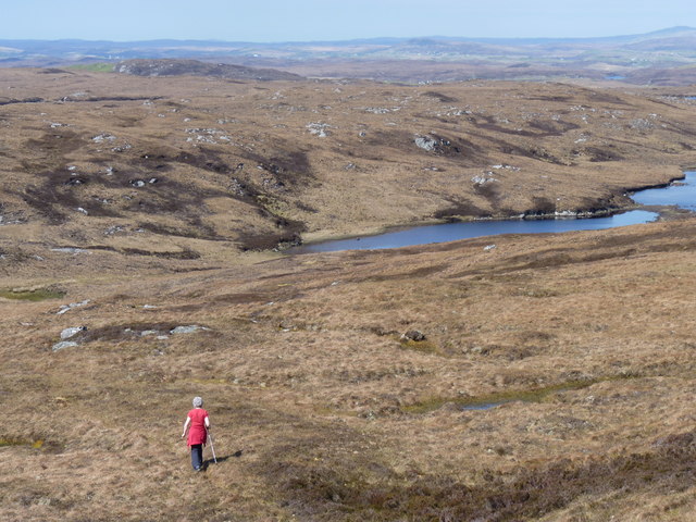
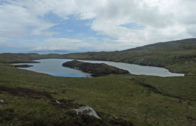
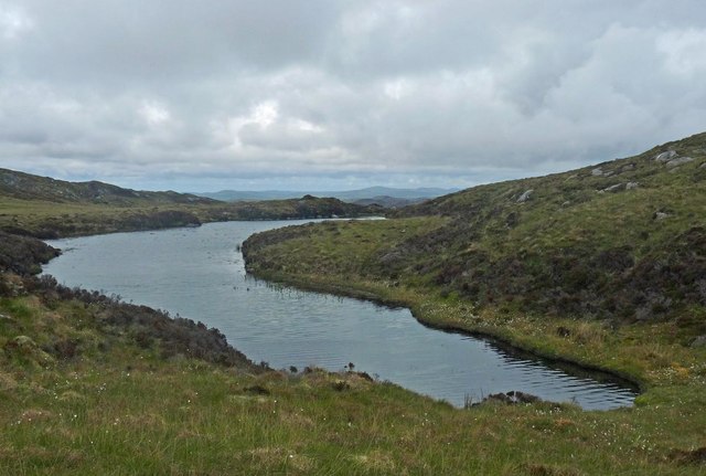
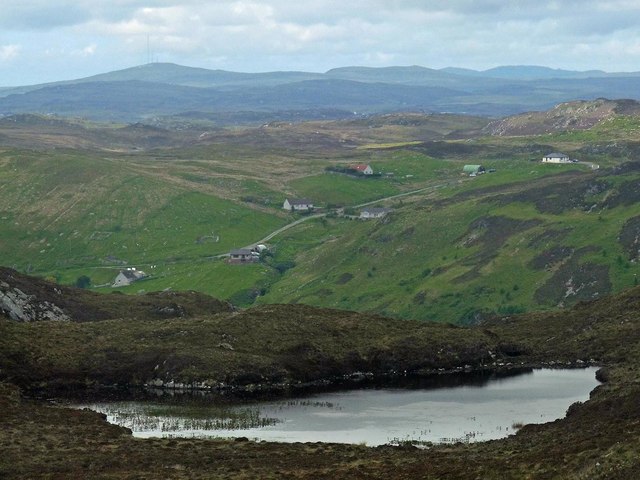
Lochan nan Cnàmh is a picturesque freshwater loch located in Ross-shire, Scotland. Situated amidst the beautiful Scottish Highlands, this loch serves as a significant natural feature in the region. The name "Lochan nan Cnàmh" translates to "loch of the caves" in English, referring to the numerous small caves that surround the loch's perimeter.

Covering an area of approximately 10 hectares, Lochan nan Cnàmh is relatively small in size compared to other lochs in the area. It is characterized by its calm and tranquil waters, reflecting the stunning mountainous landscape that surrounds it. The loch is fed by small streams and springs, ensuring a constant flow of fresh water.

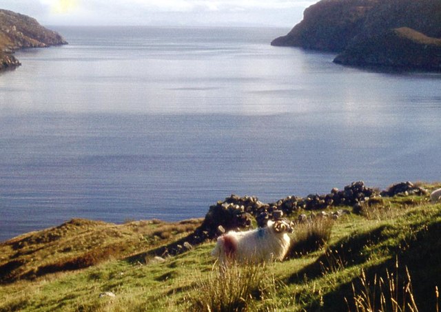
The loch serves as an important habitat for a variety of flora and fauna. Its shores are adorned with lush vegetation, including reeds, grasses, and shrubs. This rich plant life provides a habitat for small mammals, birds, and insects that thrive in the area. The loch itself is home to various species of fish, such as trout and salmon, which attract anglers and fishing enthusiasts.

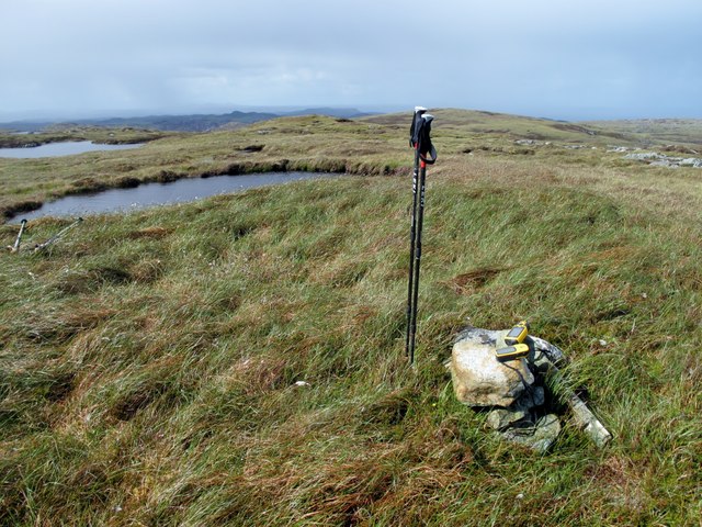
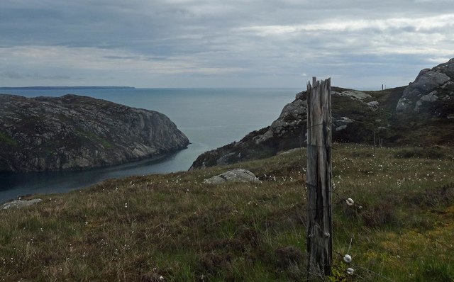
Lochan nan Cnàmh is a popular destination for nature lovers, hikers, and photographers. Its serene and idyllic setting offers breathtaking views of the surrounding mountains and reflects the rugged beauty of the Scottish Highlands. Visitors can enjoy leisurely walks around the loch, observing the diverse wildlife and taking in the tranquility of the natural environment.

Overall, Lochan nan Cnàmh is a captivating freshwater loch that showcases the natural splendor of Ross-shire. Its picturesque surroundings and abundant wildlife make it a must-visit destination for those seeking a peaceful and immersive experience in the Scottish Highlands.

If you have any feedback on the listing, please let us know in the comments section below.

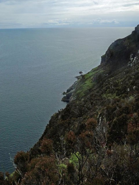
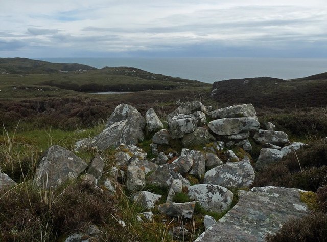
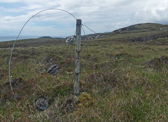
Lochan nan Cnàmh Images

Images are sourced within 2km of 58.032315/-6.3714955 or Grid Reference NB4213. Thanks to Geograph Open Source API. All images are credited.

Moorland below Beinn Bhreac
Beinn Bhreac, Lewis With Jim Bloomer and Mat Webster from NW on a sunny late afternoon.

Name: Beinn Bhreac
Hill number: 1584
Height: 191m / 627ft
Area: 24A: Lewis and Nearby Islands
Class: Ma
Grid ref: NB 40680 12104
Summit feature: small cairn
Drop: 160m
Col: 31m  NB334138
Beinn Bhreac, Lewis
With Jim Bloomer and Mat Webster from NW on a sunny late afternoon. Name: Beinn Bhreac Hill number: 1584 Height: 191m / 627ft Area: 24A: Lewis and Nearby Islands Class: Ma Grid ref: NB 40680 12104 Summit feature: small cairn Drop: 160m Col: 31m NB334138
Mouth of Loch Odhairn from Tom an Fhuadain
Fence post above Creag an Easa Dhuibh,  Isle of Lewis Looking across Loch Odhairn to Creag Nèill which also lies within the grid square.
Fence post above Creag an Easa Dhuibh, Isle of Lewis
Looking across Loch Odhairn to Creag Nèill which also lies within the grid square.
Coastline below Druim Chlachan Mòra, Isle of Lewis Looking towards the mouth of Loch Odhairn.
Coastline below Druim Chlachan Mòra, Isle of Lewis
Looking towards the mouth of Loch Odhairn.
Shieling, Gearraidh nam Beidigean, Isle of Lewis The OS Name Book of 1848-1852 describes Gearraidh nam Beidigean as, "A number of shielings, some of which are occupied by the people of Gravir for about six weeks in the summer season, the remainder are in ruins."
Shieling, Gearraidh nam Beidigean, Isle of Lewis
The OS Name Book of 1848-1852 describes Gearraidh nam Beidigean as, "A number of shielings, some of which are occupied by the people of Gravir for about six weeks in the summer season, the remainder are in ruins."
Fence below Meall Torr, Isle of Lewis The headland which can be seen through the loop of wire is <a href="https://www.geograph.org.uk/photo/1948247">NB4009 : Srianach</a> .
Fence below Meall Torr, Isle of Lewis
The headland which can be seen through the loop of wire is NB4009 : Srianach .
Loch an Eilein Leith, Isle of Lewis Behind the peninsula, not visible in the photo, is a small island from which the loch gets its name, which can be translated as Grey Island Loch.

The Shiant Islands can be seen on the horizon.
Loch an Eilein Leith, Isle of Lewis
Behind the peninsula, not visible in the photo, is a small island from which the loch gets its name, which can be translated as Grey Island Loch. The Shiant Islands can be seen on the horizon.
Unnamed lochan below Sidhean Donn, Isle of Lewis
OS Bolt, Druim Chlachan Mòra, Isle of Lewis The bolt is marked with the triangulation pillar symbol on the OS 1:25,000 map, but is not shown on the 1:50,000.

The Shiant Islands can be seen on the horizon.
OS Bolt, Druim Chlachan Mòra, Isle of Lewis
The bolt is marked with the triangulation pillar symbol on the OS 1:25,000 map, but is not shown on the 1:50,000. The Shiant Islands can be seen on the horizon.
Mol na Ceannamhoir, Isle of Lewis There used to be a summer settlement of four shieling huts on the edge of the pasture behind the beach.
Mol na Ceannamhoir, Isle of Lewis
There used to be a summer settlement of four shieling huts on the edge of the pasture behind the beach.
Steps to Milaid Point Lighthouse, Gob na Miolaid, Isle of Lewis The lighthouse is classified as a minor light.  It flashes a white light every 15 seconds and has a range of 10 nautical miles.
Steps to Milaid Point Lighthouse, Gob na Miolaid, Isle of Lewis
The lighthouse is classified as a minor light. It flashes a white light every 15 seconds and has a range of 10 nautical miles.
Disused platform below Milaid Point Lighthouse, Gob na Miolaid, Isle of Lewis The original lighthouse at Milaid Point/Gob na Miolaid was built in 1912.  It has been replaced with a more modern one just above shown at <a href="https://www.geograph.org.uk/photo/5455728">NB4211 : Milaid Point Lighthouse, Gob na Miolaid, Isle of Lewis</a>.  I assume this platform is either the foundation of the original lighthouse or was used during its construction.
Disused platform below Milaid Point Lighthouse, Gob na Miolaid, Isle of Lewis
The original lighthouse at Milaid Point/Gob na Miolaid was built in 1912. It has been replaced with a more modern one just above shown at NB4211 : Milaid Point Lighthouse, Gob na Miolaid, Isle of Lewis. I assume this platform is either the foundation of the original lighthouse or was used during its construction.
Milaid Point Lighthouse, Gob na Miolaid, Isle of Lewis The lighthouse is classified as a minor light. It flashes a white light every 15 seconds and has a range of 10 nautical miles.
Milaid Point Lighthouse, Gob na Miolaid, Isle of Lewis
The lighthouse is classified as a minor light. It flashes a white light every 15 seconds and has a range of 10 nautical miles.
Steps to Milaid Point Lighthouse, Gob na Miolaid, Isle of Lewis Looking towards Gob na Sgeithe Bàine.
Steps to Milaid Point Lighthouse, Gob na Miolaid, Isle of Lewis
Looking towards Gob na Sgeithe Bàine.
Shieling hut below Beinn Bhreac, Isle of Lewis Shielings were moorland summer grazings for cattle.  Shieling huts (often also referred to as shielings) were dwellings located within the shieling.  They were usually occupied from May until the “flitting” in September.  In early May the men of a village would go onto the moor to check and repair the shieling huts.  They would be joined by the women and children for one night before the men returned to the village to tend to crops or to travel away for summer work such as fishing.  The women and children would spend the summer at the shielings tending the cattle and making cheese and butter, some of which was for immediate use but most was salted to preserve it for the winter.  Peat cutting for fuel would also be done.  Evenings would be spent making music and story telling.  Visits were made between the shielings of different villages.

The shieling huts were made from materials available in the immediate vicinity.  They usually had walls made of stone or turf, turf roofs and compacted earth or clay floors.  In coastal areas and on the islands rafters would be made from locally collected driftwood.  Usually there would be a single doorway, facing away from the prevailing wind (although some shieling huts have two doors opposite each other), and often no windows.  Furniture built into shieling huts included stone or turf beds covered with heather, turf seats and cupboards and niches built into the stone wall, often one above the door.  Other furniture would be carried out onto the moor for the season.  In places where the practice of using shielings continued into the 20th century, shieling huts can be found which are constructed making more extensive use of timber than in the traditional type, along with other materials such as tin and bitumen.  There are also examples of buses and caravans used as shieling huts.

The Clearances and ongoing changes in agricultural methods meant that the shieling tradition had generally ended by the close of the nineteenth century.  In places it continued for longer and, particularly on Lewis, some shieling huts are still used today during the peat cutting season and as summer retreats.

The remains of shieling huts can be seen as

changes in vegetation: <a href="https://www.geograph.org.uk/photo/1962348">ND1340 : Shieling site by the Allt a' Cheracher</a> ;
shieling mounds where successive shieling huts have been built on the same site: <a href="https://www.geograph.org.uk/photo/5238987">NB5059 : Shieling mounds by the Abhainn Dhail, Isle of Lewis</a> ;
footings: <a href="https://www.geograph.org.uk/photo/5027765">NB5357 : Shieling footings beside the Feadan Mòr, Isle of Lewis</a> ; and
more substantial remains: <a href="https://www.geograph.org.uk/photo/5238993">NB3040 : Shieling above Gleann Leitir, Isle of Lewis</a> .

Examples of modern shielings are shown at:

<a href="https://www.geograph.org.uk/photo/5238999">NB5458 : Shieling, Airigh A' Bhealaich, Isle of Lewis</a> and <a href="https://www.geograph.org.uk/photo/5048077">NB5458 : Disused shieling, Airigh A' Bhealaich, Isle of Lewis</a> .
Shieling hut below Beinn Bhreac, Isle of Lewis
Shielings were moorland summer grazings for cattle. Shieling huts (often also referred to as shielings) were dwellings located within the shieling. They were usually occupied from May until the “flitting” in September. In early May the men of a village would go onto the moor to check and repair the shieling huts. They would be joined by the women and children for one night before the men returned to the village to tend to crops or to travel away for summer work such as fishing. The women and children would spend the summer at the shielings tending the cattle and making cheese and butter, some of which was for immediate use but most was salted to preserve it for the winter. Peat cutting for fuel would also be done. Evenings would be spent making music and story telling. Visits were made between the shielings of different villages. The shieling huts were made from materials available in the immediate vicinity. They usually had walls made of stone or turf, turf roofs and compacted earth or clay floors. In coastal areas and on the islands rafters would be made from locally collected driftwood. Usually there would be a single doorway, facing away from the prevailing wind (although some shieling huts have two doors opposite each other), and often no windows. Furniture built into shieling huts included stone or turf beds covered with heather, turf seats and cupboards and niches built into the stone wall, often one above the door. Other furniture would be carried out onto the moor for the season. In places where the practice of using shielings continued into the 20th century, shieling huts can be found which are constructed making more extensive use of timber than in the traditional type, along with other materials such as tin and bitumen. There are also examples of buses and caravans used as shieling huts. The Clearances and ongoing changes in agricultural methods meant that the shieling tradition had generally ended by the close of the nineteenth century. In places it continued for longer and, particularly on Lewis, some shieling huts are still used today during the peat cutting season and as summer retreats. The remains of shieling huts can be seen as changes in vegetation: ND1340 : Shieling site by the Allt a' Cheracher ; shieling mounds where successive shieling huts have been built on the same site: NB5059 : Shieling mounds by the Abhainn Dhail, Isle of Lewis ; footings: NB5357 : Shieling footings beside the Feadan Mòr, Isle of Lewis ; and more substantial remains: NB3040 : Shieling above Gleann Leitir, Isle of Lewis . Examples of modern shielings are shown at: NB5458 : Shieling, Airigh A' Bhealaich, Isle of Lewis and NB5458 : Disused shieling, Airigh A' Bhealaich, Isle of Lewis .
Loch na Biodaig, Isle of Lewis The OS Name Book of 1848-1852 describes the loch as, "a small, tolerably deep fresh water loch, into which flows Allt Loch na Beinn Buidhe and out of which runs Allt na Biodaig.  Signifies Bayonet Loch".
Loch na Biodaig, Isle of Lewis
The OS Name Book of 1848-1852 describes the loch as, "a small, tolerably deep fresh water loch, into which flows Allt Loch na Beinn Buidhe and out of which runs Allt na Biodaig. Signifies Bayonet Loch".
Fish farm, Loch Odhairn, Isle of Lewis At the time of uploading, the farm is operated by The Scottish Salmon Company and produces Atlantic salmon.  Also on the farm are wrasse and lumpsucker which are "cleaner fish" used to control sea lice.
Fish farm, Loch Odhairn, Isle of Lewis
At the time of uploading, the farm is operated by The Scottish Salmon Company and produces Atlantic salmon. Also on the farm are wrasse and lumpsucker which are "cleaner fish" used to control sea lice.
Show me another place!

Lochan nan Cnàmh is located at Grid Ref: NB4213 (Lat: 58.032315, Lng: -6.3714955)

Unitary Authority: Na h-Eileanan an Iar

Police Authority: Highlands and Islands

What 3 Words

///blanked.hamsters.coarser. Near Leurbost, Na h-Eileanan Siar

Related Wikis

Calbost

Calbost (Scottish Gaelic: Calabost) is a village on the Isle of Lewis in the Outer Hebrides, Scotland. Calbost is within the parish of Lochs, and within...

Eilean Liubhaird

Eilean Liubhaird or Eilean Iubhard is an island in the Outer Hebrides, to the east of Lewis. == Geography and geology == The rock is "gneiss bedrock with...

Gravir

Gravir (Scottish Gaelic: Grabhair), is a village on the shore of Loch Odhairn (a sea loch) in the Park district of the Isle of Lewis. Gravir is within...

Orinsay

Orinsay (Scottish Gaelic: Orasaigh) is a crofting village on the Isle of Lewis in the district of Pairc, in the Outer Hebrides, Scotland. The settlement...

Have you been to Lochan nan Cnàmh?

Leave your review of Lochan nan Cnàmh below (or comments, questions and feedback).