Croisebrig
Coastal Feature, Headland, Point in Argyllshire
Scotland
Croisebrig

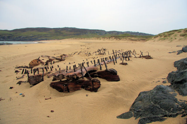
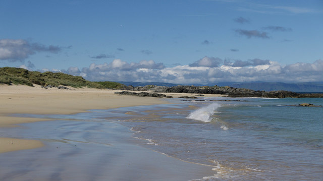
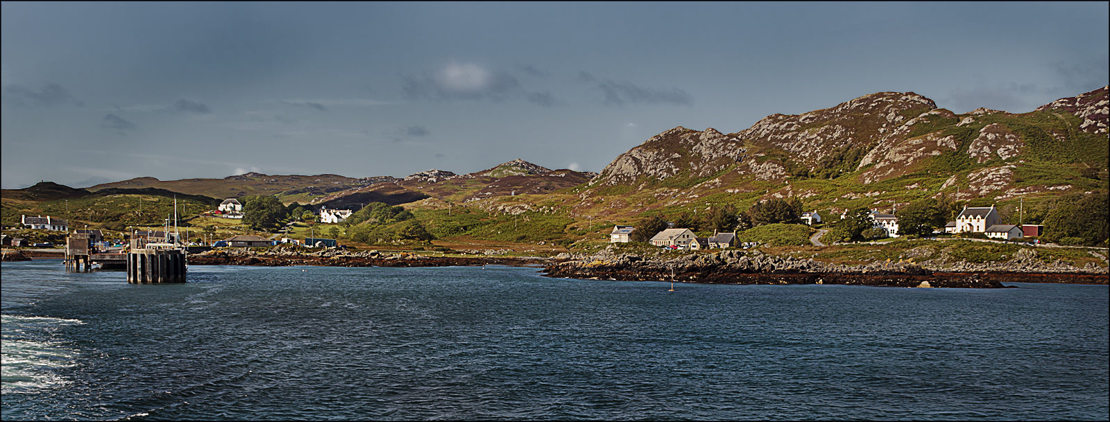
Croisebrig, located in Argyllshire, Scotland, is a prominent coastal feature known for its picturesque headland and stunning views. Situated on the western coast of Scotland, this point juts out into the Atlantic Ocean, offering visitors a unique perspective of the surrounding landscape.
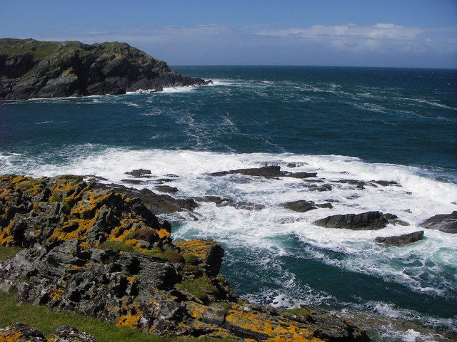
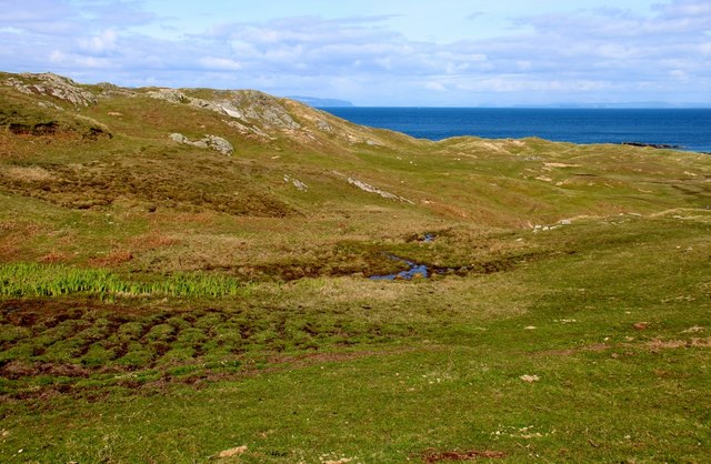
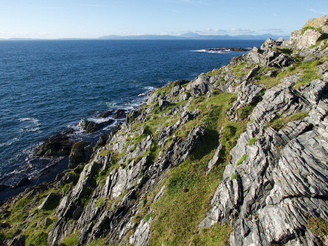
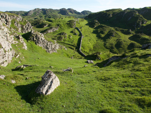
The headland is characterized by its rugged terrain, with steep cliffs that plunge into the turbulent waters below. These cliffs, made of ancient rock formations, showcase the area's geological history and provide a habitat for numerous seabirds that nest along the coastline.
Croisebrig is a popular destination for nature enthusiasts and hikers due to its diverse flora and fauna. The headland is home to a variety of plant species, including heather, gorse, and wildflowers, which carpet the landscape in vibrant colors during the summer months. Visitors may also encounter wildlife such as seals, dolphins, and even occasional sightings of basking sharks.
Aside from its natural beauty, Croisebrig offers visitors a chance to immerse themselves in history. The headland is dotted with remnants of ancient settlements, including stone circles and cairns, which are testament to the area's rich cultural heritage.
From the vantage point of Croisebrig, visitors can enjoy panoramic views of the surrounding coastline, with its pristine beaches and dramatic cliffs. The ever-present sound of crashing waves completes the sensory experience, creating a peaceful and awe-inspiring atmosphere.
In conclusion, Croisebrig is a captivating coastal feature in Argyllshire, known for its rugged headland, diverse wildlife, and rich historical significance. It offers visitors an opportunity to connect with nature, explore ancient sites, and soak in the breathtaking beauty of Scotland's western coast.
If you have any feedback on the listing, please let us know in the comments section below.
Croisebrig Images
Images are sourced within 2km of 56.127323/-6.1394444 or Grid Reference NM4200. Thanks to Geograph Open Source API. All images are credited.


Croisebrig is located at Grid Ref: NM4200 (Lat: 56.127323, Lng: -6.1394444)
Unitary Authority: Argyll and Bute
Police Authority: Argyll and West Dunbartonshire
What 3 Words
///pins.stated.tenure. Near Scalasaig, Argyll & Bute
Related Wikis

Dùn Tealtaig
Dùn Tealtaig is a promontory fort located on the Inner Hebridean island of Colonsay, Scotland. The site is located at grid reference NR38909839.The fort...

Riasg Buidhe Cross
The Riasg Buidhe Cross is a cross standing in the gardens of Colonsay House on the Inner Hebridean island of Colonsay, Scotland. It takes its name from...

Colonsay House
Colonsay House is a Georgian country house on the island of Colonsay, in the Scottish Inner Hebrides. It is a Category B listed building, and is now in...
Chapel of St. Oran, Colonsay
The Chapel of St. Oran (Scottish Gaelic: Cill Oran), was a chapel dedicated to Saint Oran at Kiloran located on the Inner Hebridean island of Colonsay...
Dùn Uragaig
Dùn Uragaig is a clifftop promontory fort located on the Inner Hebridean island of Colonsay, Scotland. The site is located at grid reference NR38169826...

Loch an Sgoltaire
Loch an Sgoltaire is an impounding reservoir located on the Inner Hebridean island of Colonsay, Scotland. It is located at grid reference NR386972, northwest...

Loch Fada (Colonsay)
Loch Fada (English: Long Lake) is a loch located on the Inner Hebridean island of Colonsay, Scotland. It extends between Kiloran and Lower Kilchattan...
Scalasaig
Scalasaig (Scottish Gaelic: Sgalasaig) lies on the east coast of Colonsay in the Hebrides of Scotland. It is the main settlement on the island and its...
Nearby Amenities
Located within 500m of 56.127323,-6.1394444Have you been to Croisebrig?
Leave your review of Croisebrig below (or comments, questions and feedback).