Rubha na Lice Buidhe

Coastal Feature, Headland, Point in Argyllshire

Scotland

Rubha na Lice Buidhe

Northern tip of Colonsay Northwards from Colonsay is the Isle of Mull
Northern tip of Colonsay Credit: Julian Paren

Rubha na Lice Buidhe is a prominent headland located in Argyllshire, Scotland. Situated on the western coast of the Ardnamurchan Peninsula, this coastal feature offers breathtaking views of the surrounding landscape and the vast Atlantic Ocean.

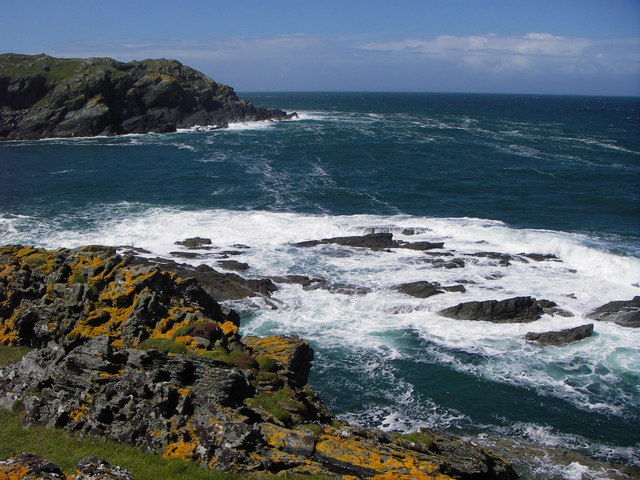
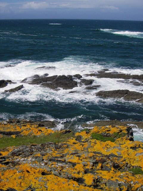
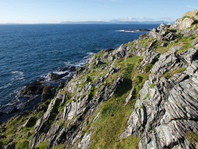
The headland is characterized by its rugged cliffs, rising to heights of approximately 100 meters above sea level. These cliffs are predominantly composed of basalt, a volcanic rock that adds to the dramatic scenery. Rubha na Lice Buidhe is known for its distinct orange hue, which gives it its name, meaning "yellow point" in Gaelic.

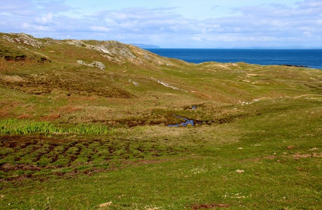
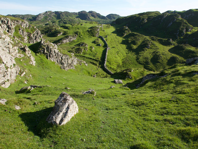
The headland is a popular destination for hikers and nature enthusiasts due to its diverse wildlife and picturesque surroundings. Several walking trails traverse the area, allowing visitors to explore the rich flora and fauna that call Rubha na Lice Buidhe home. On the landward side of the headland, heathland vegetation dominates, while the coastal cliffs provide nesting sites for various seabird species, such as puffins, razorbills, and guillemots.

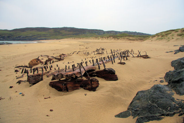
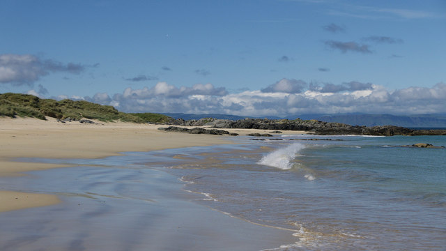
From the headland, one can enjoy panoramic views of the pristine sandy beaches that stretch along the coastline. On clear days, the Isle of Skye and the Small Isles can be seen in the distance, adding to the allure of this coastal gem.

In conclusion, Rubha na Lice Buidhe is a striking headland known for its rugged cliffs, stunning views, and abundant wildlife. Whether you are an avid hiker or simply seeking a place to appreciate nature's beauty, this coastal feature is sure to leave a lasting impression.

If you have any feedback on the listing, please let us know in the comments section below.

Rubha na Lice Buidhe Images

Images are sourced within 2km of 56.129285/-6.1423447 or Grid Reference NM4200. Thanks to Geograph Open Source API. All images are credited.

Northern tip of Colonsay Northwards from Colonsay is the Isle of Mull
Northern tip of Colonsay
Northwards from Colonsay is the Isle of Mull
Northern coastline of Colonsay This coast has more variety than a quick glance at the 1:25,000 map might suggest.
Northern coastline of Colonsay
This coast has more variety than a quick glance at the 1:25,000 map might suggest.
Flat grazing land at northern tip of Colonsay There is a large area of flat ground inland of the northern cliffs of Colonsay and above the sands of Traigh Ban.
Flat grazing land at northern tip of Colonsay
There is a large area of flat ground inland of the northern cliffs of Colonsay and above the sands of Traigh Ban.
Balnahard Bay, Colonsay A deserted sandy beach greets the keen walker at the end of a three mile trek from Kiloran Bay (no cars allowed).
Balnahard Bay, Colonsay
A deserted sandy beach greets the keen walker at the end of a three mile trek from Kiloran Bay (no cars allowed).
Wreck on the beach The remains of a vessel lie at the top of the beach at Balnahard Bay, Colonsay. The sand has covered most of the wreck, but various spars and bolts are clearly visible.
Wreck on the beach
The remains of a vessel lie at the top of the beach at Balnahard Bay, Colonsay. The sand has covered most of the wreck, but various spars and bolts are clearly visible.
Balnahard Bay, Colonsay Looking out to sea between the rocks.
Balnahard Bay, Colonsay
Looking out to sea between the rocks.
Balnahard Bay, Colonsay Looking south along the beach, with Rubh' a' Geodha in the distance.
Balnahard Bay, Colonsay
Looking south along the beach, with Rubh' a' Geodha in the distance.
Headland and tidal rocks at Port an Obain Small rocky headland and tidal rocks at the mouth of Port an Obain comprising all of the small amount of land in square NM 4000
Headland and tidal rocks at Port an Obain
Small rocky headland and tidal rocks at the mouth of Port an Obain comprising all of the small amount of land in square NM 4000
Lichen covered rocks near Port an Obain This is about all the land in the square! Taken at mid tide the rocks below would be completely covered at high tide.
Lichen covered rocks near Port an Obain
This is about all the land in the square! Taken at mid tide the rocks below would be completely covered at high tide.
Eilean Dubh Eilean Dubh sits off the northern end of Colonsay
Eilean Dubh
Eilean Dubh sits off the northern end of Colonsay
Balnahard beach Beach at the northern end of Colonsay
Balnahard beach
Beach at the northern end of Colonsay
Boggy pasture at Balnahard South end of Mull on the horizon.
Boggy pasture at Balnahard
South end of Mull on the horizon.
Looking into Port an Obain, Colonsay On the rugged coastal rocks beside the bay.
Looking into Port an Obain, Colonsay
On the rugged coastal rocks beside the bay.
Coast by Port an Obain Quite rugged and steep and care must be used to gain access to this Gridsquare.
Coast by Port an Obain
Quite rugged and steep and care must be used to gain access to this Gridsquare.
Balnahard Beach, Colonsay Wonderfully clean and beautiful.
Balnahard Beach, Colonsay
Wonderfully clean and beautiful.
Coastline near the northern tip of Colonsay Grass for sheep and cliffs for birds.
Coastline near the northern tip of Colonsay
Grass for sheep and cliffs for birds.
Northern headland of Colonsay Sheep and grass backed by a rocky coast and cliffs.
Northern headland of Colonsay
Sheep and grass backed by a rocky coast and cliffs.
Wall across the northern hills of Colonsay A rugged terrain of rocky hills and ancient forts.
Wall across the northern hills of Colonsay
A rugged terrain of rocky hills and ancient forts.
Show me another place!

Rubha na Lice Buidhe is located at Grid Ref: NM4200 (Lat: 56.129285, Lng: -6.1423447)

Unitary Authority: Argyll and Bute

Police Authority: Argyll and West Dunbartonshire

What 3 Words

///hotspot.melons.bandwagon. Near Scalasaig, Argyll & Bute

Related Wikis

Dùn Tealtaig

Dùn Tealtaig is a promontory fort located on the Inner Hebridean island of Colonsay, Scotland. The site is located at grid reference NR38909839.The fort...

Riasg Buidhe Cross

The Riasg Buidhe Cross is a cross standing in the gardens of Colonsay House on the Inner Hebridean island of Colonsay, Scotland. It takes its name from...

Colonsay House

Colonsay House is a Georgian country house on the island of Colonsay, in the Scottish Inner Hebrides. It is a Category B listed building, and is now in...

Chapel of St. Oran, Colonsay

The Chapel of St. Oran (Scottish Gaelic: Cill Oran), was a chapel dedicated to Saint Oran at Kiloran located on the Inner Hebridean island of Colonsay...

Nearby Amenities

Located within 500m of 56.129285,-6.1423447
Barrier: stile
Source: survey
Lat/Long: 56.1267811/-6.1413161
The data included in this document is from www.openstreetmap.org. The data is made available under ODbL.

Have you been to Rubha na Lice Buidhe?

Leave your review of Rubha na Lice Buidhe below (or comments, questions and feedback).