Aird Buidhe

Coastal Feature, Headland, Point in Argyllshire

Scotland

Aird Buidhe

The Road to Knockan, Ross of Mull The unclassified road to the hamlet of Knockan just north of its junction with the A849.
The Road to Knockan, Ross of Mull Credit: JaneMcArtney

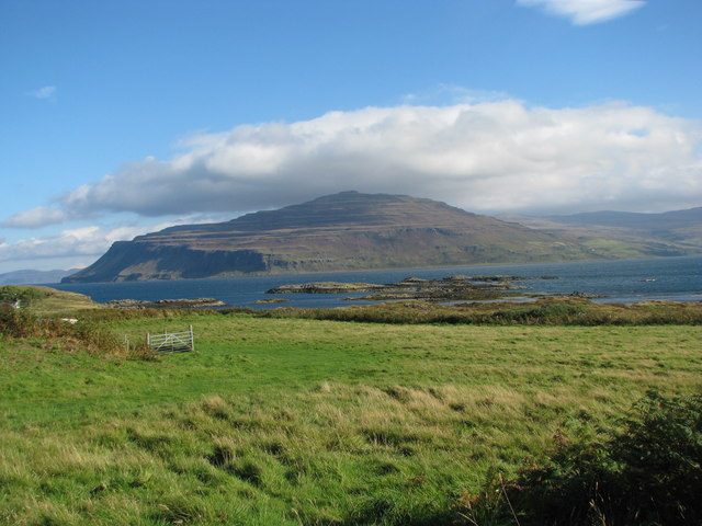
Aird Buidhe is a prominent headland located in Argyllshire, Scotland. Situated on the west coast of the country, it is known for its picturesque beauty and diverse geology. The name "Aird Buidhe" is derived from Scottish Gaelic, meaning "yellow headland," which accurately reflects the color of the cliffs and rocks that make up this coastal feature.

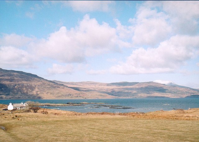
The headland of Aird Buidhe juts out into the Atlantic Ocean, offering breathtaking panoramic views of the surrounding landscape. The point is characterized by towering cliffs that stretch up to 100 meters in height, creating a dramatic and awe-inspiring sight. These cliffs are composed of various rock formations, including sandstone and limestone, which have been shaped over millions of years by the forces of erosion and weathering.

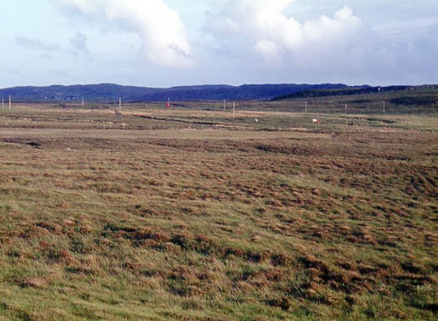
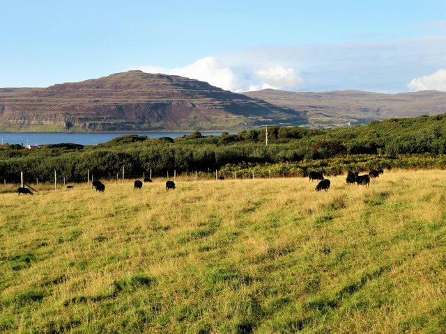
Visitors to Aird Buidhe can explore the headland's rugged coastline, which is interspersed with secluded sandy coves and rocky outcrops. The area is a haven for wildlife, with numerous seabirds nesting along the cliffs, including puffins, fulmars, and guillemots. The surrounding waters are also home to a diverse range of marine life, including seals and dolphins.

Aird Buidhe offers ample opportunities for outdoor activities such as hiking, birdwatching, and photography. There are several walking trails that wind their way along the cliffs, providing stunning vistas of the ocean and nearby islands. The headland is easily accessible by car or foot, with a small parking area available for visitors.

Overall, Aird Buidhe is a captivating coastal feature that showcases the natural beauty and geological diversity of Argyllshire. Its striking cliffs, pristine beaches, and abundant wildlife make it a must-visit destination for nature enthusiasts and outdoor adventurers alike.

If you have any feedback on the listing, please let us know in the comments section below.
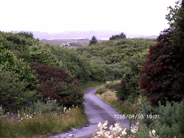
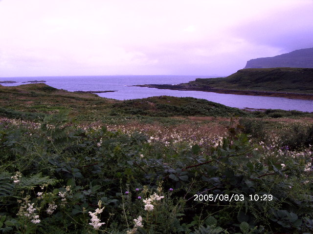
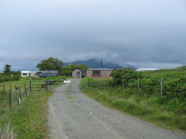
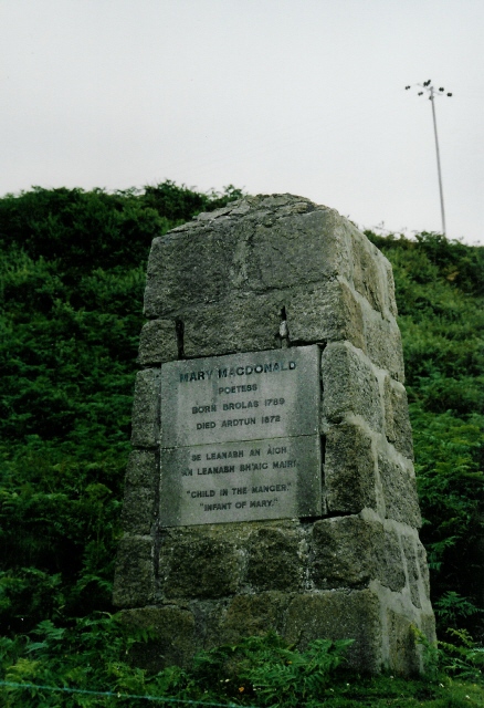
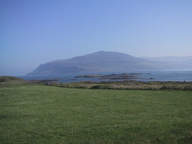
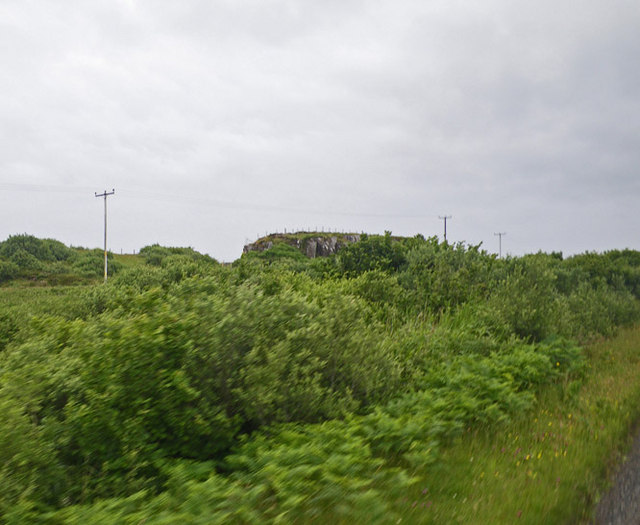
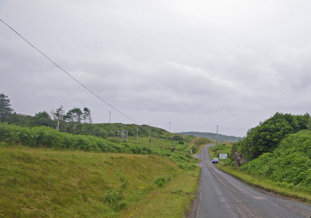
Aird Buidhe Images

Images are sourced within 2km of 56.334005/-6.2103836 or Grid Reference NM3923. Thanks to Geograph Open Source API. All images are credited.

The Road to Knockan, Ross of Mull The unclassified road to the hamlet of Knockan just north of its junction with the A849.
The Road to Knockan, Ross of Mull
The unclassified road to the hamlet of Knockan just north of its junction with the A849.
Loch na Corrobha, Ross of Mull A small sea loch Taken from the A849, the single track road, across the Ross of Mull.
Loch na Corrobha, Ross of Mull
A small sea loch Taken from the A849, the single track road, across the Ross of Mull.
Not the Rabbit Farm This is marked on the OS as a rabbit farm. It was once a combination of tourist attraction and angora production - but no longer.
Not the Rabbit Farm
This is marked on the OS as a rabbit farm. It was once a combination of tourist attraction and angora production - but no longer.
Coastal scene, Knockan, Mull Looking across croft land at Knockan towards Loch Scridain.
Coastal scene, Knockan, Mull
Looking across croft land at Knockan towards Loch Scridain.
Monument to Mary MacDonald Mary MacDonald wrote the Gaelic words to a hymn, which became an English favourite ("Child in a manger"). The tune was re-used for "Morning has broken" - probably the most famous Gaelic tune in the world now!  Beside the main road, near Ardtun where she died.
Monument to Mary MacDonald
Mary MacDonald wrote the Gaelic words to a hymn, which became an English favourite ("Child in a manger"). The tune was re-used for "Morning has broken" - probably the most famous Gaelic tune in the world now! Beside the main road, near Ardtun where she died.
Loch Scridain from Knockan
Dense wild roadside shrubbery along the main road of the Ross of Mull
Countryside along the main road on the Ross of Mull
Bracken choked expanse with Loch na Corrobha beyond Photographer is on top of the main road along the Ross of Mull. These bracken invasions are the consequence of centuries of man's disturbance to the island, including the cycle of deforestation, livestock introduction and livestock reduction.
Bracken choked expanse with Loch na Corrobha beyond
Photographer is on top of the main road along the Ross of Mull. These bracken invasions are the consequence of centuries of man's disturbance to the island, including the cycle of deforestation, livestock introduction and livestock reduction.
The Berg from Knockan
Phone box at Ardtun
Phone box at Ardtun
Moor at Faoileann
Moor at Faoileann
Left for Knockan, right for Lee
Hebridean Sheep Grazing Black Hebridean sheep in a field by Drinnan with the headland of Ardmenach in the distance.
Hebridean Sheep Grazing
Black Hebridean sheep in a field by Drinnan with the headland of Ardmenach in the distance.
Passing Loch na Corrobha The A849 east of Bunessan passing the small Loch na Corrobha on the left
Passing Loch na Corrobha
The A849 east of Bunessan passing the small Loch na Corrobha on the left
Old Milepost by the A849, east of Knockan Blaydon by the A849, in parish of Kilfinichen & Kilvickeon (Mull District), East of Knockan, North side of road overlooking Ardmeanach.

Inscription reads:- : SALEN / 30 / MILES : : IONA FERRY / 8 / MILES

Surveyed

Milestone Society National ID: AB_MLSAIF30.
Old Milepost by the A849, east of Knockan
Blaydon by the A849, in parish of Kilfinichen & Kilvickeon (Mull District), East of Knockan, North side of road overlooking Ardmeanach. Inscription reads:- : SALEN / 30 / MILES : : IONA FERRY / 8 / MILES Surveyed Milestone Society National ID: AB_MLSAIF30.
Old Milepost by the A849 near Drinnan Blaydon casting by the A849, in parish of Kilfinichen and Kilvickeon (Mull District), Drinnan, on verge, North side of road.

Inscription reads:-
: SALEN / 31 / MILES : : 1897 : : IONAFERRY / 7 / MILES :
Maker:-
: SMITH PATTERSON / FOUNDERS / BLAYDON :

Surveyed

Milestone Society National ID: AB_MLSAIF31
Old Milepost by the A849 near Drinnan
Blaydon casting by the A849, in parish of Kilfinichen and Kilvickeon (Mull District), Drinnan, on verge, North side of road. Inscription reads:- : SALEN / 31 / MILES : : 1897 : : IONAFERRY / 7 / MILES : Maker:- : SMITH PATTERSON / FOUNDERS / BLAYDON : Surveyed Milestone Society National ID: AB_MLSAIF31
Digger at Knockan A band of low basalt cliffs shelters a bay called Lochan Mòr from easterly weather.
Digger at Knockan
A band of low basalt cliffs shelters a bay called Lochan Mòr from easterly weather.
Show me another place!

Aird Buidhe is located at Grid Ref: NM3923 (Lat: 56.334005, Lng: -6.2103836)

Unitary Authority: Argyll and Bute

Police Authority: Argyll and West Dunbartonshire

What 3 Words

///arrive.incline.upwardly. Near Fionnphort, Argyll & Bute

Related Wikis

Ardtun

Ardtun (Scottish Gaelic: Àird Tunna) is a settlement on the Isle of Mull, in Argyll and Bute, Scotland. Ardtun is within the parish of Kilfinichen and...

Knockan

Knockan (Scottish Gaelic: An Cnocan) is a township of six crofts in the community of Ardtun, in the south of the Isle of Mull off the west coast of Scotland...

Bunessan

Bunessan (Scottish Gaelic: Bun Easain) is a small village on the Ross of Mull in the south-west of the Isle of Mull, off the west coast of Scotland. The...

Suidhe

Suidhe (Scottish Gaelic: Suidhe) is a ruined township located on the southwestern peninsula of the Isle of Mull, Scotland. It lies just over 1 km to the...

Camas Tuath

Camas Tuath (Scottish Gaelic: north bay) is an inlet bay on the Ross of Mull. The bay has two small tidal islands and two Quarrymans' Cottages which the...

Uisken

Uisken (Scottish Gaelic: Uisgean, meaning "water-bay") is a settlement on a sandy bay on the Ross of Mull in the south of the Isle of Mull, on the west...

Knocknafenaig

Knocknafenaig (Scottish Gaelic: Cnoc na Fennaig) is a ruined township on the Isle of Mull, Scotland. Located in the south-western portion of the island...

Ardalanish

Ardalanish (Scottish Gaelic: Àird Dealanais) is a village on the Isle of Mull in Argyll and Bute, Scotland. It is now an organic farm and weaving mill...

Nearby Amenities

Located within 500m of 56.334005,-6.2103836
Passing Place
Lat/Long: 56.3309162/-6.2108751
Building: yes
Lat/Long: 56.3325414/-6.2055565
Place: farm
Lat/Long: 56.3312073/-6.2115633
Lochan Mòr
Natural: bay
Lat/Long: 56.3362386/-6.2110074
Generator Method: photovoltaic
Generator Output Electricity: yes
Generator Source: solar
Generator Type: solar_photovoltaic_panel
Location: roof
Power: generator
Lat/Long: 56.3315753/-6.2078735
Power: pole
Lat/Long: 56.3313448/-6.2043665
Power: pole
Lat/Long: 56.3311188/-6.206008
Power: pole
Lat/Long: 56.3309552/-6.207203
Power: pole
Lat/Long: 56.3307626/-6.2085937
Power: pole
Lat/Long: 56.3327403/-6.2054488
Power: pole
Lat/Long: 56.3321321/-6.2043169
Shop: storage_rental
Lat/Long: 56.3308091/-6.2053754
Power: pole
Lat/Long: 56.3337998/-6.2182829
Power: pole
Lat/Long: 56.3338427/-6.2172118
Power: pole
Lat/Long: 56.3339062/-6.2158636
Power: pole
Lat/Long: 56.3330613/-6.2154293
Power: pole
Lat/Long: 56.3324971/-6.2151362
Power: pole
Lat/Long: 56.3316078/-6.2144487
Power: pole
Lat/Long: 56.3309165/-6.2139452
Power: pole
Lat/Long: 56.3302193/-6.2134336
Power: pole
Lat/Long: 56.3303803/-6.2117336
Power: pole
Lat/Long: 56.3305088/-6.2103081
Passing Place
Lat/Long: 56.3326805/-6.2060276
The data included in this document is from www.openstreetmap.org. The data is made available under ODbL.

Have you been to Aird Buidhe?

Leave your review of Aird Buidhe below (or comments, questions and feedback).