Eilean nan Damh

Island in Argyllshire

Scotland

Eilean nan Damh

The Road to Knockan, Ross of Mull The unclassified road to the hamlet of Knockan just north of its junction with the A849.
The Road to Knockan, Ross of Mull Credit: JaneMcArtney

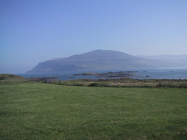
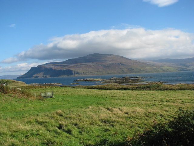
Eilean nan Damh, also known as the Island of the Stags, is a small uninhabited island located in the Inner Hebrides of Scotland, specifically in Argyllshire. It lies in the Firth of Lorn, approximately 2 miles south of the Isle of Luing.

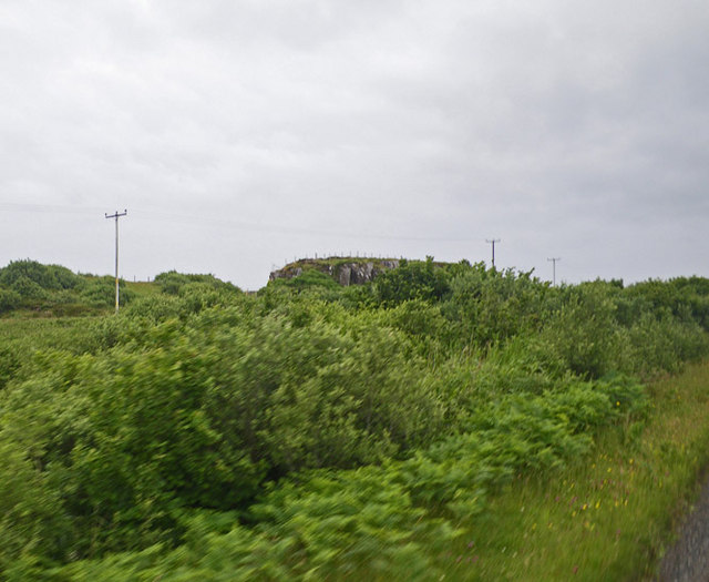
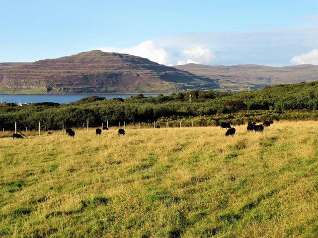
The island is characterized by its rugged and rocky terrain, with steep cliffs on its western side. It covers an area of around 32 hectares and reaches a height of about 45 meters at its highest point. Eilean nan Damh is known for its stunning natural beauty and is a popular spot for nature enthusiasts and photographers.

The island gets its name from the abundance of red deer that inhabit the area. These majestic creatures can often be seen grazing on the island's grassy slopes. Eilean nan Damh is also home to a variety of bird species, including seabirds such as gannets, cormorants, and shags.

Access to the island is limited, as there are no regular ferry services. However, it can be reached by private boat or by participating in guided tours that operate in the area. Visitors to Eilean nan Damh can enjoy peaceful walks along its coastline, taking in the breathtaking views of the surrounding sea and nearby islands.

Overall, Eilean nan Damh is a picturesque and tranquil island that offers a unique opportunity to experience the untouched beauty of the Scottish wilderness.

If you have any feedback on the listing, please let us know in the comments section below.

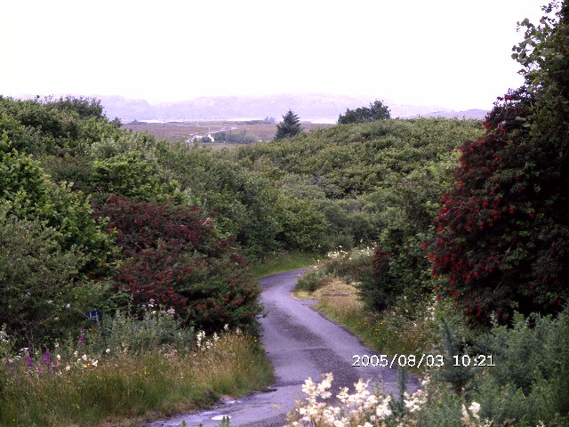
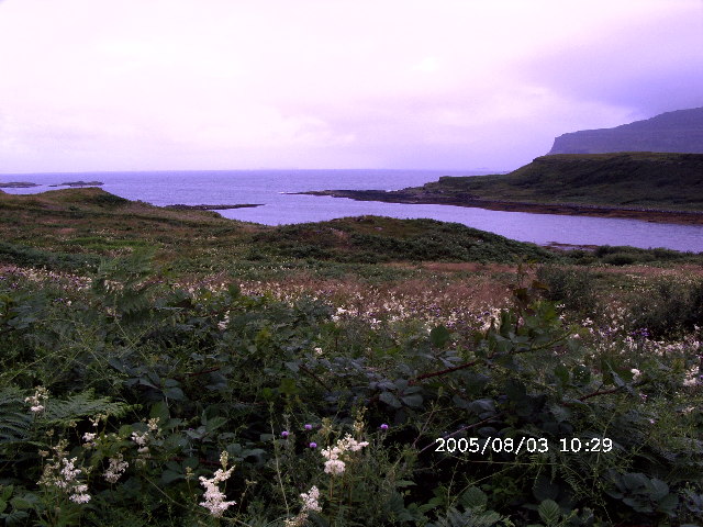
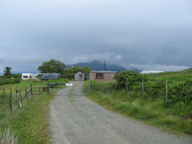
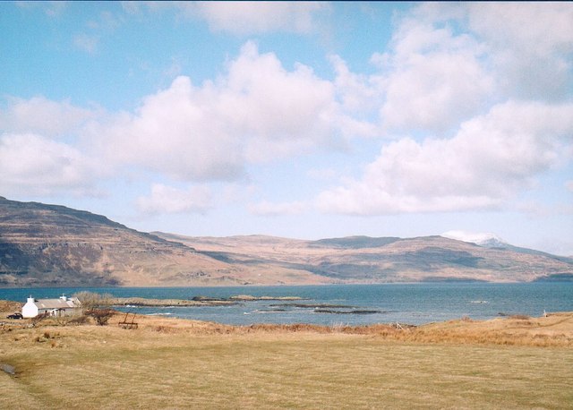
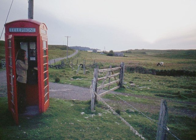
Eilean nan Damh Images

Images are sourced within 2km of 56.335828/-6.2133695 or Grid Reference NM3923. Thanks to Geograph Open Source API. All images are credited.

The Road to Knockan, Ross of Mull The unclassified road to the hamlet of Knockan just north of its junction with the A849.
The Road to Knockan, Ross of Mull
The unclassified road to the hamlet of Knockan just north of its junction with the A849.
Loch na Corrobha, Ross of Mull A small sea loch Taken from the A849, the single track road, across the Ross of Mull.
Loch na Corrobha, Ross of Mull
A small sea loch Taken from the A849, the single track road, across the Ross of Mull.
Not the Rabbit Farm This is marked on the OS as a rabbit farm. It was once a combination of tourist attraction and angora production - but no longer.
Not the Rabbit Farm
This is marked on the OS as a rabbit farm. It was once a combination of tourist attraction and angora production - but no longer.
Coastal scene, Knockan, Mull Looking across croft land at Knockan towards Loch Scridain.
Coastal scene, Knockan, Mull
Looking across croft land at Knockan towards Loch Scridain.
Monument to Mary MacDonald Mary MacDonald wrote the Gaelic words to a hymn, which became an English favourite ("Child in a manger"). The tune was re-used for "Morning has broken" - probably the most famous Gaelic tune in the world now!  Beside the main road, near Ardtun where she died.
Monument to Mary MacDonald
Mary MacDonald wrote the Gaelic words to a hymn, which became an English favourite ("Child in a manger"). The tune was re-used for "Morning has broken" - probably the most famous Gaelic tune in the world now! Beside the main road, near Ardtun where she died.
Loch Scridain from Knockan
Dense wild roadside shrubbery along the main road of the Ross of Mull
Countryside along the main road on the Ross of Mull
The Berg from Knockan
Phone box at Ardtun
Phone box at Ardtun
Moor at Faoileann
Moor at Faoileann
Left for Knockan, right for Lee
Hebridean Sheep Grazing Black Hebridean sheep in a field by Drinnan with the headland of Ardmenach in the distance.
Hebridean Sheep Grazing
Black Hebridean sheep in a field by Drinnan with the headland of Ardmenach in the distance.
Old Milepost by the A849, east of Knockan Blaydon by the A849, in parish of Kilfinichen & Kilvickeon (Mull District), East of Knockan, North side of road overlooking Ardmeanach.

Inscription reads:- : SALEN / 30 / MILES : : IONA FERRY / 8 / MILES

Surveyed

Milestone Society National ID: AB_MLSAIF30.
Old Milepost by the A849, east of Knockan
Blaydon by the A849, in parish of Kilfinichen & Kilvickeon (Mull District), East of Knockan, North side of road overlooking Ardmeanach. Inscription reads:- : SALEN / 30 / MILES : : IONA FERRY / 8 / MILES Surveyed Milestone Society National ID: AB_MLSAIF30.
Old Milepost by the A849 near Drinnan Blaydon casting by the A849, in parish of Kilfinichen and Kilvickeon (Mull District), Drinnan, on verge, North side of road.

Inscription reads:-
: SALEN / 31 / MILES : : 1897 : : IONAFERRY / 7 / MILES :
Maker:-
: SMITH PATTERSON / FOUNDERS / BLAYDON :

Surveyed

Milestone Society National ID: AB_MLSAIF31
Old Milepost by the A849 near Drinnan
Blaydon casting by the A849, in parish of Kilfinichen and Kilvickeon (Mull District), Drinnan, on verge, North side of road. Inscription reads:- : SALEN / 31 / MILES : : 1897 : : IONAFERRY / 7 / MILES : Maker:- : SMITH PATTERSON / FOUNDERS / BLAYDON : Surveyed Milestone Society National ID: AB_MLSAIF31
Digger at Knockan A band of low basalt cliffs shelters a bay called Lochan Mòr from easterly weather.
Digger at Knockan
A band of low basalt cliffs shelters a bay called Lochan Mòr from easterly weather.
Old milepost This post was completely bare of paint in 2005 and leaning slightly.  Work has been done to set it upright and paint it but in 2020 it is rusting quite badly with just traces of the yellow paint used on this and other posts along this road.   It is near to Drinnan just south west of a very minor crossroads.
Old milepost
This post was completely bare of paint in 2005 and leaning slightly. Work has been done to set it upright and paint it but in 2020 it is rusting quite badly with just traces of the yellow paint used on this and other posts along this road. It is near to Drinnan just south west of a very minor crossroads.
Lochan Mòr from Rubha Dubh
Show me another place!

Eilean nan Damh is located at Grid Ref: NM3923 (Lat: 56.335828, Lng: -6.2133695)

Unitary Authority: Argyll and Bute

Police Authority: Argyll and West Dunbartonshire

What 3 Words

///signified.jammy.slouched. Near Fionnphort, Argyll & Bute

Related Wikis

Ardtun

Ardtun (Scottish Gaelic: Àird Tunna) is a settlement on the Isle of Mull, in Argyll and Bute, Scotland. Ardtun is within the parish of Kilfinichen and...

Knockan

Knockan (Scottish Gaelic: An Cnocan) is a township of six crofts in the community of Ardtun, in the south of the Isle of Mull off the west coast of Scotland...

Bunessan

Bunessan (Scottish Gaelic: Bun Easain) is a small village on the Ross of Mull in the south-west of the Isle of Mull, off the west coast of Scotland. The...

Suidhe

Suidhe (Scottish Gaelic: Suidhe) is a ruined township located on the southwestern peninsula of the Isle of Mull, Scotland. It lies just over 1 km to the...

Camas Tuath

Camas Tuath (Scottish Gaelic: north bay) is an inlet bay on the Ross of Mull. The bay has two small tidal islands and two Quarrymans' Cottages which the...

Knocknafenaig

Knocknafenaig (Scottish Gaelic: Cnoc na Fennaig) is a ruined township on the Isle of Mull, Scotland. Located in the south-western portion of the island...

Uisken

Uisken (Scottish Gaelic: Uisgean, meaning "water-bay") is a settlement on a sandy bay on the Ross of Mull in the south of the Isle of Mull, on the west...

Ross of Mull

The Ross of Mull (Scottish Gaelic: An Ros Mhuileach) is the largest peninsula of the Isle of Mull, about 28 kilometres (17 mi) long, and makes up the south...

Nearby Amenities

Located within 500m of 56.335828,-6.2133695
Lochan Mòr
Natural: bay
Lat/Long: 56.3362386/-6.2110074
Achnahard
Place: hamlet
Lat/Long: 56.3350613/-6.2185997
Generator Method: photovoltaic
Generator Output Electricity: yes
Generator Source: solar
Generator Type: solar_photovoltaic_panel
Location: roof
Power: generator
Lat/Long: 56.3361586/-6.2195465
Power: pole
Lat/Long: 56.3340161/-6.2194258
Power: pole
Lat/Long: 56.3347803/-6.2199099
Power: pole
Lat/Long: 56.3366808/-6.2211086
Power: pole
Lat/Long: 56.3361143/-6.2207822
Power: pole
Lat/Long: 56.3355553/-6.2204278
Power: pole
Lat/Long: 56.333723/-6.2195885
Power: pole
Lat/Long: 56.3337998/-6.2182829
Power: pole
Lat/Long: 56.3338427/-6.2172118
Power: pole
Lat/Long: 56.3339062/-6.2158636
Power: pole
Lat/Long: 56.3330613/-6.2154293
Power: pole
Lat/Long: 56.3324971/-6.2151362
Power: pole
Lat/Long: 56.3316078/-6.2144487
The data included in this document is from www.openstreetmap.org. The data is made available under ODbL.

Have you been to Eilean nan Damh?

Leave your review of Eilean nan Damh below (or comments, questions and feedback).