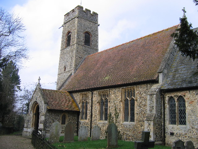
Bramerton Common

Wood, Forest in Norfolk South Norfolk

England

Bramerton Common

Corn cockles in a wild flower meadow The corn cockle, (Agrostemma githago) is a plant of cultivated cornfields and  evidence suggests that it was first brought to Britain from Europe by Iron Age farmers, some 2,400 years ago. Never ever having been as common in farmers'  fields as poppies or corn marigold it was considered a serious weed in the 16th century. With the advent of herbicides it began to decline and is now exceptionally rare as a cornfield flower. These days it is however often sold in  wildflower seed mixes.
Corn cockles in a wild flower meadow Credit: Evelyn Simak

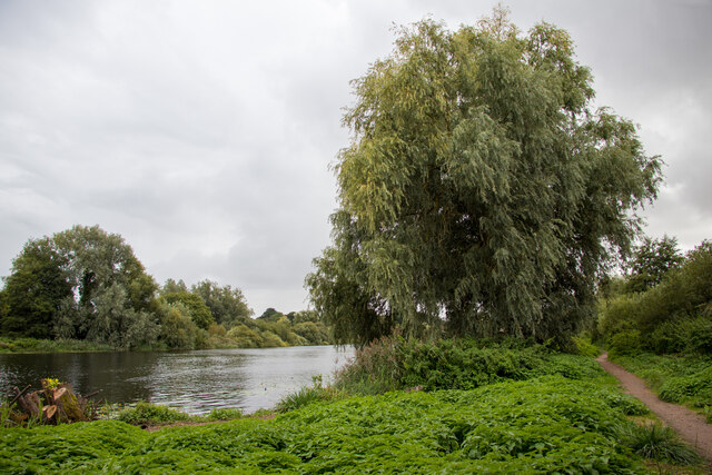
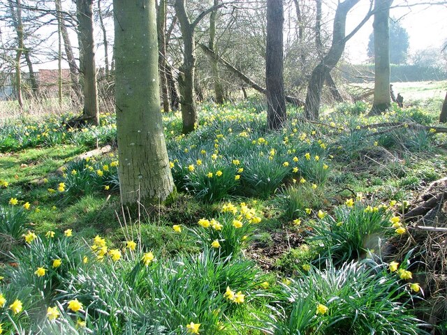
Bramerton Common is a picturesque woodland area located in Norfolk, England. Situated near the village of Bramerton, this common is a popular destination for nature lovers and outdoor enthusiasts. Covering an area of approximately 100 acres, Bramerton Common is known for its diverse range of flora and fauna.

The common is primarily composed of ancient woodlands, with a variety of tree species including oak, beech, ash, and birch. These trees provide a natural habitat for numerous wildlife species, making it an ideal spot for birdwatching and wildlife spotting. Visitors may be fortunate enough to catch a glimpse of roe deer, foxes, badgers, and a wide array of bird species such as woodpeckers, nuthatches, and tawny owls.

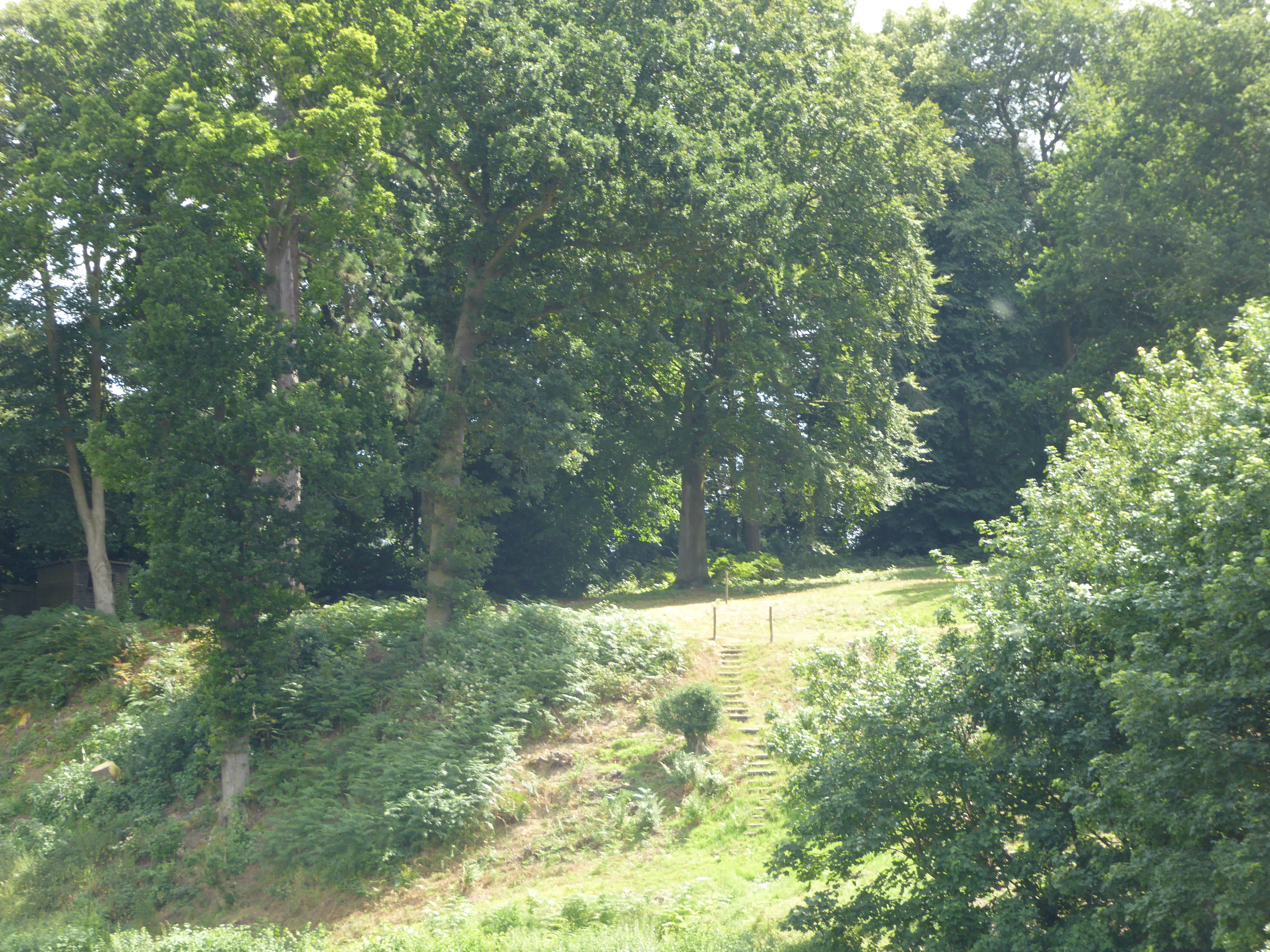
Tranquil walking trails wind their way through the common, offering visitors the chance to explore and enjoy the peaceful surroundings. The paths are well-maintained and provide access to different areas of the woodland, including open glades and secluded spots perfect for a picnic or quiet reflection.

Bramerton Common also boasts a diverse range of wildflowers, adding bursts of color to the landscape during spring and summer months. Bluebells, primroses, and violets are just a few examples of the flora that can be found here.

The common is managed by local authorities to ensure the preservation of its natural beauty and to protect its delicate ecosystem. Entry is free for visitors, and there are information boards located at various points to provide educational insights into the common's wildlife and history.

Overall, Bramerton Common is a haven of natural beauty, offering visitors the chance to escape the hustle and bustle of everyday life and immerse themselves in the tranquility of the Norfolk countryside.

If you have any feedback on the listing, please let us know in the comments section below.

Bramerton Common Images

Images are sourced within 2km of 52.603043/1.3896602 or Grid Reference TG2905. Thanks to Geograph Open Source API. All images are credited.

Corn cockles in a wild flower meadow The corn cockle, (Agrostemma githago) is a plant of cultivated cornfields and  evidence suggests that it was first brought to Britain from Europe by Iron Age farmers, some 2,400 years ago. Never ever having been as common in farmers'  fields as poppies or corn marigold it was considered a serious weed in the 16th century. With the advent of herbicides it began to decline and is now exceptionally rare as a cornfield flower. These days it is however often sold in  wildflower seed mixes.
Corn cockles in a wild flower meadow
The corn cockle, (Agrostemma githago) is a plant of cultivated cornfields and evidence suggests that it was first brought to Britain from Europe by Iron Age farmers, some 2,400 years ago. Never ever having been as common in farmers' fields as poppies or corn marigold it was considered a serious weed in the 16th century. With the advent of herbicides it began to decline and is now exceptionally rare as a cornfield flower. These days it is however often sold in wildflower seed mixes.
Wildflower meadow Some of the flowers growing here are corn cockles  <a title="https://www.geograph.org.uk/photo/7216087" href="https://www.geograph.org.uk/photo/7216087">Link</a> and corn flowers as well as marguerites.
Wildflower meadow
Some of the flowers growing here are corn cockles Link and corn flowers as well as marguerites.
Meadow with marguerites
Flower meadow with corn cockles For a closer view of corn cockles and some information see > <a title="https://www.geograph.org.uk/photo/7216087" href="https://www.geograph.org.uk/photo/7216087">Link</a>
Flower meadow with corn cockles
For a closer view of corn cockles and some information see > Link
Willow on the side of the Yare, Postwick
Covered well in the garden of Flint Cottage For a wider view of this location see > <a title="https://www.geograph.org.uk/photo/1280708" href="https://www.geograph.org.uk/photo/1280708">Link</a>.
Covered well in the garden of Flint Cottage
For a wider view of this location see > Link.
River Yare and Surlingham Ferry Pub River in flood, covering part of Ferry Lane
River Yare and Surlingham Ferry Pub
River in flood, covering part of Ferry Lane
Daffodil Wood A small copse surrounded by fields, colonised by daffdils.
Daffodil Wood
A small copse surrounded by fields, colonised by daffdils.
Small pond by Hill Farm This is no longer a working farm, but various outbuildings still exist.
Small pond by Hill Farm
This is no longer a working farm, but various outbuildings still exist.
Old oak tree and hedge flanking a farm track
Old hawthorn hedge The hedge forms a field boundary.
Old hawthorn hedge
The hedge forms a field boundary.
The River Yare As seen from a permissive path.
The River Yare
As seen from a permissive path.
Gnarly old oak tree
Gnarly old oak tree
Fields north of the River Yare Note the clusters of daffodils in this field, which during the summer months contains ewes and their lambs.
Fields north of the River Yare
Note the clusters of daffodils in this field, which during the summer months contains ewes and their lambs.
Permissive path along a field's edge
Old oak growing on a field boundary
Fields and woodland by the River Yare
Daffodils in a copse above the River Yare
Show me another place!

Bramerton Common is located at Grid Ref: TG2905 (Lat: 52.603043, Lng: 1.3896602)

Administrative County: Norfolk

District: South Norfolk

Police Authority: Norfolk

What 3 Words

///casino.clenching.newlywed. Near Brundall, Norfolk

Related Wikis

Bramerton Pits

Bramerton Pits is a 0.7-hectare (1.7-acre) geological Site of Special Scientific Interest north of the village of Bramerton in Norfolk on the southern...

Bramerton

Bramerton is a village in South Norfolk 4¾ miles (7½ km) south-east of Norwich, just north of the main A146 Norwich-Lowestoft road and on the south bank...

Kirby Bedon

Kirby Bedon is a hamlet in South Norfolk which lies approximately 3½ miles (5½ km) south-east of Norwich on the road to Bramerton. It covers an area of...

Surlingham Church Marsh RSPB reserve

Surlingham Church Marsh is a small RSPB nature reserve in the Norfolk Broads, England. It is part of Yare Broads and Marshes Site of Special Scientific...

Surlingham

Surlingham is a village and civil parish in the South Norfolk district of Norfolk situated on the Broads in eastern United Kingdom. It lies approximately...

Lesingham House

Lesingham House is a country house in Surlingham, Norfolk, England, part of which was supposedly built in 1655. == History == Lesingham House was supposedly...

Rockland St Mary

Rockland St Mary is a village in South Norfolk which lies about 6 miles (9½ km) southeast of Norwich between Surlingham, Bramerton, Claxton and Hellington...

Postwick with Witton

Postwick with Witton ( ) is a civil parish on the Broads in the English county of Norfolk, comprising the two adjacent villages of Postwick and Witton...

Related Videos

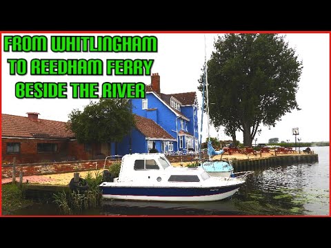
From Whitlingham To Reedham Ferry Beside The River #RiverYare #NorfolkBroads #July2021

Good morning everyone, Today I start at Whitlingham Hall and travel to Reedham Ferry. This route is along the bank of the River ...

CRAZY DRIVER ? Norwich PubStop Vancamp Broads Surlingham Is It My First EVER Pay for night ? 3 Years

norfolk #surlingham #allpowers #vantour #vanbuild #powerstation #vanlifer #talbotexpress CVUK20% Allpowers Discount R600 ...

SEVYLOR ADVENTURE INFLATABLE & WOODEN CANOE | River Yare, Camping Reedham Ferry

Its been a while since I managed to get out on the River for a Paddle! In this video I'm out in my rigid wooden canoe with my ...

Studio Cottage Video Tour

Luxury Holiday Cottage sleeping 4 Bookings for 2021 now open with only £100 deposit www.surlinghamlodgecottages.co.uk.

Nearby Amenities

Located within 500m of 52.603043,1.3896602
Source: Landsat photo - shifted
Lat/Long: 52.6052263/1.383219
Source: Landsat photo - shifted
Lat/Long: 52.604645/1.3852881
Source: Landsat photo - shifted
Lat/Long: 52.6043962/1.387359
Source: Landsat photo - shifted
Lat/Long: 52.6043149/1.3889817
Source: Landsat photo - shifted
Lat/Long: 52.6044843/1.3911286
Source: Landsat photo - shifted
Lat/Long: 52.605036/1.3925079
Source: Landsat photo - shifted
Lat/Long: 52.6058395/1.3936942
Bench
Backrest: yes
Material: wood
Seats: 3
Lat/Long: 52.6039856/1.388415
Bench
Backrest: yes
Material: wood
Seats: 3
Lat/Long: 52.6039943/1.3876356
Maxstay: 1 day
Mooring: yes
Lat/Long: 52.6041214/1.388121
Bench
Lat/Long: 52.6040919/1.3895346
Bench
Lat/Long: 52.6041159/1.3876928
Bench
Backrest: yes
Colour: brown
Material: plastic
Seats: 3
Lat/Long: 52.6011342/1.3881263
Man Made: utility_pole
Lat/Long: 52.6042929/1.3853677
Man Made: utility_pole
Lat/Long: 52.6042522/1.3861509
Man Made: utility_pole
Lat/Long: 52.6040249/1.3867316
Man Made: utility_pole
Lat/Long: 52.6035908/1.3870481
Man Made: utility_pole
Lat/Long: 52.6027254/1.3872573
Man Made: utility_pole
Lat/Long: 52.6030883/1.3871728
Power: pole
Lat/Long: 52.5985936/1.3907039
Power: pole
Lat/Long: 52.5987394/1.3911847
Power: pole
Lat/Long: 52.59897/1.3919156
Power: pole
Lat/Long: 52.599418/1.3933419
Power: pole
Lat/Long: 52.5991997/1.3926566
The data included in this document is from www.openstreetmap.org. The data is made available under ODbL.

Have you been to Bramerton Common?

Leave your review of Bramerton Common below (or comments, questions and feedback).