Adastral Park

Wood, Forest in Suffolk East Suffolk

England

Adastral Park

Entering Martlesham on Main Road <span class="nowrap"><a title="https://en.wikipedia.org/wiki/Martlesham" rel="nofollow ugc noopener" href="https://en.wikipedia.org/wiki/Martlesham">Link</a><img style="margin-left:2px;" alt="External link" title="External link - shift click to open in new window" src="https://s1.geograph.org.uk/img/external.png" width="10" height="10"/></span>
Entering Martlesham on Main Road Credit: Geographer

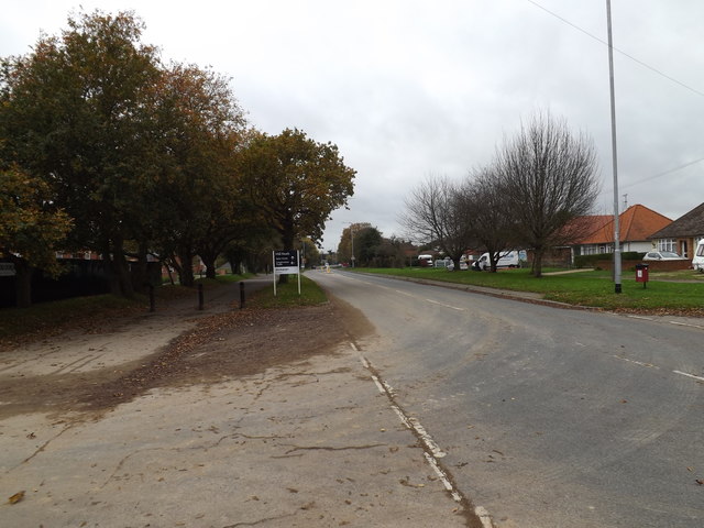
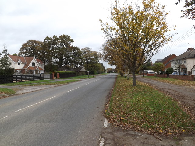
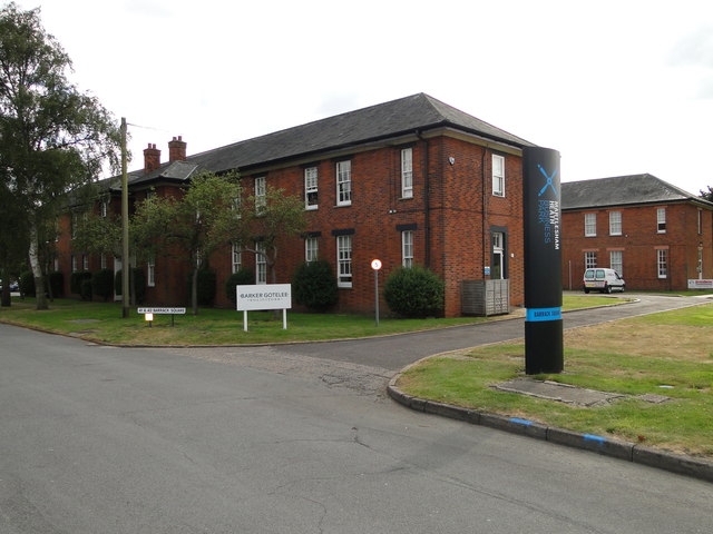
Adastral Park, located in Suffolk, England, is a sprawling scientific research and innovation campus surrounded by lush woodlands and forests. Situated near the village of Martlesham Heath, it covers an area of approximately 100 acres and is owned and operated by BT Group.

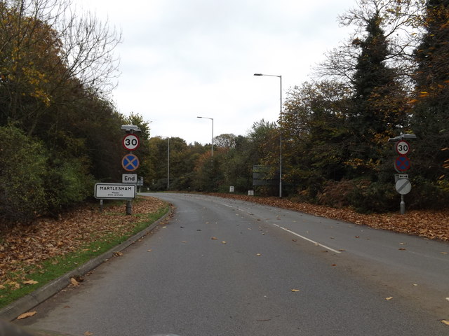
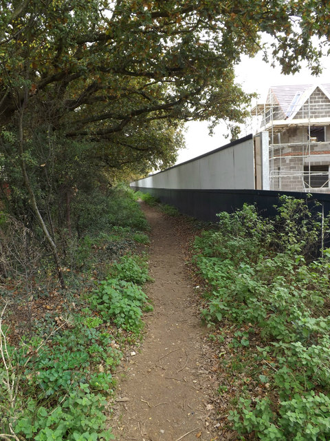
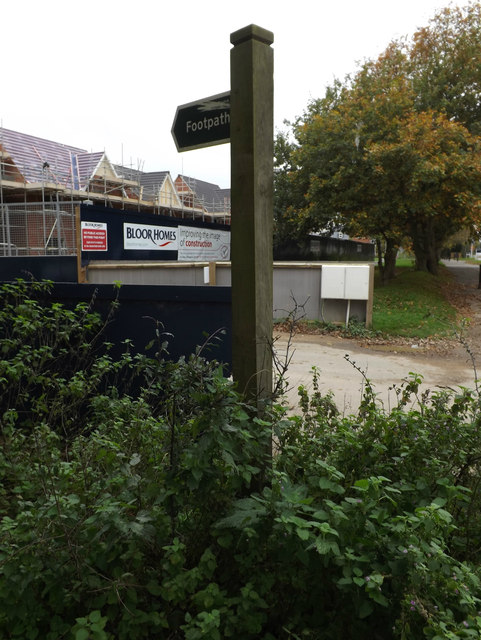
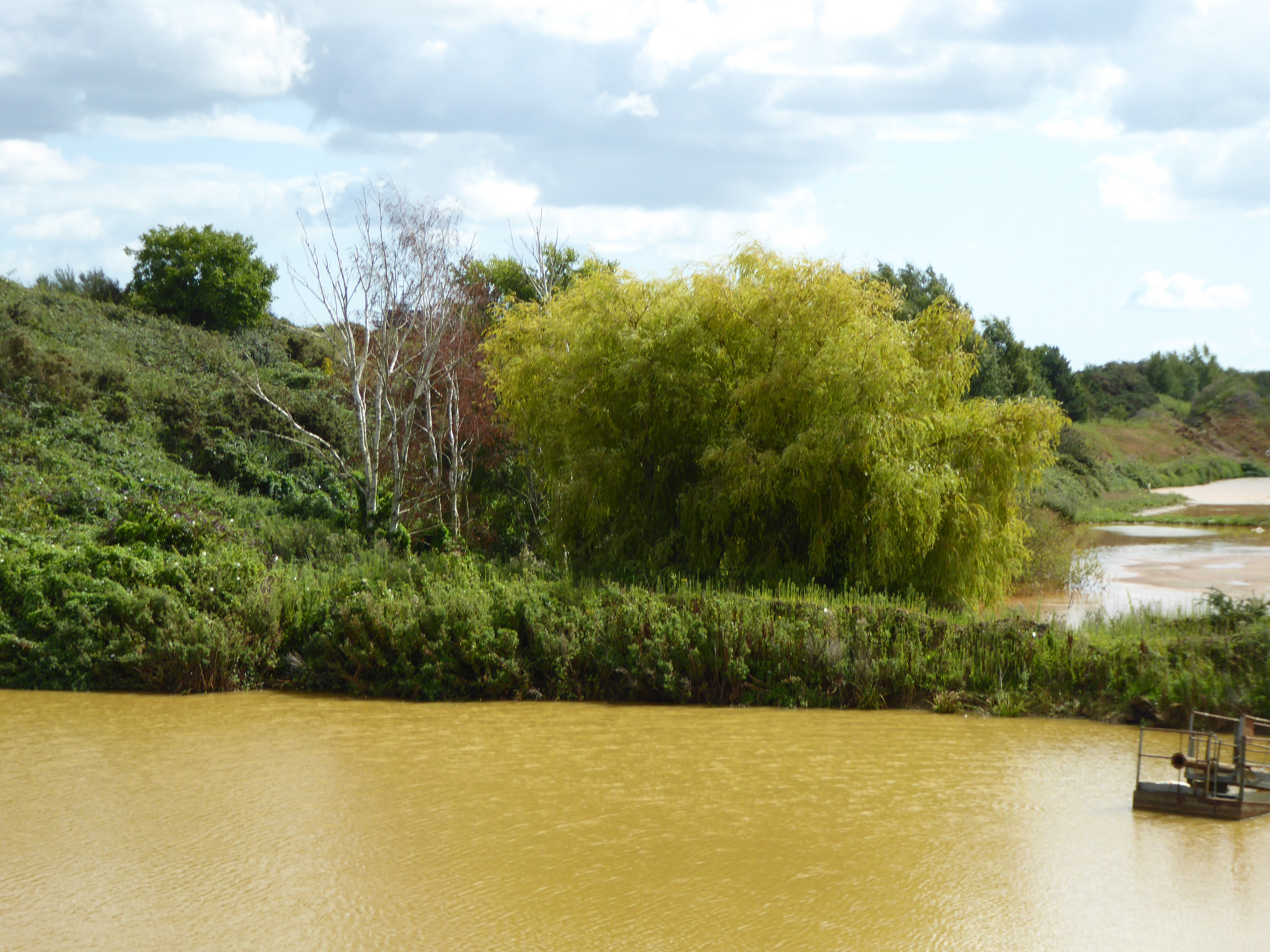
The park is renowned for its picturesque natural surroundings, with a significant portion of its land dedicated to woodlands and forests. These wooded areas are home to a diverse range of flora and fauna, including various species of trees, plants, and wildlife. The tranquil atmosphere created by the greenery and the peaceful surroundings makes Adastral Park a sought-after location for research and development activities.

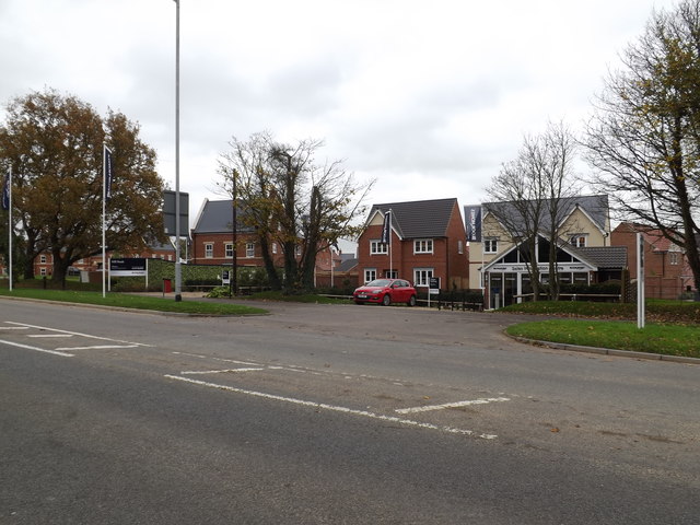
Adastral Park serves as a hub for technology-driven innovation, attracting some of the brightest minds from the fields of telecommunications, information technology, and research. The park is home to several state-of-the-art research laboratories, testing facilities, and collaborative spaces. It acts as a focal point for cutting-edge research, development, and commercialization of advanced technologies.

Additionally, Adastral Park hosts a range of events, conferences, and workshops, providing a platform for knowledge-sharing and collaboration among industry experts, academics, and entrepreneurs. The park also offers various amenities, including restaurants, cafes, and recreational facilities, ensuring a pleasant working environment for its residents and visitors.

Overall, Adastral Park in Suffolk stands as a unique blend of natural beauty and technological advancement, fostering innovation and serving as an important center for scientific research and development.

If you have any feedback on the listing, please let us know in the comments section below.

Adastral Park Images

Images are sourced within 2km of 52.056915/1.2837395 or Grid Reference TM2544. Thanks to Geograph Open Source API. All images are credited.

Entering Martlesham on Main Road <span class="nowrap"><a title="https://en.wikipedia.org/wiki/Martlesham" rel="nofollow ugc noopener" href="https://en.wikipedia.org/wiki/Martlesham">Link</a><img style="margin-left:2px;" alt="External link" title="External link - shift click to open in new window" src="https://s1.geograph.org.uk/img/external.png" width="10" height="10"/></span>
Entering Martlesham on Main Road
Martlesham Village Name sign on Main Road <span class="nowrap"><a title="https://en.wikipedia.org/wiki/Martlesham" rel="nofollow ugc noopener" href="https://en.wikipedia.org/wiki/Martlesham">Link</a><img style="margin-left:2px;" alt="External link" title="External link - shift click to open in new window" src="https://s1.geograph.org.uk/img/external.png" width="10" height="10"/></span>
Martlesham Village Name sign on Main Road
Mill Heath Housing Development Off Main Road
<span class="nowrap"><a title="https://bloorhomes.com/developments/eastern/mill-heath" rel="nofollow ugc noopener" href="https://bloorhomes.com/developments/eastern/mill-heath">Link</a><img style="margin-left:2px;" alt="External link" title="External link - shift click to open in new window" src="https://s1.geograph.org.uk/img/external.png" width="10" height="10"/></span>
Mill Heath Housing Development
Off Main Road LinkExternal link
Mill Heath sign Off Main Road
<span class="nowrap"><a title="https://bloorhomes.com/developments/eastern/mill-heath" rel="nofollow ugc noopener" href="https://bloorhomes.com/developments/eastern/mill-heath">Link</a><img style="margin-left:2px;" alt="External link" title="External link - shift click to open in new window" src="https://s1.geograph.org.uk/img/external.png" width="10" height="10"/></span>
Mill Heath sign
Off Main Road LinkExternal link
Site entrance to Mill Heath Housing Development Off Main Road
<span class="nowrap"><a title="https://bloorhomes.com/developments/eastern/mill-heath" rel="nofollow ugc noopener" href="https://bloorhomes.com/developments/eastern/mill-heath">Link</a><img style="margin-left:2px;" alt="External link" title="External link - shift click to open in new window" src="https://s1.geograph.org.uk/img/external.png" width="10" height="10"/></span>
Site entrance to Mill Heath Housing Development
Off Main Road LinkExternal link
Footpath off Main Road Near Mill Heath Housing Development
Footpath off Main Road
Near Mill Heath Housing Development
Footpath sign off Main Road Near Mill Heath Housing Development
Footpath sign off Main Road
Near Mill Heath Housing Development
Temporary Footpath Closure Notice Off Main Road near Mill Heath Housing Development
Temporary Footpath Closure Notice
Off Main Road near Mill Heath Housing Development
Footpath Diversion Map Off Main Road near Mill Heath Housing Development
Footpath Diversion Map
Off Main Road near Mill Heath Housing Development
Main Road Martlesham Looking towards the A12 Martlesham Bypass near Mill Heath Housing Development
Main Road Martlesham
Looking towards the A12 Martlesham Bypass near Mill Heath Housing Development
Main Road Martlesham Near Mill Heath Housing Development
Main Road Martlesham
Near Mill Heath Housing Development
Mill Heath sign Off Main Road
(Close up)
<span class="nowrap"><a title="https://bloorhomes.com/developments/eastern/mill-heath" rel="nofollow ugc noopener" href="https://bloorhomes.com/developments/eastern/mill-heath">Link</a><img style="margin-left:2px;" alt="External link" title="External link - shift click to open in new window" src="https://s1.geograph.org.uk/img/external.png" width="10" height="10"/></span>
Mill Heath sign
Off Main Road (Close up) LinkExternal link
Temporary Footpath Closure Notice signs Off Main Road near Mill Heath Housing Development
Temporary Footpath Closure Notice signs
Off Main Road near Mill Heath Housing Development
RAF Martlesham Memorials Each of the three memorials respect a different aspect of RAF Martlesham.
The Memorial on the left  <a title="https://www.geograph.org.uk/photo/5049313" href="https://www.geograph.org.uk/photo/5049313">Link</a> is in Remembrance of the men of the USAAF 356th Fighter Group who lost their lives in the course of their duty.
The smaller central memorial <a title="https://www.geograph.org.uk/photo/5049318" href="https://www.geograph.org.uk/photo/5049318">Link</a> is to RAF Station Martlesham itself and the contribution it made to the advancement of flight safety in both Military and Civil Aviation. From 1917 when it was the Aircraft Experimental Station of the Royal Flying Corps and continued in service until 1963. Between 1924 and 1939 it expanded its role and was renamed Aeroplane and Armament Experimental Establishment. At the outbreak of World war Two it became a Fighter base for the RAF and USAAF. Post war it resumed its experimental and research which included the Blind Landing Experimental Unit and the Bomb Ballistics Unit.
The Memorial on the right <a title="https://www.geograph.org.uk/photo/5049332" href="https://www.geograph.org.uk/photo/5049332">Link</a> is in memory of all those who gave their lives in War and Peace while serving at RAF Martlesham Heath. Including members of the Royal Flying Corps,  Royal Air Force, Dominions and Exiled Air Forces and the British Aircraft Industry.
RAF Martlesham Memorials
Each of the three memorials respect a different aspect of RAF Martlesham. The Memorial on the left Link is in Remembrance of the men of the USAAF 356th Fighter Group who lost their lives in the course of their duty. The smaller central memorial Link is to RAF Station Martlesham itself and the contribution it made to the advancement of flight safety in both Military and Civil Aviation. From 1917 when it was the Aircraft Experimental Station of the Royal Flying Corps and continued in service until 1963. Between 1924 and 1939 it expanded its role and was renamed Aeroplane and Armament Experimental Establishment. At the outbreak of World war Two it became a Fighter base for the RAF and USAAF. Post war it resumed its experimental and research which included the Blind Landing Experimental Unit and the Bomb Ballistics Unit. The Memorial on the right Link is in memory of all those who gave their lives in War and Peace while serving at RAF Martlesham Heath. Including members of the Royal Flying Corps, Royal Air Force, Dominions and Exiled Air Forces and the British Aircraft Industry.
Memorial to USAAF personnel, RAF Martlesham Heath The left memorial in this group of three <a title="https://www.geograph.org.uk/photo/5049301" href="https://www.geograph.org.uk/photo/5049301">Link</a>
Erected in Remembrance of the men of the USAAF 356th Fighter Group who lost their lives in the course of their duty.
Names should be readable in largest image.
Memorial to USAAF personnel, RAF Martlesham Heath
The left memorial in this group of three Link Erected in Remembrance of the men of the USAAF 356th Fighter Group who lost their lives in the course of their duty. Names should be readable in largest image.
The central of three RAF Martlesham Heath Memorials This memorial is one of three <a title="https://www.geograph.org.uk/photo/5049301" href="https://www.geograph.org.uk/photo/5049301">Link</a> and is to RAF Station Martlesham itself and the contribution it made to the advancement of flight safety in both Military and Civil Aviation. From 1917 when it was the Aircraft Experimental Station of the Royal Flying Corps until 1963. Between 1924 and 1939 it expanded its role and was renamed Aeroplane and Armament Experimental Establishment. At the outbreak of World War Two it became a Fighter base for the RAF and USAAF. Post war it resumed its experimental and research which included the Blind Landing Experimental Unit and the Bomb Ballistics Unit until its closure in 1963.
The central of three RAF Martlesham Heath Memorials
This memorial is one of three Link and is to RAF Station Martlesham itself and the contribution it made to the advancement of flight safety in both Military and Civil Aviation. From 1917 when it was the Aircraft Experimental Station of the Royal Flying Corps until 1963. Between 1924 and 1939 it expanded its role and was renamed Aeroplane and Armament Experimental Establishment. At the outbreak of World War Two it became a Fighter base for the RAF and USAAF. Post war it resumed its experimental and research which included the Blind Landing Experimental Unit and the Bomb Ballistics Unit until its closure in 1963.
Memorial to the role of RAF Martlesham Heath 1919-1963 This Memorial is the one on the right of this group <a title="https://www.geograph.org.uk/photo/5049301" href="https://www.geograph.org.uk/photo/5049301">Link</a> it is in memory of all those who gave their lives in War and Peace while serving at RAF Martlesham Heath. Including members of the Royal Flying Corps, Royal Air Force, Dominions and Exiled Air Forces and the British Aircraft Industry.
Memorial to the role of RAF Martlesham Heath 1919-1963
This Memorial is the one on the right of this group Link it is in memory of all those who gave their lives in War and Peace while serving at RAF Martlesham Heath. Including members of the Royal Flying Corps, Royal Air Force, Dominions and Exiled Air Forces and the British Aircraft Industry.
Once the Barracks Blocks of RAF Martlesham Heath Four Barracks blocks still stand surrounding what was once the parade ground. The Barracks are currently mainly residential with some utilised as office accommodation.
Once the Barracks Blocks of RAF Martlesham Heath
Four Barracks blocks still stand surrounding what was once the parade ground. The Barracks are currently mainly residential with some utilised as office accommodation.
Show me another place!

Adastral Park is located at Grid Ref: TM2544 (Lat: 52.056915, Lng: 1.2837395)

Administrative County: Suffolk

District: East Suffolk

Police Authority: Suffolk

What 3 Words

///follow.ladders.bearable. Near Kesgrave, Suffolk

Related Wikis

Centre for Integrated Photonics

The Centre for Integrated Photonics (CIP) was a research and development centre for photonic devices. It was based in Phoenix House at Adastral Park in...

Adastral Park

Adastral Park is a science campus based on part of the old Royal Air Force Station at Martlesham Heath, near Ipswich in the English county of Suffolk....

Waldringfield Pit

Waldringfield Pit is a 0.8-hectare (2.0-acre) geological Site of Special Scientific Interest between Martlesham Heath and Waldringfield in Suffolk. It...

Martlesham Heath

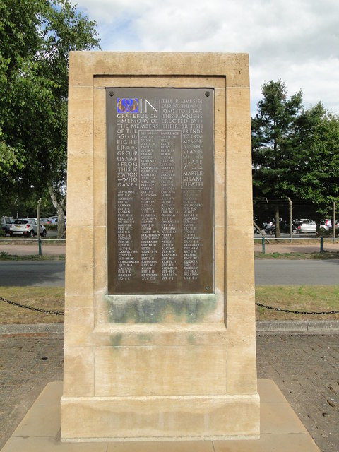
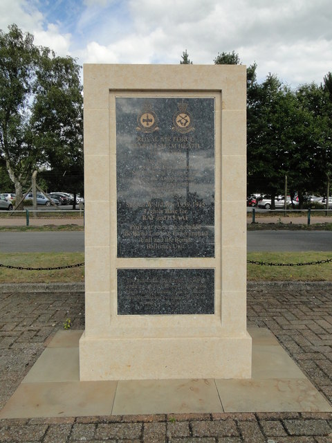
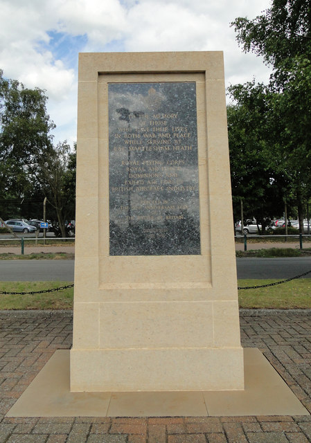
Martlesham Heath is a village in Suffolk, England. It is 6 miles (10 km) east of Ipswich, This was an ancient area of heathland and latterly the site of...

RAF Martlesham Heath

Royal Air Force Martlesham Heath or more simply RAF Martlesham Heath is a former Royal Air Force station located 1.5 miles (2.4 km) southwest of Woodbridge...

Woodbridge Rural District

Woodbridge Rural District was a rural district within the administrative county of East Suffolk between 1894 and 1934. It was created out of the earlier...

Brightwell, Suffolk

Brightwell is a village and civil parish in the East Suffolk district, in the English county of Suffolk. It has a church called St John The Baptist. For...
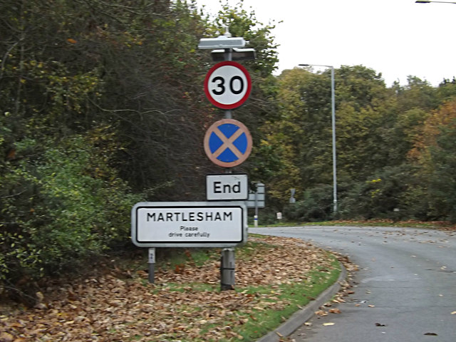
Martlesham

Martlesham is a village in Suffolk, England about two miles (3 km) South-West of Woodbridge and 6 miles (9.7 km) East of Ipswich. It is often referred...

Related Videos

Martlesham Wilds|Suffolk|UK|Virtual Walk|Dog Walking Route|4K

A man, his best mate and a camera. A walk around Martlesham Wilds, Suffolk. Made for viewers looking for new walking routes, ...

Nearby Amenities

Located within 500m of 52.056915,1.2837395
Crossing
Crossing: marked
Lat/Long: 52.0592637/1.2797338
Crossing
Crossing: marked
Lat/Long: 52.0553285/1.2824233
Crossing
Crossing: uncontrolled
Lat/Long: 52.0600422/1.2870582
Pegasus
Man Made: tower
Lat/Long: 52.0562557/1.2802403
Created By: Potlatch 0.10f
Man Made: satellite_dish
Lat/Long: 52.0596026/1.2878836
Post Box
Operator: Royal Mail
Operator Type: private
Operator Wikidata: Q638098
Ref: IP5 8222
Lat/Long: 52.0585027/1.2804727
Noexit: yes
Lat/Long: 52.0565957/1.2764851
Historic: memorial
Lat/Long: 52.0578267/1.2779971
FIXME: Needs survey to check
Bunker Type: pillbox
Military: bunker
Lat/Long: 52.0540055/1.2796951
Addr Housenumber: 65
Addr Street: Coopers Road
Source Number: Ground survey
Source Position: Yahoo & OS_OpenData_StreetView
Lat/Long: 52.0566029/1.2767994
Addr Housenumber: 67
Addr Street: Coopers Road
Source Number: Ground survey
Source Position: Yahoo & OS_OpenData_StreetView
Lat/Long: 52.0564136/1.2766911
Addr Housenumber: 57
Addr Street: Coopers Road
Source Number: Ground survey
Source Position: Yahoo & OS_OpenData_StreetView
Lat/Long: 52.0571418/1.2764457
Addr Housenumber: 59
Addr Street: Coopers Road
Source Number: Ground survey
Source Position: Yahoo & OS_OpenData_StreetView
Lat/Long: 52.0570091/1.2764262
Addr Housenumber: 63
Addr Street: Coopers Road
Source Number: Ground survey
Source Position: Yahoo & OS_OpenData_StreetView
Lat/Long: 52.0567855/1.276765
FIXME: Needs survey to check
Bunker Type: pillbox
Military: bunker
Lat/Long: 52.0532762/1.2807842
Building: bunker
Bunker Type: pillbox
Fixme: Needs survey to check
Military: bunker
Lat/Long: 52.0548428/1.2802462
Power: pole
Lat/Long: 52.0547582/1.2875489
Man Made: satellite_dish
Lat/Long: 52.0598312/1.2874766
Man Made: satellite_dish
Lat/Long: 52.0598493/1.2877126
Power: pole
Lat/Long: 52.0538659/1.2887009
Power: pole
Lat/Long: 52.0558492/1.2872659
Man Made: satellite_dish
Lat/Long: 52.059437/1.2876536
Man Made: satellite_dish
Lat/Long: 52.0600555/1.2877931
Power: pole
Lat/Long: 52.0567786/1.287062
Power: pole
Lat/Long: 52.0567671/1.2869897
Man Made: satellite_dish
Lat/Long: 52.0598774/1.2870716
Bicycle Parking
Bicycle Parking: anchors
Capacity: 6
Covered: yes
Lat/Long: 52.0560095/1.2780981
Crossing
Crossing: marked
Lat/Long: 52.0567996/1.2798129
Bus Stop
Adastral Park Reception
Bench: no
Covered: no
Shelter: no
Lat/Long: 52.0589853/1.2787775
Crossing
Crossing: marked
Lat/Long: 52.0554104/1.2808593
Crossing
Crossing: marked
Lat/Long: 52.0563829/1.2833772
Crossing
Crossing: marked
Lat/Long: 52.0573125/1.2825311
Crossing
Crossing: marked
Lat/Long: 52.0588789/1.2794436
Crossing
Crossing: marked
Lat/Long: 52.0587472/1.2813413
Bicycle Parking
Bicycle Parking: staple
Capacity: 2
Covered: no
Lat/Long: 52.0589799/1.2788419
Entrance: main
Lat/Long: 52.0565543/1.2782445
Crossing
Crossing: marked
Lat/Long: 52.0565351/1.2798239
Crossing
Crossing: marked
Lat/Long: 52.057714/1.2794501
Crossing
Crossing: marked
Lat/Long: 52.0583443/1.279449
Crossing
Crossing: marked
Lat/Long: 52.0594443/1.2801422
Crossing
Crossing: marked
Lat/Long: 52.0589688/1.2809996
Crossing
Crossing: marked
Lat/Long: 52.0591273/1.2809885
Crossing
Crossing: marked
Crossing Markings: yes
Lat/Long: 52.0586265/1.2813136
Crossing
Crossing: marked
Lat/Long: 52.0579682/1.2819209
Crossing
Crossing: marked
Lat/Long: 52.0574672/1.2822255
Crossing
Crossing: marked
Lat/Long: 52.058131/1.2813732
Crossing
Crossing: marked
Lat/Long: 52.0579997/1.2795622
Crossing
Crossing: marked;uncontrolled
Lat/Long: 52.0586461/1.2788083
Crossing
Crossing: marked;uncontrolled
Lat/Long: 52.058762/1.2788042
Landing Site
Emergency: landing_site
Lat/Long: 52.0557041/1.2801345
Man Made: charge_point
Lat/Long: 52.0590154/1.2805491
Crossing
Crossing: marked
Lat/Long: 52.0590008/1.2787366
Crossing
Crossing: marked
Lat/Long: 52.0600928/1.2806143
Crossing
Crossing: marked
Lat/Long: 52.0600985/1.2809529
Bicycle Parking
Lat/Long: 52.0563973/1.2803881
Bicycle Parking
Lat/Long: 52.056237/1.2797946
Bicycle Parking
Lat/Long: 52.0572616/1.2848268
Bicycle Parking
Lat/Long: 52.0595193/1.2851456
Bicycle Parking
Lat/Long: 52.0594827/1.2826631
Bicycle Parking
Lat/Long: 52.0596633/1.2814345
WHSmith
Access: private
Addr City: Ipswich
Addr Housename: Building B40
Addr Postcode: IP5 3RE
Addr Street: Adastral Park
Brand: WHSmith
Brand Wikidata: Q1548712
Fhrs Id: 660172
Shop: newsagent
Lat/Long: 52.0586599/1.2804638
Crossing
Crossing: marked
Lat/Long: 52.0590545/1.2822556
Information: board
Tourism: information
Lat/Long: 52.0587606/1.2796816
Man Made: charge_point
Lat/Long: 52.0567335/1.2788982
Man Made: charge_point
Lat/Long: 52.0567323/1.2791175
Smoking Area
Lat/Long: 52.0565115/1.2824667
Barrier: block
Lat/Long: 52.059193/1.2780534
Crossing
Lat/Long: 52.0585927/1.27851
Telephone
Booth: K6
Covered: booth
Lat/Long: 52.0588794/1.2792839
Man Made: charge_point
Lat/Long: 52.0564727/1.2835161
Man Made: charge_point
Lat/Long: 52.0564871/1.2835573
Man Made: charge_point
Lat/Long: 52.0589785/1.2805573
Generator Method: photovoltaic
Generator Output Electricity: yes
Generator Source: solar
Generator Type: solar_photovoltaic_panel
Location: roof
Power: generator
Lat/Long: 52.0574945/1.2765223
The data included in this document is from www.openstreetmap.org. The data is made available under ODbL.

Have you been to Adastral Park?

Leave your review of Adastral Park below (or comments, questions and feedback).