Foxburrow Plantation
Wood, Forest in Suffolk East Suffolk
England
Foxburrow Plantation
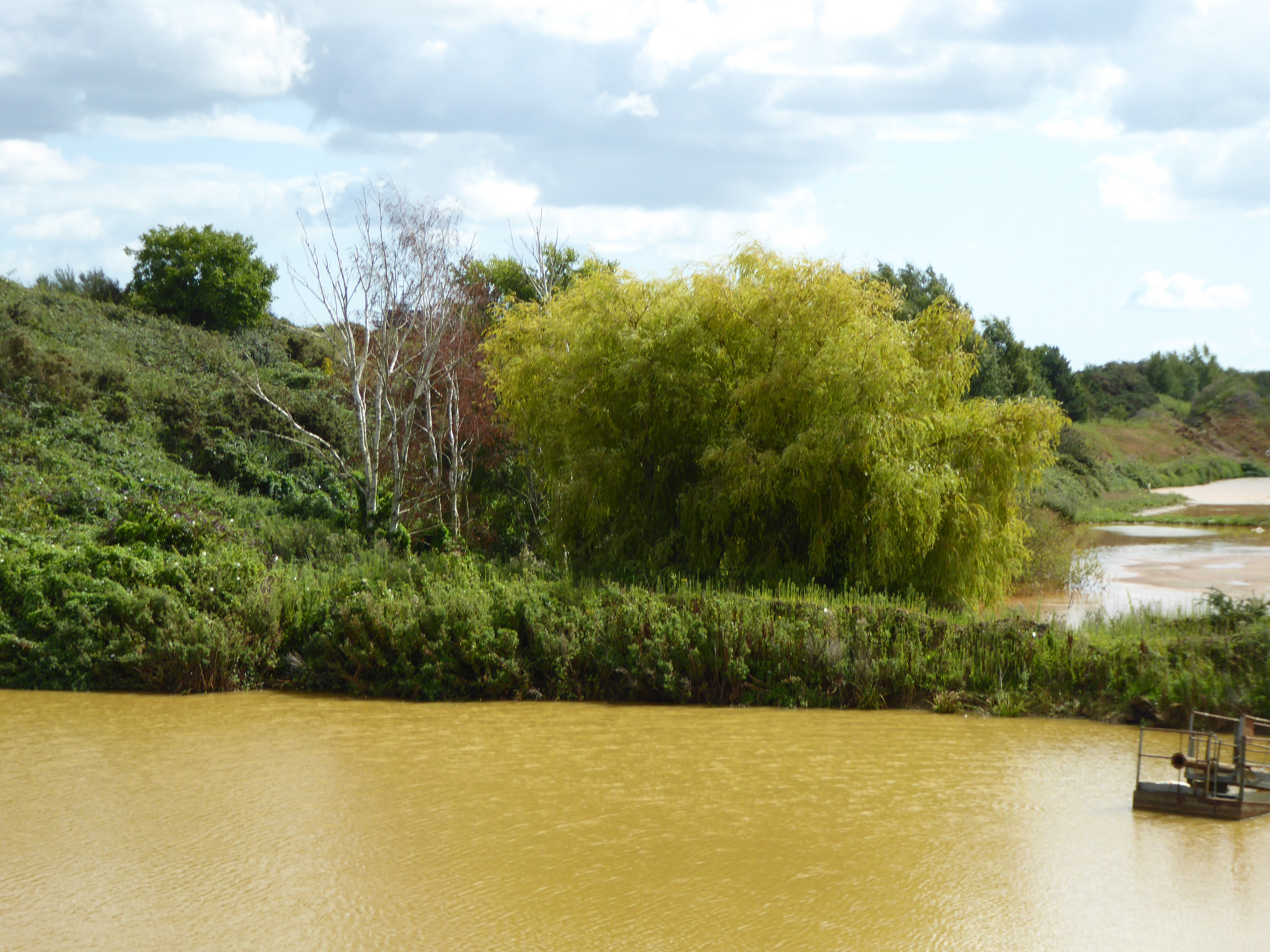
Foxburrow Plantation is a magnificent woodland located in Suffolk, England. Spanning over a vast area, this enchanting forest is situated in the heart of the county, just a short distance from the town of Woodbridge. Known for its natural beauty and rich biodiversity, Foxburrow Plantation is a haven for nature lovers and enthusiasts alike.
The plantation is characterized by its dense canopy of towering oak, beech, and birch trees, which create a serene and tranquil atmosphere. The forest floor is adorned with a diverse array of flora, including bluebells, ferns, and wildflowers, adding a splash of color to the landscape during the spring and summer months.
Home to a myriad of wildlife, Foxburrow Plantation offers a sanctuary for various species. Visitors may catch a glimpse of deer, badgers, foxes, and a variety of bird species, including owls and woodpeckers. The forest provides an ideal habitat for these creatures, offering ample food sources and shelter.
In addition to its natural wonders, Foxburrow Plantation also boasts a network of well-maintained trails, making it a popular spot for walking, hiking, and cycling. These paths wind their way through the forest, leading visitors on an adventure through its captivating scenery.
Whether one seeks solitude and tranquility or wishes to immerse themselves in the wonders of nature, Foxburrow Plantation is a destination that offers it all. With its breathtaking beauty and abundant wildlife, this woodland gem is a must-visit for anyone looking to connect with the natural world.
If you have any feedback on the listing, please let us know in the comments section below.
Foxburrow Plantation Images
Images are sourced within 2km of 52.050706/1.2922265 or Grid Reference TM2544. Thanks to Geograph Open Source API. All images are credited.


Foxburrow Plantation is located at Grid Ref: TM2544 (Lat: 52.050706, Lng: 1.2922265)
Administrative County: Suffolk
District: East Suffolk
Police Authority: Suffolk
What 3 Words
///planet.easygoing.business. Near Kesgrave, Suffolk
Nearby Locations
Related Wikis
Waldringfield Pit
Waldringfield Pit is a 0.8-hectare (2.0-acre) geological Site of Special Scientific Interest between Martlesham Heath and Waldringfield in Suffolk. It...

Centre for Integrated Photonics
The Centre for Integrated Photonics (CIP) was a research and development centre for photonic devices. It was based in Phoenix House at Adastral Park in...
Brightwell, Suffolk
Brightwell is a village and civil parish in the East Suffolk district, in the English county of Suffolk. It has a church called St John The Baptist. For...

Adastral Park
Adastral Park is a science campus based on part of the old Royal Air Force Station at Martlesham Heath, near Ipswich in the English county of Suffolk....

Newbourne Springs
Newbourne Springs is a 15.7-hectare (39-acre) biological Site of Special Scientific Interest in Newbourne in Suffolk. It is owned by Anglian Water and...

Martlesham Heath
Martlesham Heath is a village in Suffolk, England. It is 6 miles (10 km) east of Ipswich, This was an ancient area of heathland and latterly the site of...
Newbourne
Newbourne is a village and civil parish in the East Suffolk district of Suffolk, England. It lies on the peninsula between the River Orwell and the River...

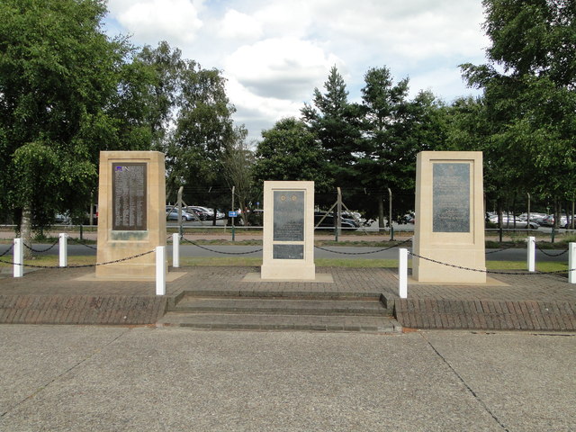
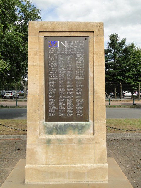
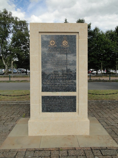
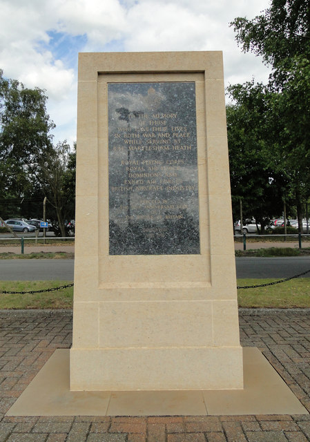
RAF Martlesham Heath
Royal Air Force Martlesham Heath or more simply RAF Martlesham Heath is a former Royal Air Force station located 1.5 miles (2.4 km) southwest of Woodbridge...
Nearby Amenities
Located within 500m of 52.050706,1.2922265Have you been to Foxburrow Plantation?
Leave your review of Foxburrow Plantation below (or comments, questions and feedback).