Frindsbury
Settlement in Kent
England
Frindsbury
![Upnor houses [1] Number 3 High Street, Upper Upnor, was built in the early 19th century. Constructed of yellow brick under a tile roof. Listed, grade II, with details at: <span class="nowrap"><a title="https://historicengland.org.uk/listing/the-list/list-entry/1085740" rel="nofollow ugc noopener" href="https://historicengland.org.uk/listing/the-list/list-entry/1085740">Link</a><img style="margin-left:2px;" alt="External link" title="External link - shift click to open in new window" src="https://s1.geograph.org.uk/img/external.png" width="10" height="10"/></span>
Upper Upnor and Lower Upnor are two small villages on the bank of the Medway River, some 1½ miles and 2 miles respectively northeast of Rochester. Upper Upnor is little more than a cobbled high street leading down to Upnor Castle, an Elizabethan artillery fort.](https://s0.geograph.org.uk/geophotos/07/07/36/7073624_9222e0ed.jpg)
Frindsbury is a small village located in the county of Kent, in southeastern England. Situated on the outskirts of the town of Rochester, Frindsbury is nestled along the banks of the River Medway. The village is part of the Medway unitary authority and benefits from its proximity to the larger urban areas while maintaining its rural charm.
Frindsbury is renowned for its picturesque setting, surrounded by rolling hills and lush green countryside. The village boasts a quaint and peaceful atmosphere, making it an ideal place for those seeking a tranquil retreat. Its close proximity to the River Medway also offers residents and visitors the opportunity to enjoy scenic walks along its banks and take part in recreational activities such as boating and fishing.
The village itself has a rich history and is home to several notable landmarks. One such landmark is St. Peter and St. Paul Church, a beautiful Grade I listed building that dates back to the 12th century. The church features stunning architectural details and serves as a reminder of Frindsbury's historical significance.
Frindsbury enjoys excellent transport links, with easy access to major roads and motorways. The nearby Rochester train station provides regular services to London and other major cities, making it an attractive location for commuters.
The village also benefits from a range of amenities, including shops, pubs, and restaurants, which cater to the needs of residents and visitors alike.
If you have any feedback on the listing, please let us know in the comments section below.
Frindsbury Images
Images are sourced within 2km of 51.401471/0.500246 or Grid Reference TQ7469. Thanks to Geograph Open Source API. All images are credited.
![Upnor houses [2] A delightfully eccentric house at number 7A High Street, Upper Upnor.
Upper Upnor and Lower Upnor are two small villages on the bank of the Medway River, some 1½ miles and 2 miles respectively northeast of Rochester. Upper Upnor is little more than a cobbled high street leading down to Upnor Castle, an Elizabethan artillery fort.](https://s2.geograph.org.uk/geophotos/07/07/36/7073626_aff411c2.jpg)
![Upnor houses [3] Castle House, number 19 High Street, seen here, and Albermarle Cottage, number 21 High Street <a href="https://www.geograph.org.uk/photo/7073630">TQ7570 : Upnor houses [4]</a>, are a pair of 17th century cottages. Number 19 has been greatly extended. Timber framed, number 19 weatherboarded, number 21 rendered ground floor, weatherboard above, all under a tile roof. Listed, grade II, with details at: <span class="nowrap"><a title="https://historicengland.org.uk/listing/the-list/list-entry/1336490" rel="nofollow ugc noopener" href="https://historicengland.org.uk/listing/the-list/list-entry/1336490">Link</a><img style="margin-left:2px;" alt="External link" title="External link - shift click to open in new window" src="https://s1.geograph.org.uk/img/external.png" width="10" height="10"/></span>
Upper Upnor and Lower Upnor are two small villages on the bank of the Medway River, some 1½ miles and 2 miles respectively northeast of Rochester. Upper Upnor is little more than a cobbled high street leading down to Upnor Castle, an Elizabethan artillery fort.](https://s1.geograph.org.uk/geophotos/07/07/36/7073629_c6e9ecd9.jpg)
![Upnor houses [4] Albermarle Cottage, number 21 High Street, seen here and Castle House, number 19 High Street, <a href="https://www.geograph.org.uk/photo/7073629">TQ7570 : Upnor houses [3]</a>, are a pair of 17th century cottages. Number 19 has been greatly extended. Timber framed, number 19 weatherboarded, number 21 rendered ground floor, weatherboard above, all under a tile roof. Listed, grade II, with details at: <span class="nowrap"><a title="https://historicengland.org.uk/listing/the-list/list-entry/1336490" rel="nofollow ugc noopener" href="https://historicengland.org.uk/listing/the-list/list-entry/1336490">Link</a><img style="margin-left:2px;" alt="External link" title="External link - shift click to open in new window" src="https://s1.geograph.org.uk/img/external.png" width="10" height="10"/></span>
Upper Upnor and Lower Upnor are two small villages on the bank of the Medway River, some 1½ miles and 2 miles respectively northeast of Rochester. Upper Upnor is little more than a cobbled high street leading down to Upnor Castle, an Elizabethan artillery fort.](https://s2.geograph.org.uk/geophotos/07/07/36/7073630_d582d622.jpg)
![Upnor buildings [1] The Tudor Rose public house, number 29 High Street, Upper Upnor, is in two builds. The nearest part is late 17th or early 18th century, the further part and the projecting entrance is 19th century. Constructed of rendered brick with a mix of tile and slate roofs. Some internal late Georgian fittings remain. Listed, grade II, with details at: <span class="nowrap"><a title="https://historicengland.org.uk/listing/the-list/list-entry/1390628" rel="nofollow ugc noopener" href="https://historicengland.org.uk/listing/the-list/list-entry/1390628">Link</a><img style="margin-left:2px;" alt="External link" title="External link - shift click to open in new window" src="https://s1.geograph.org.uk/img/external.png" width="10" height="10"/></span>
Upper Upnor and Lower Upnor are two small villages on the bank of the Medway River, some 1½ miles and 2 miles respectively northeast of Rochester. Upper Upnor is little more than a cobbled high street leading down to Upnor Castle, an Elizabethan artillery fort.](https://s0.geograph.org.uk/geophotos/07/07/44/7074440_54221b5e.jpg)
![Upnor houses [5] Numbers 30 and 32 High Street, Upper Upnor, are a pair of 17th century cottages, now combined into one. Timber framed and weatherboarded with some rendering on the first floor, all under a tile roof. Listed, grade II, with details at: <span class="nowrap"><a title="https://historicengland.org.uk/listing/the-list/list-entry/1085743" rel="nofollow ugc noopener" href="https://historicengland.org.uk/listing/the-list/list-entry/1085743">Link</a><img style="margin-left:2px;" alt="External link" title="External link - shift click to open in new window" src="https://s1.geograph.org.uk/img/external.png" width="10" height="10"/></span>
Upper Upnor and Lower Upnor are two small villages on the bank of the Medway River, some 1½ miles and 2 miles respectively northeast of Rochester. Upper Upnor is little more than a cobbled high street leading down to Upnor Castle, an Elizabethan artillery fort.](https://s1.geograph.org.uk/geophotos/07/07/44/7074441_4bcc2a66.jpg)
![Upnor houses [6] This row of cottages, even numbers 12 to 18, High Street, were built in the mid 18th century. Constructed of weatherboarded brick under a tiled mansard roof. Listed, grade II, with details at: <span class="nowrap"><a title="https://historicengland.org.uk/listing/the-list/list-entry/1336491" rel="nofollow ugc noopener" href="https://historicengland.org.uk/listing/the-list/list-entry/1336491">Link</a><img style="margin-left:2px;" alt="External link" title="External link - shift click to open in new window" src="https://s1.geograph.org.uk/img/external.png" width="10" height="10"/></span>
Upper Upnor and Lower Upnor are two small villages on the bank of the Medway River, some 1½ miles and 2 miles respectively northeast of Rochester. Upper Upnor is little more than a cobbled high street leading down to Upnor Castle, an Elizabethan artillery fort.](https://s2.geograph.org.uk/geophotos/07/07/44/7074442_74e6d169.jpg)
![Upnor features [1] At the bottom of the High Street in Upper Upnor is this delightful lookout with a fine view over the River Medway.
Upper Upnor and Lower Upnor are two small villages on the bank of the Medway River, some 1½ miles and 2 miles respectively northeast of Rochester. Upper Upnor is little more than a cobbled high street leading down to Upnor Castle, an Elizabethan artillery fort.](https://s3.geograph.org.uk/geophotos/07/07/44/7074443_4d4799ca.jpg)
![Upnor features [2] At the bottom of the High Street, Upper Upnor, on the bank of the River Medway, is this fine topograph.
Upper Upnor and Lower Upnor are two small villages on the bank of the Medway River, some 1½ miles and 2 miles respectively northeast of Rochester. Upper Upnor is little more than a cobbled high street leading down to Upnor Castle, an Elizabethan artillery fort.](https://s0.geograph.org.uk/geophotos/07/07/44/7074444_053d427b.jpg)
![Upnor Castle [1] An information board near the entrance to the castle.
Upnor Castle is an Elizabethan artillery fort intended to protect Chatham Dockyard and ships of the Royal Navy anchored in the Medway. It was constructed between 1559–67 on the orders of Elizabeth I. Neglected in the 17th century and, when the Dutch raided in 1667, the fort was replaced by stronger defences downriver and became a gunpowder store. It remained in military use until 1945 and is now in the care of English Heritage and open to the public. Listed, grade I, with details at: <span class="nowrap"><a title="https://historicengland.org.uk/listing/the-list/list-entry/1204365" rel="nofollow ugc noopener" href="https://historicengland.org.uk/listing/the-list/list-entry/1204365">Link</a><img style="margin-left:2px;" alt="External link" title="External link - shift click to open in new window" src="https://s1.geograph.org.uk/img/external.png" width="10" height="10"/></span> A Scheduled Ancient Monument with details at: <span class="nowrap"><a title="https://historicengland.org.uk/listing/the-list/list-entry/1012980" rel="nofollow ugc noopener" href="https://historicengland.org.uk/listing/the-list/list-entry/1012980">Link</a><img style="margin-left:2px;" alt="External link" title="External link - shift click to open in new window" src="https://s1.geograph.org.uk/img/external.png" width="10" height="10"/></span>](https://s1.geograph.org.uk/geophotos/07/07/44/7074445_2ad383f4.jpg)
![Upnor Castle [2] The gatehouse to the inner fort.
Upnor Castle is an Elizabethan artillery fort intended to protect Chatham Dockyard and ships of the Royal Navy anchored in the Medway. It was constructed between 1559–67 on the orders of Elizabeth I. Neglected in the 17th century and, when the Dutch raided in 1667, the fort was replaced by stronger defences downriver and became a gunpowder store. It remained in military use until 1945 and is now in the care of English Heritage and open to the public. Listed, grade I, with details at: <span class="nowrap"><a title="https://historicengland.org.uk/listing/the-list/list-entry/1204365" rel="nofollow ugc noopener" href="https://historicengland.org.uk/listing/the-list/list-entry/1204365">Link</a><img style="margin-left:2px;" alt="External link" title="External link - shift click to open in new window" src="https://s1.geograph.org.uk/img/external.png" width="10" height="10"/></span> A Scheduled Ancient Monument with details at: <span class="nowrap"><a title="https://historicengland.org.uk/listing/the-list/list-entry/1012980" rel="nofollow ugc noopener" href="https://historicengland.org.uk/listing/the-list/list-entry/1012980">Link</a><img style="margin-left:2px;" alt="External link" title="External link - shift click to open in new window" src="https://s1.geograph.org.uk/img/external.png" width="10" height="10"/></span>](https://s2.geograph.org.uk/geophotos/07/07/44/7074446_76273b5f.jpg)
![Upnor Castle [3] The gatehouse of the fort.
Upnor Castle is an Elizabethan artillery fort intended to protect Chatham Dockyard and ships of the Royal Navy anchored in the Medway. It was constructed between 1559–67 on the orders of Elizabeth I. Neglected in the 17th century and, when the Dutch raided in 1667, the fort was replaced by stronger defences downriver and became a gunpowder store. It remained in military use until 1945 and is now in the care of English Heritage and open to the public. Listed, grade I, with details at: <span class="nowrap"><a title="https://historicengland.org.uk/listing/the-list/list-entry/1204365" rel="nofollow ugc noopener" href="https://historicengland.org.uk/listing/the-list/list-entry/1204365">Link</a><img style="margin-left:2px;" alt="External link" title="External link - shift click to open in new window" src="https://s1.geograph.org.uk/img/external.png" width="10" height="10"/></span> A Scheduled Ancient Monument with details at: <span class="nowrap"><a title="https://historicengland.org.uk/listing/the-list/list-entry/1012980" rel="nofollow ugc noopener" href="https://historicengland.org.uk/listing/the-list/list-entry/1012980">Link</a><img style="margin-left:2px;" alt="External link" title="External link - shift click to open in new window" src="https://s1.geograph.org.uk/img/external.png" width="10" height="10"/></span>](https://s3.geograph.org.uk/geophotos/07/07/44/7074447_0ae557e2.jpg)
![Upnor Castle [4] Inside the fort.
Upnor Castle is an Elizabethan artillery fort intended to protect Chatham Dockyard and ships of the Royal Navy anchored in the Medway. It was constructed between 1559–67 on the orders of Elizabeth I. Neglected in the 17th century and, when the Dutch raided in 1667, the fort was replaced by stronger defences downriver and became a gunpowder store. It remained in military use until 1945 and is now in the care of English Heritage and open to the public. Listed, grade I, with details at: <span class="nowrap"><a title="https://historicengland.org.uk/listing/the-list/list-entry/1204365" rel="nofollow ugc noopener" href="https://historicengland.org.uk/listing/the-list/list-entry/1204365">Link</a><img style="margin-left:2px;" alt="External link" title="External link - shift click to open in new window" src="https://s1.geograph.org.uk/img/external.png" width="10" height="10"/></span> A Scheduled Ancient Monument with details at: <span class="nowrap"><a title="https://historicengland.org.uk/listing/the-list/list-entry/1012980" rel="nofollow ugc noopener" href="https://historicengland.org.uk/listing/the-list/list-entry/1012980">Link</a><img style="margin-left:2px;" alt="External link" title="External link - shift click to open in new window" src="https://s1.geograph.org.uk/img/external.png" width="10" height="10"/></span>](https://s0.geograph.org.uk/geophotos/07/07/44/7074448_59ca027f.jpg)
![Upnor Castle [5] Inside the fort.
Upnor Castle is an Elizabethan artillery fort intended to protect Chatham Dockyard and ships of the Royal Navy anchored in the Medway. It was constructed between 1559–67 on the orders of Elizabeth I. Neglected in the 17th century and, when the Dutch raided in 1667, the fort was replaced by stronger defences downriver and became a gunpowder store. It remained in military use until 1945 and is now in the care of English Heritage and open to the public. Listed, grade I, with details at: <span class="nowrap"><a title="https://historicengland.org.uk/listing/the-list/list-entry/1204365" rel="nofollow ugc noopener" href="https://historicengland.org.uk/listing/the-list/list-entry/1204365">Link</a><img style="margin-left:2px;" alt="External link" title="External link - shift click to open in new window" src="https://s1.geograph.org.uk/img/external.png" width="10" height="10"/></span> A Scheduled Ancient Monument with details at: <span class="nowrap"><a title="https://historicengland.org.uk/listing/the-list/list-entry/1012980" rel="nofollow ugc noopener" href="https://historicengland.org.uk/listing/the-list/list-entry/1012980">Link</a><img style="margin-left:2px;" alt="External link" title="External link - shift click to open in new window" src="https://s1.geograph.org.uk/img/external.png" width="10" height="10"/></span>](https://s1.geograph.org.uk/geophotos/07/07/44/7074449_c7535126.jpg)
![Upnor Castle [6] The river entrance to the fort from the palisade projecting into the river.
Upnor Castle is an Elizabethan artillery fort intended to protect Chatham Dockyard and ships of the Royal Navy anchored in the Medway. It was constructed between 1559–67 on the orders of Elizabeth I. Neglected in the 17th century and, when the Dutch raided in 1667, the fort was replaced by stronger defences downriver and became a gunpowder store. It remained in military use until 1945 and is now in the care of English Heritage and open to the public. Listed, grade I, with details at: <span class="nowrap"><a title="https://historicengland.org.uk/listing/the-list/list-entry/1204365" rel="nofollow ugc noopener" href="https://historicengland.org.uk/listing/the-list/list-entry/1204365">Link</a><img style="margin-left:2px;" alt="External link" title="External link - shift click to open in new window" src="https://s1.geograph.org.uk/img/external.png" width="10" height="10"/></span> A Scheduled Ancient Monument with details at: <span class="nowrap"><a title="https://historicengland.org.uk/listing/the-list/list-entry/1012980" rel="nofollow ugc noopener" href="https://historicengland.org.uk/listing/the-list/list-entry/1012980">Link</a><img style="margin-left:2px;" alt="External link" title="External link - shift click to open in new window" src="https://s1.geograph.org.uk/img/external.png" width="10" height="10"/></span>](https://s2.geograph.org.uk/geophotos/07/07/44/7074450_f86afbe8.jpg)
![Upnor Castle [7] The northern corner tower.
Upnor Castle is an Elizabethan artillery fort intended to protect Chatham Dockyard and ships of the Royal Navy anchored in the Medway. It was constructed between 1559–67 on the orders of Elizabeth I. Neglected in the 17th century and, when the Dutch raided in 1667, the fort was replaced by stronger defences downriver and became a gunpowder store. It remained in military use until 1945 and is now in the care of English Heritage and open to the public. Listed, grade I, with details at: <span class="nowrap"><a title="https://historicengland.org.uk/listing/the-list/list-entry/1204365" rel="nofollow ugc noopener" href="https://historicengland.org.uk/listing/the-list/list-entry/1204365">Link</a><img style="margin-left:2px;" alt="External link" title="External link - shift click to open in new window" src="https://s1.geograph.org.uk/img/external.png" width="10" height="10"/></span> A Scheduled Ancient Monument with details at: <span class="nowrap"><a title="https://historicengland.org.uk/listing/the-list/list-entry/1012980" rel="nofollow ugc noopener" href="https://historicengland.org.uk/listing/the-list/list-entry/1012980">Link</a><img style="margin-left:2px;" alt="External link" title="External link - shift click to open in new window" src="https://s1.geograph.org.uk/img/external.png" width="10" height="10"/></span>](https://s0.geograph.org.uk/geophotos/07/07/44/7074452_f790a131.jpg)
![Upnor Castle [8] A gun platform between the northern tower and the main block.
Upnor Castle is an Elizabethan artillery fort intended to protect Chatham Dockyard and ships of the Royal Navy anchored in the Medway. It was constructed between 1559–67 on the orders of Elizabeth I. Neglected in the 17th century and, when the Dutch raided in 1667, the fort was replaced by stronger defences downriver and became a gunpowder store. It remained in military use until 1945 and is now in the care of English Heritage and open to the public. Listed, grade I, with details at: <span class="nowrap"><a title="https://historicengland.org.uk/listing/the-list/list-entry/1204365" rel="nofollow ugc noopener" href="https://historicengland.org.uk/listing/the-list/list-entry/1204365">Link</a><img style="margin-left:2px;" alt="External link" title="External link - shift click to open in new window" src="https://s1.geograph.org.uk/img/external.png" width="10" height="10"/></span> A Scheduled Ancient Monument with details at: <span class="nowrap"><a title="https://historicengland.org.uk/listing/the-list/list-entry/1012980" rel="nofollow ugc noopener" href="https://historicengland.org.uk/listing/the-list/list-entry/1012980">Link</a><img style="margin-left:2px;" alt="External link" title="External link - shift click to open in new window" src="https://s1.geograph.org.uk/img/external.png" width="10" height="10"/></span>](https://s3.geograph.org.uk/geophotos/07/07/44/7074455_56ba6266.jpg)
![Upnor Castle [9] The view from the fort of the River Medway looking upstream. The buildings of Chatham Dockyard are prominent on the opposite bank.
Upnor Castle is an Elizabethan artillery fort intended to protect Chatham Dockyard and ships of the Royal Navy anchored in the Medway. It was constructed between 1559–67 on the orders of Elizabeth I. Neglected in the 17th century and, when the Dutch raided in 1667, the fort was replaced by stronger defences downriver and became a gunpowder store. It remained in military use until 1945 and is now in the care of English Heritage and open to the public. Listed, grade I, with details at: <span class="nowrap"><a title="https://historicengland.org.uk/listing/the-list/list-entry/1204365" rel="nofollow ugc noopener" href="https://historicengland.org.uk/listing/the-list/list-entry/1204365">Link</a><img style="margin-left:2px;" alt="External link" title="External link - shift click to open in new window" src="https://s1.geograph.org.uk/img/external.png" width="10" height="10"/></span> A Scheduled Ancient Monument with details at: <span class="nowrap"><a title="https://historicengland.org.uk/listing/the-list/list-entry/1012980" rel="nofollow ugc noopener" href="https://historicengland.org.uk/listing/the-list/list-entry/1012980">Link</a><img style="margin-left:2px;" alt="External link" title="External link - shift click to open in new window" src="https://s1.geograph.org.uk/img/external.png" width="10" height="10"/></span>](https://s0.geograph.org.uk/geophotos/07/07/44/7074456_2da4affa.jpg)
Frindsbury is located at Grid Ref: TQ7469 (Lat: 51.401471, Lng: 0.500246)
Unitary Authority: Medway
Police Authority: Kent
What 3 Words
///jungle.rust.gravel. Near Rochester, Kent
Nearby Locations
Related Wikis

Rochester and Strood (UK Parliament constituency)
Rochester and Strood is a constituency in Kent represented in the House of Commons of the UK Parliament since 2015 by Kelly Tolhurst, a Conservative. Since...
Frindsbury Extra
Frindsbury Extra is a civil parish divided into commercial, suburban residential and rural parts on the Hoo Peninsula in Medway, a ceremonial part of Kent...

Strood Rural District
Strood Rural District was a rural district in the county of Kent, England. It was subject to boundary reforms in 1934 and 1935. It consisted of the following...
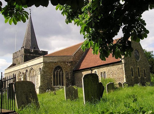
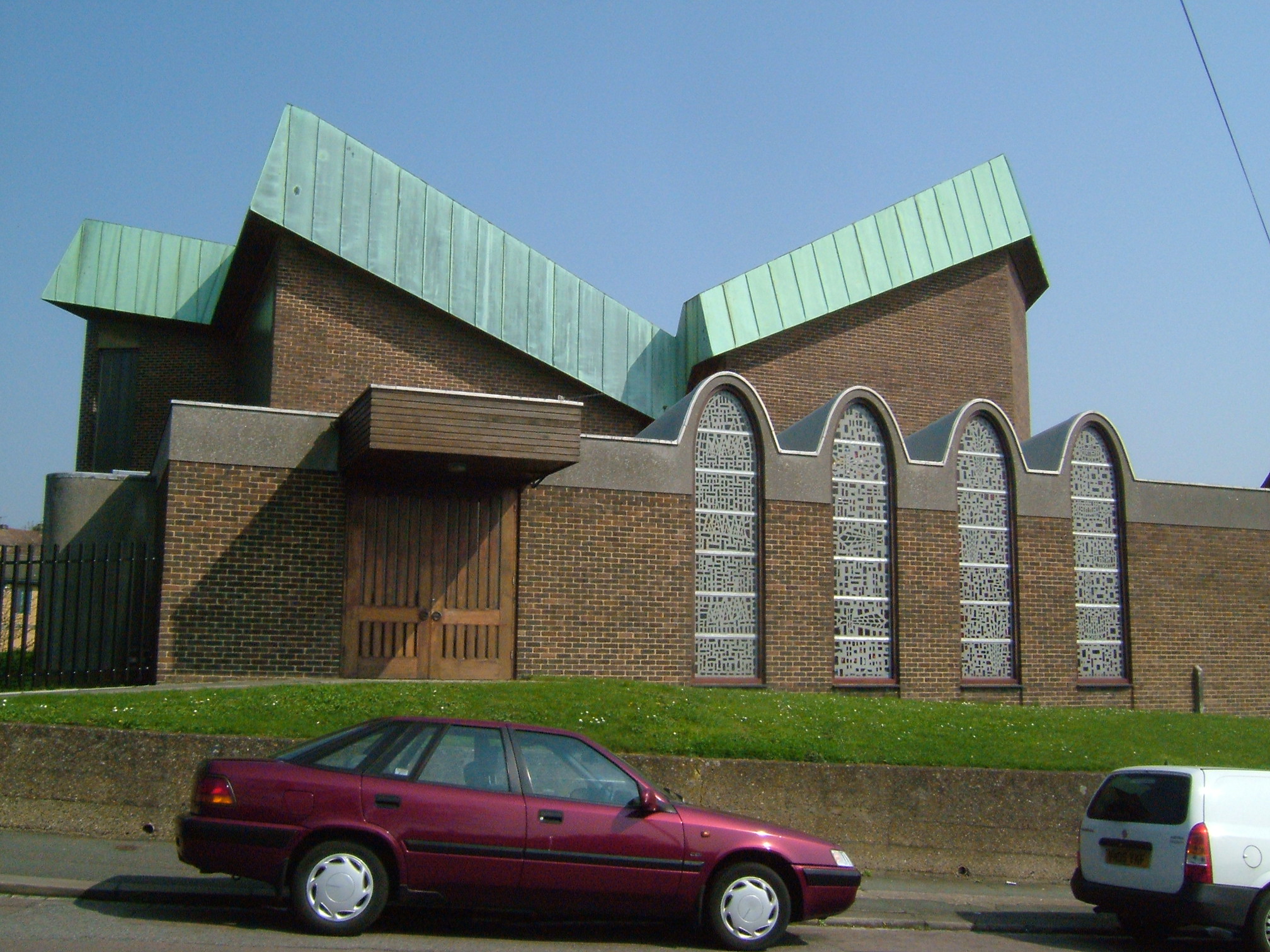
All Saints Church, Frindsbury
All Saints, Frindsbury, is a parish church serving the combined parish of Frindsbury with Upnor and Chattenden. The church dates from 1075 and lies in...
Frindsbury
Frindsbury is part of the Medway Towns conurbation in Kent, southern England. It lies on the opposite side of the River Medway to Rochester, and at various...
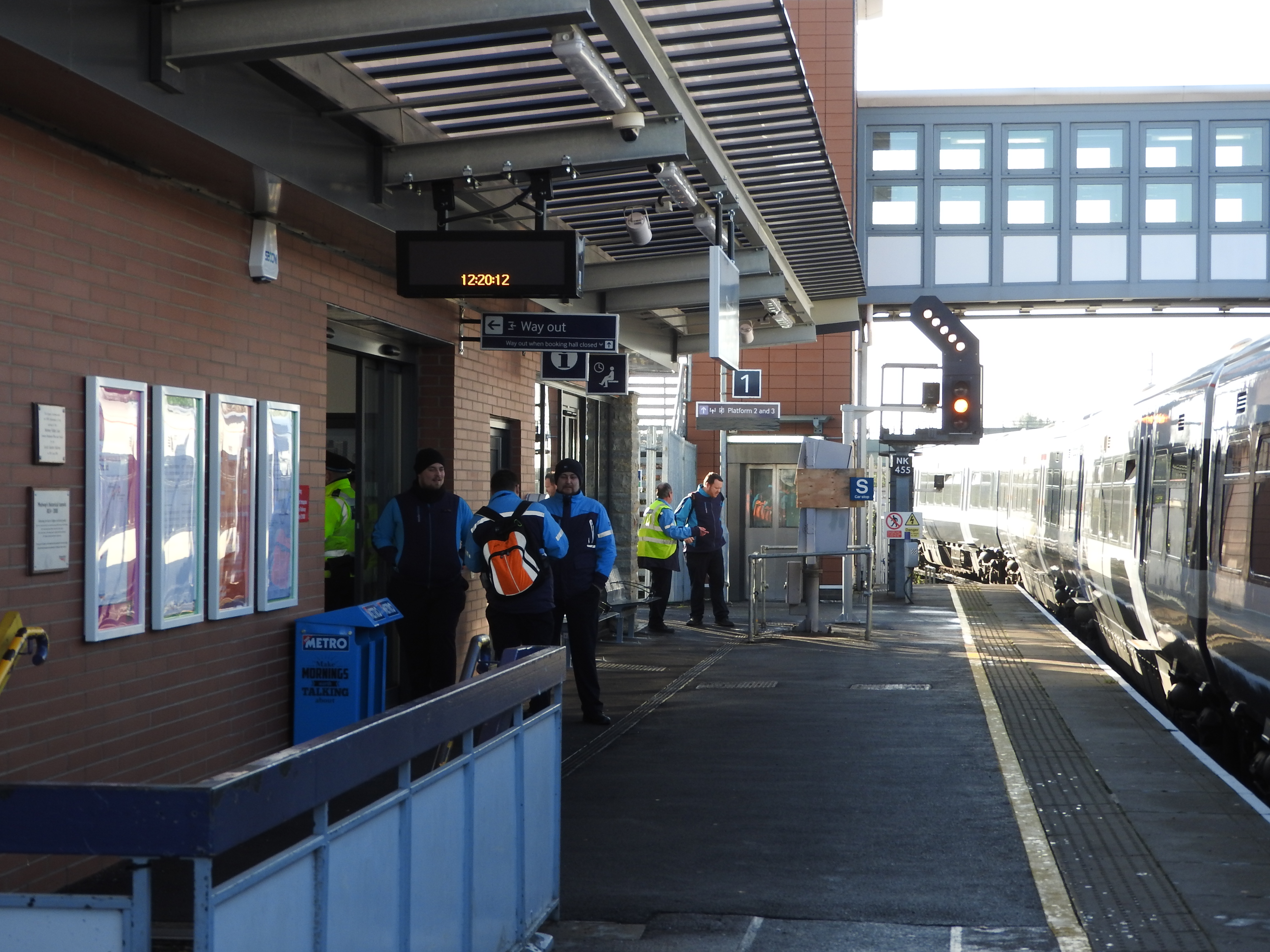
Strood railway station
Strood railway station serves the town of Strood in Medway, England. It is on the North Kent Line and is also a terminus of the Medway Valley Line. It...
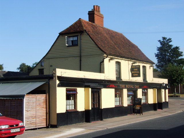
Royal Oak, Frindsbury
The Royal Oak is a Grade II-listed house (formerly a public house, or "pub") in Frindsbury, a Medway town in Kent, United Kingdom. The building dates from...
Strood (1st) railway station
Strood (1st) (locally known as and marked on old maps as The Old Terminus) was a terminus of the South Eastern Railway located in Strood and serving also...
Nearby Amenities
Located within 500m of 51.401471,0.500246Have you been to Frindsbury?
Leave your review of Frindsbury below (or comments, questions and feedback).