Dunston Common

Wood, Forest in Norfolk South Norfolk

England

Dunston Common

Church of St Peter, Swainsthorpe <span class="nowrap"><a title="https://historicengland.org.uk/listing/the-list/list-entry/1169726?section=official-list-entry" rel="nofollow ugc noopener" href="https://historicengland.org.uk/listing/the-list/list-entry/1169726?section=official-list-entry">Link</a><img style="margin-left:2px;" alt="External link" title="External link - shift click to open in new window" src="https://s1.geograph.org.uk/img/external.png" width="10" height="10"/></span>
Church of St Peter, Swainsthorpe Credit: Sandy Gerrard

Dunston Common is a picturesque woodland located in the county of Norfolk, England. Spanning over an area of approximately 50 acres, it is a haven for nature enthusiasts and provides a tranquil escape from the hustle and bustle of everyday life.

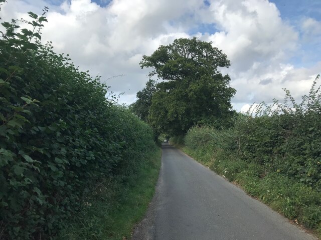
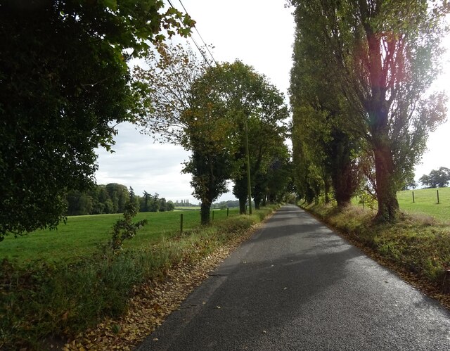
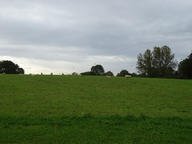
The common is predominantly covered by a dense forest of native broadleaf trees, including oak, beech, and birch, which create a vibrant and diverse ecosystem. These trees provide a habitat for a variety of wildlife, such as squirrels, deer, and numerous bird species, making it a popular destination for birdwatchers and wildlife photographers.

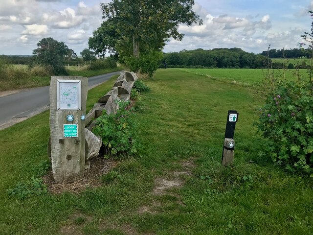
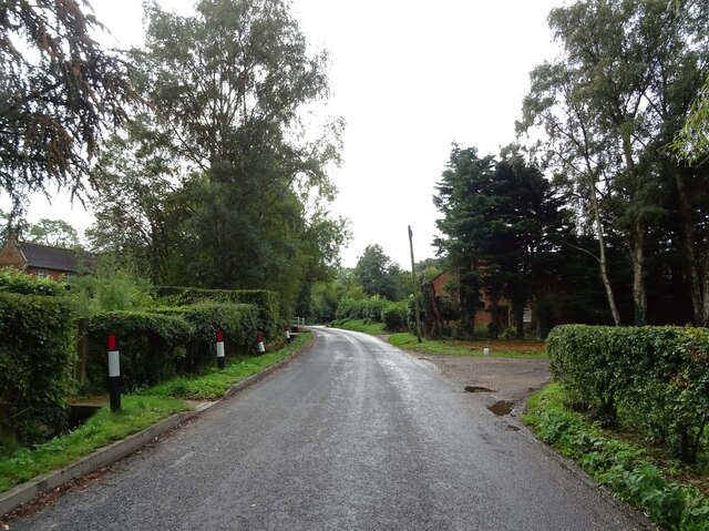
Visitors to Dunston Common are greeted by a network of well-maintained footpaths that meander through the woodland, allowing for leisurely walks and hikes. The paths are lined with vibrant wildflowers during the spring and summer months, adding a splash of color to the already picturesque landscape.

In addition to its natural beauty, Dunston Common also holds historical significance. The area was once used as a source of timber for shipbuilding during the Napoleonic Wars, and remnants of this history can still be seen in the form of old saw pits and charcoal platforms scattered throughout the woodland.

Dunston Common is a cherished community asset, and efforts have been made to ensure its preservation and accessibility. It is open to the public throughout the year, and facilities such as picnic areas and benches are provided for visitors to enjoy a peaceful day out in nature. Whether it's for a leisurely stroll, birdwatching, or a family picnic, Dunston Common offers a tranquil retreat for all nature lovers.

If you have any feedback on the listing, please let us know in the comments section below.

Dunston Common Images

Images are sourced within 2km of 52.575405/1.2860482 or Grid Reference TG2202. Thanks to Geograph Open Source API. All images are credited.

Church of St Peter, Swainsthorpe <span class="nowrap"><a title="https://historicengland.org.uk/listing/the-list/list-entry/1169726?section=official-list-entry" rel="nofollow ugc noopener" href="https://historicengland.org.uk/listing/the-list/list-entry/1169726?section=official-list-entry">Link</a><img style="margin-left:2px;" alt="External link" title="External link - shift click to open in new window" src="https://s1.geograph.org.uk/img/external.png" width="10" height="10"/></span>
Church of St Peter, Swainsthorpe
The A47 west approaching junction with A140
Keswick: A47 bridge over the Ipswich Road roundabout
Road junction at Caistor St Edmund With a rather dull village sign see <a href="https://www.geograph.org.uk/photo/6797396">TG2303 : Caistor St Edmund village sign</a>
Road junction at Caistor St Edmund
With a rather dull village sign see TG2303 : Caistor St Edmund village sign
Chandler Road Looking more like a lane.
Chandler Road
Looking more like a lane.
Concessionary path next to Wash Lane Part of a network of paths around High Ash Farm <span class="nowrap"><a title="https://www.highashfarm.com/_files/ugd/fff082_d6472f8475a545759d5d20b6c1ecc567.pdf" rel="nofollow ugc noopener" href="https://www.highashfarm.com/_files/ugd/fff082_d6472f8475a545759d5d20b6c1ecc567.pdf">Link</a><img style="margin-left:2px;" alt="External link" title="External link - shift click to open in new window" src="https://s1.geograph.org.uk/img/external.png" width="10" height="10"/></span>.
Concessionary path next to Wash Lane
Part of a network of paths around High Ash Farm LinkExternal link.
Grazing beside Foxes' Grove
Caistor Lane, Caistor St Edmund
Heading east on Caistor Lane
Grazing towards Broken Back Plantation
Caistor Lane towards Poringland
Grazing and woodland, Caistor St Edmund
Field off Chandler Road
Chandler Road Boudicca Way footpath.
Chandler Road
Boudicca Way footpath.
Sheep grazing, Halfway House
Minor road junction, Halfway House
Entering Stoke Holy Cross On Norwich Road.
Entering Stoke Holy Cross
On Norwich Road.
The Wildebeest public house
Show me another place!

Dunston Common is located at Grid Ref: TG2202 (Lat: 52.575405, Lng: 1.2860482)

Administrative County: Norfolk

District: South Norfolk

Police Authority: Norfolk

What 3 Words

///bend.furnish.incurring. Near Mulbarton, Norfolk

Related Wikis

Dunston, Norfolk

Dunston is a village in the civil parish of Stoke Holy Cross, in the South Norfolk district, in the county of Norfolk, England. It is located in the valley...

Dunston Common

Dunston Common is a 3.8-hectare (9.4-acre) Local Nature Reserve south of Norwich in Norfolk. It is owned and managed by South Norfolk District Council...

Venta Icenorum

Venta Icenorum (Classical Latin: [ˈwɛnta ɪkeːˈnoːrũː], literally "marketplace of the Iceni") was the civitas or capital of the Iceni tribe, located at...

Stoke Holy Cross

Stoke Holy Cross is a village in South Norfolk which lies approximately 4 miles (6.4 km) south of Norwich. == Geography == Stoke sits on the River Tas...

Nearby Amenities

Located within 500m of 52.575405,1.2860482
Bus Stop
Hall, opp
Bench: no
Bin: no
Lit: no
Naptan AtcoCode: 2900S497
Naptan Bearing: N
Naptan BusStopType: CUS
Naptan CommonName: Hall
Naptan Indicator: opp
Naptan Landmark: Hall
Naptan Locality: Dunston
Naptan NaptanCode: nfodwajm
Naptan PlusbusZoneRef: NRCH
Naptan ShortCommonName: Hall
Naptan Street: Ipswich Road
Naptan Verified: no
Shelter: no
Source: naptan_import
Tactile Paving: no
Lat/Long: 52.5760287/1.2793979
Bus Stop
Hall, adj
Bench: no
Naptan AtcoCode: 2900S498
Naptan Bearing: SW
Naptan BusStopType: CUS
Naptan CommonName: Hall
Naptan Indicator: adj
Naptan Locality: Dunston
Naptan NaptanCode: nfodwajp
Naptan PlusbusZoneRef: NRCH
Naptan Street: Ipswich Road
Naptan Verified: no
Shelter: no
Source: naptan_import
Tactile Paving: no
Lat/Long: 52.5766516/1.2799611
Parking
Access: yes
Fee: no
Parking: surface
Lat/Long: 52.5769656/1.2798419
Barrier: kissing_gate
Bicycle: no
Foot: yes
Lat/Long: 52.5791407/1.289806
Barrier: stile
Bicycle: yes
Foot: yes
Material: wood
Stile: stepover
Lat/Long: 52.5766815/1.2922975
Barrier: kissing_gate
Bicycle: no
Foot: yes
Lat/Long: 52.5779727/1.2891522
Barrier: kissing_gate
Bicycle: no
Foot: yes
Lat/Long: 52.5779987/1.2892084
Barrier: stile
Bicycle: yes
Foot: yes
Material: wood
Stile: stepover
Lat/Long: 52.5784258/1.2867685
Bench
Backrest: yes
Material: wood
Seats: 3
Lat/Long: 52.5720801/1.287461
Bench
Backrest: yes
Material: wood
Seats: 3
Lat/Long: 52.5721632/1.2875962
Barrier: kissing_gate
Bicycle: no
Foot: yes
Lat/Long: 52.5770803/1.282848
Entrance: main
Lat/Long: 52.5722738/1.2872077
Entrance: yes
Lat/Long: 52.5723553/1.2872062
Bench
Backrest: yes
Material: wood
Seats: 1
Lat/Long: 52.5753915/1.2848398
Leisure: playground
Lat/Long: 52.5754505/1.2850862
Bench
Backrest: yes
Material: plastic
Seats: 3
Lat/Long: 52.5750655/1.2846816
Bench
Backrest: yes
Material: wood
Seats: 3
Lat/Long: 52.5723636/1.2876306
Charging Station
Tesla Destination Charger
Amperage: 24
Authentication None: yes
Capacity: 1
Car: yes
Fee: no
Opening Hours: 24/7
Operator: Dunston Hall
Phases: 3
Power: 16.56
Socket Tesla Destination: 1
Voltage: 230
Lat/Long: 52.5713856/1.2831259
Bicycle Parking
Bicycle Parking: stands
Capacity: 8
Covered: no
Lat/Long: 52.5750949/1.2861327
Waste Basket
Waste: dog_excrement
Lat/Long: 52.574931/1.2858859
Waste Basket
Lat/Long: 52.5750582/1.2860655
Waste Basket
Lat/Long: 52.5750044/1.2859006
Post Box
Collection Times: Mo-Fr 16:00; Sa 08:30
Post Box Mounting: brick_pillar
Post Box Type: wall
Ref: NR14 1463
Royal Cypher: GR
Royal Cypher Wikidata: Q33102273
Lat/Long: 52.5757307/1.2834745
Information: board
Tourism: information
Lat/Long: 52.5767053/1.2839891
Bench
Lat/Long: 52.575046/1.2857435
Bicycle Parking
Bicycle Parking: stands
Capacity: 2
Covered: no
Lat/Long: 52.5750464/1.2859895
Waste Basket
Lat/Long: 52.5751002/1.2858581
Ford: yes
Note: timbers in ditch to assist crossing, no bridge
Lat/Long: 52.5756895/1.2839858
Give Way
Lat/Long: 52.5714746/1.2829726
Charging Station
Amperage: 32
Authentication None: yes
Capacity: 1
Car: yes
Fee: no
Opening Hours: 24/7
Operator: Dunston Hall
Power: 7.36
Socket Type2: 1
Voltage: 230
Lat/Long: 52.5713815/1.2831235
Bench
Backrest: yes
Material: metal
Seats: 2
Lat/Long: 52.5756849/1.2850705
Golf: pin
Lat/Long: 52.5720896/1.2884084
Power: pole
Lat/Long: 52.5779645/1.2888755
Power: pole
Lat/Long: 52.5772635/1.2895552
Power: pole
Lat/Long: 52.5767197/1.2900969
Power: pole
Lat/Long: 52.5758627/1.2907694
Power: pole
Lat/Long: 52.5749225/1.2912923
Power: pole
Lat/Long: 52.5740304/1.291398
Power: pole
Lat/Long: 52.5731496/1.2915089
Power: pole
Lat/Long: 52.5781246/1.2864721
Power: pole
Lat/Long: 52.5777798/1.2842483
Power: pole
Lat/Long: 52.5775875/1.2840879
Power: pole
Lat/Long: 52.5772029/1.2840545
Power: pole
Lat/Long: 52.5777146/1.2848486
Power: pole
Lat/Long: 52.5785115/1.2882604
Power: pole
Lat/Long: 52.5766059/1.2833554
The data included in this document is from www.openstreetmap.org. The data is made available under ODbL.

Have you been to Dunston Common?

Leave your review of Dunston Common below (or comments, questions and feedback).