Warren Plantation

Wood, Forest in Kent Canterbury

England

Warren Plantation

Land at Highland Court Farm, Coldharbour Lane Planning permission was refused by Canterbury City Council under application number CA//18/01948 for a "hybrid planning application for mixed use development for leisure, commercial and tourism uses comprising: (1) A detailed planning application for a centre for sporting excellence (to include sports pitches, changing rooms, clubhouse and floodlights), business innovation centre, food and drinks hub and leisure hub; with access and associated highways works. (2) An outline planning application (with all matters reserved) for business uses, food and drinks hub, innovation centre, home farm centre, artisan offices, mixed use court and holiday homes; plus associated access, landscaping, parking and drainage infrastructure". 

The development would not have reached as far as the corner of this muddy field but it would have been a blot on the landscape, which lies within an Area of Outstanding Natural Beauty.  

Highland Court Farm <a href="https://www.geograph.org.uk/gridref/TR1953">TR1953</a> is visible in the distance.
Land at Highland Court Farm, Coldharbour Lane Credit: John Baker

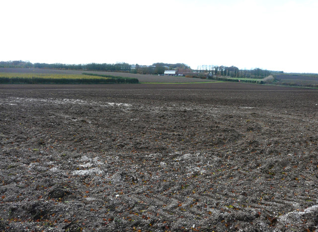
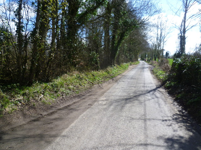
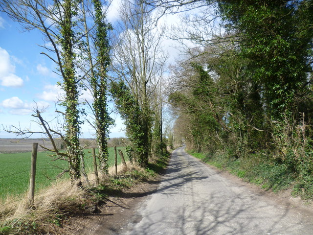
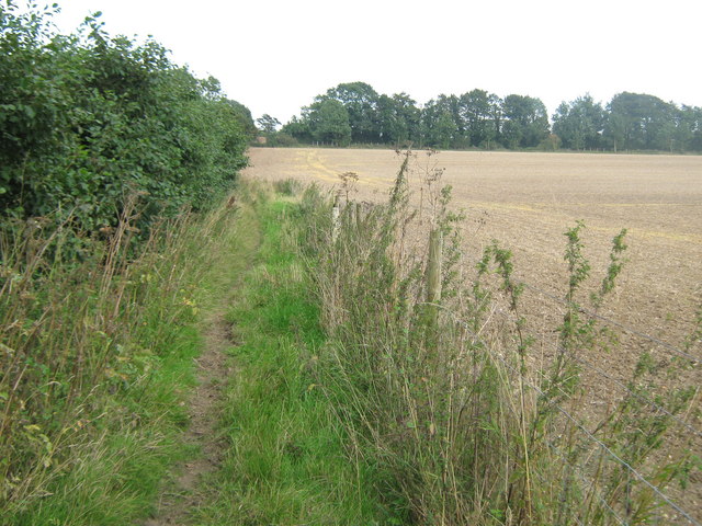
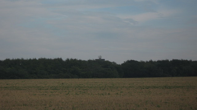
Warren Plantation, located in Kent, England, is a sprawling woodland area known for its rich natural beauty and diverse ecosystem. Covering a vast area, the plantation is home to a variety of tree species, including oak, beech, and birch, creating a picturesque landscape that changes with the seasons.

The plantation is well-known for its vibrant wildlife, attracting nature enthusiasts and birdwatchers from far and wide. The dense woodlands provide a habitat for numerous bird species, such as woodpeckers, owls, and warblers. Visitors may also be lucky enough to spot larger mammals, including deer and foxes, as they roam through the plantation.

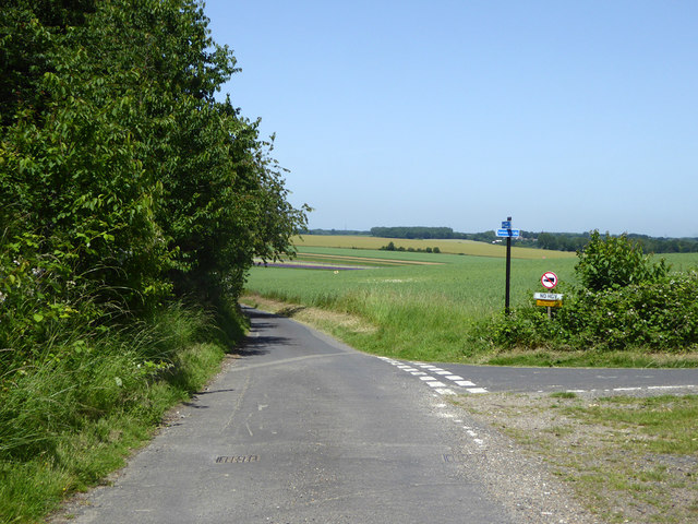
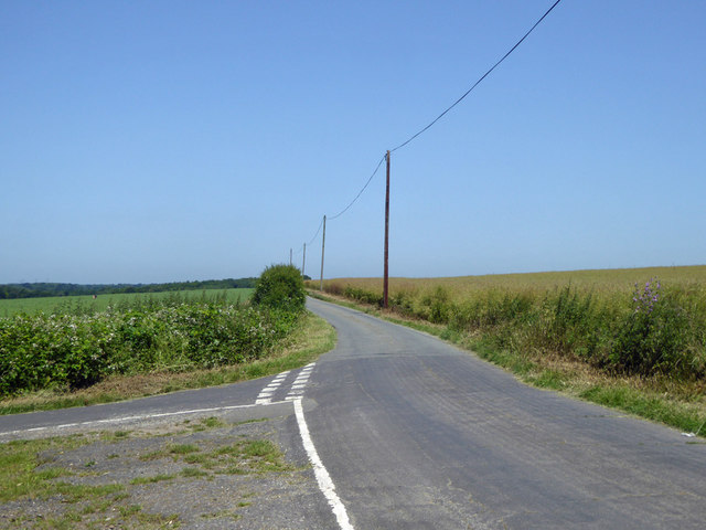
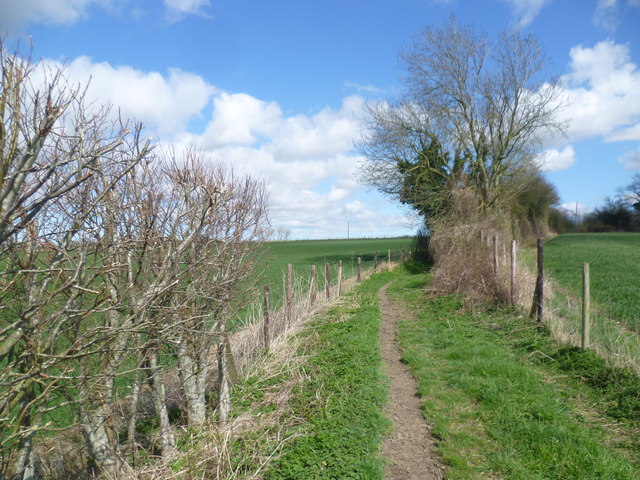
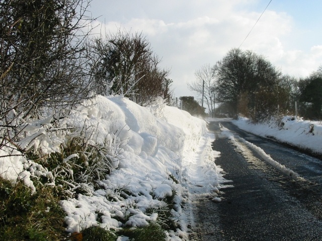
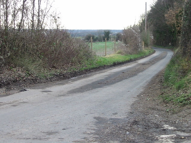
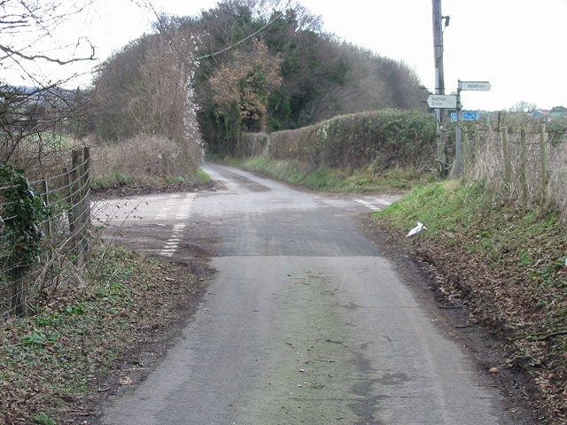
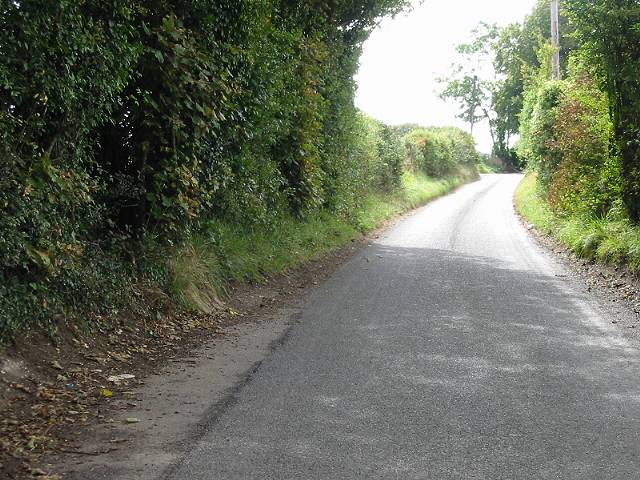
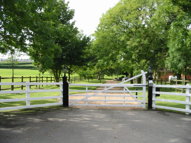
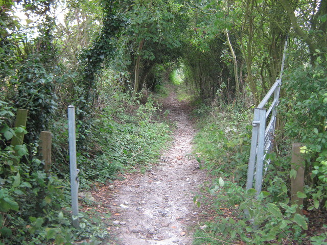
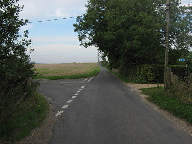
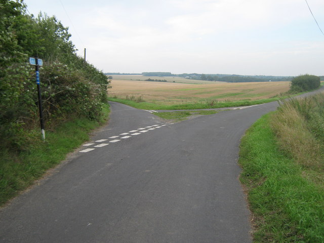
The plantation boasts a network of well-maintained trails, allowing visitors to explore the area on foot or by bike. These paths wind through the woodland, offering stunning views of the surrounding countryside and providing opportunities for peaceful walks and invigorating hikes.

Warren Plantation is not only a haven for wildlife and outdoor enthusiasts but also holds historical significance. Remnants of ancient settlements and archaeological sites have been discovered within the plantation, providing a glimpse into the area's past.

Visitors to Warren Plantation can enjoy a tranquil escape from urban life, immersing themselves in the beauty of nature. Whether it's a leisurely stroll, a birdwatching adventure, or a historical exploration, this plantation offers a diverse range of activities for all to enjoy.

If you have any feedback on the listing, please let us know in the comments section below.

Warren Plantation Images

Images are sourced within 2km of 51.239069/1.1278969 or Grid Reference TR1853. Thanks to Geograph Open Source API. All images are credited.

Land at Highland Court Farm, Coldharbour Lane Planning permission was refused by Canterbury City Council under application number CA//18/01948 for a "hybrid planning application for mixed use development for leisure, commercial and tourism uses comprising: (1) A detailed planning application for a centre for sporting excellence (to include sports pitches, changing rooms, clubhouse and floodlights), business innovation centre, food and drinks hub and leisure hub; with access and associated highways works. (2) An outline planning application (with all matters reserved) for business uses, food and drinks hub, innovation centre, home farm centre, artisan offices, mixed use court and holiday homes; plus associated access, landscaping, parking and drainage infrastructure". 

The development would not have reached as far as the corner of this muddy field but it would have been a blot on the landscape, which lies within an Area of Outstanding Natural Beauty.  

Highland Court Farm <a href="https://www.geograph.org.uk/gridref/TR1953">TR1953</a> is visible in the distance.
Land at Highland Court Farm, Coldharbour Lane
Planning permission was refused by Canterbury City Council under application number CA//18/01948 for a "hybrid planning application for mixed use development for leisure, commercial and tourism uses comprising: (1) A detailed planning application for a centre for sporting excellence (to include sports pitches, changing rooms, clubhouse and floodlights), business innovation centre, food and drinks hub and leisure hub; with access and associated highways works. (2) An outline planning application (with all matters reserved) for business uses, food and drinks hub, innovation centre, home farm centre, artisan offices, mixed use court and holiday homes; plus associated access, landscaping, parking and drainage infrastructure". The development would not have reached as far as the corner of this muddy field but it would have been a blot on the landscape, which lies within an Area of Outstanding Natural Beauty. Highland Court Farm TR1953 is visible in the distance.
Shepherds Close Road Towards Patrixbourne.
Shepherds Close Road
Towards Patrixbourne.
Lane towards Bekesbourne It does not have an obvious name, but not needed for addresses, as, apart from a pillbox, it only has farmland to either side from end to end.
Lane towards Bekesbourne
It does not have an obvious name, but not needed for addresses, as, apart from a pillbox, it only has farmland to either side from end to end.
Path near Highland Court Farm This path leads from Highland Court Farm through a narrow shaw ahead to reach a lane.
Path near Highland Court Farm
This path leads from Highland Court Farm through a narrow shaw ahead to reach a lane.
Lane towards Cold Harbour Farm This quiet lane reaches a crossroads ahead and beyond passes Cold Harbour Farm before reaching the A2.
Lane towards Cold Harbour Farm
This quiet lane reaches a crossroads ahead and beyond passes Cold Harbour Farm before reaching the A2.
Lane near Cold Harbour Farm This quiet lane reaches a junction just ahead and by turning left reaches either Bekesbourne or Patrixbourne.
Lane near Cold Harbour Farm
This quiet lane reaches a junction just ahead and by turning left reaches either Bekesbourne or Patrixbourne.
Snow drift on the Brambling road.
Looking N along Brambling Road.
Junction of Coldharbour Lane and Brambling Road.
Road and hedgerows An autumnal view of <a href="https://www.geograph.org.uk/photo/302914">TR2053 : Snow drift on the Brambling road.</a>
Road and hedgerows
Entrance to Cold Harbour House
Bridleway to Bramling Road This track leads from Keepers Hill Wood, through Highland Court Farm then it heads to the road (in the trees in the background).
Bridleway to Bramling Road
This track leads from Keepers Hill Wood, through Highland Court Farm then it heads to the road (in the trees in the background).
Bridle gate on the bridleway to Highland Court Farm This gate is on the track from Brambling Road leading to the farm and Kennel Hill Wood.
Bridle gate on the bridleway to Highland Court Farm
This gate is on the track from Brambling Road leading to the farm and Kennel Hill Wood.
View of Water Tower in Woodlands Wood As seen from Bramling Road.
View of Water Tower in Woodlands Wood
As seen from Bramling Road.
Strange Mini Golf Course near Bramling Road This little earth mound beside an orchard has been turned into a Golf Tee. 
No idea where the hole is ???

Highland Court Farm is in the background.
Strange Mini Golf Course near Bramling Road
This little earth mound beside an orchard has been turned into a Golf Tee. No idea where the hole is ??? Highland Court Farm is in the background.
Road junction on Bramling Road Bramling Road leads from the A2 Dover Road towards Bramling.
Shepherd's Close Road leads left towards Shepherd's Close Farm and onward to Patrixbourne.
A byway also heads right past Chota (house) towards Woodlands Wood.
Road junction on Bramling Road
Bramling Road leads from the A2 Dover Road towards Bramling. Shepherd's Close Road leads left towards Shepherd's Close Farm and onward to Patrixbourne. A byway also heads right past Chota (house) towards Woodlands Wood.
Road junction of Shepherd's Close Road Shepherd's Close Road leads from Bramling Road straight on to Shepherd's Close Farm and then onwards via Keeper's Hill towards Patrixbourne.
Another lane leads right towards Chalk Pit Farm.
Road junction of Shepherd's Close Road
Shepherd's Close Road leads from Bramling Road straight on to Shepherd's Close Farm and then onwards via Keeper's Hill towards Patrixbourne. Another lane leads right towards Chalk Pit Farm.
Shepherd's Close Farm house, part of Shepherd's Close Farm on Shepherd's Close Road.
Shepherd's Close
Farm house, part of Shepherd's Close Farm on Shepherd's Close Road.
Show me another place!

Warren Plantation is located at Grid Ref: TR1853 (Lat: 51.239069, Lng: 1.1278969)

Administrative County: Kent

District: Canterbury

Police Authority: Kent

What 3 Words

///outlooks.evolution.planting. Near Bridge, Kent

Related Wikis

Bourne Paddock

Bourne Paddock was a cricket ground at Bourne Park House, the seat of Sir Horatio Mann, at Bishopsbourne around 4 miles (6.4 km) south-east of Canterbury...
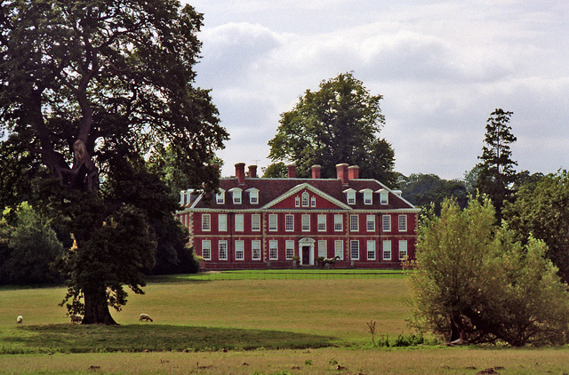
Bourne Park House

Bourne Park House is a Queen Anne style country house on Bourne Park Road, between Bishopsbourne and Bridge near Canterbury in Kent. Built in 1701, it...

Bridge, Kent

Bridge is a village and civil parish near Canterbury in Kent, South East England. Bridge village is in the Nailbourne valley in a rural setting on the...

Higham Park

Higham Park is a Grade II* listed neoclassical style house and gardens, located at Bridge, Kent, 3 miles (4.8 km) south of Canterbury. == History... ==

Bishopsbourne

Bishopsbourne is a mostly rural and wooded village and civil parish in Kent, England. It has two short developed sections of streets at the foot of the...

Bishopsbourne railway station

Bishopsbourne was a station on the Elham Valley Railway. It opened in 1889 and closed to passengers in 1940 and freight in 1947. == History == The station...

Bridge railway station

Bridge was a station on the Elham Valley Railway. It opened in 1889 and closed to passengers in 1940 and freight in 1947. == History == The station opened...

Patrixbourne Priory

Patrixbourne Priory was a priory in Kent, England. == References ==

Nearby Amenities

Located within 500m of 51.239069,1.1278969
Post Box
Collection Times: Mo-Fr 09:00; Sa 17:00
Postal Code: CT4
Ref: CT4 99
Royal Cypher: EIIR
Royal Cypher Wikidata: Q33102113
Source: survey
Lat/Long: 51.2395882/1.1333614
Barrier: kissing_gate
Foot: yes
Wheelchair: no
Lat/Long: 51.2392642/1.1329681
Bus Stop
The Steps
Bench: no
Bin: no
Bus: yes
Lit: yes
Naptan AtcoCode: 2400A045160A
Naptan Bearing: SE
Naptan CommonName: The Steps
Naptan Indicator: adj
Naptan Landmark: The Steps
Naptan NaptanCode: kntdwgag
Naptan Street: Bridge Hill
Naptan Verified: no
Public Transport: platform
Ref: kntdwgag
Shelter: no
Source: naptan_import
Source Date: 2018-08-20T15:37:00
Tactile Paving: no
Lat/Long: 51.2418819/1.1307996
Bus Stop
Higham Lane
Bench: no
Bin: no
Bus: yes
Lit: no
Naptan AtcoCode: 2400A045170A
Naptan Bearing: SE
Naptan CommonName: Higham Lane
Naptan Indicator: adj
Naptan Landmark: Higham Lane
Naptan NaptanCode: kntdwgaj
Naptan Street: Bridge Hill
Naptan Verified: no
Public Transport: platform
Ref: kntdwgaj
Shelter: no
Source: naptan_import
Source Date: 2008-06-02T16:11:00
Tactile Paving: no
Lat/Long: 51.239751/1.1330588
Bus Stop
Higham Lane
Bench: yes
Bin: no
Bus: yes
Lit: no
Naptan AtcoCode: 2400A045180A
Naptan Bearing: NW
Naptan CommonName: Higham Lane
Naptan Indicator: opp
Naptan Landmark: Higham Lane
Naptan NaptanCode: kntdwgam
Naptan Street: Bridge Hill
Naptan Verified: no
Public Transport: platform
Ref: kntdwgam
Shelter: yes
Source: naptan_import
Source Date: 2018-08-20T15:36:00
Tactile Paving: no
Lat/Long: 51.2391133/1.1336311
Barrier: stile
Bicycle: no
Foot: yes
Material: wood
Source: survey
Stile: stepover
Lat/Long: 51.2403157/1.1218483
Barrier: kissing_gate
Lat/Long: 51.2374296/1.1283517
Barrier: kissing_gate
Lat/Long: 51.239746/1.1269826
Maxspeed: 40 mph
Traffic Sign: maxspeed
Traffic Sign Direction: backward
Lat/Long: 51.2382742/1.1346956
Generator Method: photovoltaic
Generator Output Electricity: yes
Generator Source: solar
Generator Type: solar_photovoltaic_panel
Location: roof
Power: generator
Lat/Long: 51.2401742/1.1337423
Street Lamp
Survey Date: 2022-06-13
Lat/Long: 51.2394904/1.1333358
Street Lamp
Survey Date: 2022-06-16
Lat/Long: 51.2408982/1.1340212
Street Lamp
Survey Date: 2022-08-05
Lat/Long: 51.2405804/1.1343623
Street Lamp
Survey Date: 2022-08-05
Lat/Long: 51.2413261/1.1335057
Street Lamp
Survey Date: 2022-08-05
Lat/Long: 51.241755/1.1328997
Street Lamp
Survey Date: 2022-08-14
Lat/Long: 51.2422872/1.1322259
Street Lamp
Survey Date: 2022-08-14
Lat/Long: 51.2419944/1.1315489
Waste Basket
Colour: red
Material: plastic
Survey Date: 2022-08-14
Waste: dog_excrement
Lat/Long: 51.2429969/1.1296645
Street Lamp
Survey Date: 2022-08-14
Lat/Long: 51.2419626/1.1307059
Bench
Backrest: yes
Material: wood
Seats: 3
Survey Date: 2022-08-14
Lat/Long: 51.2429708/1.1296407
Street Lamp
Lamp Type: led
Ref: BME008
Survey Date: 2022-09-19
Lat/Long: 51.2427751/1.1297537
Street Lamp
Lamp Type: led
Ref: BME006
Survey Date: 2022-09-19
Lat/Long: 51.2433998/1.1288989
Addr City: Bridge
Addr Housename: 1 Bridge Hill House
Addr Postcode: CT4 5AY
Addr Street: Higham Lane
Lat/Long: 51.2404548/1.1338506
Addr City: Bridge
Addr Housename: 2 Bridge Hill House
Addr Postcode: CT4 5AY
Addr Street: Higham Lane
Lat/Long: 51.2404781/1.1338213
Addr City: Bridge
Addr Housename: 3 Bridge Hill House
Addr Postcode: CT4 5AY
Addr Street: Higham Lane
Lat/Long: 51.2405062/1.13379
Addr City: Bridge
Addr Housename: 4 Bridge Hill House
Addr Postcode: CT4 5AY
Addr Street: Higham Lane
Lat/Long: 51.2405283/1.1338272
Addr City: Bridge
Addr Housename: 5 Bridge Hill House
Addr Postcode: CT4 5AY
Addr Street: Higham Lane
Lat/Long: 51.2405503/1.1338702
Addr City: Bridge
Addr Housename: 6 Bridge Hill House
Addr Postcode: CT4 5AY
Addr Street: Higham Lane
Lat/Long: 51.2405246/1.1339054
Addr City: Bridge
Addr Housename: 7 Bridge Hill House
Addr Postcode: CT4 5AY
Addr Street: Higham Lane
Lat/Long: 51.2405013/1.1339406
Direction: 150
Maxspeed: 30 mph
Traffic Sign: maxspeed
Lat/Long: 51.2417258/1.1308783
Crossing: unmarked
Lat/Long: 51.2395102/1.1332304
Street Lamp
Lamp Type: led
Ref: BME007
Survey Date: 2022-09-19
Lat/Long: 51.2430717/1.1294551
Crossing
Crossing: unmarked
Crossing Island: no
Crossing Markings: no
Kerb: lowered
Tactile Paving: no
Lat/Long: 51.2391331/1.133666
Direction: 145
Maxspeed: 40 mph
Traffic Sign: maxspeed
Lat/Long: 51.2391311/1.1336743
Direction: 325
Maxspeed: 40 mph
Traffic Sign: maxspeed
Lat/Long: 51.2396912/1.1331326
Bridge
Direction: 150
Traffic Sign: city_limit
Lat/Long: 51.2417238/1.1308724
Direction: 150
Maxspeed: 30 mph
Traffic Sign: maxspeed
Lat/Long: 51.2417314/1.1308915
Power: substation
Lat/Long: 51.241709/1.1309924
Generator Method: photovoltaic
Generator Output Electricity: yes
Generator Source: solar
Generator Type: solar_photovoltaic_panel
Location: roof
Power: generator
Lat/Long: 51.2400499/1.1337697
The data included in this document is from www.openstreetmap.org. The data is made available under ODbL.

Have you been to Warren Plantation?

Leave your review of Warren Plantation below (or comments, questions and feedback).