The Grove

Wood, Forest in Kent Canterbury

England

The Grove

University of Kent at Canterbury A road on the northern side of the campus site.
University of Kent at Canterbury Credit: Jim Barton

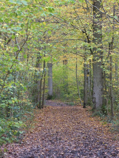
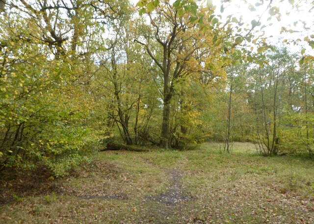
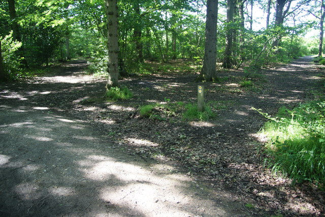
The Grove, located in Kent, England, is a scenic and enchanting woodland area known for its lush forests and natural beauty. Spanning approximately 200 acres, this woodland oasis offers a tranquil escape from the hustle and bustle of urban life.

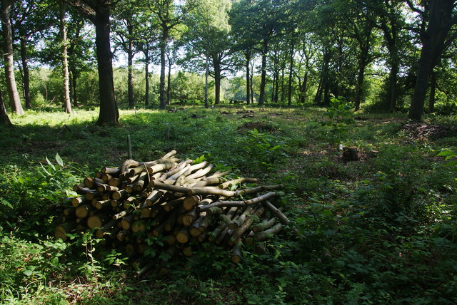
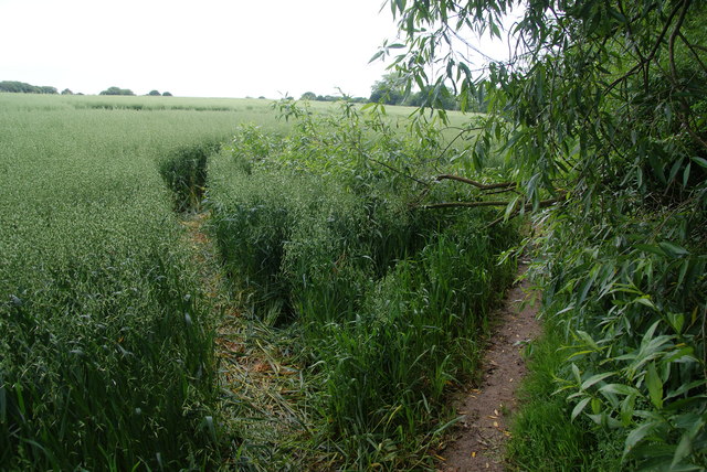
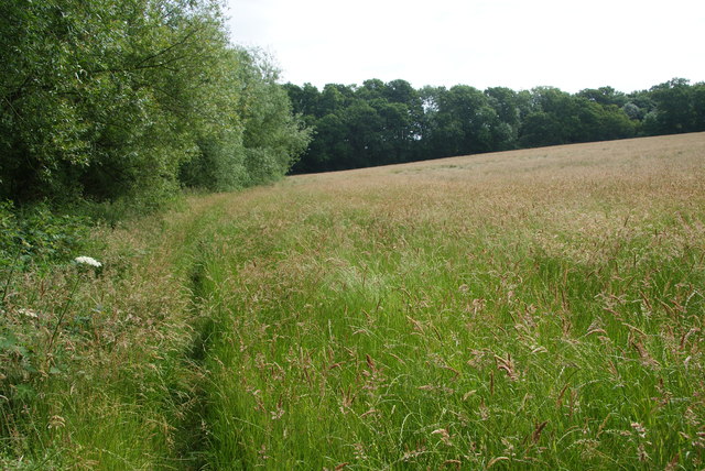
The Grove is characterized by its diverse range of tree species, including oak, birch, and beech, which create a dense canopy and provide a home to various wildlife. The forest floor is adorned with an array of wildflowers and ferns, adding to the area's natural charm.

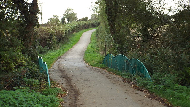
Visitors to The Grove can enjoy a network of well-maintained footpaths and trails, allowing them to explore the woodland at their own pace. These pathways meander through the forest, taking visitors past serene ponds, babbling brooks, and picturesque vistas, providing ample opportunities for photography and relaxation.

Nature enthusiasts will be delighted to encounter a variety of wildlife species that call The Grove home. From deer and foxes to a wide range of bird species, the woodland is teeming with life and offers a chance to observe and appreciate the wonders of the natural world.

The Grove is also equipped with visitor facilities, including picnic areas and benches, allowing visitors to enjoy a leisurely lunch or simply sit back and soak in the peaceful ambiance. Additionally, educational signs and information boards are strategically placed throughout the woodland, providing insight into the area's flora and fauna.

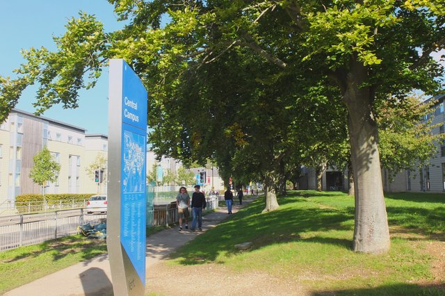
Overall, The Grove in Kent is a haven for nature lovers and those seeking solace in a serene and picturesque setting. With its diverse ecosystems, well-maintained trails, and abundance of wildlife, it is a must-visit destination for anyone looking to reconnect with nature.

If you have any feedback on the listing, please let us know in the comments section below.

The Grove Images

Images are sourced within 2km of 51.285675/1.0521464 or Grid Reference TR1258. Thanks to Geograph Open Source API. All images are credited.

University of Kent at Canterbury A road on the northern side of the campus site.
University of Kent at Canterbury
A road on the northern side of the campus site.
A290 past the Blean Tavern Heading towards Whitstable.
A290 past the Blean Tavern
Heading towards Whitstable.
Old Milestone by the A290, Tile Kiln Hill, Blean Metal plate attached to stone post by the A290, in parish of ST COSMUS AND ST DAMIAN IN THE BLEAN (CANTERBURY District), Tile Kiln Hill, opposite No. 32, by No. 27, in domestic hedge at back of tarmac footpath, on West side of road. Whitstable iron plate, erected by the Whitstable turnpike trust in the 19th century. 

Inscription reads:- : 4½ / MILES / TO / WHITSTABLE : : 2 / MILES / TO / CANTERBURY : 
Carved benchmark and rivet on top.

Milestone Society National ID: KE_CYWS02.
Old Milestone by the A290, Tile Kiln Hill, Blean
Metal plate attached to stone post by the A290, in parish of ST COSMUS AND ST DAMIAN IN THE BLEAN (CANTERBURY District), Tile Kiln Hill, opposite No. 32, by No. 27, in domestic hedge at back of tarmac footpath, on West side of road. Whitstable iron plate, erected by the Whitstable turnpike trust in the 19th century. Inscription reads:- : 4½ / MILES / TO / WHITSTABLE : : 2 / MILES / TO / CANTERBURY : Carved benchmark and rivet on top. Milestone Society National ID: KE_CYWS02.
Path in Blean Woods Part of the RSPB Blean Woods Nature Reserve.
Path in Blean Woods
Part of the RSPB Blean Woods Nature Reserve.
RSPB Blean Woods Nature Reserve
Mathematics Department, University of Kent Founded in 1965, the University of Kent is a campus university. The main Canterbury campus covers 300 acres and is just over two miles from the city centre. There are also sites at Medway and Tonbridge.
Website: <span class="nowrap"><a title="http://www.kent.ac.uk/" rel="nofollow ugc noopener" href="http://www.kent.ac.uk/">Link</a><img style="margin-left:2px;" alt="External link" title="External link - shift click to open in new window" src="https://s1.geograph.org.uk/img/external.png" width="10" height="10"/></span>
Mathematics Department, University of Kent
Founded in 1965, the University of Kent is a campus university. The main Canterbury campus covers 300 acres and is just over two miles from the city centre. There are also sites at Medway and Tonbridge. Website: LinkExternal link
Cornwallis Building, University of Kent Part of Darwin College.
Cornwallis Building, University of Kent
Part of Darwin College.
University of Kent Founded in 1965, the University of Kent is a campus university. The main Canterbury campus covers 300 acres and is just over two miles from the city centre. There are also sites at Medway and Tonbridge.
Website: <span class="nowrap"><a title="http://www.kent.ac.uk/" rel="nofollow ugc noopener" href="http://www.kent.ac.uk/">Link</a><img style="margin-left:2px;" alt="External link" title="External link - shift click to open in new window" src="https://s1.geograph.org.uk/img/external.png" width="10" height="10"/></span>
University of Kent
Founded in 1965, the University of Kent is a campus university. The main Canterbury campus covers 300 acres and is just over two miles from the city centre. There are also sites at Medway and Tonbridge. Website: LinkExternal link
Darwin College Founded in 1965, the University of Kent is a campus university. The main Canterbury campus covers 300 acres and is just over two miles from the city centre. There are also sites at Medway and Tonbridge.
Website: <span class="nowrap"><a title="http://www.kent.ac.uk/" rel="nofollow ugc noopener" href="http://www.kent.ac.uk/">Link</a><img style="margin-left:2px;" alt="External link" title="External link - shift click to open in new window" src="https://s1.geograph.org.uk/img/external.png" width="10" height="10"/></span>
Darwin College
Founded in 1965, the University of Kent is a campus university. The main Canterbury campus covers 300 acres and is just over two miles from the city centre. There are also sites at Medway and Tonbridge. Website: LinkExternal link
The Hare and Hounds, Blean An excellent village pub with predominantly Shepherd Neame beers. I have to commend the food; though the menu didn't look very original, the execution was superb.
The Hare and Hounds, Blean
An excellent village pub with predominantly Shepherd Neame beers. I have to commend the food; though the menu didn't look very original, the execution was superb.
Convergence of paths in Blean Woods A point in the woods where numerous paths meet. Only three are visible here.
Convergence of paths in Blean Woods
A point in the woods where numerous paths meet. Only three are visible here.
A pile of logs in Blean Woods The woodland behind shows signs of having been cleared.
A pile of logs in Blean Woods
The woodland behind shows signs of having been cleared.
Diversion in a field of oats A fallen branch has blocked the path, and a route through the oats has become quite established.
Diversion in a field of oats
A fallen branch has blocked the path, and a route through the oats has become quite established.
Part of the Blean Walk This section involves walking through a couple of fields of quite long grass.
Part of the Blean Walk
This section involves walking through a couple of fields of quite long grass.
Bridge over a drain near Canterbury This path forms part of the Crab & Winkle Way, and is also part of National Cycle Network route 1.
Bridge over a drain near Canterbury
This path forms part of the Crab & Winkle Way, and is also part of National Cycle Network route 1.
Tile Kiln Hill, Blean
Show me another place!

The Grove is located at Grid Ref: TR1258 (Lat: 51.285675, Lng: 1.0521464)

Administrative County: Kent

District: Canterbury

Police Authority: Kent

What 3 Words

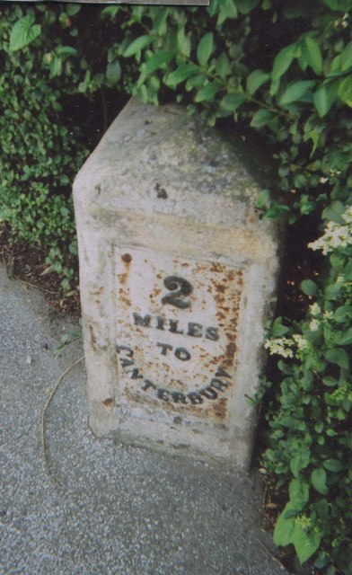
///famed.nail.kite. Near Canterbury, Kent

Nearby Locations

Harbledown The Grove

Related Wikis

Harbledown

Harbledown is a village in Kent, England, immediately west of Canterbury and contiguous with the city. At local government level the village is designated...

St Michael and All Angels Church, Harbledown

The Church of St Michael and All Angels is a Norman stone church in the village of Harbledown, near Canterbury, England. A part of the Church of England...

Thomas Byrne (VC)

Thomas Byrne, VC (December 1866 Dublin – 15 March 1944) was an Irish British Army soldier. He was the recipient of the Victoria Cross (VC), the highest...

St Edmund's School Canterbury

St Edmund's School Canterbury is a private day and boarding school located in Canterbury, Kent, England and established in 1749. The extensive school grounds...

Rough Common

Rough Common is a village in Canterbury in the parrish of Harbledown, Kent, England. It forms part of the civil parish of Harbledown and Rough Common...

Kent College

Kent College, Canterbury is a co-educational private school for boarding and day pupils between the ages of 3 months and 18 years. It was founded in 1885...

Chaucer College

Chaucer College Canterbury is an independent college for Japanese university and high school students. It was founded in 1992 by Hiroshi Kawashima, the...

The Canterbury Academy

The Canterbury Academy is a co-educational 11-19 academy school in Canterbury, Kent, England. It is a specialist Sports College and 15% of its 1081 pupils...

Nearby Amenities

Located within 500m of 51.285675,1.0521464
Traffic Signals
Lat/Long: 51.2832116/1.0475358
Traffic Calming: island
Lat/Long: 51.2834831/1.0495204
Telephone
Booth: K6
Covered: booth
Listed Status: Grade II
Payment Coins: yes
Payment Credit Cards: yes
Payment Debit Cards: yes
Phone: +44 1227 462958
Lat/Long: 51.2834477/1.053048
Barrier: bollard
Lat/Long: 51.2835358/1.0568859
Pub
The Old Coach & Horses
Addr City: Canterbury
Addr Country: GB
Addr County: Kent
Addr Postcode: CT2 9AB
Addr Street: Church Hill
Addr Village: Harbledown
Fhrs Id: 1216736
Source Addr: FHRS Open Data
Toilets Wheelchair: no
Wheelchair: no
Lat/Long: 51.2828487/1.054298
Turning Circle
Lat/Long: 51.2867979/1.0463684
Barrier: stile
Bicycle: no
Foot: permissive
Horse: no
Motor Vehicle: no
Stile: stepover
Lat/Long: 51.2816629/1.0512743
Post Box
Collection Times: Mo-Fr 09:00; Sa 07:00
Post Box Type: wall
Postal Code: CT2
Ref: CT2 214
Royal Cypher: EIIR
Royal Cypher Wikidata: Q33102113
Source: survey
Lat/Long: 51.2832218/1.0513992
Harbledown
Source: survey
Tourism: village_sign
Lat/Long: 51.2830979/1.0511414
Bus Stop
Hole In The Wall
Local Ref: W-bound
Naptan AtcoCode: 2400A050430A
Naptan Bearing: W
Naptan BusStopType: MKD
Naptan CommonName: Hole In The Wall
Naptan Indicator: W-bound
Naptan Landmark: Faulkners Lane
Naptan NaptanCode: kntgatpa
Naptan PlusbusZoneRef: CNTBE
Naptan RevisionNumber: 3
Naptan Status: act
Naptan Street: Church Hill
Naptan Verified: yes
Public Transport: platform
Ref: kntgatpa
Source: naptan_import
Source Date: 2018-09-14
Lat/Long: 51.2831015/1.0509934
Bus Stop
Hole In The Wall
Bench: no
Bin: no
Lit: no
Local Ref: E-bound
Naptan AtcoCode: 2400A050440A
Naptan Bearing: E
Naptan BusStopType: MKD
Naptan CommonName: Hole In The Wall
Naptan Indicator: E-bound
Naptan Landmark: Church Hill
Naptan NaptanCode: kntgatpd
Naptan PlusbusZoneRef: CNTBE
Naptan RevisionNumber: 2
Naptan Status: act
Naptan Street: Faulkners Lane
Naptan Verified: yes
Public Transport: platform
Ref: kntgatpd
Shelter: no
Source: naptan_import
Source Date: 2013-10-23
Tactile Paving: no
Lat/Long: 51.2832653/1.0500934
Crossing
Crossing: traffic_signals
Crossing Ref: pelican
Lat/Long: 51.2833347/1.0476331
Crossing
Crossing: traffic_signals
Crossing Ref: pelican
Lat/Long: 51.283313/1.0472934
Bus Stop
Garden Close
Flag: no
Naptan AtcoCode: 240096707
Naptan Bearing: S
Naptan BusStopType: CUS
Naptan CommonName: Garden Close
Naptan Indicator: adj
Naptan Landmark: Garden Close
Naptan NaptanCode: kntgmagm
Naptan PlusbusZoneRef: CNTBE
Naptan Street: Rough Common Road
Naptan Verified: no
Public Transport: platform
Source: naptan_import
Lat/Long: 51.2868508/1.0452321
Barrier: horse_stile
Lat/Long: 51.283958/1.0560902
Crossing
Crossing: traffic_signals
Crossing Ref: pelican
Lat/Long: 51.2833173/1.0475053
Entrance: main
Lat/Long: 51.2832429/1.0580897
Entrance: main
Lat/Long: 51.2832697/1.057979
Entrance: main
Lat/Long: 51.283305/1.058197
Entrance: main
Lat/Long: 51.2833246/1.0579075
Entrance: main
Lat/Long: 51.283367/1.0578115
Entrance: main
Lat/Long: 51.2833936/1.0577116
Entrance: main
Lat/Long: 51.2834012/1.0577534
Entrance: main
Lat/Long: 51.2834034/1.0580875
Entrance: main
Lat/Long: 51.2834176/1.0580494
Entrance: main
Lat/Long: 51.2834359/1.0575933
Entrance: main
Lat/Long: 51.2834532/1.057499
Entrance: main
Lat/Long: 51.2834924/1.0574108
Entrance: main
Lat/Long: 51.2835059/1.0573806
Entrance: main
Lat/Long: 51.2835189/1.0573513
Entrance: main
Lat/Long: 51.2835347/1.0573159
Entrance: main
Lat/Long: 51.2835756/1.0572016
Entrance: main
Lat/Long: 51.2835875/1.0568032
Entrance: main
Lat/Long: 51.2836022/1.0571893
Entrance: main
Lat/Long: 51.2836241/1.0568577
Entrance: main
Lat/Long: 51.2836862/1.0569263
Entrance: main
Lat/Long: 51.2837221/1.0569098
Entrance: main
Lat/Long: 51.2837281/1.0570316
Entrance: main
Lat/Long: 51.2837868/1.0568473
Entrance: main
Lat/Long: 51.2838/1.0571121
Entrance: main
Lat/Long: 51.2838248/1.0571833
Entrance: main
Lat/Long: 51.2838353/1.0573515
Entrance: main
Lat/Long: 51.2838409/1.0572898
Entrance: main
Lat/Long: 51.2838869/1.0570908
Entrance: main
Lat/Long: 51.283545/1.0584741
Entrance: main
Lat/Long: 51.2835117/1.0582985
Entrance: main
Lat/Long: 51.2835955/1.0583952
Entrance: main
Lat/Long: 51.2836288/1.0581679
Entrance: main
Lat/Long: 51.2836492/1.0581509
Entrance: main
Lat/Long: 51.2836552/1.0583206
Entrance: main
Lat/Long: 51.283706/1.0582472
Entrance: main
Lat/Long: 51.2837693/1.0581929
Entrance: main
Lat/Long: 51.2837903/1.0586021
Entrance: main
Lat/Long: 51.2838201/1.0581527
Entrance: main
Lat/Long: 51.2838268/1.0585865
Entrance: main
Lat/Long: 51.2838398/1.0581359
Entrance: main
Lat/Long: 51.2838982/1.0585439
Entrance: main
Lat/Long: 51.283919/1.058527
Entrance: main
Lat/Long: 51.2837586/1.0577859
Entrance: main
Lat/Long: 51.2837755/1.057772
Entrance: main
Lat/Long: 51.2837946/1.0576107
Entrance: main
Lat/Long: 51.2838785/1.057728
Entrance: main
Lat/Long: 51.2838957/1.0577037
Entrance: main
Lat/Long: 51.2839116/1.057917
Entrance: main
Lat/Long: 51.2839137/1.0575995
Entrance: main
Lat/Long: 51.2839151/1.0578858
Entrance: main
Lat/Long: 51.2839303/1.0579733
Entrance: main
Lat/Long: 51.2839429/1.0575762
Entrance: main
Lat/Long: 51.2840256/1.0576488
Entrance: main
Lat/Long: 51.2840364/1.0576397
Entrance: main
Lat/Long: 51.2841649/1.0576797
Entrance: main
Lat/Long: 51.2841868/1.0576744
Entrance: main
Lat/Long: 51.2840553/1.05832
Entrance: garage
Lat/Long: 51.2840561/1.0583396
Entrance: main
Lat/Long: 51.2840679/1.0583729
Entrance: garage
Lat/Long: 51.284123/1.0585261
Entrance: main
Lat/Long: 51.2841546/1.0585548
Entrance: main
Lat/Long: 51.2841923/1.0581282
Entrance: main
Lat/Long: 51.2842087/1.0586731
Entrance: garage
Lat/Long: 51.2842157/1.0581567
Entrance: garage
Lat/Long: 51.2842183/1.0587239
Entrance: garage
Lat/Long: 51.2842256/1.0581854
Entrance: garage
Lat/Long: 51.2842275/1.0587502
Entrance: main
Lat/Long: 51.2842329/1.0582341
Entrance: main
Lat/Long: 51.2842452/1.0587786
Entrance: main
Lat/Long: 51.2842815/1.0583556
Entrance: garage
Lat/Long: 51.2843133/1.0583742
Entrance: garage
Lat/Long: 51.2843275/1.058415
Entrance: main
Lat/Long: 51.2843387/1.0584471
Entrance: main
Lat/Long: 51.2843534/1.0589794
Entrance: yes
Lat/Long: 51.2843828/1.0584775
Entrance: garage
Lat/Long: 51.2843893/1.0589835
Entrance: main
Lat/Long: 51.2843957/1.058544
Entrance: garage
Lat/Long: 51.2844079/1.0589655
Entrance: main
Lat/Long: 51.2844131/1.0589116
Entrance: main
Lat/Long: 51.2844966/1.0587858
Entrance: garage
Lat/Long: 51.2845391/1.058777
Entrance: garage
Lat/Long: 51.2845588/1.0587578
Entrance: main
Lat/Long: 51.2845849/1.0587412
Entrance: main
Lat/Long: 51.2846983/1.0584523
Entrance: garage
Lat/Long: 51.2847118/1.058488
Entrance: main
Lat/Long: 51.2847283/1.0585794
Entrance: garage
Lat/Long: 51.2847587/1.0586046
Entrance: main
Lat/Long: 51.284777/1.0586735
Entrance: main
Lat/Long: 51.2843466/1.0578816
Entrance: main
Lat/Long: 51.2843841/1.0578514
Entrance: main
Lat/Long: 51.2844028/1.0578278
Entrance: main
Lat/Long: 51.284515/1.0579129
Entrance: main
Lat/Long: 51.2845418/1.0579162
Entrance: main
Lat/Long: 51.2845795/1.0579028
Entrance: main
Lat/Long: 51.2846025/1.0579139
Entrance: main
Lat/Long: 51.2847272/1.0579342
Entrance: main
Lat/Long: 51.2847401/1.0579354
Entrance: main
Lat/Long: 51.2847877/1.0579864
Entrance: main
Lat/Long: 51.2848189/1.0579906
Entrance: main
Lat/Long: 51.2848659/1.0579548
Entrance: main
Lat/Long: 51.284887/1.0579504
Entrance: main
Lat/Long: 51.2849387/1.0580315
Entrance: main
Lat/Long: 51.2849686/1.0580348
Entrance: main
Lat/Long: 51.2849854/1.0581849
Entrance: main
Lat/Long: 51.2850092/1.0581821
Entrance: main
Lat/Long: 51.285051/1.0580614
Entrance: main
Lat/Long: 51.285126/1.0580975
Entrance: main
Lat/Long: 51.2851647/1.0580837
Entrance: main
Lat/Long: 51.2851773/1.0580852
Entrance: main
Lat/Long: 51.2843519/1.0572345
Entrance: main
Lat/Long: 51.2843682/1.0572618
Entrance: main
Lat/Long: 51.2844138/1.057414
Entrance: main
Lat/Long: 51.28443/1.0574413
Entrance: main
Lat/Long: 51.2844665/1.0575762
Entrance: main
Lat/Long: 51.2844827/1.0576036
Entrance: main
Lat/Long: 51.2846633/1.0571819
Entrance: main
Lat/Long: 51.2846842/1.0576759
Entrance: main
Lat/Long: 51.2847344/1.0572768
Entrance: main
Lat/Long: 51.2847409/1.0571156
Entrance: main
Lat/Long: 51.2847631/1.0573056
Entrance: main
Lat/Long: 51.284773/1.0570891
Entrance: main
Lat/Long: 51.2847776/1.0573504
Entrance: main
Lat/Long: 51.2847928/1.0573974
Entrance: main
Lat/Long: 51.2847932/1.0570929
Entrance: main
Lat/Long: 51.2848247/1.057067
Grit Bin
Lat/Long: 51.2848347/1.0577719
Entrance: main
Lat/Long: 51.2848527/1.0570319
Entrance: main
Lat/Long: 51.2848552/1.0574657
Entrance: main
Lat/Long: 51.2848962/1.057036
Entrance: main
Lat/Long: 51.2849048/1.0570913
Entrance: main
Lat/Long: 51.2849104/1.0571092
Entrance: main
Lat/Long: 51.2849246/1.0576733
Entrance: main
Lat/Long: 51.2849331/1.0576527
Entrance: main
Lat/Long: 51.2849364/1.0575941
Entrance: main
Lat/Long: 51.2849514/1.057241
Entrance: main
Lat/Long: 51.284957/1.0572588
Entrance: main
Lat/Long: 51.2850128/1.0573916
Entrance: main
Lat/Long: 51.2850185/1.0574095
Entrance: main
Lat/Long: 51.2851007/1.0577886
Entrance: main
Lat/Long: 51.2851151/1.0577904
Entrance: main
Lat/Long: 51.2851551/1.0577656
Entrance: main
Lat/Long: 51.285226/1.0578518
Entrance: main
Lat/Long: 51.2852295/1.0577898
Entrance: main
Lat/Long: 51.2852395/1.0577742
Entrance: main
Lat/Long: 51.2853013/1.0579516
Entrance: main
Lat/Long: 51.2863733/1.0580263
Entrance: main
Lat/Long: 51.2864284/1.0581205
Entrance: main
Lat/Long: 51.2864793/1.0581882
Entrance: main
Lat/Long: 51.2865003/1.058063
Entrance: main
Lat/Long: 51.2865396/1.0582964
Entrance: main
Lat/Long: 51.2865897/1.0583868
Entrance: main
Lat/Long: 51.2866153/1.058239
Entrance: main
Lat/Long: 51.2866301/1.0582745
Entrance: main
Lat/Long: 51.2866375/1.0584737
Entrance: main
Lat/Long: 51.2866808/1.058577
Entrance: main
Lat/Long: 51.2867277/1.0584034
Entrance: main
Lat/Long: 51.2867306/1.0584576
Entrance: main
Lat/Long: 51.2867318/1.0586915
Entrance: main
Lat/Long: 51.2867762/1.0587731
Entrance: main
Lat/Long: 51.2868383/1.0588814
Entrance: main
Lat/Long: 51.2868768/1.0589507
Entrance: main
Lat/Long: 51.2869358/1.0590363
Entrance: main
Lat/Long: 51.286158/1.0576398
Entrance: main
Lat/Long: 51.2862131/1.0577397
Entrance: garage
Lat/Long: 51.2862368/1.0578054
Entrance: main
Lat/Long: 51.2862536/1.0578355
Entrance: main
Lat/Long: 51.2863193/1.0579291
Entrance: main
Lat/Long: 51.2864542/1.0577707
Entrance: main
Lat/Long: 51.2864843/1.0578429
Entrance: main
Lat/Long: 51.2865004/1.0575087
Entrance: main
Lat/Long: 51.2865323/1.0577774
Entrance: main
Lat/Long: 51.28606/1.0574355
Entrance: main
Lat/Long: 51.2861144/1.0575342
Entrance: garage
Lat/Long: 51.2861305/1.0575634
Entrance: main
Lat/Long: 51.2859487/1.0572397
Entrance: main
Lat/Long: 51.2859975/1.0571259
Entrance: main
Lat/Long: 51.2860083/1.0573476
Entrance: main
Lat/Long: 51.2860844/1.0572858
Entrance: main
Lat/Long: 51.2856166/1.0564174
Entrance: main
Lat/Long: 51.2856522/1.0565688
Entrance: main
Lat/Long: 51.2856736/1.0562426
Entrance: main
Lat/Long: 51.2856907/1.0567007
Entrance: garage
Lat/Long: 51.2857174/1.0567937
Entrance: main
Lat/Long: 51.285729/1.0564275
Entrance: main
Lat/Long: 51.2857345/1.0568308
Entrance: main
Lat/Long: 51.2857347/1.0564708
Entrance: main
Lat/Long: 51.2857855/1.0566777
Entrance: main
Lat/Long: 51.2857867/1.0569442
Entrance: main
Lat/Long: 51.2857995/1.0567127
Entrance: main
Lat/Long: 51.285835/1.0570608
Entrance: main
Lat/Long: 51.2858746/1.0569008
Entrance: main
Lat/Long: 51.2858924/1.0569342
Entrance: main
Lat/Long: 51.2858945/1.0571651
Entrance: garage
Lat/Long: 51.2859121/1.0571959
Entrance: garage
Lat/Long: 51.2863329/1.0592283
Entrance: main
Lat/Long: 51.2863518/1.0592106
Entrance: main
Lat/Long: 51.2864202/1.0591217
Entrance: main
Lat/Long: 51.2864443/1.0590995
Entrance: main
Lat/Long: 51.2864596/1.0590494
Entrance: main
Lat/Long: 51.2864834/1.0587102
Entrance: garage
Lat/Long: 51.2864924/1.0587509
Entrance: yes
Lat/Long: 51.2865116/1.0590568
Entrance: garage
Lat/Long: 51.2865276/1.0588004
Entrance: main
Lat/Long: 51.286566/1.0590427
Entrance: main
Lat/Long: 51.2865726/1.0588886
Entrance: main
Lat/Long: 51.2859354/1.0577177
Entrance: main
Lat/Long: 51.2859998/1.0578193
Entrance: garage
Lat/Long: 51.2860179/1.0578517
Entrance: garage
Lat/Long: 51.2860328/1.0578782
Entrance: main
Lat/Long: 51.2860438/1.0578985
Entrance: main
Lat/Long: 51.286109/1.0580146
Entrance: garage
Lat/Long: 51.2861249/1.0580937
Entrance: garage
Lat/Long: 51.2861257/1.0580446
Entrance: main
Lat/Long: 51.2861361/1.0581142
Entrance: main
Lat/Long: 51.2862028/1.0582354
Entrance: main
Lat/Long: 51.2862536/1.0583129
Entrance: garage
Lat/Long: 51.2863124/1.0584627
Entrance: main
Lat/Long: 51.2863132/1.0584242
Entrance: garage
Lat/Long: 51.2863314/1.0584828
Entrance: main
Lat/Long: 51.2863648/1.0584883
Entrance: main
Lat/Long: 51.2864258/1.058599
Entrance: garage
Lat/Long: 51.2864352/1.0586331
Entrance: main
Lat/Long: 51.2853072/1.0567631
Entrance: main
Lat/Long: 51.285346/1.0565086
Entrance: garage
Lat/Long: 51.2853688/1.0566591
Entrance: main
Lat/Long: 51.2854207/1.0567328
Entrance: garage
Lat/Long: 51.2854425/1.0569804
Entrance: main
Lat/Long: 51.2854486/1.0568645
Entrance: yes
Lat/Long: 51.2854556/1.0568886
Entrance: garage
Lat/Long: 51.2854623/1.0569123
Entrance: main
Lat/Long: 51.2854892/1.0569802
Entrance: main
Lat/Long: 51.2855522/1.0570926
Entrance: garage
Lat/Long: 51.2855655/1.0571164
Entrance: garage
Lat/Long: 51.2855934/1.0571542
Entrance: main
Lat/Long: 51.2856042/1.0571737
Entrance: main
Lat/Long: 51.2856694/1.0572671
Entrance: yes
Lat/Long: 51.2856865/1.0572974
Entrance: garage
Lat/Long: 51.2857009/1.0573311
Entrance: main
Lat/Long: 51.2857086/1.0573453
Entrance: main
Lat/Long: 51.2857842/1.0574847
Entrance: garage
Lat/Long: 51.2857913/1.0574978
Entrance: main
Lat/Long: 51.2858295/1.0575363
Entrance: main
Lat/Long: 51.2858788/1.0576413
Entrance: garage
Lat/Long: 51.2858996/1.0576777
Barrier: bollard
Lat/Long: 51.2885161/1.0549367
Entrance: main
Lat/Long: 51.2871236/1.0587028
Entrance: main
Lat/Long: 51.2871926/1.0586075
Entrance: garage
Lat/Long: 51.2872262/1.0585355
Entrance: main
Lat/Long: 51.2872735/1.0584873
Entrance: main
Lat/Long: 51.2873517/1.0582706
Entrance: main
Lat/Long: 51.2873963/1.0587278
Entrance: main
Lat/Long: 51.2874547/1.0586277
Entrance: main
Lat/Long: 51.2875134/1.0585459
Entrance: main
Lat/Long: 51.2875649/1.0586716
Entrance: main
Lat/Long: 51.2875663/1.0584291
Entrance: main
Lat/Long: 51.2876072/1.0583363
Entrance: main
Lat/Long: 51.2876586/1.0584984
Entrance: main
Lat/Long: 51.2876686/1.0582118
Entrance: main
Lat/Long: 51.2876766/1.0584616
Entrance: yes
Lat/Long: 51.2876893/1.0582071
Entrance: garage
Lat/Long: 51.2877001/1.0581853
Street Lamp
Operator: Kent County Council
Ref: HFB004
Lat/Long: 51.2870382/1.0570231
Street Lamp
Operator: Kent County Council
Ref: HFB003
Lat/Long: 51.2870914/1.0574016
Street Lamp
Operator: Kent County Council
Ref: HFB002
Lat/Long: 51.2872287/1.0577952
Street Lamp
Operator: Kent County Council
Ref: HFB001
Lat/Long: 51.2873605/1.058141
Entrance: main
Lat/Long: 51.2874438/1.0578941
Entrance: main
Lat/Long: 51.2874891/1.0580534
Street Lamp
Operator: Kent County Council
Ref: HFB008
Lat/Long: 51.2863633/1.0559616
Street Lamp
Operator: Kent County Council
Ref: HFB009
Lat/Long: 51.2864399/1.0555998
Street Lamp
Operator: Kent County Council
Ref: HFB010
Lat/Long: 51.2864613/1.0552762
Street Lamp
Operator: Kent County Council
Ref: HFB007
Lat/Long: 51.2865618/1.0563226
Street Lamp
Operator: Kent County Council
Ref: HFB006
Lat/Long: 51.2867393/1.0565825
Street Lamp
Operator: Kent County Council
Ref: HFB005
Lat/Long: 51.2868652/1.0568551
Street Lamp
Operator: Kent County Council
Ref: MCX001
Lat/Long: 51.2870132/1.0589991
Street Lamp
Operator: Kent County Council
Ref: MCX002
Lat/Long: 51.2871883/1.058736
Street Lamp
Operator: Kent County Council
Ref: MCX003
Lat/Long: 51.2873352/1.0585169
Street Lamp
Operator: Kent County Council
Ref: MCX004
Lat/Long: 51.2875063/1.0583945
Street Lamp
Operator: Kent County Council
Ref: MCX005
Lat/Long: 51.2876651/1.0580467
Street Lamp
Operator: Kent County Council
Ref: HEY015
Lat/Long: 51.2854455/1.0564981
Street Lamp
Operator: Kent County Council
Ref: HEY014
Lat/Long: 51.2855831/1.0569057
Street Lamp
Operator: Kent County Council
Ref: HEY013
Lat/Long: 51.2857163/1.0572005
Street Lamp
Operator: Kent County Council
Ref: HEY012
Lat/Long: 51.2859367/1.0574031
Street Lamp
Operator: Kent County Council
Ref: HEY011
Lat/Long: 51.2861045/1.0577244
Street Lamp
Operator: Kent County Council
Ref: HEY010
Lat/Long: 51.2862499/1.0579719
Street Lamp
Operator: Kent County Council
Ref: HEY009
Lat/Long: 51.2864235/1.0582932
Street Lamp
Operator: Kent County Council
Ref: HEY008
Lat/Long: 51.2865725/1.0585638
Street Lamp
Operator: Kent County Council
Ref: HEY007
Lat/Long: 51.2867533/1.0588873
Man Made: monitoring_station
Monitoring Traffic: induction_loop
Vehicle: yes
Lat/Long: 51.283171/1.0574018
Bicycle: yes
Man Made: monitoring_station
Monitoring Traffic: induction_loop
Motor Vehicle: no
Lat/Long: 51.2837171/1.0565452
Black Prince’s Well
Man Made: water_well
Lat/Long: 51.2826917/1.0524554
Harbledown
Board Type: map
Information: board
Tourism: information
Lat/Long: 51.2830346/1.0514438
Generator Method: photovoltaic
Generator Orientation: 189
Generator Output Electricity: yes
Generator Solar Modules: 3
Generator Source: solar
Generator Type: solar_photovoltaic_panel
Location: roof
Note: Believed to be pre-FiT
Power: generator
Lat/Long: 51.2848188/1.0452636
Generator Method: photovoltaic
Generator Orientation: 203
Generator Output Electricity: yes
Generator Solar Modules: 14
Generator Source: solar
Generator Type: solar_photovoltaic_panel
Location: roof
Power: generator
Lat/Long: 51.2866364/1.0466274
Generator Method: photovoltaic
Generator Orientation: 203
Generator Output Electricity: yes
Generator Solar Modules: 16
Generator Source: solar
Generator Type: solar_photovoltaic_panel
Location: roof
Power: generator
Lat/Long: 51.2867287/1.0466945
Generator Method: photovoltaic
Generator Orientation: 223
Generator Output Electricity: yes
Generator Solar Modules: 16
Generator Source: solar
Generator Type: solar_photovoltaic_panel
Location: roof
Power: generator
Lat/Long: 51.2893841/1.0485291
Generator Method: photovoltaic
Generator Orientation: 151
Generator Output Electricity: yes
Generator Solar Modules: 12
Generator Source: solar
Generator Type: solar_photovoltaic_panel
Location: roof
Power: generator
Lat/Long: 51.284516/1.0588717
Generator Method: photovoltaic
Generator Orientation: 241
Generator Output Electricity: yes
Generator Solar Modules: 12
Generator Source: solar
Generator Type: solar_photovoltaic_panel
Location: roof
Power: generator
Lat/Long: 51.2846233/1.0587403
Generator Method: photovoltaic
Generator Output Electricity: yes
Generator Source: solar
Generator Type: solar_photovoltaic_panel
Location: roof
Power: generator
Lat/Long: 51.2876563/1.058275
Generator Method: photovoltaic
Generator Output Electricity: yes
Generator Source: solar
Generator Type: solar_photovoltaic_panel
Location: roof
Power: generator
Lat/Long: 51.2877025/1.058224
Generator Method: photovoltaic
Generator Output Electricity: yes
Generator Source: solar
Generator Type: solar_photovoltaic_panel
Location: roof
Power: generator
Lat/Long: 51.2867748/1.0570452
Generator Method: photovoltaic
Generator Orientation: 175
Generator Output Electricity: yes
Generator Solar Modules: 5
Generator Source: solar
Generator Type: solar_photovoltaic_panel
Location: roof
Power: generator
Lat/Long: 51.2850058/1.0454178
Generator Method: photovoltaic
Generator Orientation: 189
Generator Output Electricity: yes
Generator Solar Modules: 16
Generator Source: solar
Generator Type: solar_photovoltaic_panel
Location: roof
Power: generator
Lat/Long: 51.2848305/1.0453065
Generator Method: photovoltaic
Generator Orientation: 241
Generator Output Electricity: yes
Generator Solar Modules: 10
Generator Source: solar
Generator Type: solar_photovoltaic_panel
Location: roof
Power: generator
Lat/Long: 51.2843851/1.0583943
Generator Method: photovoltaic
Generator Orientation: 243
Generator Output Electricity: yes
Generator Solar Modules: 16
Generator Source: solar
Generator Type: solar_photovoltaic_panel
Location: roof
Power: generator
Lat/Long: 51.283704/1.0577211
Generator Method: photovoltaic
Generator Orientation: 139
Generator Output Electricity: yes
Generator Solar Modules: 15
Generator Source: solar
Generator Type: solar_photovoltaic_panel
Location: roof
Power: generator
Lat/Long: 51.2862824/1.0578136
Generator Method: photovoltaic
Generator Orientation: 139
Generator Output Electricity: yes
Generator Solar Modules: 12
Generator Source: solar
Generator Type: solar_photovoltaic_panel
Location: roof
Power: generator
Lat/Long: 51.2861197/1.0574891
Generator Method: photovoltaic
Generator Orientation: 139
Generator Output Electricity: yes
Generator Solar Modules: 12
Generator Source: solar
Generator Type: solar_photovoltaic_panel
Location: roof
Power: generator
Lat/Long: 51.285832/1.0576795
Generator Method: photovoltaic
Generator Orientation: 139
Generator Output Electricity: yes
Generator Solar Modules: 10
Generator Source: solar
Generator Type: solar_photovoltaic_panel
Location: roof
Power: generator
Lat/Long: 51.285728/1.0574931
Generator Method: photovoltaic
Generator Orientation: 139
Generator Output Electricity: yes
Generator Solar Modules: 10
Generator Source: solar
Generator Type: solar_photovoltaic_panel
Location: roof
Power: generator
Lat/Long: 51.2856827/1.057418
Generator Method: photovoltaic
Generator Output Electricity: yes
Generator Source: solar
Generator Type: solar_photovoltaic_panel
Location: roof
Power: generator
Lat/Long: 51.282934/1.0563585
Generator Method: photovoltaic
Generator Output Electricity: yes
Generator Source: solar
Generator Type: solar_photovoltaic_panel
Location: roof
Power: generator
Lat/Long: 51.282944/1.0564309
Generator Method: photovoltaic
Generator Output Electricity: 1500 W
Generator Solar Modules: 6
Generator Source: solar
Generator Type: solar_photovoltaic_panel
Location: roof
Note Generator Output Electricity: Estimated based upon 6 modules at 250 W.
Power: generator
Lat/Long: 51.2846267/1.0579927
The data included in this document is from www.openstreetmap.org. The data is made available under ODbL.

Have you been to The Grove?

Leave your review of The Grove below (or comments, questions and feedback).