Harbledown

Settlement in Kent Canterbury

England

Harbledown

Convergence of paths in Blean Woods A point in the woods where numerous paths meet. Only three are visible here.
Convergence of paths in Blean Woods Credit: Bill Boaden

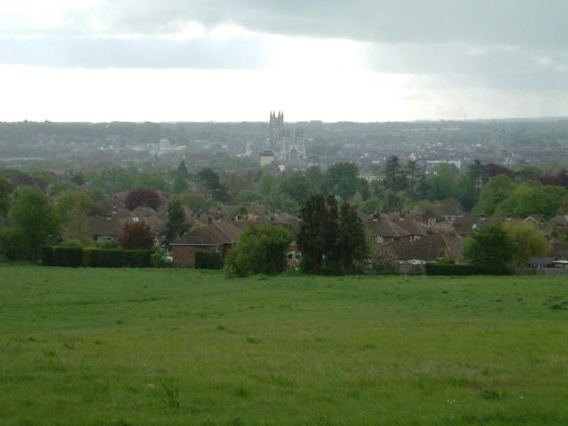
Harbledown is a village located in the county of Kent, England. Situated just outside the historic city of Canterbury, Harbledown is known for its picturesque surroundings and charming rural atmosphere. The village is rich in history and has been inhabited since ancient times, with evidence of Roman occupation and a Saxon cemetery discovered in the area.

One of the notable landmarks in Harbledown is the Church of St. Michael and All Angels, a medieval church dating back to the 12th century. The church features stunning architectural details and is a popular destination for visitors interested in historical and religious sites.

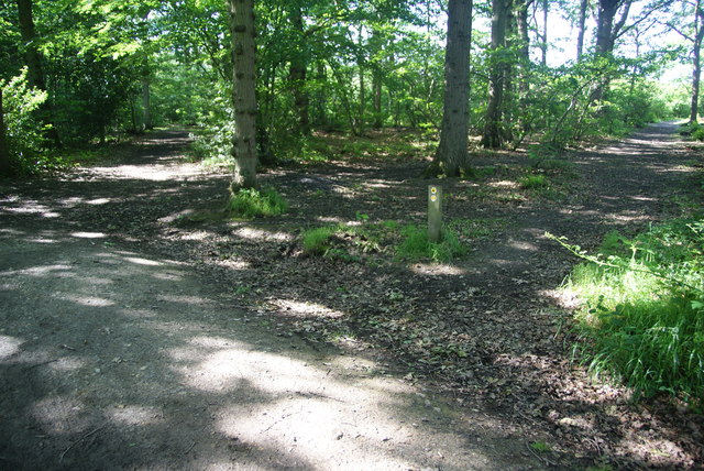
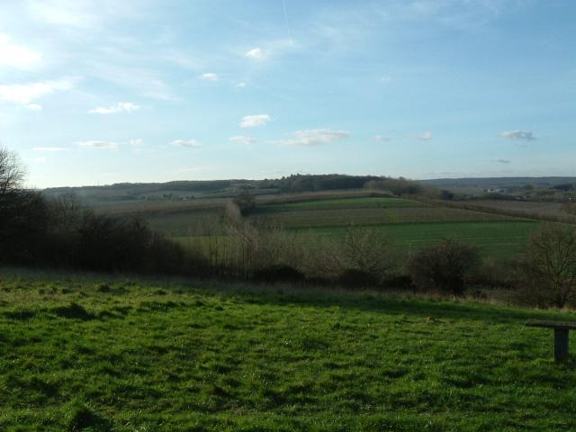
The village is surrounded by beautiful countryside, with rolling hills, lush green fields, and scenic walking trails. It offers a peaceful escape from the bustling city life of Canterbury, attracting nature lovers and hikers who enjoy exploring the countryside.

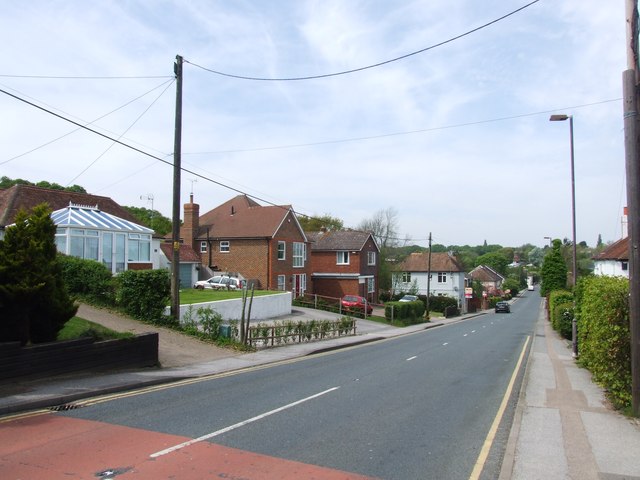
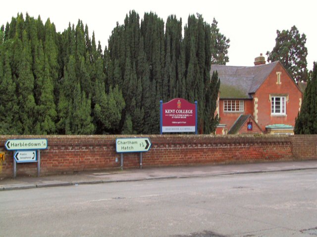
In terms of amenities, Harbledown is home to a few local shops, including a village store and a pub. The village also has a primary school, making it an attractive place for families.

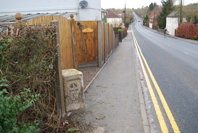
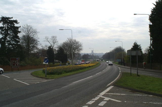
With its close proximity to Canterbury, residents of Harbledown have easy access to a wider range of amenities, including shopping centers, restaurants, and cultural attractions. The village is well-connected to the rest of Kent via road and public transportation.

Overall, Harbledown is a charming village with a rich history, beautiful surroundings, and a close-knit community, making it an idyllic place to live or visit in Kent.

If you have any feedback on the listing, please let us know in the comments section below.

Harbledown Images

Images are sourced within 2km of 51.282523/1.0446944 or Grid Reference TR1258. Thanks to Geograph Open Source API. All images are credited.

Convergence of paths in Blean Woods A point in the woods where numerous paths meet. Only three are visible here.
Convergence of paths in Blean Woods
A point in the woods where numerous paths meet. Only three are visible here.
Tile Kiln Hill, Blean
Canterbury to Whitstable cycle path Mermaid/fish tail sign by cycle path with Blean in the distance. Behind are University of Kent playing fields.
Canterbury to Whitstable cycle path
Mermaid/fish tail sign by cycle path with Blean in the distance. Behind are University of Kent playing fields.
Milestone by the A 290, Blean A milestone is one of a series of numbered markers placed along a road, canal, railway or sometimes paths at intervals of one mile or occasionally, parts of a mile. They are typically located at the side of the route. They are alternatively known as mileposts or mile posts (abbreviated MP on maps). Mileage is the distance along the route from a fixed starting point.
Milestones are constructed to provide reference points along the route. This can be used to reassure travellers that the correct route is being followed, and to indicate either distance travelled or the remaining distance to a destination.
Wikipedia: <span class="nowrap"><a title="http://en.wikipedia.org/wiki/Milestone" rel="nofollow ugc noopener" href="http://en.wikipedia.org/wiki/Milestone">Link</a><img style="margin-left:2px;" alt="External link" title="External link - shift click to open in new window" src="https://s1.geograph.org.uk/img/external.png" width="10" height="10"/></span>
Milestone by the A 290, Blean
A milestone is one of a series of numbered markers placed along a road, canal, railway or sometimes paths at intervals of one mile or occasionally, parts of a mile. They are typically located at the side of the route. They are alternatively known as mileposts or mile posts (abbreviated MP on maps). Mileage is the distance along the route from a fixed starting point. Milestones are constructed to provide reference points along the route. This can be used to reassure travellers that the correct route is being followed, and to indicate either distance travelled or the remaining distance to a destination. Wikipedia: LinkExternal link
Footpath along the edge of Blean Woods
Footpath junction in Blean Woods West Blean (including Thornden Wood) is a SSSI and forms an important part of a wider conservation jigsaw, linking the Blean Woods National Nature Reserve in the west with East Blean Wood in the east, and thereby establishing a continuous nature conservation complex, owned and managed by a partnership of local and national bodies. (KWT)
40% of the reserve is densely planted conifer plantation and 40% is sweet chestnut coppice plantation. The remaining 20% is mixed native deciduous woodland.
Part of the woods is the Blean Wood National Nature Reserve. <span class="nowrap"><a title="http://www.theblean.co.uk/" rel="nofollow ugc noopener" href="http://www.theblean.co.uk/">Link</a><img style="margin-left:2px;" alt="External link" title="External link - shift click to open in new window" src="https://s1.geograph.org.uk/img/external.png" width="10" height="10"/></span>  
Natural England: <span class="nowrap"><a title="http://www.naturalengland.org.uk/ourwork/conservation/designatedareas/nnr/1006017.aspx" rel="nofollow ugc noopener" href="http://www.naturalengland.org.uk/ourwork/conservation/designatedareas/nnr/1006017.aspx">Link</a><img style="margin-left:2px;" alt="External link" title="External link - shift click to open in new window" src="https://s1.geograph.org.uk/img/external.png" width="10" height="10"/></span>
Footpath junction in Blean Woods
West Blean (including Thornden Wood) is a SSSI and forms an important part of a wider conservation jigsaw, linking the Blean Woods National Nature Reserve in the west with East Blean Wood in the east, and thereby establishing a continuous nature conservation complex, owned and managed by a partnership of local and national bodies. (KWT) 40% of the reserve is densely planted conifer plantation and 40% is sweet chestnut coppice plantation. The remaining 20% is mixed native deciduous woodland. Part of the woods is the Blean Wood National Nature Reserve. LinkExternal link Natural England: LinkExternal link
Footpath through Blean Woods
Double Stiles near Blean Woods These stile are on a footpath from the woods towards Tile Kiln Hill on the A290 in Blean.
Double Stiles near Blean Woods
These stile are on a footpath from the woods towards Tile Kiln Hill on the A290 in Blean.
Golden Hill The view from the National Trust owned 'Golden Hill'
Golden Hill
The view from the National Trust owned 'Golden Hill'
Meadow Road Looking East over Canterbury from Neal's Place.
Meadow Road
Looking East over Canterbury from Neal's Place.
Kent College Infants and Junior School at Kent College, Harbledown, just off the A2050 near Canterbury.
Kent College
Infants and Junior School at Kent College, Harbledown, just off the A2050 near Canterbury.
Hold up on the A290 Canterbury West Station is to the right of the level crossing
Hold up on the A290
Canterbury West Station is to the right of the level crossing
Chateau d'eaux fortifie The mass of aerials sited on the water tower make it look more like a castle than ever
Chateau d'eaux fortifie
The mass of aerials sited on the water tower make it look more like a castle than ever
Entrance, St. Edmund's School
Morning rush-hour on the A290 Whitstable road
Dog and Bear Pub on Rough Common
Queuing to get onto the A2050 at Harbledown The A2050 replaced the section of the old A2 which ran through Canterbury. The new A2 by-passes the city altogether, to the West of here.
Queuing to get onto the A2050 at Harbledown
The A2050 replaced the section of the old A2 which ran through Canterbury. The new A2 by-passes the city altogether, to the West of here.
The pilgrims' view of Canterbury Cathedral The Pilgrim's Way comes down to meet the old A2 and its replacement A2050 below Harbledown hill, and the Cathedral lies straight ahead.
The pilgrims' view of Canterbury Cathedral
The Pilgrim's Way comes down to meet the old A2 and its replacement A2050 below Harbledown hill, and the Cathedral lies straight ahead.
Show me another place!

Harbledown is located at Grid Ref: TR1258 (Lat: 51.282523, Lng: 1.0446944)

Administrative County: Kent

District: Canterbury

Police Authority: Kent

What 3 Words

///tones.deal.dragon. Near Canterbury, Kent

Nearby Locations

Harbledown The Grove

Related Wikis

Harbledown

Harbledown is a village in Kent, England, immediately west of Canterbury and contiguous with the city. At local government level the village is designated...

St Michael and All Angels Church, Harbledown

The Church of St Michael and All Angels is a Norman stone church in the village of Harbledown, near Canterbury, England. A part of the Church of England...

Bigbury Camp

Bigbury Camp (formerly Bigberry Camp) is a univallate hill fort in the parish of Harbledown and Rough Common in Kent in England. The fort is a Scheduled...

Upper Harbledown

Upper Harbledown is a village in Harbledown and Rough Common civil parish about 2 miles (3 km) west of Canterbury, Kent, England. The population is roughly...

Nearby Amenities

Located within 500m of 51.282523,1.0446944
Traffic Signals
Lat/Long: 51.2832116/1.0475358
Source: local knowledge
Lat/Long: 51.2824617/1.0414094
Traffic Calming: island
Lat/Long: 51.2834831/1.0495204
Turning Circle
Lat/Long: 51.2867979/1.0463684
Barrier: stile
Bicycle: no
Foot: permissive
Horse: no
Motor Vehicle: no
Stile: stepover
Lat/Long: 51.2816629/1.0512743
Post Box
Collection Times: Mo-Fr 09:00; Sa 07:00
Post Box Type: wall
Postal Code: CT2
Ref: CT2 214
Royal Cypher: EIIR
Royal Cypher Wikidata: Q33102113
Source: survey
Lat/Long: 51.2832218/1.0513992
Harbledown
Source: survey
Tourism: village_sign
Lat/Long: 51.2830979/1.0511414
Bus Stop
Hole In The Wall
Local Ref: W-bound
Naptan AtcoCode: 2400A050430A
Naptan Bearing: W
Naptan BusStopType: MKD
Naptan CommonName: Hole In The Wall
Naptan Indicator: W-bound
Naptan Landmark: Faulkners Lane
Naptan NaptanCode: kntgatpa
Naptan PlusbusZoneRef: CNTBE
Naptan RevisionNumber: 3
Naptan Status: act
Naptan Street: Church Hill
Naptan Verified: yes
Public Transport: platform
Ref: kntgatpa
Source: naptan_import
Source Date: 2018-09-14
Lat/Long: 51.2831015/1.0509934
Bus Stop
Hole In The Wall
Bench: no
Bin: no
Lit: no
Local Ref: E-bound
Naptan AtcoCode: 2400A050440A
Naptan Bearing: E
Naptan BusStopType: MKD
Naptan CommonName: Hole In The Wall
Naptan Indicator: E-bound
Naptan Landmark: Church Hill
Naptan NaptanCode: kntgatpd
Naptan PlusbusZoneRef: CNTBE
Naptan RevisionNumber: 2
Naptan Status: act
Naptan Street: Faulkners Lane
Naptan Verified: yes
Public Transport: platform
Ref: kntgatpd
Shelter: no
Source: naptan_import
Source Date: 2013-10-23
Tactile Paving: no
Lat/Long: 51.2832653/1.0500934
Bus Stop
Vernon Holme School
Local Ref: o/s
Naptan AtcoCode: 2400A050410A
Naptan Bearing: W
Naptan BusStopType: MKD
Naptan CommonName: Vernon Holme School
Naptan Indicator: o/s
Naptan Landmark: Kent College
Naptan NaptanCode: kntgatmt
Naptan PlusbusZoneRef: CNTBE
Naptan RevisionNumber: 3
Naptan Status: act
Naptan Street: Faulkners Lane
Naptan Verified: yes
Public Transport: platform
Ref: kntgatmt
Source: naptan_import
Source Date: 2018-09-14
Lat/Long: 51.2825855/1.0454588
Bus Stop
Vernon Holme School
Local Ref: opp
Naptan AtcoCode: 2400A050420A
Naptan Bearing: E
Naptan BusStopType: MKD
Naptan CommonName: Vernon Holme School
Naptan Indicator: opp
Naptan Landmark: Kent College
Naptan NaptanCode: kntgatmw
Naptan PlusbusZoneRef: CNTBE
Naptan RevisionNumber: 4
Naptan Status: act
Naptan Street: Faulkners Lane
Naptan Verified: yes
Public Transport: platform
Ref: kntgatmw
Source: naptan_import
Source Date: 2018-09-14
Lat/Long: 51.2827729/1.0457638
Bus Stop
Wingate House
Naptan AtcoCode: 240097418
Naptan Bearing: SE
Naptan CommonName: Wingate House
Naptan Indicator: opp
Naptan Landmark: Wingate House
Naptan NaptanCode: kntgmpja
Naptan Street: London Road
Naptan Verified: no
Ref: KNTGMPJA
Source: naptan_import;survey
Lat/Long: 51.2830602/1.038993
Crossing
Crossing: traffic_signals
Crossing Ref: pelican
Lat/Long: 51.2833347/1.0476331
Crossing
Crossing: traffic_signals
Crossing Ref: pelican
Lat/Long: 51.283313/1.0472934
Bus Stop
Garden Close
Flag: no
Naptan AtcoCode: 240096707
Naptan Bearing: S
Naptan BusStopType: CUS
Naptan CommonName: Garden Close
Naptan Indicator: adj
Naptan Landmark: Garden Close
Naptan NaptanCode: kntgmagm
Naptan PlusbusZoneRef: CNTBE
Naptan Street: Rough Common Road
Naptan Verified: no
Public Transport: platform
Source: naptan_import
Lat/Long: 51.2868508/1.0452321
Bus Stop
Garden Close
Naptan AtcoCode: 2400A050330A
Naptan Bearing: N
Naptan CommonName: Garden Close
Naptan Indicator: opp
Naptan Landmark: Garden Close
Naptan NaptanCode: kntgatjp
Naptan PlusbusZoneRef: CNTBE
Naptan Street: Rough Common Road
Naptan Verified: no
Ref: kntgmagm
Shelter: no
Source: naptan_import
Lat/Long: 51.2868134/1.0451339
Barrier: stile
Foot: yes
Source: survey
Lat/Long: 51.2792136/1.0434633
Crossing
Crossing: traffic_signals
Crossing Ref: pelican
Lat/Long: 51.2833173/1.0475053
Parking
Parking: street_side
Surface: asphalt
Lat/Long: 51.2794913/1.041124
Parking
Parking: street_side
Surface: asphalt
Lat/Long: 51.2796339/1.0413761
Communication Microwave: no
Communication Mobile Phone: yes
Man Made: mast
Tower Type: communication
Lat/Long: 51.2802046/1.0403098
Communication Microwave: no
Communication Mobile Phone: yes
Man Made: mast
Tower Type: communication
Lat/Long: 51.2804288/1.040111
Communication Microwave: yes
Communication Mobile Phone: yes
Man Made: mast
Tower Type: communication
Lat/Long: 51.2805865/1.0392848
Man Made: monitoring_station
Monitoring Traffic: induction_loop
Vehicle: yes
Lat/Long: 51.2826752/1.0432186
Harbledown
Board Type: map
Information: board
Tourism: information
Lat/Long: 51.2830346/1.0514438
Generator Method: photovoltaic
Generator Orientation: 193
Generator Output Electricity: yes
Generator Source: solar
Generator Type: solar_photovoltaic_panel
Location: roof
Power: generator
Lat/Long: 51.2827561/1.0379612
Generator Method: photovoltaic
Generator Orientation: 193
Generator Output Electricity: yes
Generator Solar Modules: 40
Generator Source: solar
Generator Type: solar_photovoltaic_panel
Location: surface
Power: generator
Lat/Long: 51.2842895/1.0432211
Generator Method: photovoltaic
Generator Orientation: 189
Generator Output Electricity: yes
Generator Solar Modules: 3
Generator Source: solar
Generator Type: solar_photovoltaic_panel
Location: roof
Note: Believed to be pre-FiT
Power: generator
Lat/Long: 51.2848188/1.0452636
Generator Method: photovoltaic
Generator Orientation: 203
Generator Output Electricity: yes
Generator Solar Modules: 14
Generator Source: solar
Generator Type: solar_photovoltaic_panel
Location: roof
Power: generator
Lat/Long: 51.2866364/1.0466274
Generator Method: photovoltaic
Generator Orientation: 203
Generator Output Electricity: yes
Generator Solar Modules: 16
Generator Source: solar
Generator Type: solar_photovoltaic_panel
Location: roof
Power: generator
Lat/Long: 51.2867287/1.0466945
Generator Method: photovoltaic
Generator Orientation: 190
Generator Output Electricity: yes
Generator Solar Modules: 5
Generator Source: solar
Generator Type: solar_photovoltaic_panel
Location: roof
Power: generator
Lat/Long: 51.283051/1.0402223
Generator Method: photovoltaic
Generator Orientation: 280
Generator Output Electricity: yes
Generator Solar Modules: 4
Generator Source: solar
Generator Type: solar_photovoltaic_panel
Location: roof
Power: generator
Lat/Long: 51.2829516/1.0402143
Generator Method: photovoltaic
Generator Orientation: 100
Generator Output Electricity: yes
Generator Solar Modules: 4
Generator Source: solar
Generator Type: solar_photovoltaic_panel
Location: roof
Power: generator
Lat/Long: 51.2829449/1.0402773
Generator Method: photovoltaic
Generator Orientation: 190
Generator Output Electricity: yes
Generator Solar Modules: 3
Generator Source: solar
Generator Type: solar_photovoltaic_panel
Location: roof
Power: generator
Lat/Long: 51.2829164/1.0402384
Generator Method: photovoltaic
Generator Orientation: 175
Generator Output Electricity: yes
Generator Solar Modules: 5
Generator Source: solar
Generator Type: solar_photovoltaic_panel
Location: roof
Power: generator
Lat/Long: 51.2850058/1.0454178
Generator Method: photovoltaic
Generator Orientation: 189
Generator Output Electricity: yes
Generator Solar Modules: 16
Generator Source: solar
Generator Type: solar_photovoltaic_panel
Location: roof
Power: generator
Lat/Long: 51.2848305/1.0453065
Generator Method: photovoltaic
Generator Orientation: 193
Generator Output Electricity: yes
Generator Solar Modules: 4
Generator Source: solar
Generator Type: solar_photovoltaic_panel
Location: surface
Power: generator
Lat/Long: 51.2843658/1.0430628
Generator Method: photovoltaic
Generator Orientation: 193
Generator Output Electricity: yes
Generator Solar Modules: 54
Generator Source: solar
Generator Type: solar_photovoltaic_panel
Location: surface
Power: generator
Lat/Long: 51.2843457/1.0432586
Give Way
Direction: forward
Lat/Long: 51.2825203/1.0413621
Generator Method: photovoltaic
Generator Output Electricity: yes
Generator Source: solar
Generator Type: solar_photovoltaic_panel
Location: roof
Power: generator
Lat/Long: 51.2787774/1.0415742
The data included in this document is from www.openstreetmap.org. The data is made available under ODbL.

Have you been to Harbledown?

Leave your review of Harbledown below (or comments, questions and feedback).