The Common

Wood, Forest in Norfolk South Norfolk

England

The Common

Honingham: Blind Lane
Honingham: Blind Lane Credit: Michael Garlick

The Common, Norfolk, also known as Norfolk Wood or Norfolk Forest, is a picturesque and sprawling woodland located in the county of Norfolk, England. Covering an area of approximately 500 acres, it is a popular destination for nature enthusiasts, walkers, and families seeking tranquility in the heart of nature.

The Common is characterized by its diverse range of trees and vegetation, with oak, beech, and birch trees dominating the landscape. The woodland floor is adorned with a variety of wildflowers, including bluebells and primroses, creating a vibrant and colorful environment during the spring months.

Numerous well-maintained footpaths and trails meander through The Common, offering visitors the opportunity to explore and discover its hidden gems. These paths wind through dense forested areas, open clearings, and alongside babbling brooks, providing a delightful experience for nature lovers and hikers alike.

Wildlife thrives within The Common, and visitors may be lucky enough to spot a range of animals and birds. Squirrels, rabbits, and deer are commonly seen, while birdwatchers can enjoy observing species such as woodpeckers, owls, and various songbirds.

Facilities at The Common include picnic areas, benches, and information boards, ensuring visitors can relax and enjoy the peaceful surroundings. It is also a popular spot for outdoor activities such as photography, painting, and dog walking.

Overall, The Common, Norfolk, is a beautiful natural haven that offers a tranquil escape from the hustle and bustle of everyday life, providing a wonderful opportunity to immerse oneself in the splendor of nature.

If you have any feedback on the listing, please let us know in the comments section below.
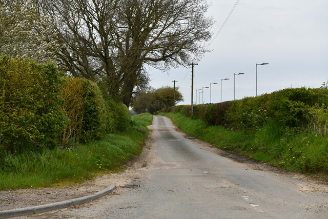
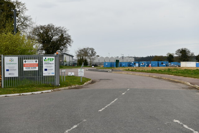
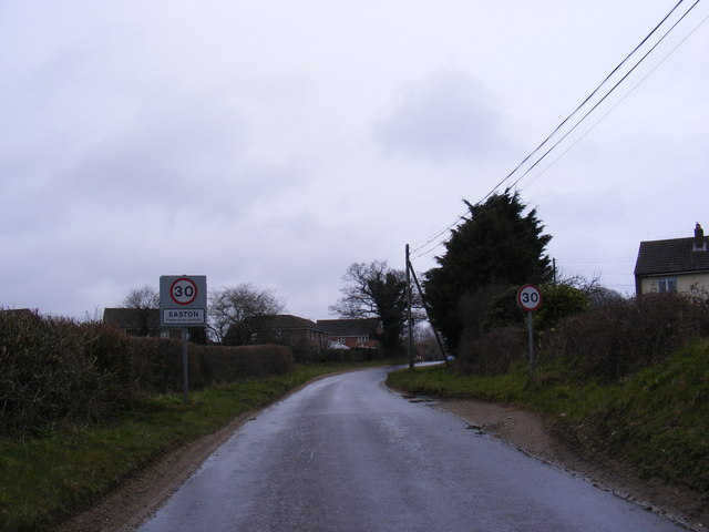
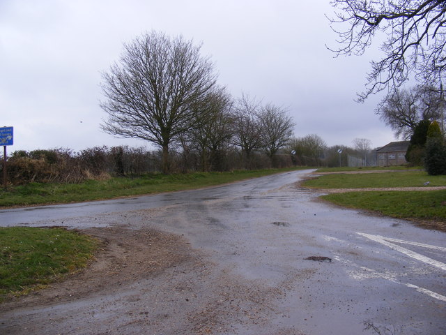
The Common Images

Images are sourced within 2km of 52.636007/1.1445695 or Grid Reference TG1208. Thanks to Geograph Open Source API. All images are credited.

Honingham: Blind Lane
Easton: Food Enterprise Park
Colton: Church Lane
Colton: Church Lane
Colton: Crossroad
Colton: Crossroad
Colton: Colton Wood
Colton: Colton Wood
Colton: Barford Road
New hedge adjacent road, near Easton
Marlingford Road At the entrance to Easton College and Broom Lane
Marlingford Road
At the entrance to Easton College and Broom Lane
Easton College sign Off Marlingford Road at the junction with Broom Lane
Easton College sign
Off Marlingford Road at the junction with Broom Lane
Broom Lane sign On Broom Lane at the junction with Marlingford Road
Broom Lane sign
On Broom Lane at the junction with Marlingford Road
Broom Lane At the junction with Marlingford Road
Broom Lane
At the junction with Marlingford Road
Easton College entrance At the junction with Marlingford Road & Broom Lane
Easton College entrance
At the junction with Marlingford Road & Broom Lane
Entering Easton on Marlingford Road <span class="nowrap"><a title="https://en.wikipedia.org/wiki/Easton,_Norfolk" rel="nofollow ugc noopener" href="https://en.wikipedia.org/wiki/Easton,_Norfolk">Link</a><img style="margin-left:2px;" alt="External link" title="External link - shift click to open in new window" src="https://s1.geograph.org.uk/img/external.png" width="10" height="10"/></span>
Entering Easton on Marlingford Road
Marlingford Road, Easton At the junction with Hall Road
Marlingford Road, Easton
At the junction with Hall Road
Hall Road, Easton At the junction with Marlingford Road
Hall Road, Easton
At the junction with Marlingford Road
Hall Road sign On Hall Road at the junction with Marlingford Road
Hall Road sign
On Hall Road at the junction with Marlingford Road
Blind Lane and Red Barn, Honingham At the junction with Grange Lane
Blind Lane and Red Barn, Honingham
At the junction with Grange Lane
Honingham Thorpe sign On Blind Lane at the junction with Grange Lane
Honingham Thorpe sign
On Blind Lane at the junction with Grange Lane
Show me another place!

The Common is located at Grid Ref: TG1208 (Lat: 52.636007, Lng: 1.1445695)

Administrative County: Norfolk

District: South Norfolk

Police Authority: Norfolk

What 3 Words

///workforce.bitters.stalemate. Near Hethersett, Norfolk

Related Wikis

Marlingford

Marlingford is a village and former civil parish, 6 miles (9.7 km) west of Norwich, now in the parish of Marlingford and Colton, in the South Norfolk district...

Marlingford and Colton

Marlingford and Colton, formerly Marlingford is a civil parish in the English county of Norfolk, made from the villages of Colton and Marlingford. It covers...

River Tiffey

The River Tiffey is a small river in Norfolk, England and a tributary of the River Yare. It rises near Hethel and passes through Wymondham before flowing...

Easton College

Easton College is a college of further and higher education in Norfolk, United Kingdom. It is located on a 200-hectare (490-acre) campus in the village...

Barford, Norfolk

Barford is a village and civil parish in the English county of Norfolk, situated some 4 miles (6 km) north of Wymondham and 8 miles (13 km) west of Norwich...

Easton, Norfolk

Easton is a village and civil parish in the English county of Norfolk. The village is located 6.2 miles (10.0 km) north-west of Norwich and 9 miles (14...

Colton, Norfolk

Colton is a village and former civil parish, 8 miles (13 km) west of Norwich, now in the parish of Marlingford and Colton, in the South Norfolk district...

Bawburgh

Bawburgh () is a village and civil parish in the South Norfolk district of Norfolk, England, lying in the valley of the River Yare about 5 miles (8.0 km...

Nearby Amenities

Located within 500m of 52.636007,1.1445695
The Bell, adj
Naptan AtcoCode: 2900M024
Naptan Bearing: SW
Naptan BusStopType: CUS
Naptan CommonName: The Bell
Naptan Indicator: adj
Naptan Landmark: Mill Road
Naptan Locality: Marlingford
Naptan NaptanCode: nfodgdtd
Naptan Street: Barford Road
Naptan Verified: no
Source: naptan_import
Lat/Long: 52.6383327/1.1481656
The Bell, opp
Naptan AtcoCode: 2900M025
Naptan Bearing: NE
Naptan BusStopType: CUS
Naptan CommonName: The Bell
Naptan Indicator: opp
Naptan Landmark: Easton Road
Naptan Locality: Marlingford
Naptan NaptanCode: nfodgdtg
Naptan Street: Barford Road
Naptan Verified: no
Source: naptan_import
Lat/Long: 52.638428/1.1482942
Barford Road, adj
Naptan AtcoCode: 2900M028
Naptan Bearing: SE
Naptan BusStopType: CUS
Naptan CommonName: Barford Road
Naptan Indicator: adj
Naptan Landmark: Barford Rd
Naptan Locality: Marlingford
Naptan NaptanCode: nfogjwpg
Naptan Street: Church Road
Naptan Verified: no
Source: naptan_import
Lat/Long: 52.6343056/1.1378563
Marlingford
Place: village
Lat/Long: 52.6362729/1.145027
Former Amenity: post_box
Note: Post remains, but no box, as of 2019-04
Lat/Long: 52.6345127/1.1376297
Marlingford
Man Made: village_sign
Material: wood
Lat/Long: 52.6382995/1.1484669
Grit Bin
Colour: yellow
Lat/Long: 52.6382864/1.1484414
Give Way
Lat/Long: 52.638449/1.1487038
Stop
Lat/Long: 52.6383678/1.1484213
Defibrillator
Defibrillator Location: On exterior wall of Marlingford Bell pub, at the right-hand end of the building when viewed from the main car park.
Emergency: defibrillator
Ref: CHT-9024
Ref GB The Circuit: 90154EBD-9047-4022-B21D-B01F015B57D8
Lat/Long: 52.6381763/1.1488252
Post Box
Collection Times: Mo-Fr 16:45; Sa 08:45
Post Box Mounting: pier
Post Box Type: lamp
Ref: NR9 954
Royal Cypher: EIIR
Royal Cypher Wikidata: Q33102113
Lat/Long: 52.6382311/1.1473177
Information: board
Operator: Marlingford & Colton Parish Council
Lat/Long: 52.6382116/1.1472346
Recycling
Operator: Planet Aid
Recycling Clothes: yes
Recycling Glass: no
Recycling Glass Bottles: no
Recycling Shoes: yes
Recycling Type: container
Lat/Long: 52.6381456/1.1487553
Recycling
Recycling Glass Bottles: yes
Recycling Type: container
Lat/Long: 52.638142/1.1487801
Shop: plants
Lat/Long: 52.6386702/1.1487224
The data included in this document is from www.openstreetmap.org. The data is made available under ODbL.

Have you been to The Common?

Leave your review of The Common below (or comments, questions and feedback).